Category:Sudbury, Derbyshire
Jump to navigation
Jump to search
English: Sudbury is a village and civil parish in Derbyshire, England, located approximately to the south of Ashbourne. It is part of the Derbyshire Dales district. The £0.5m A50 bypass opened in 1972.
village and civil parish in Derbyshire Dales district, Derbyshire, England  | |||||
| Upload media | |||||
| Instance of | |||||
|---|---|---|---|---|---|
| Location | Derbyshire Dales, Derbyshire, East Midlands, England | ||||
 | |||||
Subcategories
This category has the following 9 subcategories, out of 9 total.
A
- Aston Heath (2 F)
- Aston, Derbyshire Dales (1 F)
F
- Folly or Deercote in Park (2 F)
L
- The Laurels, Sudbury (9 F)
O
- Oaks Green (1 F)
S
V
- The Vernon Arms, Sudbury (16 F)
Media in category "Sudbury, Derbyshire"
The following 200 files are in this category, out of 261 total.
(previous page) (next page)-
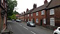
 14, 16 and 17 Main Road, Sudbury.jpg 5,184 × 3,456; 7.22 MB
-
 2-6 Main Road, Sudbury.jpg 640 × 360; 62 KB
-

-
 A private road but a public footpath - geograph.org.uk - 5727576.jpg 2,000 × 1,333; 3.55 MB
-
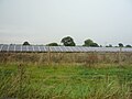
 A solar farm - geograph.org.uk - 5718272.jpg 2,000 × 1,333; 1.96 MB
-
 A view of Dovebank - geograph.org.uk - 5718276.jpg 2,000 × 1,333; 2.56 MB
-
 A wet field - geograph.org.uk - 5727573.jpg 2,000 × 1,333; 2.98 MB
-

-
 A50 approaching roundabout, Aston - geograph.org.uk - 3413423.jpg 640 × 417; 43 KB
-
 A50 Approaching Sudbury Roundabout - geograph.org.uk - 4240561.jpg 640 × 480; 249 KB
-
 A50 at the A515 bridge - geograph.org.uk - 2340452.jpg 640 × 480; 52 KB
-
 A50 at the A515 junction - geograph.org.uk - 2340445.jpg 640 × 480; 57 KB
-
 A50 between Aston and Foston - geograph.org.uk - 2340408.jpg 640 × 480; 53 KB
-
 A50 eastbound at Dovebank roundabout - geograph.org.uk - 3594760.jpg 640 × 480; 32 KB
-
 A50 eastbound at Portway Head - geograph.org.uk - 3594757.jpg 640 × 480; 37 KB
-
 A50 near Sudbury - geograph.org.uk - 4240565.jpg 640 × 427; 250 KB
-
 A50 north of Sudbury - geograph.org.uk - 2340435.jpg 640 × 480; 64 KB
-
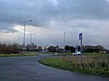 A50 roundabout - geograph.org.uk - 1119964.jpg 640 × 480; 46 KB
-
 A515 north of Sudbury - geograph.org.uk - 5782502.jpg 1,600 × 1,067; 482 KB
-
 A515 northbound - geograph.org.uk - 5093328.jpg 640 × 480; 48 KB
-
 A515 Road - geograph.org.uk - 4277941.jpg 4,000 × 3,000; 3.38 MB
-
 A515 towards Ashbourne - geograph.org.uk - 5093308.jpg 640 × 480; 96 KB
-
 A515 towards Ashbourne - geograph.org.uk - 5093311.jpg 640 × 480; 95 KB
-
 A515 towards Ashbourne - geograph.org.uk - 5093319.jpg 640 × 480; 65 KB
-
 A515 towards Ashbourne - geograph.org.uk - 5093326.jpg 640 × 480; 63 KB
-
 A515 towards Ashbourne - geograph.org.uk - 5093331.jpg 640 × 480; 56 KB
-
 All Saints Church, Sudbury - geograph.org.uk - 5770065.jpg 1,500 × 1,000; 1.59 MB
-
 All Saints Church, Sudbury - geograph.org.uk - 6281222.jpg 1,024 × 576; 157 KB
-
 All Saints' Church Nameboard - geograph.org.uk - 4669698.jpg 640 × 481; 625 KB
-
 All Saints' Church, Evacuee Window - geograph.org.uk - 4669955.jpg 480 × 640; 471 KB
-
 All Saints' Parish Church, Sudbury - geograph.org.uk - 4669705.jpg 640 × 480; 497 KB
-
 All Saints, Sudbury - geograph.org.uk - 5489200.jpg 5,376 × 3,024; 2.05 MB
-
 Along the lane towards Somersal House - geograph.org.uk - 5845436.jpg 1,795 × 1,346; 955 KB
-
 Altar and Reredos, All Saints' Church - geograph.org.uk - 4669909.jpg 640 × 480; 540 KB
-

-
 Aston Bridge - geograph.org.uk - 396412.jpg 640 × 427; 109 KB
-
 Aston Bridge Farm - geograph.org.uk - 1360413.jpg 640 × 480; 65 KB
-
 Aston Bridge in the rain - geograph.org.uk - 2039633.jpg 1,024 × 768; 100 KB
-
 Aston Farm North - geograph.org.uk - 2920512.jpg 3,925 × 1,909; 3.75 MB
-
 Aston House Farm solar farm - geograph.org.uk - 5573168.jpg 1,280 × 960; 337 KB
-
 Aston Lane, Ashton Heath - geograph.org.uk - 2471002.jpg 640 × 480; 89 KB
-
 Aston Lane, Aston - geograph.org.uk - 4210524.jpg 3,855 × 2,834; 2.73 MB
-
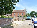
 Attractive old house in Sudbury - geograph.org.uk - 2002211.jpg 640 × 480; 114 KB
-
 Bluebells and Sudbury Coppice - geograph.org.uk - 432260.jpg 640 × 428; 144 KB
-
 Boundary sign - geograph.org.uk - 5573167.jpg 1,280 × 960; 555 KB
-
 Bowling green, Sudbury - geograph.org.uk - 2144227.jpg 640 × 480; 117 KB
-
 Bridge carrying the A50 - geograph.org.uk - 1119955.jpg 640 × 457; 44 KB
-
 Bridge in Sudbury Park towards The Deercote - geograph.org.uk - 6361144.jpg 1,024 × 768; 266 KB
-
 Bus stop on Main Road, Sudbury - geograph.org.uk - 5093181.jpg 640 × 480; 94 KB
-
 Butcher's House and Shop, School Lane - geograph.org.uk - 4669682.jpg 640 × 480; 577 KB
-
 Butcher's House, Shop and 10 School Lane, Sudbury.jpg 4,952 × 3,302; 6.79 MB
-
 Calves near Potter Somersal - geograph.org.uk - 432309.jpg 640 × 428; 129 KB
-
 Close up, Elizabeth II postbox, Oaks Green - geograph.org.uk - 5098282.jpg 1,478 × 2,713; 782 KB
-
 Close up, George V postbox on Main Road, Sudbury - geograph.org.uk - 5098269.jpg 1,247 × 2,408; 653 KB
-
 Communications centre, Oaks Green - geograph.org.uk - 5098284.jpg 640 × 480; 99 KB
-
 Cricket Pitch, Sudbury Hall Estate (National Trust) - geograph.org.uk - 4492379.jpg 3,264 × 2,448; 1.26 MB
-
 Crop field off the A515 - geograph.org.uk - 5093323.jpg 640 × 480; 45 KB
-
 Curved wall of Hill Farm - geograph.org.uk - 4457847.jpg 4,320 × 3,240; 3.01 MB
-
 Dale Brook at Dalebrook - geograph.org.uk - 5789935.jpg 1,280 × 960; 653 KB
-
 Derby Road near Fiddlers Farm - geograph.org.uk - 5843501.jpg 1,469 × 1,102; 605 KB
-
 Derbyshire UK parish map highlighting Sudbury.svg 888 × 1,308; 2.34 MB
-
 Disused farm buildings at Aston Heath - geograph.org.uk - 3927373.jpg 3,008 × 2,000; 4.25 MB
-
 Elizabeth II postbox, Oaks Green - geograph.org.uk - 5098281.jpg 640 × 636; 123 KB
-
 Farm buildings, Flackets Lane - geograph.org.uk - 5093519.jpg 640 × 441; 51 KB
-
 Farm buildings, Harehill Farm - geograph.org.uk - 5093330.jpg 640 × 413; 51 KB
-

-
 Farmland north of Sudbury - geograph.org.uk - 432326.jpg 640 × 428; 121 KB
-
 Field and hedgerow - geograph.org.uk - 5093125.jpg 640 × 480; 67 KB
-

-
 Field entrance off the A515 - geograph.org.uk - 5093301.jpg 640 × 480; 53 KB
-
 Field entrance, Hill Somersal - geograph.org.uk - 5093506.jpg 640 × 480; 94 KB
-
 Field entrance, Somersal - geograph.org.uk - 5093513.jpg 640 × 480; 79 KB
-
 Field of beans - geograph.org.uk - 5093341.jpg 640 × 480; 98 KB
-
 Field off Leathersley Lane - geograph.org.uk - 5093127.jpg 640 × 480; 59 KB
-
 Fields near Mackley House - geograph.org.uk - 4210538.jpg 4,000 × 3,000; 2.93 MB
-
 Flackets Lane - geograph.org.uk - 5093516.jpg 640 × 480; 97 KB
-
 Footbridge over Dale Brook - geograph.org.uk - 5789949.jpg 1,280 × 960; 527 KB
-
 Footbridge, Sudbury Park.jpg 5,376 × 3,024; 3.52 MB
-
 Footpath off Hollyhurst Lane - geograph.org.uk - 5093372.jpg 640 × 480; 75 KB
-
 Fountain, Sudbury Hall - geograph.org.uk - 954302.jpg 427 × 640; 268 KB
-

-
 George V postbox on Main Road, Sudbury - geograph.org.uk - 5098267.jpg 3,648 × 2,274; 1.81 MB
-
 Grazing near Somersal House - geograph.org.uk - 5093441.jpg 640 × 480; 60 KB
-
 Grazing off Flackets Lane - geograph.org.uk - 5093518.jpg 640 × 480; 72 KB
-
 Grazing off Oak Lane - geograph.org.uk - 5093368.jpg 640 × 480; 73 KB
-
 Grazing west of the A515 - geograph.org.uk - 5093310.jpg 640 × 480; 56 KB
-
 Grazing, Oaks Green Farm - geograph.org.uk - 5093299.jpg 640 × 480; 54 KB
-
 Grazing, Sudbury - geograph.org.uk - 5093138.jpg 640 × 480; 78 KB
-
 Grove of Trees at Sudbury Hall - geograph.org.uk - 5428826.jpg 640 × 427; 132 KB
-

-
 Heading south on Bowling Alley Lane - geograph.org.uk - 5093444.jpg 640 × 480; 70 KB
-
 Heading south, Hill Somersal - geograph.org.uk - 5093508.jpg 640 × 480; 103 KB
-
 Hollyhurst Lane - geograph.org.uk - 3769183.jpg 2,256 × 1,504; 2.98 MB
-
 Hollyhurst Lane - geograph.org.uk - 4154819.jpg 4,000 × 3,000; 2.56 MB
-
 House and Grounds, Sudbury Hall - geograph.org.uk - 4669612.jpg 640 × 480; 484 KB
-

-
 Kennels at Oaks Green - geograph.org.uk - 2832659.jpg 640 × 437; 94 KB
-
 Knife Sharpening Grooves - geograph.org.uk - 5427709.jpg 427 × 640; 104 KB
-
 Lane Junction and Vernon's Oak - geograph.org.uk - 4154805.jpg 4,000 × 3,000; 2.79 MB
-
 Lane to Marston Montgomery - geograph.org.uk - 434291.jpg 640 × 428; 103 KB
-
 Lane to Somersal Herbert - geograph.org.uk - 3768202.jpg 3,000 × 2,000; 6.23 MB
-
 Lane to Somersal Herbert - geograph.org.uk - 3770344.jpg 2,256 × 1,504; 2.96 MB
-
 Late Rape Flower - geograph.org.uk - 871344.jpg 640 × 427; 281 KB
-
 Lawns at Sudbury Hall - geograph.org.uk - 4669510.jpg 640 × 480; 468 KB
-
 Layby near Sudbury - geograph.org.uk - 4240569.jpg 640 × 427; 256 KB
-
 Leathersley Farm in Leathersley Lane - geograph.org.uk - 2950892.jpg 640 × 386; 74 KB
-
 Leathersley Lane - geograph.org.uk - 3709256.jpg 2,256 × 1,504; 2.37 MB
-
 Leathersley Lane - geograph.org.uk - 5093115.jpg 640 × 480; 64 KB
-
 Locker's Knoll woodland - geograph.org.uk - 5093327.jpg 640 × 428; 75 KB
-
 Main Road into Sudbury from the east - geograph.org.uk - 5843488.jpg 1,469 × 1,102; 694 KB
-
 Main Road outside Sudbury Hall - geograph.org.uk - 5843497.jpg 1,402 × 1,052; 611 KB
-
 Main Road Sudbury - geograph.org.uk - 4457827.jpg 4,320 × 3,240; 3.54 MB
-
 Main Road, Sudbury - geograph.org.uk - 2144208.jpg 640 × 480; 131 KB
-
 Main Road, Sudbury - geograph.org.uk - 2144262.jpg 640 × 480; 116 KB
-
 Main Road, Sudbury - geograph.org.uk - 5630177.jpg 640 × 360; 63 KB
-
 Main Road, Sudbury - geograph.org.uk - 5630197.jpg 640 × 360; 56 KB
-
 Memorial in All Saints' Church - geograph.org.uk - 4669933.jpg 427 × 640; 358 KB
-
 Minor road junction with the A515 - geograph.org.uk - 5093194.jpg 640 × 480; 49 KB
-
 Minor road towards Oaks Green - geograph.org.uk - 5093515.jpg 640 × 480; 102 KB
-
 Minor road, Hill Somersal - geograph.org.uk - 5093504.jpg 640 × 480; 97 KB
-
 Muddy Field off Aston Lane - geograph.org.uk - 3709259.jpg 2,256 × 1,504; 2.08 MB
-
 Narrow lane north of Hill Somersal - geograph.org.uk - 5845434.jpg 1,469 × 1,102; 654 KB
-

-
 National Cycle Route 549, Sudbury - geograph.org.uk - 5093142.jpg 640 × 480; 73 KB
-
 National Trust Museum of Childhood at Sudbury Hall - geograph.org.uk - 4492341.jpg 3,264 × 2,448; 1.31 MB
-

-
 Oak Lane - geograph.org.uk - 3768157.jpg 2,256 × 1,504; 3.08 MB
-
 Oak Lane - geograph.org.uk - 5093370.jpg 640 × 480; 85 KB
-
 Oak Lane and Footpath Entrance - geograph.org.uk - 4154779.jpg 4,000 × 3,000; 2.75 MB
-
 Oaks Lane near Elm Tree Cottage - geograph.org.uk - 5093361.jpg 640 × 480; 88 KB
-
 Old Aston Lane, Aston - geograph.org.uk - 4210518.jpg 4,000 × 3,000; 2.71 MB
-
 Old farm Building Sudbury - geograph.org.uk - 5428817.jpg 640 × 427; 71 KB
-
 Old forge on School Lane, Sudbury - geograph.org.uk - 5093153.jpg 640 × 480; 73 KB
-
 Old Stables - geograph.org.uk - 955900.jpg 640 × 427; 316 KB
-

-
 Over The Hedge - geograph.org.uk - 954375.jpg 640 × 427; 180 KB
-
 Overgrown footbridge - geograph.org.uk - 5790058.jpg 1,280 × 960; 855 KB
-
 Parish Church of All Saints, The Font - geograph.org.uk - 4669983.jpg 481 × 640; 391 KB
-
 Parkland at Sudbury Hall - geograph.org.uk - 5940907.jpg 1,024 × 768; 198 KB
-
 Path to the car park - geograph.org.uk - 5940911.jpg 1,024 × 768; 273 KB
-
 Path to the Car Park at Sudbury Hall - geograph.org.uk - 4669036.jpg 640 × 480; 550 KB
-
 Porch Doors, Sudbury Hall - geograph.org.uk - 954403.jpg 405 × 640; 176 KB
-
 Porch, Sudbury Hall - geograph.org.uk - 954391.jpg 640 × 423; 192 KB
-

-
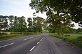
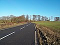
 Road Bend on the A515 - geograph.org.uk - 4277933.jpg 3,830 × 2,601; 2.73 MB
-
 Road Junction near Sudbury Coppice - geograph.org.uk - 4277947.jpg 4,000 × 3,000; 3.2 MB
-
 Road junction, Dovebank - geograph.org.uk - 5093130.jpg 640 × 480; 92 KB
-
 Road off the A515, Sudbury - geograph.org.uk - 5782504.jpg 1,600 × 1,067; 551 KB
-
 Roller and Sight Screen - geograph.org.uk - 955824.jpg 640 × 427; 202 KB
-
 Row of Estate Cottages in Sudbury - geograph.org.uk - 4154367.jpg 3,847 × 2,615; 1.89 MB
-
 School Lane in Sudbury - geograph.org.uk - 4154369.jpg 3,756 × 2,665; 2.43 MB
-
 School Lane, Sudbury - geograph.org.uk - 5093156.jpg 640 × 480; 98 KB
-
 School Lane, Sudbury - geograph.org.uk - 5630169.jpg 640 × 360; 55 KB
-
 School Lane, Sudbury - geograph.org.uk - 6223687.jpg 1,067 × 1,600; 377 KB
-
 Side Gate Farm - geograph.org.uk - 366115.jpg 640 × 480; 118 KB
-
 Solar farm near Leathersley Farm - geograph.org.uk - 5093111.jpg 640 × 480; 58 KB
-
 Somersal Lane Farm - geograph.org.uk - 4154683.jpg 3,888 × 2,861; 2.44 MB
-
 Somersal Lane Farmhouse.jpg 2,026 × 1,518; 1.12 MB
-
 Somersal Lodge, six years on - geograph.org.uk - 2949897.jpg 640 × 425; 85 KB
-
 South Elevation, Sudbury Hall - geograph.org.uk - 4669516.jpg 640 × 481; 508 KB
-

-

-

-

-
 Stepping stones and a gate - geograph.org.uk - 5790048.jpg 1,280 × 960; 796 KB
-
 Steps and Balustrade - geograph.org.uk - 953760.jpg 438 × 640; 220 KB
-
 Stubble field, Twelve Acres Farm - geograph.org.uk - 5093315.jpg 640 × 480; 69 KB
-
 Sudbury (Derbyshire) signalbox geograph-4022167-by-Ben-Brooksbank.jpg 2,227 × 1,268; 2.72 MB
-
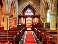
 Sudbury All Saints' Church (interior) - geograph.org.uk - 4669903.jpg 480 × 640; 450 KB
-
 Sudbury Church - geograph.org.uk - 5368181.jpg 2,000 × 1,333; 2.18 MB
-
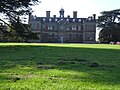
 Sudbury Hall - geograph.org.uk - 2002020.jpg 640 × 480; 101 KB
-
 Sudbury Hall - geograph.org.uk - 2144198.jpg 628 × 470; 113 KB
-
 Sudbury Hall - geograph.org.uk - 2144255.jpg 640 × 480; 178 KB
-
 Sudbury Hall - geograph.org.uk - 2688026.jpg 1,024 × 689; 220 KB
-
 Sudbury Hall - geograph.org.uk - 2813974.jpg 1,024 × 695; 142 KB
-
 Sudbury Hall - geograph.org.uk - 4154624.jpg 3,892 × 2,853; 2.58 MB
-
 Sudbury Hall - geograph.org.uk - 4154641.jpg 3,818 × 2,676; 2.23 MB
-
 Sudbury Hall - geograph.org.uk - 4563405.jpg 800 × 600; 206 KB
-
 Sudbury Hall - geograph.org.uk - 4563406.jpg 800 × 600; 156 KB
-
 Sudbury Hall - geograph.org.uk - 4669610.jpg 640 × 481; 534 KB
-
 Sudbury Hall - geograph.org.uk - 5480213.jpg 671 × 1,024; 262 KB
-
 Sudbury Hall - geograph.org.uk - 5480218.jpg 1,024 × 651; 242 KB
-
 Sudbury Hall - geograph.org.uk - 5489190.jpg 4,361 × 2,688; 1.53 MB
-
 Sudbury Hall - geograph.org.uk - 5770055.jpg 1,500 × 1,000; 1.73 MB
-
 Sudbury Hall - geograph.org.uk - 5940898.jpg 1,024 × 768; 245 KB
-
 Sudbury Hall - geograph.org.uk - 5940900.jpg 1,024 × 768; 272 KB
-
 Sudbury Hall - geograph.org.uk - 5940904.jpg 1,024 × 768; 283 KB
-
 Sudbury Hall - geograph.org.uk - 5940908.jpg 1,024 × 768; 270 KB
-
 Sudbury Hall - geograph.org.uk - 6223694.jpg 1,600 × 1,067; 323 KB
-
 Sudbury Hall - geograph.org.uk - 955888.jpg 640 × 427; 197 KB
-
 Sudbury Hall and Fountain - geograph.org.uk - 954094.jpg 427 × 640; 258 KB
-
 Sudbury Hall Estate Cottages - geograph.org.uk - 46017.jpg 640 × 360; 88 KB
-
 Sudbury Hall Garden - geograph.org.uk - 4669607.jpg 640 × 481; 654 KB
-
 Sudbury Hall, North Front - geograph.org.uk - 4669624.jpg 640 × 481; 542 KB
-
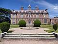
 Sudbury Hall, South Front - geograph.org.uk - 4669515.jpg 640 × 481; 624 KB
-
 Sudbury Hall, The Lake - geograph.org.uk - 4669617.jpg 640 × 480; 544 KB
-
 Sudbury Junction - geograph.org.uk - 3672218.jpg 800 × 600; 73 KB
-
 Sudbury Parish Church - geograph.org.uk - 4669912.jpg 480 × 640; 481 KB
-
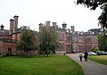
 Sudbury Park - geograph.org.uk - 4277925.jpg 4,000 × 3,000; 2.5 MB
-
 Sudbury Park - geograph.org.uk - 4277927.jpg 4,000 × 3,000; 2.72 MB


_-_geograph.org.uk_-_4492379.jpg)


_signalbox_geograph-4022167-by-Ben-Brooksbank.jpg)
_-_geograph.org.uk_-_4669903.jpg)


