Category:Submarine-related graphs and maps
Jump to navigation
Jump to search
Media in category "Submarine-related graphs and maps"
The following 20 files are in this category, out of 20 total.
-
 Allveelaevageo.jpg 1,139 × 571; 308 KB
-
 Denizaltı lambası.JPG 3,264 × 2,448; 2.05 MB
-
 Flooding Valve.PNG 512 × 384; 10 KB
-
 K129 HGE Bergungsort.png 652 × 642; 106 KB
-
 Operation Sandblast track - All Hands magazine July 1960.JPG 1,630 × 863; 662 KB
-
 Operation Sunshine - All Hands - Oct 1959.JPG 353 × 280; 33 KB
-
 Porównanie akustycznego stealth okrętów podwodnych.png 600 × 400; 21 KB
-
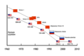
 Soviet naval threat to the Trident-armed submarine fleet.png 1,200 × 752; 747 KB
-
 Sub Noise Comparison ENG.svg 1,289 × 859; 42 KB
-
 Sub Noise Comparison PL.svg 1,289 × 859; 44 KB
-
 Submarine Acustic Stealth Comparison.png 600 × 400; 26 KB
-
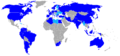 Submarine operators countries.PNG 1,357 × 628; 28 KB
-
 Trident Pacific area of operations from Bangor naval base.png 1,250 × 971; 790 KB
-
 Trident patrol area 1975 and beyond.png 1,372 × 895; 732 KB
-
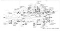 TriesteIIEquipmentConfiguration.jpg 2,048 × 1,072; 583 KB
-
 USS Triton SSRN-586 circumnavigation map 1960.jpg 1,024 × 1,222; 544 KB
-
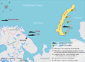 Verklappter Atommüll bei Nowaja Semlja.png 1,571 × 1,148; 336 KB
-
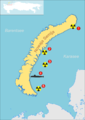 Verklappung bei Nowaja Semlja.png 1,358 × 1,923; 376 KB
-
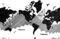
 Worldmap Submarines.svg 2,754 × 1,397; 1.27 MB
-
 Схема гибели АПЛ «Комсомолец».svg 744 × 673; 598 KB


