Category:Stubble fields in Wiltshire
Jump to navigation
Jump to search
Images of fields in the County of Wiltshire which contain stubble.
Media in category "Stubble fields in Wiltshire"
The following 105 files are in this category, out of 105 total.
-
 A harvested field near Stert - geograph.org.uk - 523628.jpg 640 × 480; 341 KB
-
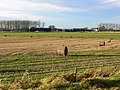
 Across a wet field - Nov 2012 - panoramio.jpg 4,000 × 3,000; 5.09 MB
-
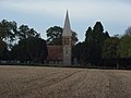 St Mary's, Chute Forest - geograph.org.uk - 275027.jpg 640 × 480; 103 KB
-
 Claas combine, near Stoford - geograph.org.uk - 1449559.jpg 640 × 480; 122 KB
-
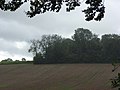
 Clearing next to Beechy Dean Copse - geograph.org.uk - 508997.jpg 640 × 430; 255 KB
-
 Conholt Hill - geograph.org.uk - 999142.jpg 640 × 427; 163 KB
-
 Copse, Woodlands Farm - geograph.org.uk - 265599.jpg 640 × 480; 107 KB
-
 Countryside near Colerne - geograph.org.uk - 1629122.jpg 640 × 480; 93 KB
-
 Cropped field near Down Farm - geograph.org.uk - 1446220.jpg 640 × 494; 144 KB
-

-
 Downland - Collingbourne - Nov 2012 - panoramio.jpg 4,000 × 3,000; 4.96 MB
-
 Evening light - Nov 2012 - panoramio (1).jpg 4,000 × 3,000; 4.39 MB
-
 Farmland and bales, near Yatesbury - geograph.org.uk - 1057595.jpg 640 × 480; 144 KB
-
 Farmland, Haxton - geograph.org.uk - 909796.jpg 640 × 480; 137 KB
-
 Farmland, Haxton - geograph.org.uk - 909801.jpg 640 × 480; 144 KB
-
 Farmland, Manningford - geograph.org.uk - 1560463.jpg 640 × 480; 152 KB
-
 Farmland, Marridge Hill - geograph.org.uk - 988163.jpg 640 × 480; 108 KB
-
 Farmland, Marridge Hill - geograph.org.uk - 988180.jpg 640 × 480; 128 KB
-
 Farmland, Shalbourne - geograph.org.uk - 1014739.jpg 640 × 480; 113 KB
-
 Farmland, Shalbourne - geograph.org.uk - 1014745.jpg 640 × 480; 141 KB
-
 Farmland, Shalbourne - geograph.org.uk - 1014746.jpg 640 × 480; 135 KB
-
 Farmland, Shalbourne - geograph.org.uk - 1014751.jpg 640 × 480; 152 KB
-
 Farmland, Tidcombe - geograph.org.uk - 1561787.jpg 640 × 480; 139 KB
-
 Farmland, West Knoyle - geograph.org.uk - 975485.jpg 640 × 480; 142 KB
-
 Farmland, Witcha - geograph.org.uk - 988023.jpg 640 × 480; 138 KB
-
 Farmland, Witcha - geograph.org.uk - 988037.jpg 640 × 480; 136 KB
-
 Faulston Down - geograph.org.uk - 975363.jpg 640 × 480; 94 KB
-
 Fields beyond Rag Copse - Nov 2012 - panoramio.jpg 4,000 × 3,000; 4.62 MB
-
 Former wheatfield near Chapmanslade - geograph.org.uk - 945691.jpg 640 × 476; 59 KB
-
 From Rook Hill on the downs - geograph.org.uk - 1537605.jpg 640 × 522; 206 KB
-
 Gap in the hedge, Farley - geograph.org.uk - 983155.jpg 640 × 480; 91 KB
-
 Hare in a field near Winterbourne Monkton - geograph.org.uk - 969466.jpg 640 × 480; 121 KB
-
 Harvested at last, Bishopstone - geograph.org.uk - 974087.jpg 640 × 480; 85 KB
-
 Harvested farmland, Haxton - geograph.org.uk - 909770.jpg 640 × 480; 114 KB
-
 Harvested field near Fovant - geograph.org.uk - 1451963.jpg 640 × 481; 151 KB
-
 Harvested field near Northwood Farm - geograph.org.uk - 994674.jpg 640 × 478; 77 KB
-
 Harvested field near Sandridge Park - geograph.org.uk - 975673.jpg 640 × 452; 94 KB
-
 Harvested field waiting for the plough - geograph.org.uk - 1073567.jpg 640 × 568; 233 KB
-
 Harvested field, Bishopstone - geograph.org.uk - 1453601.jpg 640 × 480; 144 KB
-
 Harvested field, Croucheston Down - geograph.org.uk - 1462698.jpg 640 × 480; 144 KB
-
 Harvested fields near Bishopstone - geograph.org.uk - 1453623.jpg 640 × 480; 154 KB
-
 Harvested fields, Wylye Valley - geograph.org.uk - 948534.jpg 640 × 480; 123 KB
-
 Hayfield with view of Kings Play Hill - geograph.org.uk - 191727.jpg 640 × 480; 63 KB
-
 Haystacks by the A303 - geograph.org.uk - 967053.jpg 640 × 480; 142 KB
-
 Haystacks by the A303 - geograph.org.uk - 967061.jpg 640 × 480; 133 KB
-
 Hippenscombe Bottom - geograph.org.uk - 999080.jpg 640 × 427; 172 KB
-
 Hippenscombe Bottom - geograph.org.uk - 999108.jpg 640 × 427; 174 KB
-
 Illuminated plastic - panoramio.jpg 3,140 × 2,048; 1.66 MB
-
 Late afternoon - Rag Copse - Nov 2012 - panoramio.jpg 4,000 × 3,000; 4.91 MB
-
 Looking towards Lus Hill - geograph.org.uk - 1456185.jpg 640 × 480; 78 KB
-
 Maize stubble off the A342 - geograph.org.uk - 1183783.jpg 640 × 501; 145 KB
-

-
 Pertwood Down - geograph.org.uk - 1167820.jpg 640 × 480; 210 KB
-
 Pertwood Down 2 - geograph.org.uk - 1167826.jpg 640 × 480; 194 KB
-
 Picked Copse - Woodland Edge - geograph.org.uk - 994214.jpg 640 × 480; 83 KB
-
 Pond by Chippenham Lane - geograph.org.uk - 1179581.jpg 640 × 494; 128 KB
-
 Power line posts with phase splitter - geograph.org.uk - 1618821.jpg 640 × 566; 193 KB
-
 Ready for shooting - geograph.org.uk - 999100.jpg 427 × 640; 189 KB
-

-
 Rivar Down - geograph.org.uk - 1014753.jpg 640 × 480; 160 KB
-
 Road, Eastridge - geograph.org.uk - 987990.jpg 640 × 480; 128 KB
-
 Round straw bales, Codford Down - geograph.org.uk - 540119.jpg 640 × 479; 157 KB
-
 Rows of straw, Compton Down - geograph.org.uk - 1452118.jpg 640 × 480; 181 KB
-

-
 Setting sun at College Fields - geograph.org.uk - 1535185.jpg 640 × 480; 159 KB
-

-
 South west from Stoke Hill trigpoint - geograph.org.uk - 894951.jpg 640 × 459; 74 KB
-
 Sow-thistle, Netton Farm - geograph.org.uk - 1002200.jpg 640 × 480; 138 KB
-
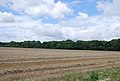
 Straw and stubble north-east of Avebury - geograph.org.uk - 970745.jpg 640 × 480; 126 KB
-
 Straw bales and The Firs, Beckhampton - geograph.org.uk - 962416.jpg 640 × 480; 113 KB
-
 Straw bales near The Firs, Beckhampton - geograph.org.uk - 962409.jpg 640 × 480; 108 KB
-
 Straw bales, Bishopstone - geograph.org.uk - 974101.jpg 640 × 480; 89 KB
-
 Stubble above Whittonditch - geograph.org.uk - 987929.jpg 640 × 480; 124 KB
-
 Stubble and farm road, Ham - geograph.org.uk - 1014727.jpg 640 × 480; 136 KB
-

-
 Stubble field near Corton - geograph.org.uk - 1479452.jpg 640 × 480; 121 KB
-
 Stubble field, Compton Down - geograph.org.uk - 1452161.jpg 640 × 480; 165 KB
-
 Stubble field, Compton Down - geograph.org.uk - 1452206.jpg 640 × 480; 100 KB
-
 Stubble field, Compton Down - geograph.org.uk - 1452209.jpg 640 × 480; 129 KB
-
 Stubble lines or contour lines^ - geograph.org.uk - 999112.jpg 640 × 427; 177 KB
-
 Stubble near Bushton - geograph.org.uk - 1448624.jpg 640 × 480; 160 KB
-
 Stubble near Matrimony Farm - geograph.org.uk - 1148825.jpg 640 × 427; 113 KB
-

-
 Stubble on Rivar Down - geograph.org.uk - 1014756.jpg 640 × 480; 144 KB
-
 Stubble on the Marborough Downs - geograph.org.uk - 1435734.jpg 640 × 480; 177 KB
-
 Stubble, Ham - geograph.org.uk - 1014728.jpg 640 × 480; 142 KB
-
 Stubble, Netton Farm - geograph.org.uk - 919262.jpg 640 × 396; 76 KB
-
 Stubble, Wylye Valley - geograph.org.uk - 948596.jpg 640 × 456; 103 KB
-
 The A4361 east of Berwick Bassett - geograph.org.uk - 885249.jpg 640 × 480; 90 KB
-
 The Edge of Littlecote Park - geograph.org.uk - 263343.jpg 481 × 640; 167 KB
-
 The Firs, Beckhampton - geograph.org.uk - 962441.jpg 640 × 480; 117 KB
-
 The road to Manton, near Marlborough - geograph.org.uk - 968183.jpg 640 × 480; 93 KB
-
 The road to the A338 west of Shalbourne - geograph.org.uk - 1252349.jpg 640 × 480; 142 KB
-
 Towards Cleves Copse - geograph.org.uk - 999139.jpg 640 × 427; 170 KB
-

-
 Track junction, Compton Down - geograph.org.uk - 1452155.jpg 640 × 481; 148 KB
-
 View at West Amesbury - geograph.org.uk - 1626687.jpg 640 × 428; 70 KB
-
 Wet November Day - Great Bedwyn Woods - Savernake - 2012 - panoramio.jpg 4,000 × 3,000; 4.43 MB
-
 Wheat straw, north-east of Avebury - geograph.org.uk - 970696.jpg 640 × 480; 99 KB
-
 Wheat stubble, near Beckhampton - geograph.org.uk - 962451.jpg 480 × 640; 147 KB
-
 Wheat stubble, near Hodson, Swindon - geograph.org.uk - 952477.jpg 640 × 480; 68 KB
-
 Wheat stubble, near the Firs, Beckhampton - geograph.org.uk - 962446.jpg 640 × 480; 190 KB
-
 Wheat stubble, north-east of Avebury - geograph.org.uk - 970723.jpg 640 × 480; 103 KB
-
 White Sheet Castle - geograph.org.uk - 951647.jpg 640 × 442; 45 KB
-
 Wood Farm from White Sheet Hill - geograph.org.uk - 950602.jpg 640 × 457; 60 KB


.jpg)


