Category:Strines
Jump to navigation
Jump to search
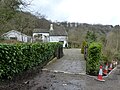
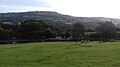
English: Strines is a village in Greater Manchester, located in the valley of the River Goyt midway between Marple and New Mills and about six miles southeast of Stockport. The village falls mainly within Marple parish and Stockport metropolitan borough, though a small part (including the railway station) falls within the boundaries of New Mills and thus in the Borough of High Peak, Derbyshire. Immediately surrounding Strines are the villages of Woodend, Hague Bar and Brookbottom. Close by are the towns of Marple and New Mills and the villages of Mellor and Rowarth. Nearby is the hamlet of Turf Lea.
village in Stockport, Greater Manchester, UK .jpg) | |||||
| Upload media | |||||
| Instance of | |||||
|---|---|---|---|---|---|
| Location | Stockport, Greater Manchester, North West England, England | ||||
 | |||||
Subcategories
This category has the following 3 subcategories, out of 3 total.
R
- Roman Bridge, Strawberry Hill (13 F)
S
- St Paul's Church, Strines (3 F)
- Strines railway station (11 F)
Media in category "Strines"
The following 66 files are in this category, out of 66 total.
-
 160, Strines Road 01.jpg 4,000 × 3,000; 1.07 MB
-
 160, Strines Road 02.jpg 4,000 × 3,000; 1.26 MB
-
 160, Strines Road 03.jpg 4,000 × 3,000; 1.3 MB
-
 Approaching Strines Railway Station (33316821971).jpg 4,896 × 3,264; 6.17 MB
-
 Aqueduct near Peers Cottages.jpg 1,024 × 768; 321 KB
-
 Bridge 23 peak forest canal strines.jpg 4,032 × 3,024; 4 MB
-
 Bridleway near the Peak Forest Canal - geograph.org.uk - 2527591.jpg 3,648 × 2,736; 6.19 MB
-
 Bruce's Clock, Strines - geograph.org.uk - 5232532.jpg 2,920 × 5,184; 1.26 MB
-
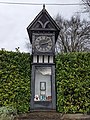 Bruces clock strines.jpg 3,024 × 4,032; 4.26 MB
-
 Chinese Dovecot, Strines.jpg 3,000 × 4,000; 4.34 MB
-
 Cross on Top of Mellor Moor - geograph.org.uk - 200894.jpg 640 × 480; 59 KB
-
 Dovecote, Strines Fishing Lake - geograph.org.uk - 4969952.jpg 640 × 480; 141 KB
-
 Dovecote, Strines.jpg 640 × 480; 570 KB
-
 Farmhouse near Strines Inn - geograph.org.uk - 987661.jpg 640 × 426; 65 KB
-

-
 Greenclough Farm - geograph.org.uk - 2535760.jpg 3,648 × 2,736; 6.17 MB
-
 High Cliff Cottage, Brookbottom.jpg 4,000 × 3,000; 1.55 MB
-
 High Cliff Farmhouse.jpg 4,000 × 3,000; 1.22 MB
-
 Ivy Cottage, Ridge End - geograph.org.uk - 55281.jpg 480 × 640; 97 KB
-
 Lower Cliffe Farm - geograph.org.uk - 4443418.jpg 4,967 × 3,689; 5.69 MB
-
 Lumm House, Strines (winter).jpg 4,000 × 3,000; 4.91 MB
-
 Lumm House, Strines.jpg 4,079 × 3,106; 1.93 MB
-
 Marple - Windy Bottom - geograph.org.uk - 615922.jpg 405 × 640; 71 KB
-
 Narrow Boats near Strines - geograph.org.uk - 5101098.jpg 3,264 × 1,836; 2.09 MB
-
 Old Turnstile - geograph.org.uk - 854719.jpg 546 × 640; 171 KB
-
 Old works pond at Strines - geograph.org.uk - 5210951.jpg 3,648 × 2,736; 5.07 MB
-
 Path at The Banks - geograph.org.uk - 4443417.jpg 4,988 × 3,761; 5.97 MB
-
 Path Junction (geograph 5567138).jpg 1,280 × 960; 1.51 MB
-
 Path junction west of The Banks - geograph.org.uk - 4117761.jpg 1,600 × 1,200; 914 KB
-
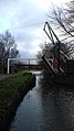 Peak Forest Canal lift bridge, Strines, High Peak.jpg 1,836 × 3,264; 2.83 MB
-
 Peak Forest Canal near Strines, Stockport - geograph.org.uk - 4320188.jpg 1,024 × 768; 635 KB
-
 Peak Forest Canal near Strines, Stockport - geograph.org.uk - 4320463.jpg 1,024 × 1,024; 678 KB
-
 Peak Forest Canal near Strines, Stockport - geograph.org.uk - 4320470.jpg 1,024 × 713; 471 KB
-
 Peers Cottages.jpg 1,024 × 768; 309 KB
-
 Royal Oak Public House - geograph.org.uk - 2596159.jpg 3,479 × 2,622; 2.96 MB
-
 Spout House Farm, Strines.jpg 4,000 × 3,000; 1.22 MB
-
 Spout House, Strines 01.jpg 4,000 × 3,000; 1.3 MB
-
 Spout House, Strines 02.jpg 4,000 × 3,000; 1.27 MB
-
 Story of strines printing company.jpg 4,032 × 3,024; 3.68 MB
-
 Strawberry Hill, Strines 01.jpg 4,000 × 3,000; 4.92 MB
-
 Strawberry Hill, Strines 02.jpg 4,000 × 3,000; 4.78 MB
-
 Strawberry Hill, Strines 03.jpg 4,000 × 3,000; 4.7 MB
-
 Strines aqueduct.jpg 4,032 × 3,024; 5.99 MB
-
 Strines dovecote thingey.jpg 5,184 × 3,456; 5.47 MB
-
 Strines Hall.jpg 4,000 × 3,000; 1.46 MB
-
 Strines Recreation Ground Fishing - geograph.org.uk - 2535777.jpg 3,648 × 2,736; 5.18 MB
-
 Strines Road (B6101) at Marple - geograph.org.uk - 3145513.jpg 640 × 481; 516 KB
-
 Strines, Mill Green - geograph.org.uk - 3144218.jpg 640 × 481; 585 KB
-
 Strines, The Royal Oak - geograph.org.uk - 3145389.jpg 640 × 480; 461 KB
-
 Summer walk to the pub. - geograph.org.uk - 3683260.jpg 3,264 × 2,448; 3.53 MB
-
 The road into Strines - geograph.org.uk - 3163831.jpg 1,600 × 1,200; 480 KB
-
 The Royal Oak, Strines Road - geograph.org.uk - 3145383.jpg 640 × 480; 520 KB
-
 The Sportsman - geograph.org.uk - 3163823.jpg 1,600 × 1,200; 290 KB
-
 The Sportsman - geograph.org.uk - 6373676.jpg 3,750 × 2,657; 3.33 MB
-
 The Sportsman Public House - geograph.org.uk - 2596161.jpg 2,595 × 2,605; 2.14 MB
-
 The Sportsman, Strines - geograph.org.uk - 3145376.jpg 640 × 481; 457 KB
-
 The strines dovecote.jpg 4,032 × 3,024; 3.17 MB
-
 Unmade Road and Woodland Entrance near Strines - geograph.org.uk - 2810753.jpg 3,148 × 2,262; 1.91 MB
-

-
 Whitecroft Farm - geograph.org.uk - 3145246.jpg 640 × 480; 522 KB
-
 Whitecroft farm strines.jpg 4,032 × 3,024; 3.9 MB
-
 Carrington Barn Farm, near Marple - geograph.org.uk - 80259.jpg 640 × 426; 93 KB
-

-
 Mellor Moor - geograph.org.uk - 9751.jpg 640 × 445; 81 KB
-

-
 View from Ridge End - geograph.org.uk - 55280.jpg 640 × 480; 120 KB


.jpg)


.jpg)


.jpg)


_at_Marple_-_geograph.org.uk_-_3145513.jpg)


