Category:Strijbeek
Jump to navigation
Jump to search
| Object location | | View all coordinates using: OpenStreetMap |
|---|
Nederlands: Afbeeldingen van Strijbeek, behorende tot de gemeente Alphen-Chaam, in de provincie Noord-Brabant in het zuiden van Nederland. Strijbeek is onder meer nabij Chaam, Galder, Meersel-Dreef en Ulvenhout. (bron [1])
village in Alphen-Chaam, the Netherlands    | |||||
| Upload media | |||||
| Instance of | |||||
|---|---|---|---|---|---|
| Location | Alphen-Chaam, North Brabant, Netherlands | ||||
 | |||||
Subcategories
This category has the following 8 subcategories, out of 8 total.
Media in category "Strijbeek"
The following 4 files are in this category, out of 4 total.
-
 Ingang Kapellerlaan postcard no. 1597 verso.jpg 3,234 × 2,082; 1.84 MB
-
 Oogsten Markhoeve IMG 0642 (2).jpg 3,241 × 2,091; 1.88 MB
-
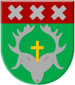 Strijbeek wapen.svg 231 × 261; 11 KB
-
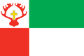 Vlag van Strijbeek.png 988 × 659; 60 KB

.jpg)
