Category:Strelakette
Jump to navigation
Jump to search
| Object location | | View all coordinates using: OpenStreetMap |
|---|
 | |||||
| Upload media | |||||
| Instance of | |||||
|---|---|---|---|---|---|
| Location | Grisons, Switzerland | ||||
| Mountain range | |||||
| Highest point | |||||
 | |||||
Media in category "Strelakette"
The following 18 files are in this category, out of 18 total.
-
 Arosa golfplatz maran.jpg 3,648 × 2,736; 1.3 MB
-
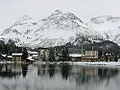 Arosa mit Obersee im Winter.jpg 500 × 375; 46 KB
-
 Arosa, Switzerland - Lake (1).jpg 2,592 × 1,944; 1.59 MB
-
 Chüpfenflue Sapün.jpg 2,048 × 1,536; 1.28 MB
-
 Furkahorn.jpg 2,080 × 1,544; 800 KB
-
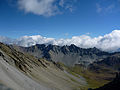 Guggernellgrat.jpg 4,000 × 3,000; 8.18 MB
-
 Hörnli1a.jpg 2,048 × 1,536; 2.91 MB
-
 Innerschanfigg.jpg 2,048 × 1,536; 560 KB
-
 Medergerflue Chüpfenflue.jpg 2,048 × 1,536; 438 KB
-
 Plessur8.JPG 2,816 × 2,112; 2.63 MB
-
 Schanfigg Arosa.jpg 2,002 × 1,325; 442 KB
-
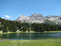
 Strelakette Schwellisee.jpg 2,048 × 1,536; 427 KB
-
 Strelakette Tiejerflue2.jpg 1,942 × 1,382; 417 KB
-
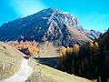
 Tiejer Flue.jpg 2,048 × 1,536; 2.68 MB
-
 Tschuggen1.jpg 2,048 × 1,536; 2.21 MB
-
 Tschuggen4.jpg 2,048 × 1,536; 3.04 MB
-
 Welschtobel1.jpg 2,048 × 1,536; 651 KB
-
 Welschtobel3.jpg 2,048 × 1,536; 3.01 MB


.jpg)


