Category:Streets in Pittenweem
Jump to navigation
Jump to search
Subcategories
This category has the following 6 subcategories, out of 6 total.
A
- Abbey Wall Road, Pittenweem (3 F)
C
- Cove Wynd (3 F)
H
- High Street, Pittenweem (4 F)
M
- Mid Shore, Pittenweem (9 F)
R
- Routine Row (4 F)
W
- West Shore, Pittenweem (22 F)
Media in category "Streets in Pittenweem"
The following 13 files are in this category, out of 13 total.
-
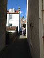 Bruce's Wynd, Pittenweem.jpg 2,448 × 3,264; 2.27 MB
-
 Charles Street, Pittenweem - geograph.org.uk - 976693.jpg 640 × 460; 68 KB
-
 Fife Coast Path, Pittenweem - geograph.org.uk - 1725883.jpg 640 × 359; 75 KB
-
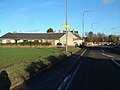
 Inch Farm Road - geograph.org.uk - 566427.jpg 640 × 399; 53 KB
-
-

-
 Road bridge over the Dreel Burn - geograph.org.uk - 62770.jpg 640 × 480; 260 KB
-
 St Abbs Crescent, Pittenweem - geograph.org.uk - 1726669.jpg 638 × 442; 83 KB
-
 Street sign for Water Wynd, Pittenweem, Fife.JPG 2,557 × 765; 403 KB
-
 Terra Firma - geograph.org.uk - 552103.jpg 640 × 424; 94 KB
-
 Viewforth Place, Pittenweem - geograph.org.uk - 976683.jpg 640 × 385; 76 KB
-
 Waggon Road, Pittenweem - geograph.org.uk - 499635.jpg 640 × 424; 81 KB
-
 Water Wynd, Pittenweem - geograph.org.uk - 150753.jpg 640 × 480; 280 KB


