Category:Street lights in the City of Leeds
Jump to navigation
Jump to search
Subcategories
This category has the following 2 subcategories, out of 2 total.
W
- Street lights in Wetherby (13 F)
Media in category "Street lights in the City of Leeds"
The following 74 files are in this category, out of 74 total.
-
 Advertisment banner on Park Row for the Leeds 10K (4th May 2010).jpg 2,592 × 3,872; 2.33 MB
-
 After the sledging - geograph.org.uk - 5705344.jpg 1,024 × 768; 89 KB
-
 Albion Place looking East - geograph.org.uk - 548321.jpg 640 × 480; 50 KB
-
 Albion Street - geograph.org.uk - 962817.jpg 640 × 480; 249 KB
-

-
 Armley Road viewed from Footbridge - geograph.org.uk - 551662.jpg 640 × 436; 38 KB
-
 Wooler Street, Beeston, Leeds - geograph.org.uk - 90584.jpg 640 × 480; 97 KB
-
 St Luke's Church Beeston 2017.jpg 3,072 × 2,304; 2.37 MB
-
 The spire of Bramley St Margaret - geograph.org.uk - 276158.jpg 480 × 640; 146 KB
-
 Bus stop and lamp post, , Thorp Arch Trading Estate (5th June 2013).JPG 2,176 × 3,872; 1.7 MB
-
 Call Lane, Leeds (35419509431).jpg 3,840 × 1,910; 2.86 MB
-
 Clyde flats in Wortley during sunset.jpg 751 × 1,024; 293 KB
-
 CollageSwarcliffepubs.jpg 649 × 1,014; 155 KB
-
 DanceSchool1.jpg 1,600 × 1,200; 187 KB
-
 East Ardsley speed limit, Woodhouse Lane - geograph.org.uk - 1760500.jpg 518 × 389; 144 KB
-
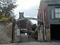 Entrance to Wetherby Parish Church from North Street.jpg 2,048 × 1,536; 398 KB
-
 Gas lamp by Canal Road, Leeds - geograph.org.uk - 4920905.jpg 768 × 1,014; 302 KB
-
 Gas Lamp Post On Pavement Between Numbers 10 And 11.jpg 3,330 × 4,440; 2.25 MB
-
 Gas Lamp Post On Pavement Between Numbers 16 And 17.jpg 1,170 × 1,560; 613 KB
-
 Gas Lamp Post On Pavement Between Numbers 3 And 4.jpg 2,936 × 3,914; 2.55 MB
-
 GiptonHousing.jpg 642 × 486; 98 KB
-
 Hark to Rover Cottages, Morris Lane - geograph.org.uk - 1344616.jpg 640 × 426; 91 KB
-
 Holbecknew2.JPG 600 × 344; 59 KB
-
 Housing in Whinmoor.jpg 3,648 × 2,736; 2.18 MB
-
 Spire of St Mary the Virgin (Hunslet Parish Church).jpg 2,736 × 3,648; 1.78 MB
-
 Illuminated ww1 Tommy.jpg 3,120 × 4,160; 5.34 MB
-
 Jimmys Entrance 2008.jpg 2,048 × 1,536; 929 KB
-
 KentmereAvenue.jpg 2,794 × 1,400; 767 KB
-
 Kirkstall Forge. Leeds (34514287316).jpg 1,280 × 853; 548 KB
-
 Lamp post on Woodhouse Lane in Leeds (4th April 2010).jpg 3,872 × 2,592; 1.39 MB
-
 Lampost replacement on Roseville Road (25th September 2010).jpg 2,736 × 3,648; 1.58 MB
-
 Leeds (15), September 2009.JPG 4,272 × 2,848; 4.59 MB
-
 Leeds (34831277751).jpg 6,000 × 4,000; 12.93 MB
-
 Leeds And Liverpool Canal, Leeds City Centre (34514840010).jpg 6,000 × 4,000; 13.65 MB
-
 Leeds And Liverpool Canal, Leeds City Centre (34770054541).jpg 5,992 × 3,137; 11.13 MB
-
 Leeds And Liverpool Canal, Leeds City Centre (34861639246).jpg 6,000 × 4,000; 15.08 MB
-
 Leeds Bridge arms and lamp post MF.jpg 2,736 × 3,648; 3.04 MB
-
 Leeds Cathedral (4th May 2010) 007.jpg 2,592 × 3,872; 2.98 MB
-
 Leeds Town Hall (4th May 2010).jpg 3,872 × 2,592; 2.31 MB
-
 K2B.jpg 1,600 × 1,200; 599 KB
-
 Leicester Place, Leeds. - geograph.org.uk - 388030.jpg 640 × 480; 44 KB
-
 Looking west from Quarry House - geograph.org.uk - 5162399.jpg 1,024 × 738; 173 KB
-
 Lovell Park Grange - off North Street - geograph.org.uk - 565544.jpg 480 × 640; 39 KB
-
 Main Street, Scholes, Leeds 001.jpg 3,872 × 2,592; 1.86 MB
-
 Market Street Arcade, Leeds (4th May 2010).jpg 3,872 × 2,592; 2.69 MB
-
 New Farnley (34320182505).jpg 6,000 × 4,000; 8.28 MB
-
 New Farnley (34320201165).jpg 4,000 × 6,000; 13 MB
-
 New Lane - looking South East (April 2010) 003.jpg 2,592 × 3,872; 2.13 MB
-
 Old and New. Streetlight replacement on York Road, Wetherby (28th December 2013).JPG 3,456 × 4,608; 6.32 MB
-
 Park Lane College.jpg 640 × 480; 76 KB
-
 Path by the River Aire - geograph.org.uk - 786117.jpg 450 × 600; 72 KB
-
 Path by the River Aire - geograph.org.uk - 786121.jpg 640 × 480; 83 KB
-
 PennyFun.JPG 3,254 × 1,740; 1.01 MB
-
 Queen Square, Leeds - geograph.org.uk - 1729464.jpg 427 × 640; 76 KB
-
 Queen Street, Morley.jpg 1,200 × 1,600; 549 KB
-
 Radisson BLU sign on The Light, Leeds (4th May 2010).jpg 3,872 × 2,592; 2.62 MB
-
 Scott Lane, Wetherby (March 2010) 001.jpg 2,736 × 3,648; 3.19 MB
-
 Seacroft Gate (11th June 2010) 002.jpg 3,648 × 2,736; 2.08 MB
-
 Seacroft Green shopping centre and Queensview (11th June 2010).jpg 3,648 × 2,736; 1.38 MB
-
 SeacroftHRFlats.jpg 2,176 × 1,632; 1.02 MB
-
 Sheepscar Gasholder, Leeds.jpg 3,648 × 2,736; 1.64 MB
-
 Sheepscar Interchange 001.jpg 3,648 × 2,736; 918 KB
-
 St Margaret's View - Fitzroy Drive - geograph.org.uk - 1128734.jpg 640 × 442; 190 KB
-
 Staging Post.jpg 1,496 × 1,197; 394 KB
-
 Streetlighting being lowererd, Crown Point Retail Park, Leeds (19th July 2014).JPG 3,456 × 4,608; 6.29 MB
-
 Talbot Gardens - Talbot Avenue - geograph.org.uk - 1446736.jpg 640 × 480; 245 KB
-
 Thorpe Park, Leeds 004.jpg 3,872 × 2,592; 2.42 MB
-
 Tour de France banners, Eastgate, Leeds (30th May 2014).JPG 3,456 × 4,608; 6.3 MB
-
 Town Street Middleton Leeds.jpg 640 × 480; 70 KB
-
 U of Leeds Montague Burton Residences F.jpg 2,856 × 2,142; 2.38 MB
-
 University of Leeds (4th May 2010) 072.jpg 2,592 × 3,872; 2.02 MB
-
 Westerly Croft, Armley.jpg 1,057 × 1,433; 235 KB
-
 Whitehall Riverside - geograph.org.uk - 630733.jpg 426 × 640; 64 KB
-
 Whitehouse Lane, Leeds Bradford International Airport (24th July 2010).jpg 2,736 × 3,648; 1.66 MB
.jpg)


.JPG)
.jpg)


.jpg)


.jpg)
.jpg)
.jpg)
,_September_2009.JPG)
.jpg)
.jpg)
.jpg)
.jpg)

_007.jpg)
.jpg)


.jpg)
.jpg)
.jpg)
_003.jpg)
.JPG)


.jpg)
_001.jpg)
_002.jpg)
.jpg)


.JPG)


.JPG)


_072.jpg)


.jpg)