Category:Stour Valley Walk
Jump to navigation
Jump to search
recreational walking route | |||||
| Upload media | |||||
| Instance of | |||||
|---|---|---|---|---|---|
| Location |
| ||||
 | |||||
This Category is about the Stour Valley Walk in Kent. For the Stour Valley Way in Dorset, see Stour Valley Way. For the Stour Valley Path in Suffolk, see Stour Valley Path.

Subcategories
This category has only the following subcategory.
S
- Stour Valley Walk in Ashford (14 F)
Media in category "Stour Valley Walk"
The following 111 files are in this category, out of 111 total.
-

-
 A cottage opposite the Rising Sun - geograph.org.uk - 764295.jpg 600 × 450; 186 KB
-
 A Touch of White Water - geograph.org.uk - 1141153.jpg 426 × 640; 126 KB
-

-
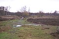
 Cattle pond near Shapwick - geograph.org.uk - 1197932.jpg 640 × 480; 71 KB
-

-
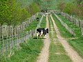 Cow on Chart Avenue - geograph.org.uk - 1272634.jpg 640 × 480; 164 KB
-
 Detail on plaque - geograph.org.uk - 468036.jpg 640 × 480; 150 KB
-
 Footbridge across the Little Stour - geograph.org.uk - 1620218.jpg 640 × 430; 134 KB
-

-

-
-
 Footpath to Beech Wood and Crundale - geograph.org.uk - 792467.jpg 640 × 480; 243 KB
-
 Footpath to Wye from Marriage Hill - geograph.org.uk - 792463.jpg 640 × 480; 181 KB
-

-

-

-

-

-
-
 Looking NE along the Stour Valley Walk - geograph.org.uk - 783089.jpg 640 × 480; 228 KB
-
 Looking NE along the Stour Valley Walk - geograph.org.uk - 786044.jpg 640 × 480; 224 KB
-
 Looking NE from near Horton - geograph.org.uk - 783132.jpg 640 × 480; 202 KB
-
 Looking NW along the Stour Valley Walk - geograph.org.uk - 786014.jpg 640 × 480; 216 KB
-

-
-
 Looking SE along the Stour Valley Walk - geograph.org.uk - 786001.jpg 640 × 480; 224 KB
-
 Looking SW along the Stour Valley Walk - geograph.org.uk - 1280189.jpg 640 × 480; 186 KB
-
 Looking upstream on the River Stour - geograph.org.uk - 1269398.jpg 640 × 480; 193 KB
-
 Looking W along the Stour Valley Walk - geograph.org.uk - 794955.jpg 640 × 480; 175 KB
-

-
-
-
 Orchards by the Stour Valley Walk - geograph.org.uk - 983931.jpg 640 × 430; 83 KB
-
 Ornamental Pond and duck bridge - geograph.org.uk - 1292620.jpg 640 × 480; 131 KB
-

-

-

-

-
 Sheep on the footpath - geograph.org.uk - 789932.jpg 640 × 480; 226 KB
-

-
 Stile on the Stour Valley Walk - geograph.org.uk - 1274995.jpg 640 × 480; 197 KB
-
 Stile on the Stour Valley Walk - geograph.org.uk - 1602178.jpg 640 × 427; 98 KB
-
 Stile on the Stour Valley Walk - geograph.org.uk - 786006.jpg 640 × 480; 255 KB
-

-
 Stour Valley Path - geograph.org.uk - 1141172.jpg 426 × 640; 64 KB
-
 Stour Valley Path towards West Street - geograph.org.uk - 1601840.jpg 640 × 427; 118 KB
-
 Stour Valley Walk - geograph.org.uk - 1620141.jpg 640 × 430; 132 KB
-
 Stour Valley Walk - geograph.org.uk - 535131.jpg 640 × 479; 168 KB
-
 Stour Valley Walk along the Great Stour - geograph.org.uk - 1619845.jpg 640 × 430; 162 KB
-
 Stour Valley Walk along the Great Stour - geograph.org.uk - 1619857.jpg 640 × 430; 185 KB
-
 Stour Valley Walk along the Great Stour - geograph.org.uk - 1619873.jpg 640 × 430; 168 KB
-
 Stour Valley Walk beside Marriage Wood - geograph.org.uk - 1765551.jpg 3,072 × 2,304; 2.5 MB
-
 Stour Valley Walk crosses West Street - geograph.org.uk - 1601850.jpg 640 × 427; 137 KB
-
 Stour Valley Walk enters Warren Wood - geograph.org.uk - 1765433.jpg 2,304 × 3,072; 3.03 MB
-

-

-

-

-

-

-

-
 Stour Valley Walk in Victoria Park - geograph.org.uk - 1279107.jpg 640 × 480; 119 KB
-
 Stour Valley Walk near The Boathouse - geograph.org.uk - 1620121.jpg 640 × 430; 158 KB
-

-

-

-
 Stour Valley Walk through Worten Wood - geograph.org.uk - 1278271.jpg 480 × 640; 395 KB
-

-
 Stour Valley Walk, Trenleypark Wood - geograph.org.uk - 1618811.jpg 640 × 430; 184 KB
-
 Stour Valley Walk, Trenleypark Wood - geograph.org.uk - 1618823.jpg 640 × 430; 194 KB
-
 Stour Valley Walk, Trenleypark Wood - geograph.org.uk - 1618839.jpg 640 × 430; 196 KB
-

-

-

-

-
 The River Stour near Victoria Park - geograph.org.uk - 1279115.jpg 640 × 480; 134 KB
-
 The route of the Stour Valley Walk - geograph.org.uk - 1280182.jpg 640 × 480; 193 KB
-
 The route SW of the Stour Valley Walk - geograph.org.uk - 783024.jpg 640 × 480; 112 KB
-
 The Stour Valley Walk - geograph.org.uk - 1003495.jpg 640 × 480; 183 KB
-
 The Stour Valley Walk - geograph.org.uk - 1620192.jpg 640 × 430; 126 KB
-

-

-
 The Stour Valley Walk and the Great Stour - geograph.org.uk - 794850.jpg 640 × 480; 259 KB
-

-

-

-
 The Stour Valley Walk near Horton - geograph.org.uk - 783124.jpg 640 × 480; 226 KB
-

-

-

-
-
 Valley of the Stour (Dedham Vale).jpg 5,312 × 2,988; 4.52 MB
-

-

-
 View along Stour Valley walk - geograph.org.uk - 779020.jpg 640 × 480; 255 KB
-

-

-
 View along the Stour Valley Walk - geograph.org.uk - 1270227.jpg 640 × 480; 196 KB
-
-
 View from Lenham.JPG 2,048 × 1,536; 665 KB
-

-
 Waymarker, Stour Valley Walk - geograph.org.uk - 1620157.jpg 314 × 640; 73 KB
-
 Well defined footpath towards Ashford - geograph.org.uk - 794845.jpg 640 × 480; 217 KB
-
 Worten Mill from the Stour Valley Walk - geograph.org.uk - 1275599.jpg 640 × 480; 153 KB
-
 Worten Wood from the Stour Valley Walk - geograph.org.uk - 1278310.jpg 640 × 480; 126 KB
-
 Cows expecting rain^ - geograph.org.uk - 465001.jpg 640 × 480; 55 KB
-

-

-
 Stour Valley Walk - geograph.org.uk - 403488.jpg 427 × 640; 172 KB
-
 The Stour Valley Walk - geograph.org.uk - 478877.jpg 640 × 480; 113 KB


.jpg)


