Category:Stottesdon
Jump to navigation
Jump to search
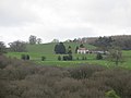
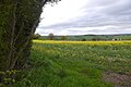
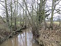
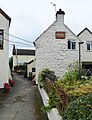
English: Stottesdon is a village and civil parish in south east Shropshire, England. The parish of Stottesdon covers is rural and includes the hamlets of Bagginswood and Chorley. The village is situated near the market towns of Cleobury Mortimer and Bridgnorth.
village and civil parish in Shropshire, United Kingdom  | |||||
| Upload media | |||||
| Instance of | |||||
|---|---|---|---|---|---|
| Location | Shropshire, West Midlands, England | ||||
 | |||||
Subcategories
This category has the following 4 subcategories, out of 4 total.
Media in category "Stottesdon"
The following 149 files are in this category, out of 149 total.
-
 80 metres of pettyness - geograph.org.uk - 4349169.jpg 800 × 600; 400 KB
-
 A Field Boundary Yew - geograph.org.uk - 5711823.jpg 1,600 × 1,068; 606 KB
-
 A line of oaks - geograph.org.uk - 5664147.jpg 1,024 × 683; 333 KB
-
 A muddy field near Hinton - geograph.org.uk - 5851998.jpg 1,024 × 576; 245 KB
-
 A road between Farlow and Stottesdon - geograph.org.uk - 5664151.jpg 1,024 × 683; 408 KB
-
 Access road to Newton Farm - geograph.org.uk - 941763.jpg 640 × 480; 95 KB
-
 Access to a footpath - geograph.org.uk - 1065394.jpg 640 × 480; 156 KB
-
 Across the fields to Brown Clee - geograph.org.uk - 2418383.jpg 640 × 480; 127 KB
-
 Along the hedgeline on Overton Hill - geograph.org.uk - 4480714.jpg 1,142 × 857; 538 KB
-
 Bagginslye Coppice - geograph.org.uk - 4359329.jpg 800 × 600; 505 KB
-
 Barns at Upper Overton - geograph.org.uk - 4482316.jpg 1,142 × 857; 335 KB
-
 Baveney - geograph.org.uk - 4422086.jpg 800 × 533; 439 KB
-
 Birchen Park - geograph.org.uk - 4421581.jpg 800 × 533; 489 KB
-
 Bragginslye Covert - geograph.org.uk - 4349158.jpg 800 × 600; 538 KB
-
 Bridge, Harcourt - geograph.org.uk - 4359305.jpg 800 × 600; 501 KB
-
 Brook near Newton Farm, Shropshire - geograph.org.uk - 606841.jpg 640 × 461; 148 KB
-
 Bush Cottage - geograph.org.uk - 3045284.jpg 2,562 × 3,451; 6.27 MB
-
 Bush Cottage, Stottesdon.jpg 3,600 × 2,700; 6.69 MB
-
 Chapel, Stottesdon - geograph.org.uk - 5664167.jpg 1,024 × 683; 452 KB
-
 Chorley Covert - geograph.org.uk - 4349138.jpg 800 × 600; 528 KB
-
 Chorley Covert - geograph.org.uk - 4359295.jpg 800 × 600; 544 KB
-
 Chorley Village Hall, New Road, Chorley, Shrops - geograph.org.uk - 4710167.jpg 1,024 × 724; 193 KB
-

-

-
 Deer, Rays - geograph.org.uk - 4146248.jpg 800 × 600; 524 KB
-
 Dismantled Railway - geograph.org.uk - 511913.jpg 480 × 640; 139 KB
-
 Dismantled Railway looking south-east - geograph.org.uk - 511636.jpg 640 × 480; 114 KB
-
 Dismantled Railway looking west - geograph.org.uk - 511626.jpg 640 × 480; 97 KB
-
 Dismantled railway southeast - geograph.org.uk - 512895.jpg 640 × 480; 122 KB
-
 Downstream on the Rea Brook - geograph.org.uk - 2409054.jpg 480 × 640; 87 KB
-
 Fallen Barn - geograph.org.uk - 398363.jpg 603 × 599; 122 KB
-
 Farm road, Upper Harcourt - geograph.org.uk - 4360685.jpg 800 × 600; 425 KB
-
 Farm road, Upper Harcourt - geograph.org.uk - 4360691.jpg 800 × 600; 352 KB
-
 Farmland, Stottesdon - geograph.org.uk - 5664173.jpg 1,024 × 683; 312 KB
-
 Felled area, Chorley Covert - geograph.org.uk - 4349050.jpg 800 × 600; 435 KB
-
 Field edge - geograph.org.uk - 4348088.jpg 800 × 533; 383 KB
-
 Field near The Bold - geograph.org.uk - 4131805.jpg 640 × 480; 269 KB
-
 Field, Prescott - geograph.org.uk - 4360716.jpg 800 × 600; 425 KB
-
 Field, The Plackett - geograph.org.uk - 5664247.jpg 1,024 × 683; 298 KB
-
 Forage maize - geograph.org.uk - 5583180.jpg 1,024 × 683; 346 KB
-
 Former Admiralty railway - geograph.org.uk - 2411806.jpg 640 × 480; 83 KB
-
 Former Admiralty railway - geograph.org.uk - 2411816.jpg 640 × 480; 78 KB
-

-

-
 Green lane, Prescott - geograph.org.uk - 4349230.jpg 800 × 600; 501 KB
-
 Green lane, Prescott - geograph.org.uk - 4349269.jpg 800 × 600; 487 KB
-
 Hardwicke Bridge - geograph.org.uk - 2411837.jpg 640 × 480; 99 KB
-
 Hardwicke Bridge - geograph.org.uk - 4349323.jpg 800 × 600; 438 KB
-
 Hay field - geograph.org.uk - 5447095.jpg 1,024 × 768; 299 KB
-
 Access to High Green - geograph.org.uk - 1111122.jpg 640 × 480; 128 KB
-
 It's Pickthorn Farm^ - geograph.org.uk - 1038592.jpg 640 × 480; 109 KB
-
 Lane alongside Park Coppice - geograph.org.uk - 4482330.jpg 1,142 × 857; 575 KB
-
 Lane near New House Farm - geograph.org.uk - 1065386.jpg 640 × 480; 100 KB
-
 Lane near Stottesdon - geograph.org.uk - 4131862.jpg 640 × 480; 234 KB
-
 Lane to Day House - geograph.org.uk - 1065388.jpg 640 × 480; 64 KB
-
 Lane to Stottesdon - geograph.org.uk - 2472083.jpg 640 × 480; 95 KB
-
 Leaving Stottesdon - geograph.org.uk - 939359.jpg 640 × 480; 83 KB
-
 Little used path across a field - geograph.org.uk - 939360.jpg 640 × 480; 75 KB
-
 Logging - geograph.org.uk - 395570.jpg 640 × 470; 140 KB
-
 Access road to Lower Harcourt - geograph.org.uk - 1111119.jpg 640 × 480; 93 KB
-
 Lower Woodend - geograph.org.uk - 4349349.jpg 800 × 600; 445 KB
-
 Maize stubble - geograph.org.uk - 4348079.jpg 800 × 533; 357 KB
-
 Maize stubble - geograph.org.uk - 4358839.jpg 800 × 533; 358 KB
-
 Mass House - geograph.org.uk - 4146216.jpg 640 × 480; 209 KB
-
 Midwinters Coppice - geograph.org.uk - 4359290.jpg 800 × 600; 550 KB
-
 Muddy gateway, Bagginslye - geograph.org.uk - 4360680.jpg 800 × 600; 374 KB
-
 Muddy lane near Stottesdon - geograph.org.uk - 4349312.jpg 800 × 600; 384 KB
-

-
 Northwood Lane - geograph.org.uk - 5664177.jpg 1,024 × 683; 330 KB
-
 Oakwood, Bagginswood - geograph.org.uk - 4349194.jpg 800 × 600; 356 KB
-
 Oakwoods - geograph.org.uk - 5664228.jpg 1,024 × 683; 588 KB
-
 Oilseed rape near Chorley - geograph.org.uk - 5664174.jpg 1,024 × 683; 362 KB
-

-

-
 Ordnance Survey Cut Mark - geograph.org.uk - 4750974.jpg 480 × 640; 79 KB
-
 Ordnance Survey Cut Mark - geograph.org.uk - 4762001.jpg 480 × 640; 103 KB
-
 OS flush bracket - Overton trig - geograph.org.uk - 4480708.jpg 857 × 1,142; 629 KB
-
 Overton trigpoint - geograph.org.uk - 4480671.jpg 1,142 × 857; 610 KB
-
 Park Wood - geograph.org.uk - 4348055.jpg 800 × 600; 524 KB
-
 Partially abandoned small holding at Overton - geograph.org.uk - 4480723.jpg 1,142 × 857; 443 KB
-
 Pickthorn Farm - geograph.org.uk - 941772.jpg 640 × 480; 88 KB
-
 Pond, Chorley Covert - geograph.org.uk - 4359298.jpg 800 × 600; 525 KB
-
 Pond, Park Coppice - geograph.org.uk - 5664207.jpg 1,024 × 683; 507 KB
-
 Prescott Bridge - geograph.org.uk - 611032.jpg 640 × 480; 88 KB
-
 Rea Brook - geograph.org.uk - 5664252.jpg 1,024 × 683; 491 KB
-
 Rea Valley arable - geograph.org.uk - 4131856.jpg 640 × 480; 244 KB
-

-
 Recycling area, New Road, Chorley, Shrops - geograph.org.uk - 4710190.jpg 1,024 × 736; 234 KB
-
 Riddings Lane - geograph.org.uk - 4358831.jpg 800 × 533; 483 KB
-
 River Rea - geograph.org.uk - 4360735.jpg 800 × 600; 497 KB
-

-

-

-
 Road at Chorley, Shrops - geograph.org.uk - 4711460.jpg 1,024 × 759; 165 KB
-
 Road heading out of Chorley, Shrops - geograph.org.uk - 4710177.jpg 1,024 × 747; 189 KB
-
 Road outside the Duck Inn, Chorley, Shrops - geograph.org.uk - 4711448.jpg 1,024 × 758; 168 KB
-
 Road signs, Bagginswood - geograph.org.uk - 4360706.jpg 800 × 600; 500 KB
-
 Road to Lower and Upper Harcourt - geograph.org.uk - 4349184.jpg 800 × 600; 323 KB
-
 Road to Overton - geograph.org.uk - 4348098.jpg 800 × 533; 354 KB
-
 Road to Pickthorn - geograph.org.uk - 5664181.jpg 1,024 × 683; 441 KB
-
 Road, Overton - geograph.org.uk - 5664191.jpg 1,024 × 683; 352 KB
-
 Roadside railings, Chorley - geograph.org.uk - 4131891.jpg 640 × 480; 306 KB
-
 Roadworks, Walton - geograph.org.uk - 4349205.jpg 800 × 600; 391 KB
-
 Roadworks, Walton - geograph.org.uk - 4360711.jpg 800 × 600; 358 KB
-
 Route of the old railway line - geograph.org.uk - 2418365.jpg 640 × 480; 118 KB
-
 Ruin, The Plackett - geograph.org.uk - 5664254.jpg 1,024 × 683; 351 KB
-
 Sheep pasture, The Plackett - geograph.org.uk - 5664241.jpg 1,024 × 683; 252 KB
-
 Sign post at the junction - geograph.org.uk - 867864.jpg 640 × 480; 382 KB
-
 Site of Burwarton Halt - geograph.org.uk - 2409101.jpg 640 × 480; 77 KB
-
 Stanley Farm Lane - geograph.org.uk - 1038594.jpg 640 × 480; 140 KB
-
 Stile near Bagginswood - geograph.org.uk - 4349336.jpg 800 × 600; 541 KB
-
 Disused Fallen Barn - geograph.org.uk - 675366.jpg 640 × 424; 54 KB
-
 Stottesdon - geograph.org.uk - 4131873.jpg 640 × 480; 250 KB
-
 Stottesdon - geograph.org.uk - 5664171.jpg 1,024 × 683; 336 KB
-
 Stottesdon school - geograph.org.uk - 4348052.jpg 800 × 600; 355 KB
-
 Stottesdon village and the Brown Clee (geograph 4026271).jpg 4,048 × 2,281; 4.26 MB
-
 Straight on for Bridgnorth - geograph.org.uk - 913389.jpg 640 × 480; 130 KB
-
 The Duck Inn (1), Chorley, Shrops - geograph.org.uk - 4711474.jpg 787 × 1,024; 203 KB
-
 The Duck Inn (2) and car park, Chorley, Shrops - geograph.org.uk - 4711495.jpg 1,024 × 720; 156 KB
-
 The Duck Inn (3) - sign, Chorley, Shrops - geograph.org.uk - 4711517.jpg 1,024 × 741; 102 KB
-
 The Highlands - that way - geograph.org.uk - 4131879.jpg 640 × 480; 328 KB
-
 The lane passing Hinton Farm - geograph.org.uk - 2418353.jpg 640 × 480; 83 KB
-
 The only pub in the village - geograph.org.uk - 687154 (cropped).jpg 335 × 335; 22 KB
-
 The only pub in the village - geograph.org.uk - 687154.jpg 640 × 480; 61 KB
-
 The Titterstone Clee summit - geograph.org.uk - 4026256.jpg 4,048 × 3,040; 5.22 MB
-
 Upper Cowslow Covert - geograph.org.uk - 4146052.jpg 800 × 600; 406 KB
-
 View towards Knowle Hill - geograph.org.uk - 4146209.jpg 800 × 600; 341 KB
-
 What's the brook called^ - geograph.org.uk - 4146238.jpg 640 × 480; 350 KB
-
 Wheatfield south of Bradley Wood - geograph.org.uk - 4480654.jpg 979 × 734; 339 KB
-
 Willow, Overton - geograph.org.uk - 5664196.jpg 427 × 640; 69 KB
-
 Woodland near Stottesdon - geograph.org.uk - 4131882.jpg 800 × 600; 550 KB
-
 Wrickton Mill - Sawmill - geograph.org.uk - 4471280.jpg 426 × 640; 116 KB
-
 Yellow road near Rays Bridge - geograph.org.uk - 4146224.jpg 800 × 600; 572 KB
-
 Access road to the Hall - geograph.org.uk - 1038595.jpg 640 × 480; 152 KB
-

-

-
 Autumn Grazing with Oak Trees, Shropshire - geograph.org.uk - 606883.jpg 640 × 448; 130 KB
-

-
 Deer pasture east of Stottesdon - geograph.org.uk - 511971.jpg 640 × 480; 88 KB
-
 Entrance to Walton Farm - geograph.org.uk - 511377.jpg 640 × 480; 98 KB
-
 Farmland near Stottesdon, Shropshire - geograph.org.uk - 605731.jpg 640 × 384; 130 KB
-

-
 Lower Overton Farm, Shropshire - geograph.org.uk - 396702.jpg 640 × 442; 107 KB
-
 Northwood Lane, Shropshire - geograph.org.uk - 396587.jpg 640 × 392; 96 KB
-
 Pickthorn Farm, Shropshire - geograph.org.uk - 396635.jpg 640 × 287; 83 KB
-
-
 View across Shropshire countryside - geograph.org.uk - 396720.jpg 640 × 411; 93 KB
-
 View from Riddings Lane, Shropshire - geograph.org.uk - 396612.jpg 640 × 398; 86 KB
-
 Winterburn Bridge junction, Shropshire - geograph.org.uk - 396732.jpg 640 × 506; 102 KB


.jpg)

,_Chorley,_Shrops_-_geograph.org.uk_-_4711474.jpg)
_and_car_park,_Chorley,_Shrops_-_geograph.org.uk_-_4711495.jpg)
_-_sign,_Chorley,_Shrops_-_geograph.org.uk_-_4711517.jpg)


.jpg)


