Category:Stone in Oxney
Jump to navigation
Jump to search
English: Stone in Oxney is a village south of Ashford in Kent, South East England, in the civil parish of Stone-cum-Ebony near Appledore.
village in Ashford, Kent, UK  | |||||
| Upload media | |||||
| Instance of | |||||
|---|---|---|---|---|---|
| Location | Stone-cum-Ebony, Ashford, Kent, South East England, England | ||||
 | |||||
Subcategories
This category has the following 2 subcategories, out of 2 total.
O
Media in category "Stone in Oxney"
The following 33 files are in this category, out of 33 total.
-
 Becket's Court - geograph.org.uk - 1749100.jpg 640 × 510; 99 KB
-
 Becket's Sewer - geograph.org.uk - 1749103.jpg 640 × 430; 130 KB
-
 Brick build cottage, Becket's Court - geograph.org.uk - 1749101.jpg 640 × 430; 136 KB
-
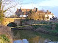
 Bridge over Five Watering Sewer - geograph.org.uk - 1749357.jpg 640 × 430; 141 KB
-
 Cliff Marsh Farm - geograph.org.uk - 1980943.jpg 1,024 × 679; 140 KB
-
 Cliff Marsh Farm summer harvest - geograph.org.uk - 1996489.jpg 3,072 × 1,728; 1.01 MB
-
 Cliff Marsh Farm, Stone in Oxney - geograph.org.uk - 2311833.jpg 1,600 × 1,200; 364 KB
-

-

-
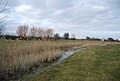
 Five Watering Sewer - geograph.org.uk - 1749655.jpg 640 × 430; 125 KB
-
 Flock of Sheep near Becket's Court - geograph.org.uk - 1749104.jpg 640 × 430; 117 KB
-

-
 Kent Ditch - geograph.org.uk - 1749344.jpg 640 × 430; 136 KB
-
 Level Crossing across the Marsh Line - geograph.org.uk - 1749105.jpg 640 × 430; 114 KB
-
 Oat Barn House - geograph.org.uk - 373360.jpg 640 × 480; 100 KB
-

-
 Pumping station on Becket's Sewer - geograph.org.uk - 1749060.jpg 640 × 407; 69 KB
-
 Roman Altar at Stone in the Isle of Oxney.jpg 1,081 × 1,236; 176 KB
-

-
 The Ferry Inn - geograph.org.uk - 388580.jpg 640 × 480; 127 KB
-
 Swans near the Ferry Inn - geograph.org.uk - 1539126.jpg 640 × 480; 114 KB
-
 The Crown inn Pub, Stone in Oxney, Tenterden, Kent - geograph.org.uk - 1755960.jpg 2,048 × 1,536; 519 KB
-
 The Marsh Line looking south west - geograph.org.uk - 1749107.jpg 640 × 430; 121 KB
-
 The Marsh Line, looking north east - geograph.org.uk - 1749108.jpg 640 × 430; 131 KB
-
 Track to Pumping Station - geograph.org.uk - 1539125.jpg 640 × 480; 100 KB
-

-
 Odiam Farm - geograph.org.uk - 412759.jpg 640 × 418; 99 KB
-

-
 Stone Cliff - geograph.org.uk - 470078.jpg 640 × 296; 60 KB
-

-

-

-


