Category:Stone arch bridges in North Yorkshire
Jump to navigation
Jump to search
Ceremonial counties of England: Bedfordshire · Berkshire · Buckinghamshire · Cambridgeshire · Cheshire · Cornwall · Cumbria · Derbyshire · Devon · Dorset · Durham · Essex · Gloucestershire · Greater London · Greater Manchester · Hampshire · Herefordshire · Kent · Lancashire · Leicestershire · Lincolnshire · Merseyside · Norfolk · North Yorkshire · Northamptonshire · Northumberland · Nottinghamshire · Oxfordshire · Shropshire · Somerset · South Yorkshire · Staffordshire · Suffolk · Surrey · Warwickshire · West Midlands · West Sussex · West Yorkshire · Wiltshire · Worcestershire
City-counties: Bristol ·
Former historic counties:
Other former counties:
City-counties: Bristol ·
Former historic counties:
Other former counties:
Subcategories
This category has the following 50 subcategories, out of 50 total.
A
- Appersett Viaduct (12 F)
B
- Barden Aqueduct Bridge (20 F)
- Barden Bridge (38 F)
- Beggar's Bridge, River Esk (29 F)
- Borough Bridge (6 F)
- Buckden Bridge (7 F)
- Burnsall Bridge (63 F)
- Burton Bridge, Selby Canal (6 F)
C
- Croft-on-Tees Bridge (7 F)
D
- Dob Park Bridge (4 F)
- Downholme Bridge (8 F)
E
- Eller Beck bridge, Beck Hole (9 F)
F
- Far Lane Bridge, Kettlewell (4 F)
G
- Gargrave Bridge (21 F)
- Grassington Bridge (7 F)
H
- Hampsthwaite Bridge (2 F)
- Hubberholme Bridge (3 F)
I
- Ings Bridge, Pickering (4 F)
- Ivelet Bridge (12 F)
J
- John Carr's bridge, Ferrybridge (32 F)
K
- Kildwick Bridge (5 F)
- Kirkham Bridge, North Yorkshire (23 F)
- Knight Stainforth Bridge (10 F)
L
- Levenside packhorse bridge (3 F)
- Li'le Emily's Bridge (9 F)
- Lindley Bridge, North Yorkshire (14 F)
M
- Mossdale Viaduct (3 F)
N
- New Bridge, Malham (20 F)
P
- Piercebridge Bridge (15 F)
- Pillimire Bridge (5 F)
R
- Ravenseat packhorse bridge (4 F)
- Richmond Bridge, North Yorkshire (13 F)
- Rievaulx Bridge (10 F)
- Romanby packhorse bridge (3 F)
S
- Skipton Packhorse Bridge (3 F)
- Spofforth Viaduct (4 F)
- Spruisty packhorse bridge (3 F)
T
- Tanfield Bridge (7 F)
- Topcliffe Bridge (3 F)
- Townfoot Bridge, Kettlewell (8 F)
- Townhead Bridge, Kettlewell (3 F)
W
- Wharfe Bridge, Kettlewell (9 F)
Y
- Yockenthwaite Bridge (20 F)
Media in category "Stone arch bridges in North Yorkshire"
The following 94 files are in this category, out of 94 total.
-
 2013 Surrender Bridge Healaugh North Yorkshire.jpg 3,136 × 2,091; 4.32 MB
-
 A Buttressed Bridge - geograph.org.uk - 1516933.jpg 640 × 480; 108 KB
-
 Across the Valley - geograph.org.uk - 1118883.jpg 480 × 640; 79 KB
-
 Birch Hall Inn - geograph.org.uk - 397823.jpg 640 × 480; 155 KB
-
 Boat under Horse Close Bridge - geograph.org.uk - 1283005.jpg 640 × 481; 340 KB
-
 Bolton Abbey - arch over the B6160 - geograph.org.uk - 1901931.jpg 640 × 480; 104 KB
-
 B6265 road bridge over River Ure.jpg 640 × 480; 100 KB
-
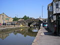
 Bridge No. 180, Leeds and Liverpool Canal - geograph.org.uk - 176141.jpg 640 × 480; 105 KB
-
 Bridge over the Esk at Grosmont - geograph.org.uk - 277287.jpg 640 × 480; 110 KB
-

-
 Bridge ^1 - geograph.org.uk - 832321.jpg 640 × 481; 128 KB
-
 Bridge ^2 - geograph.org.uk - 1073690.jpg 640 × 480; 145 KB
-
 Bridge ^2 - geograph.org.uk - 1081478.jpg 640 × 485; 103 KB
-
 Built to last (8649170463).jpg 4,288 × 2,416; 2.71 MB
-
 Canal Branch - geograph.org.uk - 32467.jpg 640 × 480; 287 KB
-
 Canal bridge - geograph.org.uk - 381888.jpg 500 × 335; 207 KB
-
 Canal Bridge - geograph.org.uk - 893690.jpg 640 × 480; 116 KB
-
 Canal crossing the River Aire - geograph.org.uk - 491687.jpg 640 × 480; 71 KB
-
 Canal in Skipton 04.jpg 2,560 × 1,920; 2.34 MB
-

-
 Church Street bridge - panoramio (1).jpg 3,072 × 1,728; 1.87 MB
-
 Church Street bridge - panoramio.jpg 1,728 × 3,072; 1.87 MB
-
 Coach Street Bridge - geograph.org.uk - 968484.jpg 640 × 480; 93 KB
-
 Cover Bridge, Yorkshire - geograph.org.uk - 716257.jpg 640 × 554; 87 KB
-
 Dismantled Railway Foot Bridge - geograph.org.uk - 466707.jpg 640 × 480; 87 KB
-
 DoubleArchedBridgeAtEastMarton.JPG 1,056 × 792; 142 KB
-
 Eller Beck, Skipton - geograph.org.uk - 1651177.jpg 640 × 407; 113 KB
-
 Eller Beck, Skipton, Yorkshire - geograph.org.uk - 873035.jpg 480 × 640; 103 KB
-
 Farnhill Bridge.jpg 640 × 480; 57 KB
-
 Flash flood aftermath - geograph.org.uk - 276461.jpg 640 × 427; 83 KB
-
 Footbridge and Weir, Eller Beck, Skipton - geograph.org.uk - 739650.jpg 640 × 408; 100 KB
-
 Foss bridge, Strensall.jpg 640 × 480; 83 KB
-
 Church Street Bridge - geograph.org.uk - 968304.jpg 640 × 480; 91 KB
-
 Gurtof Beck and Bridge - geograph.org.uk - 2098421.jpg 4,000 × 3,000; 4.21 MB
-
 Old bridge in Hampsthwaite.jpg 640 × 480; 142 KB
-
 Higherland Lock - geograph.org.uk - 512780.jpg 640 × 427; 79 KB
-
 Hungate Bridge - geograph.org.uk - 1717013.jpg 2,048 × 1,536; 1.45 MB
-
 Leat Bridge - Fountains Hall - North Yorkshire, England - DSC00552.jpg 3,648 × 5,472; 14.59 MB
-
 Leathley Bridge - geograph.org.uk - 1057929.jpg 640 × 480; 120 KB
-
 Leathley Bridge - geograph.org.uk - 1058474.jpg 518 × 640; 94 KB
-
 Leeds and Liverpool Canal at Skipton - geograph.org.uk - 621438.jpg 640 × 480; 99 KB
-
-

-

-

-
 Leeds-Liverpool canal at Gargrave - geograph.org.uk - 520052.jpg 640 × 473; 154 KB
-
 Railway bridge - geograph.org.uk - 338838.jpg 640 × 480; 145 KB
-
 Mark Bridge, Colsterdale - geograph.org.uk - 1276261.jpg 481 × 640; 139 KB
-
 Milepost 225 at Gargrave - geograph.org.uk - 1397416.jpg 640 × 480; 171 KB
-
 Mill Bridge - geograph.org.uk - 1081498.jpg 634 × 640; 172 KB
-
 Narrow boats in Skipton 03.JPG 1,855 × 1,727; 760 KB
-
 Narrow boats, Skipton Canal (1) - geograph.org.uk - 869653.jpg 640 × 479; 70 KB
-
 Nathwaite Bridge - geograph.org.uk - 1575755.jpg 600 × 450; 470 KB
-
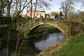
 New Bridge, Birstwith - geograph.org.uk - 1179290.jpg 640 × 428; 109 KB
-
 Packhorse Bridge - geograph.org.uk - 644320.jpg 640 × 480; 137 KB
-
 Posforth Bridge, Wharfedale - geograph.org.uk - 820088.jpg 640 × 425; 120 KB
-
 Priest Holme Bridge - geograph.org.uk - 491776.jpg 640 × 480; 79 KB
-

-

-
 Railway bridge, Gilsthwaite Lane.jpg 3,264 × 2,448; 2.94 MB
-
 Ray Bridge, Gargrave - geograph.org.uk - 745999.jpg 640 × 426; 96 KB
-
 Reeth Bridge.jpg 4,608 × 3,456; 10.77 MB
-
 Revamped Rustic Bridge - geograph.org.uk - 1568785.jpg 480 × 640; 183 KB
-
 Ribston Park - geograph.org.uk - 325456.jpg 640 × 480; 190 KB
-
 Ribston Park Bridge - geograph.org.uk - 1088047.jpg 640 × 480; 119 KB
-

-
 Sinnington Bridge.jpg 640 × 433; 80 KB
-
 Sour Bridge, Tunstall Lane - geograph.org.uk - 1558719.jpg 640 × 480; 83 KB
-
 Packhorse Bridge, Spofforth Mill - geograph.org.uk - 1612458.jpg 640 × 480; 132 KB
-
 Spring Branch Canal - geograph.org.uk - 484016.jpg 640 × 480; 140 KB
-
 Springs Branch Canal, Skipton - geograph.org.uk - 1651235.jpg 640 × 408; 112 KB
-

-
 Springs Branch or Lord Thanet's Canal. - geograph.org.uk - 620538.jpg 640 × 480; 194 KB
-

-

-

-
 Springs Canal - geograph.org.uk - 796279.jpg 640 × 427; 103 KB
-
 Springsbranch.jpg 640 × 480; 87 KB
-
 Stone arch bridge for farm traffic - geograph.org.uk - 1397310.jpg 640 × 480; 123 KB
-
 Stone Bridge over Apedale Beck - geograph.org.uk - 732129.jpg 640 × 480; 116 KB
-
 Stream bed - geograph.org.uk - 724018.jpg 640 × 480; 72 KB
-
 The old road bridge at Ferrybridge - geograph.org.uk - 1286111.jpg 640 × 427; 82 KB
-

-

-
 Tramway Bridge over Old Beck - geograph.org.uk - 734487.jpg 640 × 572; 154 KB
-
 Two Bridges - geograph.org.uk - 878872.jpg 640 × 457; 105 KB
-
 Under Mill Bridge - geograph.org.uk - 1081501.jpg 640 × 452; 121 KB
-
 Ure Frost - geograph.org.uk - 765607.jpg 640 × 480; 76 KB
-
 Wath Bridge - geograph.org.uk - 1505546.jpg 640 × 480; 136 KB
-
 Wath Bridge - geograph.org.uk - 1505839.jpg 480 × 640; 113 KB
-
 Weir at Gayle Bridge - geograph.org.uk - 678438.jpg 640 × 427; 88 KB
-
 World's End Bridge, Sowerby - geograph.org.uk - 76693.jpg 640 × 427; 129 KB
-
 Yockenthwaite Farm - geograph.org.uk - 42145.jpg 640 × 480; 110 KB
-
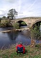 Bolton Bridge - geograph.org.uk - 411058.jpg 454 × 640; 110 KB


.jpg)


.jpg)


_-_geograph.org.uk_-_869653.jpg)


