Category:Stocksbridge
Jump to navigation
Jump to search
town in the City of Sheffield, South Yorkshire, England  | |||||
| Upload media | |||||
| Instance of | |||||
|---|---|---|---|---|---|
| Location | Sheffield, South Yorkshire, Yorkshire and the Humber, England | ||||
 | |||||
English: Stocksbridge is a small town and civil parish in the City of Sheffield, in South Yorkshire, England, with a population of 13,663. It lies just to the east of the Peak District.
Italiano: Stocksbridge è una città di 13.663 abitanti della contea del South Yorkshire, in Inghilterra.
Nederlands: Stocksbridge is een stad (town) en civil parish in het bestuurlijke gebied Sheffield, in het Engelse graafschap South Yorkshire. De civil parish telt
Subcategories
This category has the following 12 subcategories, out of 12 total.
B
E
F
- Footpaths in Stocksbridge (1 F)
M
N
- New Hall Wood, Stocksbridge (1 F)
S
- Stocksbridge Clock Tower (5 F)
- Stocksbridge Town Hall (4 F)
U
W
- Wharncliffe Woods (7 F)
Media in category "Stocksbridge"
The following 200 files are in this category, out of 870 total.
(previous page) (next page)-
 'Close up' of Dry Stone Walls on Lee Lane - geograph.org.uk - 720843.jpg 640 × 480; 138 KB
-

-

-

-

-

-
 'Le Tour à pied’ - geograph.org.uk - 3729087.jpg 1,024 × 683; 131 KB
-
 'Lonely' House in Stocksbridge - geograph.org.uk - 1033401.jpg 640 × 480; 76 KB
-
 'New' gates - geograph.org.uk - 3689776.jpg 1,024 × 683; 240 KB
-
 'Spooky Wood,' Stocksbridge - geograph.org.uk - 4771994.jpg 1,024 × 659; 298 KB
-
 18th Century Waymarking - geograph.org.uk - 922030.jpg 480 × 640; 118 KB
-
 1919 welcome home at Fox Glen Stocksbridge West Riding of Yorkshire England.jpg 1,075 × 674; 488 KB
-
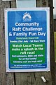 4SLC raft race poster - geograph.org.uk - 3564132.jpg 683 × 1,024; 177 KB
-
 4SLC raft races - geograph.org.uk - 3564133.jpg 1,024 × 342; 91 KB
-
 4SLC raft races - geograph.org.uk - 3564137.jpg 1,024 × 507; 142 KB
-
 53 Marjorie goes shopping - geograph.org.uk - 5256530.jpg 806 × 1,024; 198 KB
-
 A Busy Day at Lidl, Stocksbridge - geograph.org.uk - 1033343.jpg 640 × 480; 59 KB
-
 A climber jumping from Prow rock - geograph.org.uk - 2652343.jpg 2,560 × 1,920; 1.31 MB
-
-
 A guidestoop (Guidestone) - geograph.org.uk - 2932950.jpg 1,200 × 1,600; 486 KB
-
 A new gate on Wharncliffe Crag edge path - geograph.org.uk - 713930.jpg 640 × 480; 101 KB
-
 A view of Wind Hill Farm - geograph.org.uk - 3686632.jpg 3,418 × 2,734; 2.08 MB
-
 A616 towards Sheffield - geograph.org.uk - 6098772.jpg 800 × 600; 127 KB
-
 Above Cote House Farm - geograph.org.uk - 3578999.jpg 750 × 563; 126 KB
-
 Above Knoll Brook - looking to Brooks Bank - geograph.org.uk - 3686591.jpg 3,648 × 2,736; 2.34 MB
-
 Access land sign - geograph.org.uk - 4173317.jpg 703 × 1,024; 139 KB
-

-

-
 Across Underbank Reservoir - geograph.org.uk - 2082125.jpg 640 × 480; 157 KB
-
 Alfie takes a break - geograph.org.uk - 1660252.jpg 480 × 640; 79 KB
-
 All lines lead to Mucky Lane - geograph.org.uk - 4881886.jpg 3,072 × 1,728; 3.72 MB
-
 Alongside the A629 Thurgoland - geograph.org.uk - 1194967.jpg 640 × 424; 69 KB
-

-
 Approaching Low Flat Farm - geograph.org.uk - 4161797.jpg 800 × 533; 106 KB
-
 Ascending Pales Wood Gate in Wharncliffe Wood - geograph.org.uk - 3809748.jpg 4,000 × 2,248; 6.23 MB
-
 At a road junction south of Underbank Reservoir - geograph.org.uk - 3686563.jpg 3,648 × 2,736; 2.19 MB
-
 At Wharncliffe Lodge - geograph.org.uk - 3652918.jpg 3,380 × 2,415; 1.57 MB
-
 Back of the Cinema in Stocksbridge - geograph.org.uk - 1030834.jpg 640 × 480; 68 KB
-
 Bad View, Good Fishing ... Morehall Fisheries - geograph.org.uk - 1841739.jpg 2,576 × 1,932; 1.83 MB
-
 Bank lane - geograph.org.uk - 1660139.jpg 480 × 640; 27 KB
-
 Barns at Yew Trees neat Bolsterstone - geograph.org.uk - 3008814.jpg 1,024 × 685; 112 KB
-
 Barnside Farm, Stocksbridge - geograph.org.uk - 2998803.jpg 1,024 × 768; 255 KB
-
 Barnside Moor - geograph.org.uk - 398788.jpg 640 × 480; 117 KB
-
 Bath cascade at Waldershaigh Farm - geograph.org.uk - 3269129.jpg 4,520 × 2,712; 3.28 MB
-
 Belly Busters café - geograph.org.uk - 1022399.jpg 640 × 377; 50 KB
-
 Bench on Clay Pits Lane - geograph.org.uk - 1022431.jpg 462 × 640; 107 KB
-
 Bench with a view, Oaks Lane, near Stocksbridge - geograph.org.uk - 3595665.jpg 2,783 × 1,814; 2.01 MB
-
 Bessemer Terrace, Stocksbridge - geograph.org.uk - 1029710.jpg 640 × 480; 86 KB
-

-
 Big Green Bear - geograph.org.uk - 5682555.jpg 5,044 × 3,755; 4.53 MB
-

-
 Birdlife and Path at Underbank Reservoir - geograph.org.uk - 2280090.jpg 3,296 × 2,472; 1.03 MB
-
 Bitholmes Wood - geograph.org.uk - 6101096.jpg 800 × 600; 112 KB
-
 Bitholmes Wood - geograph.org.uk - 6381891.jpg 1,024 × 768; 357 KB
-

-
 Bluebell in the Churchyard - geograph.org.uk - 4475737.jpg 1,600 × 1,067; 189 KB
-
 Bolsterstone - geograph.org.uk - 3032007.jpg 1,024 × 768; 315 KB
-
 Bolsterstone - geograph.org.uk - 4023471.jpg 1,024 × 485; 123 KB
-
 Bolsterstone Church - geograph.org.uk - 6353042.jpg 1,024 × 618; 207 KB
-
 Bolsterstone churchyard - geograph.org.uk - 2752761.jpg 2,448 × 3,264; 2.27 MB
-
 Bolsterstone Churchyard - geograph.org.uk - 4238920.jpg 1,024 × 683; 263 KB
-
 Bolsterstone Churchyard - geograph.org.uk - 4238926.jpg 1,024 × 683; 299 KB
-
 Bolsterstone Churchyard - geograph.org.uk - 4292236.jpg 1,024 × 595; 240 KB
-
 Bolsterstone Churchyard - geograph.org.uk - 4292239.jpg 1,024 × 535; 160 KB
-
 Bolsterstone village sign - geograph.org.uk - 2637124.jpg 2,608 × 1,952; 1.29 MB
-
 Bolsterstone village sign - geograph.org.uk - 4160813.jpg 800 × 533; 117 KB
-
 Bolsterstone village. - geograph.org.uk - 4417784.jpg 640 × 375; 59 KB
-
 Bolsterstones - geograph.org.uk - 4424367.jpg 4,190 × 2,815; 2.03 MB
-
 Bolsterstones - geograph.org.uk - 4425114.jpg 5,184 × 3,456; 1.66 MB
-
 Brambles and Gorse on Hunshelf Bank - geograph.org.uk - 916631.jpg 640 × 480; 85 KB
-
 Bridge over the Beck^ - geograph.org.uk - 5266955.jpg 1,024 × 683; 332 KB
-
 Bridge over the Beck^ - geograph.org.uk - 5266959.jpg 1,082 × 1,600; 650 KB
-
 Bridge over the River Don - geograph.org.uk - 4285077.jpg 1,024 × 768; 310 KB
-
 Bridge over the River Don - geograph.org.uk - 5273003.jpg 1,024 × 683; 277 KB
-
 Bridleway bridge - geograph.org.uk - 6350700.jpg 1,024 × 617; 226 KB
-
 Briery Busk Farm - geograph.org.uk - 2828175.jpg 3,072 × 2,304; 1.14 MB
-

-
 Broomhead Dam - geograph.org.uk - 1012699.jpg 640 × 480; 128 KB
-
 Broomhead Moor (in the distance) - geograph.org.uk - 4292242.jpg 1,024 × 459; 116 KB
-
 Broomhead Moor - geograph.org.uk - 4296153.jpg 1,024 × 491; 131 KB
-
 Broomhead Reservoir - geograph.org.uk - 2126496.jpg 640 × 480; 215 KB
-
 Broomhead Reservoir - geograph.org.uk - 3043861.jpg 768 × 1,024; 234 KB
-
 Broomhead Reservoir - geograph.org.uk - 3440320.jpg 1,024 × 293; 104 KB
-
 Broomhead Reservoir - geograph.org.uk - 3689809.jpg 1,024 × 683; 129 KB
-
 Broomhead Reservoir and the Ewden Valley - geograph.org.uk - 6362199.jpg 1,024 × 500; 158 KB
-
 Broomhead Reservoir overflow - geograph.org.uk - 3305829.jpg 723 × 1,024; 195 KB
-
 Broomhead Reservoir run-off - geograph.org.uk - 4285084.jpg 1,024 × 768; 240 KB
-
 Broomhead Reservoir Tower Sheffield - geograph.org.uk - 4686106.jpg 640 × 480; 50 KB
-
 Burnt-out car - geograph.org.uk - 5226168.jpg 1,024 × 555; 210 KB
-

-
 Bus stop on the A6102 near Deepcar - geograph.org.uk - 3008782.jpg 1,024 × 726; 173 KB
-
 By-passing Stocksbridge - geograph.org.uk - 4876510.jpg 800 × 294; 65 KB
-
 Byway Overlooking Broomhead Reservoir - geograph.org.uk - 1992190.jpg 3,296 × 2,472; 1.07 MB
-
 Car Park on Long Lane - geograph.org.uk - 2305101.jpg 3,296 × 2,472; 1.15 MB
-
 Car Parking at Stocksbridge - geograph.org.uk - 1056132.jpg 640 × 480; 87 KB
-

-

-
 Carr Head Farm - geograph.org.uk - 4881898.jpg 3,072 × 1,728; 3.79 MB
-
 Carr Road, Deepcar - geograph.org.uk - 2637973.jpg 2,185 × 1,639; 947 KB
-
 Castle Inn, Bolsterstone - geograph.org.uk - 5374958.jpg 1,024 × 683; 273 KB
-
 Castle Inn, Bolsterstone - geograph.org.uk - 5374970.jpg 1,024 × 748; 259 KB
-
 Cattle on Hollin Edge Height - geograph.org.uk - 6381883.jpg 1,024 × 768; 112 KB
-
 Caution Beware of Golfers - geograph.org.uk - 4245788.jpg 1,024 × 768; 205 KB
-
 Chapel Farm - geograph.org.uk - 161440.jpg 640 × 480; 170 KB
-
 Chicken of the Wood Fungi on tree stump - geograph.org.uk - 1323455.jpg 480 × 640; 142 KB
-

-

-

-

-
-

-

-
 Christ Church Gates and Sign, Manchester Road, Stocksbridge - geograph.org.uk - 3447825.jpg 3,973 × 2,632; 4.16 MB
-
 Christ Church Sign, Manchester Road, Stocksbridge - geograph.org.uk - 3447824.jpg 3,610 × 2,330; 2.88 MB
-
 Christ Church, Manchester Road, Stocksbridge - 1 - geograph.org.uk - 3447821.jpg 3,969 × 2,678; 3.31 MB
-
 Christ Church, Manchester Road, Stocksbridge - 2 - geograph.org.uk - 3447822.jpg 4,058 × 2,614; 2.99 MB
-
 Church and pub in Bolsterstone - geograph.org.uk - 2880761.jpg 2,413 × 1,596; 1,002 KB
-
 Climbing Hunshelf Bank - geograph.org.uk - 911757.jpg 640 × 480; 97 KB
-
 Close up, Elizabeth II postbox on Manchester Road, Deepcar - geograph.org.uk - 6099850.jpg 2,583 × 4,201; 2.64 MB
-

-
 Co-op Supermarket, Stocksbridge - geograph.org.uk - 1029987.jpg 640 × 427; 50 KB
-
 Cockshot Lane - the road to Bolsterstone - geograph.org.uk - 2637129.jpg 2,608 × 1,952; 1.37 MB
-
 Come Fishin', Morehall Fisheries - geograph.org.uk - 1841731.jpg 2,576 × 1,932; 1.6 MB
-
 Commemorative plaque in Stocksbridge - geograph.org.uk - 2932930.jpg 1,600 × 1,200; 644 KB
-

-
 Cottages on Stone Moor Road - geograph.org.uk - 4161789.jpg 800 × 533; 100 KB
-
 Crag View House, Stocksbridge - geograph.org.uk - 1030860.jpg 640 × 427; 87 KB
-
 Cross Lane on Smithy Moor, Stocksbridge - geograph.org.uk - 3686551.jpg 3,435 × 2,454; 1.61 MB
-
 Crossing the train line - geograph.org.uk - 4285071.jpg 1,024 × 768; 320 KB
-
 Cut Grassland near Bolsterstone - geograph.org.uk - 4039952.jpg 4,000 × 3,000; 2.49 MB
-
 Cut Mark Bolsterstone Parish Church - geograph.org.uk - 4686855.jpg 640 × 480; 138 KB
-

-

-

-
 Cut Mark New Mill Bank Bolsterstone - geograph.org.uk - 4686841.jpg 640 × 480; 126 KB
-
 Dam in Wharncliffe Woods - geograph.org.uk - 2478992.jpg 2,144 × 2,848; 1.48 MB
-
 Dam wall at Underbank Reservoir - geograph.org.uk - 3786874.jpg 648 × 1,024; 249 KB
-
-
 Date stone on the Porter's Lodge - geograph.org.uk - 4161796.jpg 800 × 533; 181 KB
-
 Deepcar and Stocksbridge - geograph.org.uk - 2903230.jpg 3,264 × 2,448; 2.59 MB
-
 Deepcar and the by-pass - geograph.org.uk - 2883850.jpg 3,264 × 2,448; 2.16 MB
-
 Deepcar from Hunshelf Bank - geograph.org.uk - 4718304.jpg 2,887 × 2,347; 2.46 MB
-
 Deepcar from Hunshelf Bank - geograph.org.uk - 4718309.jpg 2,870 × 2,348; 2.27 MB
-
 Deepcar Police Station - geograph.org.uk - 4178437.jpg 800 × 600; 109 KB
-
 Deepcar Railway Station - geograph.org.uk - 2957061.jpg 1,600 × 1,200; 819 KB
-
 Detail on Bolsterstone Church - geograph.org.uk - 4238931.jpg 1,024 × 683; 249 KB
-
 Detail on Bolsterstone Church - geograph.org.uk - 4238940.jpg 683 × 1,024; 238 KB
-
 Detail on the stocks - geograph.org.uk - 2752760.jpg 2,448 × 3,264; 3.46 MB
-
 Development Site, Manchester Road, Deepcar - geograph.org.uk - 3180829.jpg 3,597 × 2,698; 2.79 MB
-

-
 Disused mine shaft on Cockshot Lane - geograph.org.uk - 1019774.jpg 640 × 493; 103 KB
-
 Disused quarry - geograph.org.uk - 3008657.jpg 1,024 × 381; 177 KB
-

-
 Don Hill House with roofless barn - geograph.org.uk - 911832.jpg 640 × 480; 84 KB
-

-

-
 Dragon Woods - geograph.org.uk - 2806492.jpg 3,264 × 2,448; 2.27 MB
-

-
 Dyson's Funeral Home, Stocksbridge - geograph.org.uk - 1033389.jpg 640 × 480; 88 KB
-
 Edge cliff lane. - geograph.org.uk - 4034029.jpg 640 × 480; 67 KB
-
 Edgecliff Farm - geograph.org.uk - 2828171.jpg 3,072 × 2,304; 1.15 MB
-
 Edgecliff Farm and Hunshelf Bank - geograph.org.uk - 3578946.jpg 750 × 563; 103 KB
-
 Edgecliff Farm track and Hunshelf Bank - geograph.org.uk - 3578942.jpg 750 × 563; 108 KB
-
 Edgecliffe Farm - geograph.org.uk - 4876514.jpg 800 × 600; 122 KB
-
 Edgecliffe Farm Quarry - geograph.org.uk - 3263063.jpg 1,024 × 330; 143 KB
-

-
 Elizabeth II postbox on Manchester Road, Deepcar - geograph.org.uk - 6098198.jpg 2,011 × 3,887; 1.9 MB
-
 Elizabeth II postbox on Manchester Road, Deepcar - geograph.org.uk - 6098201.jpg 2,198 × 4,375; 2.51 MB
-
 Elizabeth II postbox on Manchester Road, Deepcar - geograph.org.uk - 6099848.jpg 3,888 × 5,184; 6.76 MB
-
 Elizabeth II postbox on Manchester Road, Stocksbridge - geograph.org.uk - 6098207.jpg 2,094 × 4,092; 1.99 MB
-

-
 End of Heads Lane - geograph.org.uk - 1660243.jpg 640 × 480; 26 KB
-
 Entering Stocksbridge - geograph.org.uk - 6098771.jpg 800 × 600; 161 KB
-
 Entrance Gates to More Hall Reservoir - geograph.org.uk - 3136223.jpg 4,000 × 3,000; 3.61 MB
-
 Entrance gateway to More Hall reservoir road - geograph.org.uk - 3008788.jpg 1,024 × 716; 241 KB
-
 Entrance to Bitholmes Woodland - geograph.org.uk - 6381896.jpg 1,024 × 768; 391 KB
-

-
 Ewden Brows - geograph.org.uk - 4161801.jpg 800 × 533; 119 KB
-
 Ewden Brows - geograph.org.uk - 6381864.jpg 1,024 × 768; 157 KB
-
 Ewden Valley from Heads Lane - geograph.org.uk - 4319392.jpg 1,024 × 775; 137 KB
-
 Ex-steel works - geograph.org.uk - 2386918.jpg 2,048 × 1,536; 671 KB
-
 Farm at Waldershaigh - geograph.org.uk - 2880772.jpg 3,072 × 2,304; 1.21 MB
-

-

-
 Field near Old Park House - geograph.org.uk - 3578855.jpg 750 × 563; 115 KB
-
 Fields Adjoining Royd near Stocksbridge - geograph.org.uk - 3136367.jpg 4,000 × 3,000; 1.44 MB
-
 Fields and valley view - geograph.org.uk - 3579003.jpg 750 × 563; 82 KB
-
 Fish and Chip shop at Stocksbridge, South Yorkshire, England.jpg 640 × 427; 73 KB
-
 Fishing in More Hall Reservoir, near Oughtibridge - geograph.org.uk - 2921598.jpg 2,576 × 1,932; 1.34 MB
-

-
 Floods - the day after - geograph.org.uk - 798678.jpg 640 × 480; 152 KB
-

-
 Footbridge in the woods west of Ewden Village - geograph.org.uk - 2880737.jpg 3,072 × 2,304; 1.26 MB
-

-

-

-
 Footpath in New Hall Wood - geograph.org.uk - 2082131.jpg 640 × 480; 215 KB
-
 Footpath sign and sign for Bitholmes Woodland - geograph.org.uk - 3008794.jpg 1,024 × 768; 280 KB
-
 Footpath to Horner Close, Horner House, Stocksbridge - geograph.org.uk - 3447799.jpg 2,560 × 3,366; 3.27 MB
-
 Footpath to Manchester Road, Horner House, Stocksbridge - geograph.org.uk - 3447801.jpg 3,062 × 4,593; 5.73 MB


_-_geograph.org.uk_-_2932950.jpg)


_-_geograph.org.uk_-_4292242.jpg)


,_Stocksbridge_-_geograph.org.uk_-_6101081.jpg)


,_Deepcar_-_geograph.org.uk_-_6101093.jpg)


