Category:Stinsford
Jump to navigation
Jump to search
English: Stinsford is a village in south west Dorset, England, one mile east of Dorchester. The village has a population of 346 (.
village in the United Kingdom  | |||||
| Upload media | |||||
| Instance of | |||||
|---|---|---|---|---|---|
| Location | Dorset, South West England, England | ||||
| Population |
| ||||
 | |||||
Subcategories
This category has the following 4 subcategories, out of 4 total.
Media in category "Stinsford"
The following 200 files are in this category, out of 267 total.
(previous page) (next page)-
 176th Dorchester Show - Main Ring - geograph.org.uk - 5542038.jpg 1,024 × 768; 175 KB
-
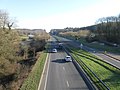
 A35 - geograph.org.uk - 2850899.jpg 640 × 476; 80 KB
-
 A35 looking north east - geograph.org.uk - 2789313.jpg 640 × 480; 78 KB
-
 A35 Louds Mill Flyover - geograph.org.uk - 4330175.jpg 640 × 428; 60 KB
-
 A35 Louds Mill Flyover - geograph.org.uk - 4330186.jpg 428 × 640; 58 KB
-
 A35 southwest bound - geograph.org.uk - 4116256.jpg 640 × 480; 47 KB
-
 A35 southwest bound - geograph.org.uk - 4116267.jpg 640 × 480; 59 KB
-
 A35 towards Dorchester - geograph.org.uk - 5964741.jpg 1,024 × 684; 249 KB
-
 A35 towards Dorchester - geograph.org.uk - 5964757.jpg 1,024 × 684; 285 KB
-
 A35 westbound - geograph.org.uk - 4116233.jpg 640 × 480; 46 KB
-
 A35 westbound - geograph.org.uk - 4116240.jpg 640 × 456; 82 KB
-
 A35, Dorchester Bypass - geograph.org.uk - 2851359.jpg 640 × 430; 54 KB
-
 B3150 London Road into Dorchester - geograph.org.uk - 5964804.jpg 1,024 × 684; 316 KB
-
 Bad Hair Day Pavilion - geograph.org.uk - 2556564.jpg 3,648 × 2,736; 3.43 MB
-
 Badgers Copse and adjacent fields - geograph.org.uk - 3215352.jpg 640 × 480; 73 KB
-
 Bank protection by drain, Stinsford - geograph.org.uk - 809476.jpg 480 × 640; 105 KB
-
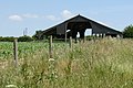 Barn at Higher Bockhampton, Dorset - geograph.org.uk - 1937834.jpg 3,648 × 2,432; 4.05 MB
-
 Being near a Tourist Attraction - geograph.org.uk - 5487572.jpg 3,888 × 2,592; 2.82 MB
-
 Benchmark on Grey's Bridge - geograph.org.uk - 3696653.jpg 683 × 1,024; 265 KB
-
 Bockhampton Bridge - geograph.org.uk - 2298440.jpg 1,024 × 683; 302 KB
-
 Bockhampton Bridge - geograph.org.uk - 2299577.jpg 1,024 × 683; 216 KB
-
 Bockhampton Bridge, Dorset - geograph.org.uk - 1938043.jpg 3,648 × 2,432; 4.32 MB
-
 Bockhampton Bridge, Dorset - geograph.org.uk - 1938624.jpg 3,648 × 2,432; 4.37 MB
-
 Bockhampton Cross - geograph.org.uk - 1375514.jpg 640 × 480; 76 KB
-
 Boot scraper, St Michael's Church - geograph.org.uk - 2767280.jpg 640 × 480; 109 KB
-
 Branch of the Frome - geograph.org.uk - 809615.jpg 480 × 640; 81 KB
-
 Bridge Cottage, Lower Bockhampton - geograph.org.uk - 2298396.jpg 1,024 × 683; 162 KB
-
 Bridge near Stinsford - geograph.org.uk - 809482.jpg 640 × 480; 112 KB
-

-
 Bridge over the A35 - geograph.org.uk - 2850896.jpg 640 × 429; 45 KB
-
 Bridge over the Frome at Bockhampton - geograph.org.uk - 707199.jpg 640 × 480; 103 KB
-
 Bridge over the River Frome, Lower Bockhampton - geograph.org.uk - 3562641.jpg 3,072 × 2,304; 3.34 MB
-
 Bridleway at Stinsford, Dorset - geograph.org.uk - 1937724.jpg 3,648 × 2,432; 4.24 MB
-
 Bridleway near Stinsford - geograph.org.uk - 1180949.jpg 640 × 481; 181 KB
-
 Bridleway near Stinsford - geograph.org.uk - 1181672.jpg 640 × 480; 184 KB
-
 Bridleway near Stinsford - geograph.org.uk - 809574.jpg 480 × 640; 144 KB
-
 Bridleway Near Stinsford, Dorset - geograph.org.uk - 1938633.jpg 3,648 × 2,432; 4.52 MB
-
 Bridleway Near Stinsford, Dorset - geograph.org.uk - 1938641.jpg 3,648 × 2,432; 4.5 MB
-
 Bridleway Near Stinsford, Dorset - geograph.org.uk - 1938655.jpg 3,648 × 2,432; 4.61 MB
-
 Bridleway on Ridgeway - geograph.org.uk - 5656267.jpg 640 × 480; 60 KB
-
 Bridleway to Higher Bockhampton - geograph.org.uk - 1180956.jpg 640 × 481; 153 KB
-
 Bridleway to Higher Bockhampton, Dorset - geograph.org.uk - 1937780.jpg 3,648 × 2,432; 4.31 MB
-
 Carving of St Michael - geograph.org.uk - 2748974.jpg 480 × 640; 91 KB
-
 Cattle on winter feed - geograph.org.uk - 3215325.jpg 640 × 480; 68 KB
-
 Church Lane, Stinsford - geograph.org.uk - 1394987.jpg 640 × 427; 111 KB
-
 Church Lane, Stinsford - geograph.org.uk - 1395046.jpg 427 × 640; 97 KB
-
 Church Lane, Stinsford - geograph.org.uk - 4397608.jpg 1,024 × 768; 456 KB
-
 Church Lane, Stinsford - geograph.org.uk - 5070741.jpg 640 × 480; 134 KB
-
 Church Lane, Stinsford - geograph.org.uk - 809906.jpg 640 × 480; 108 KB
-
 Coker's Frome, sheep grazing - geograph.org.uk - 2000370.jpg 1,024 × 733; 115 KB
-
 Cokers Frome Farm - geograph.org.uk - 1208431.jpg 640 × 428; 86 KB
-
 Cottage at Cokers Frome - geograph.org.uk - 3511510.jpg 3,072 × 2,304; 3.47 MB
-
 Cottages at Lower Bockhampton, Dorset - geograph.org.uk - 1938032.jpg 3,648 × 2,432; 4.17 MB
-
 Countryside near Higher Bockhampton - geograph.org.uk - 881289.jpg 640 × 426; 46 KB
-
 Crossroads of paths in Puddletown Forest - geograph.org.uk - 5656277.jpg 640 × 480; 121 KB
-
 Crows, old tree and hedgerow - geograph.org.uk - 644889.jpg 640 × 480; 52 KB
-
 Cycle Trail - geograph.org.uk - 390496.jpg 640 × 480; 24 KB
-
 Dead Oak Tree Frome Whitfield - geograph.org.uk - 1208432.jpg 640 × 475; 104 KB
-
 Death-defying footpath - geograph.org.uk - 5656283.jpg 640 × 480; 74 KB
-

-

-

-
 Detail, St Michael's Church - geograph.org.uk - 2757472.jpg 640 × 480; 78 KB
-

-
 Dorchester bypass - geograph.org.uk - 3666132.jpg 640 × 430; 73 KB
-
 Dorchester County Show - geograph.org.uk - 1553738.jpg 640 × 551; 92 KB
-
 Dorchester County Show - geograph.org.uk - 1553749.jpg 640 × 391; 76 KB
-
 Dorchester Show Ground - geograph.org.uk - 1208430.jpg 640 × 428; 72 KB
-
 Dorset Bridge Sign - geograph.org.uk - 2769275.jpg 640 × 427; 458 KB
-
 Dorset County Show 2009 - geograph.org.uk - 1484849.jpg 640 × 433; 65 KB
-
 Dreamy days in Dorset 33, Stinsford - geograph.org.uk - 3125668.jpg 640 × 480; 77 KB
-
 Eddie Stobart lorry on the A35, Stinsford - geograph.org.uk - 5450266.jpg 2,048 × 1,536; 1.58 MB
-
 End of dual carriageway on A35 - geograph.org.uk - 5964625.jpg 1,024 × 684; 190 KB
-
 End of dual carriageway on westbound A35 - geograph.org.uk - 5964717.jpg 1,024 × 684; 234 KB
-

-
 Entrance to Lower Bockhampton - geograph.org.uk - 2789311.jpg 640 × 466; 62 KB
-
 Entrance to the Visitor Centre - geograph.org.uk - 5487598.jpg 1,600 × 1,048; 645 KB
-
 Far From the Madding Crowd - geograph.org.uk - 2925863.jpg 2,520 × 1,680; 638 KB
-
 Far From The Madding Crowd - geograph.org.uk - 4398203.jpg 1,024 × 768; 337 KB
-
 Farm track north of Cokers Frome - geograph.org.uk - 786646.jpg 532 × 640; 106 KB
-
 Farm track towards Cokers Frome - geograph.org.uk - 786655.jpg 640 × 360; 42 KB
-
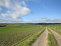
 Farmland above Stinsford - geograph.org.uk - 655513.jpg 640 × 480; 152 KB
-
 Farmland on Slyers lane - geograph.org.uk - 786674.jpg 640 × 360; 55 KB
-
 Field near Pigeon House Farm - geograph.org.uk - 5721618.jpg 640 × 427; 42 KB
-

-
 Footpath - geograph.org.uk - 390503.jpg 640 × 480; 46 KB
-
 Footpath at Higher Bockhampton, Dorset - geograph.org.uk - 1937822.jpg 3,648 × 2,432; 4.11 MB
-
 Footpath from the Blue Bridge to Frome Whitfield - geograph.org.uk - 5395220.jpg 1,600 × 1,200; 1.03 MB
-
 Footpath in Puddletown Forest - geograph.org.uk - 5656269.jpg 640 × 480; 78 KB
-
 Footpath near Charminster - geograph.org.uk - 5721575.jpg 640 × 427; 48 KB
-
 Footpath to Coker's Frome Farm - geograph.org.uk - 5721562.jpg 427 × 640; 72 KB
-
 Footpath, Stinsford - geograph.org.uk - 2748964.jpg 640 × 480; 96 KB
-
 Ford at Frome Whitfield - geograph.org.uk - 6619763.jpg 4,032 × 3,024; 5.87 MB
-

-
 Former footpath at side of A35 - geograph.org.uk - 5656264.jpg 640 × 480; 128 KB
-
 Frome Whitfield Ford - geograph.org.uk - 6619769.jpg 4,032 × 3,024; 5.31 MB
-
 Gatehouse at Stinsford, Dorset - geograph.org.uk - 1941736.jpg 3,648 × 2,432; 4.48 MB
-
-
 Hardy's Wessex - geograph.org.uk - 1937799.jpg 3,648 × 2,432; 4.13 MB
-
 Hedge laying - geograph.org.uk - 380736.jpg 640 × 427; 179 KB
-
 High gate at Higher Kingston Farm - geograph.org.uk - 5656279.jpg 640 × 480; 57 KB
-
 Higher Bockhampton, bridleway - geograph.org.uk - 5673107.jpg 1,024 × 768; 222 KB
-
 Higher Bockhampton, Claas Western - geograph.org.uk - 5652017.jpg 1,024 × 768; 131 KB
-
 Higher Bockhampton, cottage - geograph.org.uk - 5673119.jpg 1,024 × 768; 275 KB
-
 Higher Bockhampton, cottages - geograph.org.uk - 5673113.jpg 1,024 × 768; 163 KB
-
 Higher Bockhampton, footpath - geograph.org.uk - 5673250.jpg 1,024 × 768; 309 KB
-
 Higher Bockhampton, Hardy's Cottage - geograph.org.uk - 5673242.jpg 1,024 × 768; 239 KB
-

-

-

-
 Higher Bockhampton, Signposts - geograph.org.uk - 2863410.jpg 900 × 513; 235 KB
-

-

-
 Higher Bockhampton, Thorncombe Wood - geograph.org.uk - 2863398.jpg 900 × 596; 333 KB
-
 Higher Bockhampton, visitor centre - geograph.org.uk - 5673100.jpg 1,024 × 768; 293 KB
-
 Higher Bockhampton, Yellowham Hill - geograph.org.uk - 5652029.jpg 1,024 × 768; 222 KB
-
 Higher Burton Cottages - geograph.org.uk - 2166878.jpg 640 × 480; 66 KB
-
 Home Farm - geograph.org.uk - 786664.jpg 640 × 360; 60 KB
-
 Horse Manure^ - geograph.org.uk - 1935521.jpg 2,432 × 3,648; 4.41 MB
-

-
 House by a bridleway into Dorchester - geograph.org.uk - 3453296.jpg 4,608 × 3,072; 7.48 MB
-
 Houses in woodland and farmland - geograph.org.uk - 3453303.jpg 4,608 × 3,072; 6.52 MB
-
 How cross^ - geograph.org.uk - 3618155.jpg 2,136 × 2,848; 1.08 MB
-
 Irrigation Channel - geograph.org.uk - 1558761.jpg 640 × 427; 74 KB
-
 Junction with Church Lane - geograph.org.uk - 3014288.jpg 800 × 600; 348 KB
-
 Kingston Maurward College - geograph.org.uk - 3215272.jpg 640 × 480; 76 KB
-
 Kingston Maurward Gardens - geograph.org.uk - 5710430.jpg 900 × 1,600; 587 KB
-
 Kingston Maurward Gardens - geograph.org.uk - 5710440.jpg 1,200 × 675; 907 KB
-
 Kingston Maurward Gardens Croquet Lawn - geograph.org.uk - 5710436.jpg 1,200 × 675; 872 KB
-
 Kingston Maurward House and Gardens - geograph.org.uk - 5710439.jpg 1,200 × 675; 992 KB
-
 Kingston Maurward, Higher Dairy Farm - geograph.org.uk - 1375496.jpg 640 × 480; 65 KB
-

-
 Kingston Maurward, River Frome - geograph.org.uk - 1375428.jpg 480 × 640; 145 KB
-
 Kingston Maurward, Stafford Centre - geograph.org.uk - 1375447.jpg 640 × 480; 84 KB
-
 Lake with island at Kingston Maurward - geograph.org.uk - 2560022.jpg 3,505 × 2,520; 5.16 MB
-
 Lay-by off A35 - geograph.org.uk - 4116242.jpg 640 × 480; 100 KB
-
 Lay-by on the A35 - geograph.org.uk - 379201.jpg 640 × 427; 85 KB
-
 Layby on the A35, Stinsford - geograph.org.uk - 5450415.jpg 2,048 × 1,536; 1.5 MB
-
 Layby on the A35, Stinsford - geograph.org.uk - 5450417.jpg 2,048 × 1,536; 1,007 KB
-
 Leafy Lane, Higher Bockhampton - geograph.org.uk - 6064564.jpg 2,918 × 3,320; 1.52 MB
-
 London Road, B3150, approaching Grey's Bridge - geograph.org.uk - 6178486.jpg 2,933 × 1,977; 3.42 MB
-
 London Road, Dorchester - geograph.org.uk - 809633.jpg 640 × 480; 135 KB
-
 Lower Bockhampton - geograph.org.uk - 3215259.jpg 640 × 480; 101 KB
-
 Lower Bockhampton buildingss (geograph 6783931).jpg 4,320 × 3,240; 2.23 MB
-
 Lower Bockhampton houses (1) (geograph 6783930).jpg 4,320 × 3,240; 3.06 MB
-
 Lower Bockhampton housess (geograph 6783933).jpg 4,320 × 3,240; 2.92 MB
-
 Lower Bockhampton housess (geograph 6783939).jpg 4,207 × 3,155; 2.29 MB
-
 Lower Bockhampton housess (geograph 6783940).jpg 4,320 × 3,240; 1.86 MB
-
 Lower Bockhampton, bridleway - geograph.org.uk - 1375383.jpg 640 × 480; 146 KB
-
 Lower Bockhampton, footpath - geograph.org.uk - 1375420.jpg 640 × 480; 133 KB
-
 Lower Bockhampton, irrigation ditch - geograph.org.uk - 1375404.jpg 640 × 480; 126 KB
-

-

-
 Lower Bockhampton, the telephone box - geograph.org.uk - 4722963.jpg 640 × 480; 112 KB
-

-
 Maintenance works at Kingston Maurward House - geograph.org.uk - 2556431.jpg 3,648 × 2,736; 2.5 MB
-
 Meadows near the River Frome North of Dorchester - geograph.org.uk - 5395109.jpg 1,200 × 900; 380 KB
-
 Milestone Near Stinsford, Dorset - geograph.org.uk - 1939901.jpg 3,648 × 2,432; 4.54 MB
-
 Mole City, Near Stinsford, Dorset - geograph.org.uk - 1938652.jpg 3,648 × 2,432; 4.49 MB
-

-
 Monument to Thomas Hardy, Higher Bockhampton, Dorset - geograph.org.uk - 1936652.jpg 3,648 × 2,432; 4.48 MB
-

-
 Name That Tune - geograph.org.uk - 1939910.jpg 3,648 × 2,432; 4.62 MB
-
 Near Coker's Frome Farm - geograph.org.uk - 5721561.jpg 640 × 427; 66 KB
-
 Near Lower Bockhampton - geograph.org.uk - 638373.jpg 640 × 480; 112 KB
-
 Oak Tree, Frome Whitfield - geograph.org.uk - 786213.jpg 640 × 389; 63 KB
-
 Old A35 - geograph.org.uk - 380733.jpg 640 × 427; 107 KB
-

-
 Old Wayside Cross by Pond House, Duddle (geograph 6045704).jpg 376 × 640; 78 KB
-
 Ordnance Survey Cut Mark - geograph.org.uk - 4935590.jpg 569 × 640; 153 KB
-
 Our Wedding (2011-04-02 09.57.19JH1 9881) (5872982956).jpg 2,832 × 4,256; 3.96 MB
-
 Our Wedding (2011-04-02 11.07.47JH1 9945) (5872520545).jpg 2,832 × 4,256; 5.37 MB
-
 Path through Puddletown Forest - geograph.org.uk - 4637480.jpg 1,920 × 1,080; 642 KB
-
 Pigeon House Barn - geograph.org.uk - 3215336.jpg 640 × 480; 101 KB
-
 Pigs at Stinsford, Dorset - geograph.org.uk - 1936229.jpg 3,648 × 2,432; 4.03 MB
-
 Pigs at Stinsford, Dorset - geograph.org.uk - 1936238.jpg 3,648 × 2,432; 4.12 MB
-
 Pigs at Stinsford, Dorset - geograph.org.uk - 1936248.jpg 3,648 × 2,432; 2.64 MB
-
 Puddletown Forest - geograph.org.uk - 3215297.jpg 640 × 480; 121 KB
-
 Puddletown Forest, path junction - geograph.org.uk - 5673295.jpg 1,024 × 768; 325 KB
-
 Restaurant at Kingston Maurward House - geograph.org.uk - 2556358.jpg 3,648 × 2,736; 2.76 MB
-
 River Frome at Dorchester - geograph.org.uk - 1870893.jpg 640 × 480; 104 KB
-
 River Frome at Lower Bockhampton - geograph.org.uk - 5487615.jpg 3,888 × 2,592; 3.24 MB
-
 River Frome Causeway - geograph.org.uk - 6619860.jpg 4,032 × 3,024; 5.64 MB
-
 River Frome Lower Bockhampton. - geograph.org.uk - 2885514.jpg 640 × 480; 90 KB
-
 River Frome, Dorchester, Dorset - geograph.org.uk - 1939897.jpg 3,648 × 2,432; 4.13 MB
-
 Road between the Bockhamptons - geograph.org.uk - 707290.jpg 640 × 480; 89 KB
-
 Roman Road near Stinsford, Dorset - geograph.org.uk - 707306.jpg 640 × 480; 156 KB
-
 Roman Road, Thorncombe Wood - geograph.org.uk - 2093281.jpg 640 × 480; 137 KB
-
 Rook Near Stinsford, Dorset - geograph.org.uk - 1939912.jpg 3,648 × 2,432; 3.08 MB
-
 Roundabout on Stinsford Hill - geograph.org.uk - 5449709.jpg 1,930 × 1,362; 829 KB
-
 RSPCA Rehoming Centre - geograph.org.uk - 2555461.jpg 1,024 × 768; 134 KB
-
 Rushy Pond - geograph.org.uk - 2093262.jpg 640 × 480; 113 KB
-
 Rushy Pond - geograph.org.uk - 2671934.jpg 640 × 480; 119 KB
-
 Rushy Pond - geograph.org.uk - 5738763.jpg 1,536 × 2,048; 1.48 MB
-
 Rushy Pond on a hot summer's day - geograph.org.uk - 506543.jpg 640 × 429; 112 KB
-
 Rushy Pond, Black Heath - geograph.org.uk - 394325.jpg 480 × 640; 129 KB
-
 Sheep at Stinsford - geograph.org.uk - 809889.jpg 640 × 437; 104 KB
-
 Sheep on footpath near Badger's Copse - geograph.org.uk - 5721570.jpg 640 × 571; 119 KB
-
 Sign on Bockhampton Bridge, Dorset - geograph.org.uk - 1938609.jpg 3,648 × 2,432; 4.49 MB
-
 Sign on Bockhampton Bridge, Dorset - geograph.org.uk - 1938615.jpg 3,648 × 2,432; 4.13 MB


_-_geograph.org.uk_-_4842319.jpg)
_-_geograph.org.uk_-_4842324.jpg)
_-_geograph.org.uk_-_4842330.jpg)


.jpg)
_(geograph_6783930).jpg)
.jpg)
.jpg)
.jpg)


.jpg)

_(5872982956).jpg)
_(5872520545).jpg)


