Category:Staunton (near Gloucester)
Jump to navigation
Jump to search
village and civil parish in Forest of Dean, Gloucestershire, England  | |||||
| Upload media | |||||
| Instance of | |||||
|---|---|---|---|---|---|
| Location | Forest of Dean, Gloucestershire, South West England, England | ||||
 | |||||
English: Staunton is a village and civil parish in the Forest of Dean in west Gloucestershire, England.
Subcategories
This category has the following 3 subcategories, out of 3 total.
J
S
- Snig's End (12 F)
- Staunton War Memorial (2 F)
Media in category "Staunton (near Gloucester)"
The following 200 files are in this category, out of 238 total.
(previous page) (next page)-

-
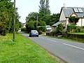
 A (small) lay-by by the A417 west of Staunton - geograph.org.uk - 4450968.jpg 1,600 × 800; 897 KB
-
 A Chartist goat - geograph.org.uk - 3933701.jpg 4,279 × 2,648; 3.82 MB
-
 A Chartist's bungalow, Corse - geograph.org.uk - 1551800.jpg 640 × 426; 98 KB
-
 A welcome sight^ - geograph.org.uk - 1441584.jpg 640 × 480; 250 KB
-
 A417 at Hethelpit Cross - geograph.org.uk - 1984355.jpg 640 × 480; 248 KB
-
 A417 at Staunton-Corse - geograph.org.uk - 3322669.jpg 800 × 451; 196 KB
-
 A417 in Staunton village - geograph.org.uk - 3047751.jpg 640 × 480; 42 KB
-
 A417 near Hethelpit Cross - geograph.org.uk - 3047757.jpg 640 × 481; 69 KB
-
 A417 near Staunton Church - geograph.org.uk - 4105525.jpg 1,600 × 1,040; 416 KB
-
 A417 November dawn - geograph.org.uk - 2703533.jpg 1,024 × 768; 563 KB
-
 A417 towards Hethelpit Cross - geograph.org.uk - 4108097.jpg 1,600 × 1,053; 462 KB
-
 An original Chartist cottage, Snig's End - geograph.org.uk - 3931257.jpg 5,530 × 3,480; 4.68 MB
-
 Approaching Staunton centre - geograph.org.uk - 2967860.jpg 1,024 × 577; 336 KB
-
 Arable fields near Staunton - geograph.org.uk - 934113.jpg 640 × 480; 104 KB
-
 Arable land near Staunton - geograph.org.uk - 3504738.jpg 800 × 451; 178 KB
-

-
 Avon Dale on Prince Crescent, Corse - geograph.org.uk - 4979539.jpg 1,600 × 1,065; 765 KB
-
 B4208 looking north - geograph.org.uk - 2005479.jpg 640 × 480; 267 KB
-
 Bale collecting near Staunton - geograph.org.uk - 2004051.jpg 640 × 480; 204 KB
-
 Barley crop - geograph.org.uk - 3504751.jpg 800 × 451; 206 KB
-
 Barley crop mid-harvest - geograph.org.uk - 2534543.jpg 800 × 600; 380 KB
-
 Ben Creese Country Butchers - geograph.org.uk - 2814550.jpg 1,024 × 577; 308 KB
-
 Berry Bridge over Glynch Brook - geograph.org.uk - 4450957.jpg 1,600 × 801; 998 KB
-
 Blue morning, blue day - geograph.org.uk - 2968255.jpg 800 × 451; 200 KB
-
 Braceland Cottages - geograph.org.uk - 1723895.jpg 640 × 480; 116 KB
-
 Bracelands Camp-site - geograph.org.uk - 356114.jpg 640 × 480; 76 KB
-
 Brierley Lane - geograph.org.uk - 6157769.jpg 798 × 800; 212 KB
-
 Broadstone, near Staunton - geograph.org.uk - 736823.jpg 640 × 426; 84 KB
-
 Broadstone, near Staunton - geograph.org.uk - 736831.jpg 640 × 426; 105 KB
-

-
 Bus shelter with solar panel - geograph.org.uk - 679876.jpg 640 × 480; 172 KB
-
 Bush Farm, Staunton - geograph.org.uk - 886393.jpg 640 × 480; 88 KB
-
 Cameo on a gravestone, Staunton - geograph.org.uk - 1551844.jpg 640 × 426; 84 KB
-
 Carry on camping^ - geograph.org.uk - 1441547.jpg 640 × 481; 260 KB
-
 Chartist bungalow, Snig's End - geograph.org.uk - 2744936.jpg 1,024 × 681; 161 KB
-
 Chartist cottage, Ledbury Road Crescent - geograph.org.uk - 3933696.jpg 4,813 × 3,200; 2.94 MB
-
 Chartist Land Company, Snigs End - geograph.org.uk - 4979493.jpg 1,397 × 1,600; 654 KB
-
 Chartist Land Company, Snigs End - geograph.org.uk - 4979496.jpg 1,600 × 1,065; 750 KB
-
 Chartist Way off Prince Crescent, Corse - geograph.org.uk - 4979456.jpg 1,600 × 1,065; 921 KB
-
 Christchurch Campsite - geograph.org.uk - 127961.jpg 640 × 480; 118 KB
-
 Church and Manor House, Staunton - geograph.org.uk - 3935269.jpg 6,016 × 4,000; 5.58 MB
-
 Commuter queue - geograph.org.uk - 2263377.jpg 1,024 × 683; 505 KB
-
 Dawn over St. James's, Staunton - geograph.org.uk - 2785337.jpg 1,024 × 768; 439 KB
-
 Dawn over Staunton - geograph.org.uk - 2255816.jpg 800 × 600; 349 KB
-
 Dawn over Staunton 2 - geograph.org.uk - 2703540.jpg 1,024 × 768; 686 KB
-
 Dawn over Staunton 3 - geograph.org.uk - 2775455.jpg 1,024 × 768; 482 KB
-
 Dovecote and fish pond at Staunton - geograph.org.uk - 1528239.jpg 640 × 426; 58 KB
-
 Dovecote, Staunton Court - geograph.org.uk - 1505188.jpg 426 × 640; 80 KB
-
 Downing - geograph.org.uk - 1994680.jpg 640 × 481; 269 KB
-
 Downing, 2016 - geograph.org.uk - 5153700.jpg 1,600 × 901; 690 KB
-
 Drive to the Rectory, Staunton - geograph.org.uk - 4849143.jpg 800 × 531; 107 KB
-
 Ellis Farm, Sladbrook Lane - geograph.org.uk - 933170.jpg 640 × 480; 139 KB
-
 Entering Worcestershire - geograph.org.uk - 2005496.jpg 640 × 480; 241 KB
-
 Entering Worcestershire on the B4208 - geograph.org.uk - 4979627.jpg 1,600 × 1,078; 783 KB
-
 Farm buildings by Glebe Barn - geograph.org.uk - 886195.jpg 640 × 480; 114 KB
-
 Farmland by Hethelpit Cross - geograph.org.uk - 3757355.jpg 2,592 × 1,944; 1.26 MB
-
 Farmland near Glebe Barn, Staunton - geograph.org.uk - 4849138.jpg 800 × 531; 127 KB
-
 Farms east of The Kymin - geograph.org.uk - 1700764.jpg 640 × 412; 87 KB
-
 Fishing lake at Staunton Court - geograph.org.uk - 4061601.jpg 800 × 534; 206 KB
-
 Fishing Lake at Staunton Court - geograph.org.uk - 4980531.jpg 1,600 × 1,065; 695 KB
-
 Footpath off Moat Lane, Staunton - geograph.org.uk - 1950537.jpg 640 × 480; 238 KB
-
 Footpath to Brierley farm - geograph.org.uk - 3338627.jpg 800 × 451; 188 KB
-
 Footpath to Brierley Farm - geograph.org.uk - 3504745.jpg 600 × 800; 233 KB
-
 Footpath towards Glynch Farm - geograph.org.uk - 4602028.jpg 800 × 451; 196 KB
-
 Footpaths meet 2 - geograph.org.uk - 1441604.jpg 640 × 480; 266 KB
-
 Forest road, Highmeadow Wood - geograph.org.uk - 737167.jpg 640 × 426; 132 KB
-
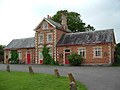
 Former National School, Staunton - geograph.org.uk - 3933285.jpg 5,562 × 3,698; 3.74 MB
-
 Four oaks - geograph.org.uk - 6122022.jpg 1,600 × 899; 386 KB
-
 Frosty field - geograph.org.uk - 2277909.jpg 800 × 600; 343 KB
-
 Glebe Barn - geograph.org.uk - 4849137.jpg 800 × 531; 125 KB
-
 Glebe Barn Gadfield Elm - geograph.org.uk - 886191.jpg 640 × 480; 95 KB
-
 Glebe Barn on Mill Lane - geograph.org.uk - 4980499.jpg 1,600 × 1,065; 754 KB
-
 Glebe Barn, 2015 - geograph.org.uk - 4602043.jpg 800 × 451; 190 KB
-
 GR postbox, Sladbrook - geograph.org.uk - 934112.jpg 480 × 640; 197 KB
-
 Green barley, 1 - geograph.org.uk - 6157731.jpg 1,600 × 755; 686 KB
-
 Green barley, 2 - geograph.org.uk - 6157735.jpg 1,600 × 1,068; 881 KB
-
 Group reflection - geograph.org.uk - 2695605.jpg 768 × 1,024; 605 KB
-
 Harvest safely gathered in - geograph.org.uk - 934111.jpg 640 × 459; 144 KB
-
 Hethelpit Cross - geograph.org.uk - 933205.jpg 640 × 480; 98 KB
-
 His and hers benches - geograph.org.uk - 745152.jpg 639 × 479; 220 KB
-
 House on Staunton Court, Staunton - geograph.org.uk - 4980647.jpg 1,600 × 1,065; 729 KB
-
 Houses at Hethelpit Cross - geograph.org.uk - 933198.jpg 640 × 480; 165 KB
-
 Lay-by, Broadstones - geograph.org.uk - 1725724.jpg 640 × 462; 81 KB
-
 Ledbury Road Crescent - geograph.org.uk - 2321571.jpg 800 × 600; 371 KB
-
 Ledbury Road Crescent - geograph.org.uk - 3212080.jpg 1,200 × 676; 421 KB
-
 Line of oaks - geograph.org.uk - 933193.jpg 640 × 480; 103 KB
-
 Lone angler at Staunton Court - geograph.org.uk - 707209.jpg 640 × 480; 171 KB
-

-
 Mill Lane - geograph.org.uk - 1984358.jpg 640 × 480; 250 KB
-
 Mill Lane at Glebe Barn - geograph.org.uk - 4602049.jpg 800 × 451; 205 KB
-
 Mill Lane at Hethelpit Cross - geograph.org.uk - 4980523.jpg 1,600 × 1,110; 756 KB
-
 Near Hearkening Rock - geograph.org.uk - 533272.jpg 640 × 480; 175 KB
-
 No through road to Sladbrook Farm - geograph.org.uk - 933164.jpg 640 × 447; 151 KB
-
 Oak in late spring - geograph.org.uk - 2967844.jpg 1,024 × 768; 443 KB
-
 Oaks and barley - geograph.org.uk - 3558199.jpg 800 × 452; 180 KB
-
 Oaks in early summer - geograph.org.uk - 3504749.jpg 800 × 451; 205 KB
-
 Old Milepost by the A417, Ledbury Road, Staunton parish - geograph.org.uk - 6050025.jpg 1,061 × 1,704; 317 KB
-
 Pasture near Spooner's Farm - geograph.org.uk - 3232724.jpg 1,200 × 676; 420 KB
-
 Ploughed fields near Brierley Grange - geograph.org.uk - 1529924.jpg 640 × 426; 79 KB
-
 Poppy growing by a War Memorial - geograph.org.uk - 4061588.jpg 800 × 534; 221 KB
-
 Prince Crescent, Corse - geograph.org.uk - 4979476.jpg 1,600 × 1,141; 486 KB
-
-
 Rectors of Staunton - geograph.org.uk - 4980548.jpg 1,216 × 1,600; 441 KB
-
 Redding's Lodge, Highmeadow Wood - geograph.org.uk - 737165.jpg 640 × 426; 98 KB
-
 Ripe barley crop - geograph.org.uk - 2515376.jpg 640 × 480; 99 KB
-
 Road from Upleadon to Hethelpit Cross - geograph.org.uk - 934110.jpg 640 × 480; 129 KB
-
 Sheep in a field near Staunton - geograph.org.uk - 4849141.jpg 800 × 531; 124 KB
-
 Sheep pasture near Moat Farm - geograph.org.uk - 1950529.jpg 640 × 480; 216 KB
-
 Shop and post office, Staunton - geograph.org.uk - 4450951.jpg 1,600 × 1,199; 1.08 MB
-
 Single oak - geograph.org.uk - 6122017.jpg 1,600 × 1,202; 682 KB
-
 Sladbrook - geograph.org.uk - 5153706.jpg 1,600 × 901; 600 KB
-
 Sladbrook Lane - geograph.org.uk - 1984362.jpg 640 × 480; 265 KB
-
 Sladbrook, near Staunton (geograph 6970117).jpg 1,024 × 768; 218 KB
-
 St James Church, Staunton - geograph.org.uk - 4980535.jpg 1,600 × 1,065; 617 KB
-
 St James Church, Staunton - geograph.org.uk - 4980538.jpg 1,600 × 1,065; 426 KB
-
 St James Church, Staunton - geograph.org.uk - 4980619.jpg 1,089 × 1,600; 683 KB
-
 St James Church, Staunton - geograph.org.uk - 4980620.jpg 1,065 × 1,600; 458 KB
-
 St James Church, Staunton - geograph.org.uk - 4980626.jpg 891 × 1,600; 592 KB
-
 St James Church, Staunton - geograph.org.uk - 4980631.jpg 1,600 × 1,065; 339 KB
-
 St James Church, Staunton - geograph.org.uk - 4980632.jpg 913 × 1,600; 476 KB
-
 St James Church, Staunton - geograph.org.uk - 4980635.jpg 1,065 × 1,600; 506 KB
-
 St James Church, Staunton - geograph.org.uk - 4980638.jpg 1,065 × 1,600; 436 KB
-
 St James' church, Staunton - geograph.org.uk - 3757354.jpg 2,592 × 1,944; 1,009 KB
-
 St James' Church, Staunton - geograph.org.uk - 4449411.jpg 640 × 480; 43 KB
-
 St James, Staunton - geograph.org.uk - 3933709.jpg 5,145 × 3,700; 3.4 MB
-
 St James, Staunton - geograph.org.uk - 3933723.jpg 5,553 × 3,825; 3.67 MB
-
 St James, Staunton - geograph.org.uk - 3935248.jpg 4,370 × 3,078; 2.29 MB
-
 St James, Staunton - geograph.org.uk - 3935249.jpg 5,586 × 3,713; 3.15 MB
-
 St James, Staunton - geograph.org.uk - 3935255.jpg 5,717 × 3,802; 3.19 MB
-
 Standing Stone on the A4136 - geograph.org.uk - 73780.jpg 640 × 480; 114 KB
-
 Staunton and Corse - geograph.org.uk - 2005507.jpg 640 × 480; 214 KB
-
 Staunton church and Staunton Court - geograph.org.uk - 2967808.jpg 1,024 × 768; 471 KB
-
 Staunton Court - geograph.org.uk - 3934979.jpg 6,016 × 4,000; 5.42 MB
-
 Staunton Court Business Park - geograph.org.uk - 1528242.jpg 640 × 426; 70 KB
-
 Staunton Court reflected - geograph.org.uk - 2967816.jpg 1,024 × 768; 389 KB
-
 Staunton Cross Garage - geograph.org.uk - 2834264.jpg 1,024 × 577; 319 KB
-
 Staunton Cross Garage - geograph.org.uk - 4256365.jpg 800 × 600; 196 KB
-
 Staunton Cross Garage - geograph.org.uk - 679927.jpg 640 × 453; 162 KB
-
 Staunton Garden Centre - geograph.org.uk - 2079878.jpg 640 × 480; 195 KB
-
 Staunton Garden Centre - geograph.org.uk - 680310.jpg 640 × 431; 124 KB
-
 Staunton Mill - geograph.org.uk - 1994773.jpg 640 × 480; 222 KB
-
 Staunton Mill - geograph.org.uk - 27429.jpg 640 × 479; 106 KB
-
 Staunton Mill - geograph.org.uk - 4849144.jpg 1,024 × 680; 274 KB
-
 Staunton Post Office - geograph.org.uk - 679906.jpg 640 × 480; 115 KB
-
 Staunton village.jpg 639 × 479; 213 KB
-
 Staunton, Gloucestershire ... post office. (3451953651).jpg 2,287 × 3,047; 3.84 MB
-
 Still November morning - geograph.org.uk - 2695613.jpg 1,024 × 768; 633 KB
-
 Stone Walls Farm on Malvern Road, Staunton - geograph.org.uk - 4979621.jpg 1,600 × 1,098; 537 KB
-
 Straight Lane, B4208 - geograph.org.uk - 2834256.jpg 1,024 × 768; 361 KB
-
 Sunset over Highmeadow Woods - geograph.org.uk - 91920.jpg 640 × 480; 39 KB
-
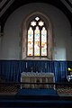
 The East Window, Staunton - geograph.org.uk - 3935263.jpg 3,446 × 4,828; 3.18 MB
-
 The Old Rectory, Staunton - geograph.org.uk - 886381.jpg 640 × 480; 87 KB
-
 The Parish Chest, Staunton - geograph.org.uk - 3935258.jpg 5,100 × 3,389; 3.02 MB
-
 The Stone Road off Prince Crescent, Corse - geograph.org.uk - 4979463.jpg 1,600 × 1,065; 641 KB
-
 The Swan at Staunton, Glos - geograph.org.uk - 6293096.jpg 640 × 480; 49 KB
-
 The Swan Inn, Staunton - geograph.org.uk - 2721323.jpg 1,024 × 768; 510 KB
-
 The Swan Inn, Staunton - geograph.org.uk - 3013999.jpg 1,024 × 768; 410 KB
-
 The Swan Inn, Staunton - geograph.org.uk - 4792428.jpg 640 × 480; 50 KB
-
 The Swan Public House, Staunton - geograph.org.uk - 4979597.jpg 1,600 × 1,090; 373 KB
-
 The Swan Public House, Staunton - geograph.org.uk - 4979600.jpg 1,600 × 1,272; 517 KB
-
 The Whitemore Way, Staunton - geograph.org.uk - 886387.jpg 640 × 480; 84 KB
-
 Towards Birchen Wood - geograph.org.uk - 745796.jpg 639 × 479; 184 KB
-
 Towards Pillows Green - geograph.org.uk - 4718127.jpg 1,600 × 901; 749 KB
-
 Track and footpath - geograph.org.uk - 1994685.jpg 640 × 480; 255 KB
-
 Track Leading to Glynch Farm - geograph.org.uk - 4980505.jpg 1,600 × 1,065; 903 KB
-
 View across a gate - geograph.org.uk - 933210.jpg 640 × 480; 168 KB
-
 View from the Whitmore Way - geograph.org.uk - 1994688.jpg 480 × 640; 233 KB
-
 View over the Glynch Brook - geograph.org.uk - 1994774.jpg 640 × 480; 242 KB
-
 View to Glebe Barn - geograph.org.uk - 2004064.jpg 640 × 480; 209 KB
-
 View to The Hill - geograph.org.uk - 2004059.jpg 640 × 480; 306 KB
-
 View towards Staunton Church - geograph.org.uk - 933217.jpg 640 × 504; 173 KB
-
 View towards Staunton Coppice - geograph.org.uk - 933184.jpg 640 × 480; 171 KB
-
 View towards Staunton Court - geograph.org.uk - 6294074.jpg 1,600 × 900; 622 KB
-
 Walking the Whitmore Way, 1 - geograph.org.uk - 4601932.jpg 800 × 451; 236 KB
-
 Walking the Whitmore Way, 2 - geograph.org.uk - 4602006.jpg 800 × 451; 248 KB
-
 Walking the Whitmore Way, 3 - geograph.org.uk - 4602011.jpg 800 × 451; 252 KB
-
 Walking the Whitmore Way, 4 - geograph.org.uk - 4602017.jpg 800 × 600; 238 KB
-
 Walking the Whitmore Way, 5 - geograph.org.uk - 4602020.jpg 800 × 451; 174 KB
-
 War memorial at Staunton - geograph.org.uk - 4061577.jpg 534 × 800; 259 KB
-
 War Memorial, Staunton - geograph.org.uk - 4449416.jpg 640 × 480; 49 KB
-
 War Memorial, Staunton - geograph.org.uk - 4980642.jpg 1,065 × 1,600; 933 KB
-
 Wheat awaiting harvest - geograph.org.uk - 4602035.jpg 800 × 451; 250 KB
-
 Wheat field near Staunton - geograph.org.uk - 886378.jpg 480 × 640; 117 KB
-
 Whitmore Way footpath - geograph.org.uk - 933166.jpg 640 × 480; 134 KB
-
 William Horton lies here, 1612 - geograph.org.uk - 3935260.jpg 3,496 × 2,390; 1.53 MB
-
 A lake to himself - geograph.org.uk - 707223.jpg 495 × 640; 181 KB
-
 B4432 heading for Hillersland - geograph.org.uk - 841820.jpg 640 × 480; 155 KB
-
 B4432 heading north - geograph.org.uk - 1441588.jpg 640 × 480; 218 KB
-
 Beech woodland north of Broom Hill - geograph.org.uk - 1441561.jpg 640 × 480; 293 KB
-
 Biblins Adventure Centre - geograph.org.uk - 733914.jpg 426 × 640; 99 KB
-
 Birchen Wood - geograph.org.uk - 287069.jpg 640 × 480; 72 KB
-
 Blue-grey barn - geograph.org.uk - 1439663.jpg 640 × 480; 233 KB
-
 Border - geograph.org.uk - 268029.jpg 640 × 480; 87 KB
-
 Braceland Road 1 - geograph.org.uk - 1441585.jpg 640 × 480; 237 KB
-
 Braceland Road 2 - geograph.org.uk - 1441586.jpg 640 × 480; 234 KB
-
 Braceland Road 3 - geograph.org.uk - 1441587.jpg 640 × 480; 283 KB
-
 Brook Farm - geograph.org.uk - 679613.jpg 640 × 465; 203 KB
-

-


_lay-by_by_the_A417_west_of_Staunton_-_geograph.org.uk_-_4450968.jpg)


.jpg)


.jpg)


&filefrom=ZChartist+Bungalow%2C+Staunton+-+geograph.org.uk+-+1408290.jpg%0AChartist+Bungalow%2C+Staunton+-+geograph.org.uk+-+1408290.jpg#mw-category-media)