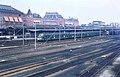
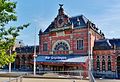
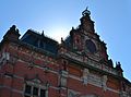
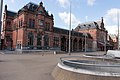
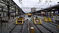
Category:Station Groningen
Jump to navigation
Jump to search
| Object location | | View all coordinates using: OpenStreetMap |
|---|
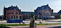
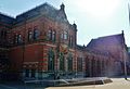
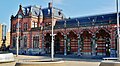
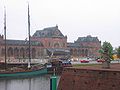
railway station in the Dutch city of Groningen  | |||||
| Upload media | |||||
| Instance of | |||||
|---|---|---|---|---|---|
| Location | Groningen, Netherlands | ||||
| Located on street |
| ||||
| Transport network | |||||
| Architect | |||||
| Owned by | |||||
| Operator | |||||
| Heritage designation | |||||
| Date of official opening |
| ||||
| Connecting line | |||||
| Adjacent station | |||||
| official website | |||||
 | |||||
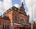
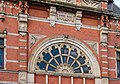
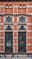
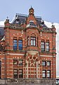
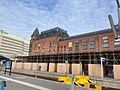
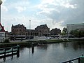
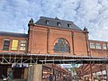
Nederlands: Het hoofdstation van Groningen (1895-'98, I. Gosschalk, rm 18691, gem.mon. 104542)
|
This is a category about rijksmonument number 18691
|
|
This is a category about a municipal monument in Groningen with number 104542 |
| Address |
|
Subcategories
This category has the following 9 subcategories, out of 9 total.
B
- Buses at Station Groningen (34 F)
F
- Fiets & Service (Groningen) (11 F)
- Flower shop station Groningen (11 F)
H
M
- Models of Station Groningen (4 F)
P
- Peerd van Ome Loeks (16 F)
S
T
- Trains at Groningen station (75 F)
Media in category "Station Groningen"
The following 200 files are in this category, out of 222 total.
(previous page) (next page)-
 2006-12-17-Stadsbalkon-02s.jpg 500 × 333; 122 KB
-
 20080122 Groningen NL Stationsgebied.jpg 4,500 × 814; 399 KB
-
 20080430 Hoofdstation Groningen NL.jpg 2,000 × 1,008; 1.19 MB
-
 20110812 Achterweg 1 (vm EKP PTT Post) Groningen NL.jpg 4,800 × 2,400; 3.38 MB
-
 2012 Hoofdstation Groningen perron 4.JPG 4,592 × 3,056; 5.31 MB
-
 2012 Hoofdstation Groningen perron 7a.JPG 4,592 × 3,056; 4.56 MB
-
 20120202 Overkapping Hoofdstation Groningen NL.jpg 4,000 × 2,000; 2.4 MB
-
 20120415 Overdekte loopbrug seinhuis hoofdstation Groningen NL.jpg 2,400 × 2,400; 1.77 MB
-
 20120705 Luchtbrug Hoofdstation Groningen NL.jpg 5,500 × 2,200; 3.13 MB
-
 20120925 Hoofdstation Groningen NL (detail).jpg 3,200 × 2,400; 1.71 MB
-
 20140917 Stadsbalkon Hoofdstation Groningen NL.jpg 7,500 × 2,500; 9.12 MB
-
 20140928 Trap naar Emmaviaduct Hoofdstation Groningen NL.jpg 5,195 × 2,970; 10.04 MB
-
 00 6851 Groningen - Hauptbahnhof (Hoofdstation).jpg 2,160 × 1,440; 1.41 MB
-
 20200621 Groningen Hoofdstation.jpg 4,027 × 3,020; 2.63 MB
-
 20230908 Omleidingsbord Hoofdstation Achterweg-Driehovenstraat Groningen NL.jpg 4,000 × 2,672; 3.76 MB
-
 230 to 400 Volt sign, Groningen Central Station (2018).jpg 1,728 × 3,072; 1.58 MB
-
 Arriva OV chipkaart-reader, Groningen Central Station (2018).jpg 3,120 × 4,160; 4.4 MB
-
 Arriva OV servicepunt, Groningen railway station (2018) 01.jpg 3,840 × 2,160; 1.75 MB
-
 Arriva OV servicepunt, Groningen railway station (2018) 02.jpg 3,840 × 2,160; 1.66 MB
-
 Asbaktegel in Station Groningen.jpg 3,072 × 1,728; 1.33 MB
-
 ATB-Vv en stootblok-III.JPG 4,288 × 2,848; 8.03 MB
-
 Bahnsteig Gleis 3 & 4 Groningen CS (2017).jpg 4,500 × 2,531; 7.73 MB
-
 Bahnsteig Gleis 3 & 4 Groningen CS - Wechsel Bahngesellschaft (2017).jpg 4,500 × 3,000; 6.49 MB
-
 Bicycling route signs outside of the Groningen railway station (2018).jpg 2,160 × 3,840; 1.44 MB
-
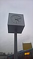 Clock with the municipal logo of Groningen, Groningen railway station (2018).jpg 2,160 × 3,840; 1.35 MB
-
 Cígo, Groningen Central Station (2018) 01.jpg 4,160 × 3,120; 3.92 MB
-
 DB Bahn sign, Groningen Central Station (2018).jpg 3,072 × 1,728; 1.79 MB
-
 Deel van de trapopgang naar loopbrug.jpg 4,738 × 3,159; 7.7 MB
-

-

-
 Doorkijk station Groningen.jpg 4,000 × 2,248; 2.12 MB
-
 Dutch PT chipcard charging stations Groningen Station 2012.jpg 2,592 × 1,944; 972 KB
-
 Dutch public transportation chipcard poles Groningen station 2012.jpg 2,592 × 1,944; 884 KB
-
 Fotos Viaje Europa 2011 (49803801067).jpg 1,360 × 958; 439 KB
-

-
 Groningen (stad), bouwkraan boven het stationsgebied. 13-06-2022. (actm.) 01.jpg 4,768 × 2,679; 7.94 MB
-
 Groningen (stad), bouwkraan boven het stationsgebied. 13-06-2022. (actm.) 02.jpg 4,761 × 2,392; 8.26 MB
-
 Groningen (stad), station Groningen. 13-06-2022. (actm.) 01.jpg 3,826 × 3,061; 7.99 MB
-
 Groningen (stad), station Groningen. 13-06-2022. (actm.) 02.jpg 3,920 × 3,136; 9.78 MB
-
 Groningen (stad), station Groningen. 13-06-2022. (actm.) 03.jpg 3,848 × 2,685; 9 MB
-
 Groningen (stad), station Groningen. 13-06-2022. (actm.) 04.jpg 2,659 × 4,254; 9.89 MB
-
 Groningen (stad), station Groningen. 13-06-2022. (actm.) 05.jpg 2,406 × 4,432; 8.98 MB
-
 Groningen (stad), station Groningen. 13-06-2022. (actm.) 06.jpg 2,993 × 4,789; 14.15 MB
-
 Groningen (stad), station Groningen. 13-06-2022. (actm.) 07.jpg 2,963 × 4,361; 10.01 MB
-
 Groningen (stad), station Groningen. 13-06-2022. (actm.) 08.jpg 3,033 × 4,345; 9.89 MB
-
 Groningen - bustunnel in aanleg.jpg 3,923 × 5,884; 6.68 MB
-
 Groningen - emplacement vanuit westen in 1908.jpg 1,855 × 834; 662 KB
-
 Groningen - hoofdstation bij avond.jpg 4,981 × 3,321; 10.16 MB
-
 Groningen - luchtbrug.jpg 3,845 × 5,383; 9.9 MB
-
 Groningen - seinhuis tijdens werkzaamheden.jpg 5,242 × 3,495; 7.38 MB
-
 Groningen - station - fiets- en voetgangerstunnel in aanbouw (1).jpg 3,698 × 5,177; 8.91 MB
-
 Groningen - station - fiets- en voetgangerstunnel in aanbouw (2).jpg 5,462 × 3,641; 5.77 MB
-
 Groningen - station - fiets- en voetgangerstunnel in aanbouw (3).jpg 6,000 × 4,000; 7.49 MB
-
 Groningen - station - fiets- en voetgangerstunnel in aanbouw (4).jpg 5,000 × 4,000; 9.5 MB
-
 Groningen - station - fiets- en voetgangerstunnel in aanbouw (5).jpg 4,000 × 6,000; 7.82 MB
-
 Groningen - station - fiets- en voetgangerstunnel in aanbouw (6).jpg 3,962 × 5,943; 6.03 MB
-
 Groningen - station - fiets- en voetgangerstunnel in aanbouw (7).jpg 5,970 × 3,980; 6.53 MB
-
 Groningen - stationsgebied - bouwactiviteiten (1).jpg 6,000 × 4,000; 7.74 MB
-
 Groningen - stationsgebied - bouwactiviteiten (2).jpg 5,594 × 3,996; 9.64 MB
-
 Groningen - terrein Spoorzone gezien vanaf pad naar traverse.jpg 3,752 × 5,628; 7.5 MB
-
 Groningen - traverse - sloopwerkzaamheden.jpg 5,978 × 3,985; 7.01 MB
-
 Groningen - zuidelijke stationsingang (1).jpg 5,836 × 3,283; 10.87 MB
-
 Groningen - zuidelijke stationsingang (2).jpg 6,000 × 4,000; 11.79 MB
-
 Groningen - zuidelijke stationsingang (3).jpg 6,000 × 4,000; 15.18 MB
-
 Groningen 21 18 41 110000.jpeg 4,032 × 3,024; 4.14 MB
-
 Groningen 21 18 49 869000.jpeg 4,032 × 3,024; 3.89 MB
-
 Groningen 21 18 58 044000.jpeg 4,032 × 3,024; 4.32 MB
-
 Groningen 21 19 07 574000.jpeg 4,032 × 3,024; 2.29 MB
-
 Groningen 21 19 14 899000.jpeg 4,032 × 3,024; 1.85 MB
-
 Groningen Central Station.jpg 1,024 × 680; 442 KB
-
 Groningen City public telephone 2012.jpg 2,592 × 1,944; 706 KB
-
 Groningen CS with Mat '54 - 1970.jpg 2,406 × 1,547; 762 KB
-
 Groningen Hauptbahnhof 01.jpg 4,212 × 1,980; 3.07 MB
-
 Groningen Hauptbahnhof 02.jpg 4,572 × 2,016; 3.06 MB
-
 Groningen Hauptbahnhof 03.jpg 3,093 × 2,222; 2.24 MB
-
 Groningen Hauptbahnhof 04.jpg 3,969 × 2,714; 3.32 MB
-
 Groningen Hauptbahnhof 05.jpg 4,498 × 2,292; 3.69 MB
-
 Groningen Hauptbahnhof 06.jpg 4,583 × 2,524; 4.67 MB
-
 Groningen Hauptbahnhof 07.jpg 3,971 × 2,701; 4.61 MB
-
 Groningen Hauptbahnhof 08.jpg 4,533 × 2,839; 4.36 MB
-
 Groningen Hauptbahnhof 09.jpg 4,279 × 3,288; 4.7 MB
-
 Groningen Hauptbahnhof 10.jpg 4,592 × 3,390; 6.37 MB
-
 Groningen Hauptbahnhof Restaurant 1.jpg 4,582 × 3,434; 5.52 MB
-
 Groningen Hauptbahnhof Restaurant 2.jpg 4,592 × 3,448; 5.67 MB
-
 Groningen Hoofdstation 14 46 51 445000.jpeg 4,032 × 3,024; 1.51 MB
-
 Groningen Hoofdstation 14 46 57 945000.jpeg 4,032 × 3,024; 1.53 MB
-
 Groningen Hoofdstation 14 47 04 932000.jpeg 4,032 × 3,024; 1.72 MB
-
 Groningen Hoofdstation.jpeg 4,032 × 3,024; 1.39 MB
-
 Groningen overpad spoor 4-6.JPG 640 × 427; 271 KB
-
 Groningen Railway Station (7965488730).jpg 4,036 × 2,997; 7.02 MB
-
 Groningen spoor 4-6 III.JPG 3,834 × 2,725; 5.34 MB
-
 Groningen spoor 4-6.JPG 640 × 453; 292 KB
-
 Groningen station (9580019579).jpg 6,016 × 4,000; 14.6 MB
-
 Groningen station bicycle parking 2010.jpg 2,690 × 2,030; 729 KB
-
 Groningen station juni 2020 1.jpg 3,648 × 2,736; 3.9 MB
-
 Groningen station juni 2020 3.jpg 3,648 × 2,736; 3.65 MB
-
 Groningen station werkzaamheden.jpg 4,000 × 2,248; 1.95 MB
-
 Groningen Train Station.jpg 1,024 × 768; 346 KB
-
 Groningen train station.jpg 4,160 × 2,340; 3.65 MB
-
 Groningen, Groningen, Nederland Apr 10, 2021 10-04-17 AM.jpeg 4,032 × 3,024; 2.58 MB
-
 Groningen, perron (1) station, RM-18691-WLM.jpg 3,648 × 2,736; 2.77 MB
-
 Groningen, perron (2) station, RM-18691-WLM.jpg 3,648 × 2,736; 3.18 MB
-
 Groningen, station, (veraf) RM-18691-WLM.jpg 3,648 × 2,736; 2.35 MB
-
 Groningen, station, RM-18691-WLM.jpg 3,647 × 2,424; 2.08 MB
-
 Groningen-Oorlogsmonument plaquette station (1).jpg 2,268 × 4,032; 4.04 MB
-
 Groningen-Oorlogsmonument plaquette station (2).jpg 4,032 × 2,268; 3.79 MB
-
 Hoofdstation Groningen - panoramio.jpg 2,000 × 3,008; 2.47 MB
-
 Intercity - Rotterdam Centraal - Rijdt niet verder dan Zwolle, Groningen (2023) 01.jpg 4,032 × 2,268; 2.06 MB
-
 Intercity - Rotterdam Centraal - Rijdt niet verder dan Zwolle, Groningen (2023) 02.jpg 4,032 × 2,268; 2.1 MB
-

-
 Interieur seinhuis, detail raamkozijn - Groningen - 20390139 - RCE.jpg 1,200 × 1,200; 104 KB
-
 Interieur, opgang naar seinhuis - Groningen - 20390133 - RCE.jpg 1,200 × 1,200; 141 KB
-
 Interieur, overzicht loopbrug - Groningen - 20390132 - RCE.jpg 1,200 × 1,200; 207 KB
-
 Interieur, overzicht seinhuis - Groningen - 20390136 - RCE.jpg 1,200 × 1,200; 124 KB
-
 Interieur, raampartij in seinhuis - Groningen - 20390138 - RCE.jpg 1,200 × 1,200; 96 KB
-
 Interieur, trap naar seinhuis - Groningen - 20390134 - RCE.jpg 1,200 × 1,200; 221 KB
-
 Jernbanestasjonen.jpg 2,573 × 2,037; 3.19 MB
-
 Kaartautomaat NS-Arriva.JPG 555 × 640; 277 KB
-
 Kaartlezer Arriva-IX.JPG 2,848 × 4,288; 6.94 MB
-
 Kaartlezer Arriva-VIII.JPG 1,790 × 2,723; 1.77 MB
-
 Kaartlezer NS-Arriva-II.JPG 536 × 640; 347 KB
-
 Kaartlezer NS-Arriva-III.JPG 515 × 640; 276 KB
-
 Kaartlezer NS-Arriva-VIII.JPG 2,200 × 2,979; 2.74 MB
-
 Kaartlezer NS-Arriva.JPG 391 × 640; 206 KB
-
 Ligfiets bij de trein naar Delfzijl (8012880915).jpg 2,592 × 1,952; 1.17 MB
-
 Lijn 22 Groningen.jpg 3,968 × 2,976; 2.86 MB
-
 Loopbrug Station Groningen.jpg 4,744 × 3,163; 7.83 MB
-
 NS 1223 station Groningen - HUA-168000.jpg 3,929 × 2,770; 1.9 MB
-
 NS Tickets & Service sign, Groningen Central Station (2018) 01.jpg 3,072 × 1,728; 1.48 MB
-
 NS Tickets & Service sign, Groningen Central Station (2018) 02.jpg 1,728 × 3,072; 1.97 MB
-
 NS Tickets & Service, Groningen railway station (2018).jpg 3,840 × 2,160; 1.79 MB
-
 NS-operated AED, Groningen Central Station (2018).jpg 3,120 × 4,160; 3.36 MB
-
 Openbare piano in Station Groningen.jpg 3,072 × 1,728; 1.82 MB
-
 Outdated Arriva check-in station, Groningen Central Station (2018).jpg 1,728 × 3,072; 1.57 MB
-
 OV-chipcard charging stations, Groningen railway station (2018).jpg 3,840 × 2,160; 1.65 MB
-
 Overstappen - Groningen CS (2015).jpg 3,000 × 4,500; 6.28 MB
-

-
 Overzicht perron met op de achtergrond de loopbrug - Groningen - 20390127 - RCE.jpg 1,200 × 1,200; 286 KB
-
 Overzicht seinhuis met loopbrug - Groningen - 20390125 - RCE.jpg 1,200 × 1,200; 271 KB
-
 Overzicht van de voorgevel - Groningen - 20380488 - RCE.jpg 1,200 × 1,199; 272 KB
-
 Overzicht van de voorgevel - Groningen - 20380489 - RCE.jpg 1,200 × 1,173; 184 KB
-
 Overzicht vanaf perron naar beide rij-richtingen - Groningen - 20390130 - RCE.jpg 1,200 × 1,200; 285 KB
-
 Post T Station Groningen 2.jpg 697 × 660; 174 KB
-
 Post T Station Groningen.JPG 2,164 × 660; 536 KB
-
 Proral Ns Hoofdstation Groningen 10 32 08 651000.jpeg 4,032 × 3,024; 3.07 MB
-
 Proral Ns Hoofdstation Groningen 10 32 17 787000.jpeg 4,032 × 3,024; 2.85 MB
-
 Proral Ns Hoofdstation Groningen 10 32 26 766000.jpeg 4,032 × 3,024; 2.92 MB
-
 Proral Ns Hoofdstation Groningen 10 32 36 695000.jpeg 4,032 × 3,024; 2.64 MB
-
 Proral Ns Hoofdstation Groningen 10 32 44 693000.jpeg 4,032 × 3,024; 2.28 MB
-
 Proral Ns Hoofdstation Groningen 10 32 50 630000.jpeg 4,032 × 3,024; 3.21 MB
-
 Proral Ns Hoofdstation Groningen 10 32 58 107000.jpeg 4,032 × 3,024; 3.58 MB
-
 Proral Ns Hoofdstation Groningen 10 33 06 200000.jpeg 4,032 × 3,024; 5.02 MB
-
 Proral Ns Hoofdstation Groningen 10 33 15 405000.jpeg 4,032 × 3,024; 5.13 MB
-
 Proral Ns Hoofdstation Groningen 10 33 27 692000.jpeg 4,032 × 3,024; 5.72 MB
-
 Proral Ns Hoofdstation Groningen 10 33 38 059000.jpeg 4,032 × 3,024; 2.83 MB
-
 Proral Ns Hoofdstation Groningen 10 33 46 471000.jpeg 4,032 × 3,024; 2.44 MB
-
 Proral Ns Hoofdstation Groningen 10 33 52 282000.jpeg 4,032 × 3,024; 2.66 MB
-
 Proral Ns Hoofdstation Groningen.jpeg 4,032 × 3,024; 2.57 MB
-
 Rawie buffer stops in Groningen.jpg 4,896 × 3,672; 6.77 MB
-
 RM 18691 Station Groningen.JPG 2,816 × 2,112; 2.62 MB
-
 Route sign inside of the Groningen Central Station at night (2018).jpg 3,072 × 1,728; 1.31 MB
-
 Rubbish bin at the central train station, Groningen (2019) 01.jpg 2,736 × 4,864; 6.21 MB
-
 Rubbish bin at the central train station, Groningen (2019) 02.jpg 2,736 × 4,864; 5.6 MB
-
 Rubbish bin at the central train station, Groningen (2019) 03.jpg 4,864 × 2,736; 4.22 MB
-
 Rubbish bin at the central train station, Groningen (2019) 04.jpg 2,736 × 4,864; 6.68 MB
-
 Rule signs, Groningen Central Station (2018).jpg 1,728 × 3,072; 1.24 MB
-
 Sign remembering the renovation of 1999, Groningen Central Station (2018).jpg 3,072 × 1,728; 1.57 MB
-
 Spoorkaart aan de wand.jpg 4,000 × 2,248; 2.67 MB
-
 Spoorlijn Groningen - Leeuwarden Roodeschool Delfzijl Drachten.JPG 4,752 × 3,168; 7.41 MB
-
 Station Groningen - arcade.jpg 4,698 × 2,643; 11.43 MB
-
 Station Groningen - gebrandschilderde ramen.jpg 3,832 × 2,555; 5.48 MB
-
 Station Groningen - luchtbrug (1).jpg 4,896 × 3,264; 11.17 MB
-
 Station Groningen - luchtbrug (2).jpg 4,896 × 3,264; 11.76 MB
-
 Station Groningen - luchtbrug (3).jpg 4,896 × 3,264; 12.48 MB
-
 Station Groningen - luchtbrug (4).jpg 4,896 × 3,264; 11.57 MB
-
 Station Groningen - overkapping perron.jpg 4,896 × 2,754; 9.57 MB
-
 Station Groningen - perron.jpg 4,896 × 3,264; 11.69 MB
-
 Station Groningen - traverse - toeloop met versiering.jpg 5,169 × 3,446; 8.47 MB
-
 Station Groningen 01 12 45 917000.jpeg 4,032 × 3,024; 3.1 MB
-
 Station Groningen 01 12 52 540000.jpeg 4,032 × 3,024; 1.95 MB
-
 Station Groningen 01 12 58 249000.jpeg 4,032 × 3,024; 3 MB
-
 Station Groningen 03 50 40 718000.jpeg 3,024 × 4,032; 1.66 MB
-
 Station Groningen 03 50 46 858000.jpeg 3,024 × 4,032; 2.47 MB
-
 Station Groningen 03 50 52 280000.jpeg 4,032 × 3,024; 2.69 MB
-
 Station Groningen 03 50 57 614000.jpeg 4,032 × 3,024; 2.62 MB
-
 Station Groningen 03 51 05 059000.jpeg 4,032 × 3,024; 3.34 MB
-
 Station Groningen 03 51 09 590000.jpeg 4,032 × 3,024; 4.29 MB
-
 Station Groningen 03 51 14 831000.jpeg 4,032 × 3,024; 2.28 MB
-
 Station Groningen 03 51 18 532000.jpeg 4,032 × 3,024; 1.79 MB
-
 Station Groningen 03 51 21 883000.jpeg 4,032 × 3,024; 2.18 MB
-
 Station Groningen 2018.jpg 5,472 × 3,648; 7.7 MB
-
 Station Groningen 2021.jpg 4,494 × 3,383; 8.79 MB
-
 Station Groningen 2022 1.jpg 5,472 × 3,648; 6.37 MB
-
 Station Groningen 2023 4.jpg 5,472 × 3,648; 5.26 MB
-
 Station Groningen bij nacht.jpg 4,896 × 3,264; 8.57 MB
-
 Station Groningen Netherlands 01.jpg 2,916 × 1,885; 2.98 MB
-
 Station Groningen Netherlands 02.jpg 2,000 × 3,008; 4.68 MB
-
 Station Groningen vanaf Emmaviaduct.jpg 6,000 × 4,000; 13.91 MB
-
 Station Groningen vanaf Groninger Museum 2005 Fruggo.jpg 1,600 × 1,200; 223 KB
-
 Station Groningen.jpg 700 × 526; 409 KB

_Groningen_NL.jpg)


.jpg)

.jpg)


.jpg)
.jpg)
_01.jpg)
_02.jpg)


.jpg)
.jpg)
.jpg)
_01.jpg)
.jpg)

_sign,_Groningen_Central_Station_(2019)_01.jpg)
_sign,_Groningen_Central_Station_(2019)_02.jpg)


.jpg)

,_bouwkraan_boven_het_stationsgebied._13-06-2022._(actm.)_01.jpg)
,_bouwkraan_boven_het_stationsgebied._13-06-2022._(actm.)_02.jpg)
,_station_Groningen._13-06-2022._(actm.)_01.jpg)
,_station_Groningen._13-06-2022._(actm.)_02.jpg)
,_station_Groningen._13-06-2022._(actm.)_03.jpg)
,_station_Groningen._13-06-2022._(actm.)_04.jpg)
,_station_Groningen._13-06-2022._(actm.)_05.jpg)
,_station_Groningen._13-06-2022._(actm.)_06.jpg)
,_station_Groningen._13-06-2022._(actm.)_07.jpg)
,_station_Groningen._13-06-2022._(actm.)_08.jpg)


.jpg)
.jpg)
.jpg)
.jpg)
.jpg)
.jpg)
.jpg)
.jpg)
.jpg)


.jpg)
.jpg)
.jpg)


.jpg)


.jpg)


_station,_RM-18691-WLM.jpg)
_station,_RM-18691-WLM.jpg)
_RM-18691-WLM.jpg)

.jpg)
.jpg)

_01.jpg)
_02.jpg)


.jpg)


_01.jpg)
_02.jpg)
.jpg)
.jpg)

.jpg)
.jpg)
.jpg)


.jpg)
_01.jpg)
_02.jpg)
_03.jpg)
_04.jpg)
.jpg)
.jpg)


.jpg)
.jpg)
.jpg)
.jpg)


.jpg)