Category:Stanton-by-Dale
Jump to navigation
Jump to search
English: Stanton-by-Dale is a village in the South East of Derbyshire, England. It lies south of Ilkeston and North of Sandiacre. Since 1974 it has been part of the Erewash Borough.
village and civil parish in Erewash District, Derbyshire, England  | |||||
| Upload media | |||||
| Instance of | |||||
|---|---|---|---|---|---|
| Location | Erewash, Derbyshire, East Midlands, England | ||||
 | |||||
Subcategories
This category has the following 5 subcategories, out of 5 total.
Media in category "Stanton-by-Dale"
The following 200 files are in this category, out of 200 total.
-
 29 Stanhope Street, Stanton by Dale.jpg 1,280 × 1,021; 443 KB
-
 An Illuminated Bend - geograph.org.uk - 897581.jpg 427 × 640; 236 KB
-
 Anachronistic sign - geograph.org.uk - 1565130.jpg 640 × 427; 101 KB
-
 Bench mark on gatepost, Seven Oaks Road - geograph.org.uk - 3489608.jpg 1,280 × 960; 580 KB
-
 Bench mark on Quarry Hill - geograph.org.uk - 3489622.jpg 1,280 × 960; 452 KB
-
 Bench mark, Grove Farm, Dale Lane - geograph.org.uk - 5490129.jpg 1,280 × 960; 737 KB
-
 Bench mark, Littlewell Lane - geograph.org.uk - 3489648.jpg 960 × 1,280; 657 KB
-
 Bench mark, Littlewell Lane - geograph.org.uk - 5490124.jpg 1,280 × 1,280; 468 KB
-
 Bench mark, School Lane - geograph.org.uk - 3489671.jpg 1,280 × 960; 753 KB
-
 Bench mark, Stanton-by-Dale - geograph.org.uk - 3489631.jpg 1,280 × 960; 624 KB
-
 Boundary stone near Grove Farm – 1 - geograph.org.uk - 5490140.jpg 1,280 × 1,280; 701 KB
-
 Boundary stone near Grove Farm – 2 - geograph.org.uk - 5490143.jpg 1,280 × 960; 587 KB
-
 Brick building on Littlewell Lane - geograph.org.uk - 5490122.jpg 1,280 × 960; 384 KB
-
 Bridge 13A, from the south - geograph.org.uk - 6186833.jpg 1,600 × 1,199; 414 KB
-
 Broken Cistern - geograph.org.uk - 1549019.jpg 426 × 640; 113 KB
-
 Butterfly Sluices on the Nutbrook Canal - geograph.org.uk - 1458546.jpg 640 × 480; 116 KB
-
 Cattle, Stanton by Dale - geograph.org.uk - 6196479.jpg 800 × 600; 129 KB
-
 Central melting plant - geograph.org.uk - 1881591.jpg 1,280 × 960; 219 KB
-
 Cereal crop towards High Lodge Farm - geograph.org.uk - 6196500.jpg 800 × 600; 115 KB
-
 Cottages on Stanhope Street - geograph.org.uk - 3489638.jpg 1,280 × 960; 314 KB
-
 Cottages, Stanton by Dale - geograph.org.uk - 6196460.jpg 800 × 559; 121 KB
-
 Cross in Stanton-by-Dale - geograph.org.uk - 3802477.jpg 3,874 × 2,826; 2.28 MB
-
 Cyclist heading north on the Erewash Canal towpath - geograph.org.uk - 6186828.jpg 1,703 × 1,277; 1.08 MB
-
 Cyclist on the Nutbrook Trail - geograph.org.uk - 6184968.jpg 1,703 × 1,277; 1.06 MB
-
 Dale Lane, Stanton-by-Dale - geograph.org.uk - 5490132.jpg 1,280 × 900; 390 KB
-
 Dale Road - geograph.org.uk - 6368085.jpg 3,008 × 2,000; 4.25 MB
-
 Dale Road near Grove Farm - geograph.org.uk - 4740759.jpg 1,280 × 851; 430 KB
-
 Dale Road Passing Grove Farm - geograph.org.uk - 3810971.jpg 4,000 × 3,000; 2.94 MB
-
 Dale Road towards Dale Abbey - geograph.org.uk - 6196484.jpg 640 × 480; 62 KB
-
 Dale Road, Stanton by Dale - geograph.org.uk - 6196475.jpg 800 × 532; 88 KB
-
 Dale Road, Stanton by Dale - geograph.org.uk - 6196481.jpg 800 × 600; 118 KB
-
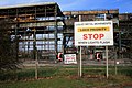
 Demolition Contractor Sign - geograph.org.uk - 1548962.jpg 640 × 426; 101 KB
-
 Derbyshire UK parish map highlighting Stanton by Dale.svg 888 × 1,308; 2.34 MB
-
 End of the line - geograph.org.uk - 3461618.jpg 2,159 × 3,238; 867 KB
-
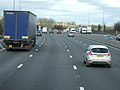
 Entering Derbyshire on the M1 motorway - geograph.org.uk - 4048349.jpg 1,600 × 1,378; 1.06 MB
-
 Entering Derbyshire, M1 - geograph.org.uk - 4682314.jpg 640 × 357; 25 KB
-
 Entering Nottinghamshire - geograph.org.uk - 3725606.jpg 4,509 × 1,654; 983 KB
-
 Entrance to High Lodge Farm - geograph.org.uk - 897882.jpg 420 × 640; 242 KB
-
 Erewash , M1 Motorway - geograph.org.uk - 5951651.jpg 6,000 × 4,000; 7.45 MB
-
 Erewash , M1 Motorway - geograph.org.uk - 5951652.jpg 5,726 × 3,817; 5.37 MB
-
 Erewash , M1 Motorway - geograph.org.uk - 5951654.jpg 6,000 × 4,000; 6.75 MB
-
 Erewash , M1 Motorway - geograph.org.uk - 5979032.jpg 6,000 × 4,000; 6.01 MB
-
 Erewash , M1 Motorway - geograph.org.uk - 5979035.jpg 6,000 × 4,000; 6.52 MB
-
 Erewash Valley Golf Club from Quarry Hill - geograph.org.uk - 3489620.jpg 1,280 × 960; 774 KB
-

-
 Field entrance off Hixon's Lane - geograph.org.uk - 6196487.jpg 800 × 600; 136 KB
-
 Fire Station, Stanton Works - geograph.org.uk - 448793.jpg 640 × 477; 106 KB
-
 Footpath over field near Dalemoor Farm - geograph.org.uk - 6196492.jpg 800 × 600; 118 KB
-
 Footpath to Stanton village - geograph.org.uk - 3489615.jpg 1,280 × 960; 871 KB
-
 Former Flanged Pipe Works, Stanton Ironworks - geograph.org.uk - 3489683.jpg 1,280 × 853; 435 KB
-
 Former junction of the Erewash and Nutbrook Canals - geograph.org.uk - 6184983.jpg 1,703 × 1,277; 980 KB
-
 Former Methodist Chapel, Dale Road - geograph.org.uk - 3489656.jpg 1,280 × 960; 427 KB
-
 Former Wesleyan Chapel, Stanton by Dale - geograph.org.uk - 6196468.jpg 800 × 628; 127 KB
-
 Fortress Security a.k.a. A Skip - geograph.org.uk - 1549144.jpg 640 × 426; 88 KB
-
 Gateway to Grove Farm, Stanton-by-Dale - geograph.org.uk - 5490135.jpg 1,280 × 960; 511 KB
-
 Going, going, going, going gone - geograph.org.uk - 1881589.jpg 1,280 × 853; 318 KB
-
 Golf Club Road - geograph.org.uk - 6296874.jpg 2,000 × 1,330; 2.31 MB
-
 Goodbye to the Melting Shop - geograph.org.uk - 1548889.jpg 640 × 426; 79 KB
-
 Goodbye to the melting shop - geograph.org.uk - 1548893.jpg 640 × 426; 62 KB
-
 Goodbye to the melting shop - geograph.org.uk - 1549244.jpg 640 × 426; 55 KB
-
 Goodbye to the Melting Shop - geograph.org.uk - 1549259.jpg 640 × 426; 117 KB
-
 Goodbye to the melting shop - geograph.org.uk - 1597144.jpg 640 × 426; 65 KB
-
 Grazing Land near Grove Farm - geograph.org.uk - 3810979.jpg 4,000 × 3,000; 2.94 MB
-
 Grazing off Dale Road, Stanton by Dale - geograph.org.uk - 6196477.jpg 800 × 600; 106 KB
-
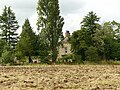 Grove Farmhouse, Stanton by Dale.jpg 1,280 × 960; 512 KB
-
 Hallam Plant - geograph.org.uk - 1881582.jpg 1,280 × 853; 537 KB
-
 Hixon's Lane towards Dale Moor - geograph.org.uk - 6196489.jpg 800 × 600; 125 KB
-
 Houses on Dale Road, Stanton by Dale - geograph.org.uk - 6196462.jpg 800 × 578; 92 KB
-
 Houses on Dale Road, Stanton by Dale - geograph.org.uk - 6196474.jpg 640 × 480; 74 KB
-

-
 Industrial units on the Stanton Ironworks site - geograph.org.uk - 2461094.jpg 1,024 × 756; 185 KB
-

-
 Ladle Hoist - geograph.org.uk - 1559415.jpg 591 × 640; 92 KB
-
 Lagoon near the Nutbrook Trail - geograph.org.uk - 3803003.jpg 3,910 × 2,878; 1.92 MB
-
 Laying out track - geograph.org.uk - 3489692.jpg 1,280 × 853; 290 KB
-
 Littlewell Lane - geograph.org.uk - 6196452.jpg 800 × 600; 147 KB
-
 M1 Bridge over Ilkeston Road - geograph.org.uk - 3489596.jpg 1,280 × 960; 302 KB
-
 M1 northbound at Stanton Gate - geograph.org.uk - 2843242.jpg 640 × 480; 50 KB
-
 M1 Signs from beside the Erewash Canal - geograph.org.uk - 5316796.jpg 640 × 640; 130 KB
-
 M1 southbound near junction 25 - geograph.org.uk - 2716550.jpg 640 × 443; 49 KB
-
 M1, southbound - geograph.org.uk - 4682315.jpg 640 × 369; 26 KB
-
 Main Street, looking east - geograph.org.uk - 3489664.jpg 1,280 × 960; 514 KB
-
 Middlemore Almshouses, Stanton By Dale - geograph.org.uk - 17584.jpg 640 × 423; 92 KB
-
 Middlemore's Almshouses, Stanton-by-Dale - geograph.org.uk - 5490107.jpg 1,280 × 850; 384 KB
-
 Nearly gone - geograph.org.uk - 1650248.jpg 640 × 426; 43 KB
-
 New Stanton Cottages - geograph.org.uk - 5488607.jpg 1,280 × 894; 291 KB
-
 New Stanton Cottages on Sowbrook Lane - geograph.org.uk - 6296881.jpg 2,000 × 1,330; 2.56 MB
-

-
 No 18, Stanhope Street - geograph.org.uk - 3489650.jpg 870 × 1,280; 418 KB
-
 No Man's Lane towards Sandiacre - geograph.org.uk - 6196749.jpg 800 × 600; 121 KB
-
 Northbound along the M1 motorway - geograph.org.uk - 4847564.jpg 800 × 600; 121 KB
-
 Northbound Steel Empties - geograph.org.uk - 3849148.jpg 800 × 599; 279 KB
-
 Nutbrook Canal near Stanton Bridge - geograph.org.uk - 3802973.jpg 4,000 × 3,000; 2.21 MB
-
 Nutbrook Canal, Stanton - geograph.org.uk - 2498940.jpg 1,280 × 856; 228 KB
-
 Nutbrook Canal, Stanton - geograph.org.uk - 2499714.jpg 1,280 × 856; 356 KB
-
 Nutbrook Trail near Hallam Fields - geograph.org.uk - 5818592.jpg 1,280 × 1,280; 730 KB
-
 Off Dale Road, Stanton By Dale - geograph.org.uk - 17578.jpg 640 × 423; 66 KB
-
 Old Barn Behind Hedge - geograph.org.uk - 897883.jpg 640 × 427; 238 KB
-
 Old Central Cross by Stanhope Street, Stanton-by-Dale - geograph.org.uk - 6094273.jpg 1,024 × 1,024; 259 KB
-
 Old headstones, Church of St Michael, Stanton - geograph.org.uk - 5490111.jpg 1,280 × 960; 478 KB
-
 Old Lock on the Nutbrook Canal - geograph.org.uk - 1458523.jpg 480 × 640; 90 KB
-
 Old Railway Line - geograph.org.uk - 1549349.jpg 426 × 640; 112 KB
-
 Parting of the railways - geograph.org.uk - 5715756.jpg 5,376 × 3,024; 4.19 MB
-
 Path to Risley Lodge Farm - geograph.org.uk - 1363461.jpg 640 × 480; 83 KB
-
 Path to Risley Lodge Farm - geograph.org.uk - 1397295.jpg 640 × 480; 100 KB
-
 Path to Risley Lodge Farm - geograph.org.uk - 1458577.jpg 640 × 480; 121 KB
-
 Path to Risley Lodge Farm - geograph.org.uk - 878703.jpg 640 × 427; 313 KB
-
 Path to Risley Lodge Farm - geograph.org.uk - 917149.jpg 640 × 427; 253 KB
-
 Pipeworks Entrance - geograph.org.uk - 1549316.jpg 640 × 373; 54 KB
-
 Poppy, Rape and Raincloud - geograph.org.uk - 889303.jpg 640 × 361; 174 KB
-

-
 Retaining wall on Quarry Hill - geograph.org.uk - 3489625.jpg 1,280 × 960; 503 KB
-
 River Erewash - geograph.org.uk - 5715755.jpg 5,376 × 3,024; 5.35 MB
-
 Saturated Crop Field near Stanton-by-Dale - geograph.org.uk - 3802433.jpg 4,000 × 3,000; 2.54 MB
-
 Seasonal Kissing Gate - geograph.org.uk - 899277.jpg 427 × 640; 392 KB
-
 Seven Oaks Lane - geograph.org.uk - 3489609.jpg 1,280 × 960; 650 KB
-
 Shark Headed Tree - geograph.org.uk - 898076.jpg 640 × 427; 312 KB
-

-

-
 Signs at Stanton Bridge - geograph.org.uk - 2499419.jpg 856 × 1,280; 169 KB
-
 Slight kink in the M1 northbound - geograph.org.uk - 2843235.jpg 640 × 468; 53 KB
-
 Sowbrook Lane - geograph.org.uk - 6296879.jpg 2,000 × 1,330; 2.34 MB
-
 Sowbrook Lane towards New Stanton - geograph.org.uk - 6196438.jpg 800 × 600; 155 KB
-
 Stanhope Street in Stanton - geograph.org.uk - 6296877.jpg 2,000 × 1,330; 2.03 MB
-
 Stanhope Street in Stanton-by-Dale - geograph.org.uk - 3802521.jpg 3,444 × 2,193; 1.15 MB
-
 Stanton Bonna Head Office - geograph.org.uk - 6196446.jpg 800 × 507; 82 KB
-
 Stanton Bonna works - geograph.org.uk - 6196449.jpg 800 × 585; 102 KB
-
 Stanton Bridge, Nutbrook Canal - geograph.org.uk - 2499717.jpg 1,280 × 856; 285 KB
-
 Stanton by Dale - geograph.org.uk - 954373.jpg 640 × 428; 107 KB
-
 Stanton by Dale - geograph.org.uk - 954398.jpg 428 × 640; 107 KB
-

-
 Stanton Cross and the old Post Office - geograph.org.uk - 3489627.jpg 1,280 × 960; 284 KB
-
 Stanton Gate - geograph.org.uk - 3489601.jpg 1,280 × 960; 475 KB
-
 Stanton Iron Works Fire Station - geograph.org.uk - 1397346.jpg 640 × 480; 68 KB
-

-
 Stanton Pipe Works - geograph.org.uk - 448769.jpg 640 × 480; 90 KB
-
 Stanton Pipe Works - geograph.org.uk - 448771.jpg 640 × 480; 140 KB
-
 Stanton Pipe Works - geograph.org.uk - 448780.jpg 640 × 480; 120 KB
-
 Stanton Pipe Works - geograph.org.uk - 448783.jpg 640 × 480; 94 KB
-
 Stanton Village Hall - geograph.org.uk - 3489654.jpg 1,280 × 960; 355 KB
-
 Stanton-by-Dale PO - geograph.org.uk - 577366.jpg 640 × 428; 37 KB
-
 Stanton-by-Dale, Derbys. - geograph.org.uk - 3336000.jpg 3,478 × 2,080; 1.75 MB
-
 Stanton-by-Dale, Derbys. - geograph.org.uk - 3336017.jpg 3,750 × 2,746; 1.58 MB
-
 Stanton-by-Dale, Derbys. - geograph.org.uk - 3336028.jpg 2,429 × 3,173; 1.43 MB
-
 Stanton-by-Dale, Derbys. - geograph.org.uk - 3336042.jpg 2,710 × 3,113; 1.41 MB
-
 Stanton-by-Dale, Derbys. - geograph.org.uk - 3336062.jpg 3,518 × 2,495; 1.7 MB
-
 Stanton-by-Dale, Derbys. - geograph.org.uk - 3336078.jpg 3,688 × 2,414; 1.73 MB
-
 Stanton-by-Dale, Derbys. - geograph.org.uk - 3336094.jpg 3,352 × 2,411; 1.6 MB
-
 Stanton-by-Dale, Derbys. - geograph.org.uk - 3336124.jpg 3,733 × 2,941; 2.01 MB
-
 Stanton-by-Dale, Derbys. - geograph.org.uk - 3336139.jpg 3,292 × 2,066; 1.33 MB
-
 Stanton-by-Dale, Derbys. - geograph.org.uk - 3336161.jpg 3,688 × 2,240; 1.61 MB
-
 Stanton-by-Dale, Derbys. - geograph.org.uk - 3336703.jpg 2,593 × 2,081; 1.13 MB
-
 Stanton-by-Dale, Derbys. - geograph.org.uk - 3336752.jpg 2,907 × 2,332; 1.35 MB
-
 Stanton-by-Dale, Derbys. - geograph.org.uk - 3336776.jpg 3,456 × 2,204; 1.47 MB
-
 Stanton-by-Dale, Derbys. - geograph.org.uk - 3336846.jpg 4,032 × 3,024; 2.53 MB
-
 Stanton-by-Dale, Derbys. - geograph.org.uk - 3336874.jpg 3,461 × 2,354; 1.22 MB
-
 Stanton-by-Dale, Derbys. - geograph.org.uk - 3336923.jpg 2,618 × 3,608; 1.98 MB
-
 Stanton-by-Dale, Derbys. - geograph.org.uk - 3337022.jpg 3,508 × 2,210; 1.53 MB
-
 Stanton-by-Dale, Derbys. - geograph.org.uk - 3337049.jpg 3,420 × 2,435; 1.64 MB
-
 Stanton-by-Dale, Derbys. - geograph.org.uk - 3337106.jpg 4,030 × 2,439; 2.09 MB
-
 Stanton-by-Dale, Derbys. - geograph.org.uk - 3337578.jpg 3,930 × 2,370; 1.95 MB
-
 Stanton-by-Dale, Derbys. - geograph.org.uk - 3337620.jpg 3,077 × 2,642; 1.6 MB
-
 Stanton-by-Dale, Derbys. - geograph.org.uk - 3338032.jpg 3,851 × 2,305; 1.76 MB
-
 Stanton-by-Dale, Derbys. - geograph.org.uk - 3338116.jpg 3,851 × 2,117; 1.8 MB
-
 Stanton-by-Dale, Derbys. - geograph.org.uk - 3338179.jpg 3,750 × 2,180; 1.86 MB
-
 Stanton-by-Dale, Derbys. - geograph.org.uk - 3338225.jpg 3,854 × 2,903; 2.23 MB
-
 Stanton-by-Dale, Derbys. - geograph.org.uk - 3338251.jpg 3,586 × 2,693; 1.97 MB
-
 StantonByDale.jpg 428 × 640; 81 KB
-
 Stoney Clouds Nature Reserve Vicinity, Sandiacre. - geograph.org.uk - 3335355.jpg 3,215 × 2,113; 1.13 MB
-
 Sunrise over Stapleford - geograph.org.uk - 668615.jpg 640 × 427; 46 KB
-
 The Chequers Inn and row of cottages - geograph.org.uk - 3489662.jpg 1,280 × 960; 378 KB
-
 The Chequers Inn, Stanton by Dale - geograph.org.uk - 6196469.jpg 800 × 535; 89 KB
-

-
 The corner of School Lane - geograph.org.uk - 3489668.jpg 1,280 × 960; 509 KB
-
 The easy way to play golf - geograph.org.uk - 3489604.jpg 1,280 × 960; 580 KB
-
 The edge of Stanton by Dale - geograph.org.uk - 6296875.jpg 2,000 × 1,330; 3.69 MB
-
 The last bit is a bit tough - geograph.org.uk - 1628640.jpg 640 × 480; 66 KB
-
 The M1 Motorway from Stony Clouds - geograph.org.uk - 3802417.jpg 4,000 × 3,000; 2.43 MB
-
 The Nutbrook Trail at Stanton - geograph.org.uk - 2461073.jpg 1,024 × 761; 257 KB
-
 The old Post Office and postbox, Stanton-by-Dale - geograph.org.uk - 3489634.jpg 960 × 1,280; 396 KB
-
 The Old Schoolhouse village shop and tea rooms - geograph.org.uk - 3489675.jpg 1,280 × 968; 475 KB
-
 The Seven Oaks Inn - geograph.org.uk - 1397330.jpg 640 × 480; 61 KB
-
 The Seven Oaks Inn, Stanton - geograph.org.uk - 2098493.jpg 1,280 × 857; 184 KB
-
 The Stanhope Arms, Stanton by Dale - geograph.org.uk - 6196455.jpg 800 × 485; 87 KB
-
 The view from Quarry Hill - geograph.org.uk - 3489618.jpg 1,280 × 960; 516 KB
-
 Twelve Houses, New Stanton - geograph.org.uk - 17050.jpg 640 × 480; 81 KB
-
 View over Stanton-by-Dale - geograph.org.uk - 897879.jpg 640 × 427; 208 KB
-
 War Memorial, Stanton-by-Dale - geograph.org.uk - 5490117.jpg 960 × 1,280; 372 KB
-
 Wasteland off the Nutbrook Trail - geograph.org.uk - 774954.jpg 640 × 427; 87 KB
-
 Water Pump, Stanton by Dale - geograph.org.uk - 1019254.jpg 480 × 640; 134 KB
-
 Wesleyan Chapel - geograph.org.uk - 897880.jpg 640 × 416; 166 KB
-
 Wesleyan Chapel, Stanton by Dale - geograph.org.uk - 1019239.jpg 640 × 538; 99 KB
-
 Wheat near Risley Lodge Farm - geograph.org.uk - 1397530.jpg 640 × 480; 141 KB
-
 A Hedge at sunset - geograph.org.uk - 597560.jpg 640 × 426; 185 KB
-
 A Wall or a Bridge - geograph.org.uk - 1458559.jpg 640 × 480; 132 KB
-
 Dead tree near to No Mans Lane - geograph.org.uk - 597555.jpg 640 × 426; 45 KB
-
 Path to Risley Lodge Farm - geograph.org.uk - 597558.jpg 640 × 426; 197 KB
-
 Stanton By Dale - geograph.org.uk - 17686.jpg 640 × 423; 97 KB
-
 Stanton Ironworks Offices (1914) - geograph.org.uk - 293783.jpg 480 × 640; 79 KB
-
 Training Centre, Stanton Works - geograph.org.uk - 448796.jpg 640 × 479; 107 KB


_-_geograph.org.uk_-_293783.jpg)
