Category:Stansfield
Jump to navigation
Jump to search
English: Stansfield is a village and civil parish in the St Edmundsbury district of Suffolk in eastern England. Located seven miles south-west of Bury St Edmunds, in 2005 its population was 230.[1] The parish also contains the hamlets of Assington Green, Purton Green, Upper Street and Lower Street.
village and civil parish in Suffolk, UK  | |||||
| Upload media | |||||
| Instance of | |||||
|---|---|---|---|---|---|
| Location | St Edmundsbury, Suffolk, East of England, England | ||||
| Different from | |||||
 | |||||
- ↑ Cite error: Invalid
<ref>tag; no text was provided for refs namedpopulation
Subcategories
This category has the following 5 subcategories, out of 5 total.
A
- All Saints church, Stansfield (29 F)
C
- The Compasses, Stansfield (7 F)
P
- Purton Green (4 F)
S
- Stansfield Windmill (4 F)
V
- Stansfield Village Sign (3 F)
Media in category "Stansfield"
The following 38 files are in this category, out of 38 total.
-
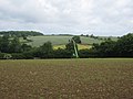
 A wet barley field - geograph.org.uk - 2021449.jpg 1,600 × 1,200; 706 KB
-

-
 Bridle path - geograph.org.uk - 925828.jpg 640 × 480; 78 KB
-
 Clay pigeon launcher - geograph.org.uk - 2022774.jpg 1,600 × 1,200; 701 KB
-
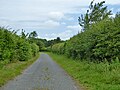
 Country road - geograph.org.uk - 925957.jpg 480 × 640; 126 KB
-
 Elizabeth II postbox on High Street, Upper Street - geograph.org.uk - 6256161.jpg 3,015 × 4,324; 4.14 MB
-
 Entering Stansfield - geograph.org.uk - 6255335.jpg 800 × 600; 148 KB
-
 Farm track with public footpath at field edge - geograph.org.uk - 5569089.jpg 1,500 × 810; 1.31 MB
-
 Field of sugarbeet at Stansfield - geograph.org.uk - 4635657.jpg 1,240 × 930; 672 KB
-
 Field of wheat - geograph.org.uk - 5447575.jpg 640 × 480; 117 KB
-
 Field with fine tilth - geograph.org.uk - 5568407.jpg 1,499 × 830; 1.11 MB
-
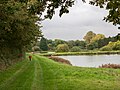
 Fish pond - geograph.org.uk - 917901.jpg 640 × 480; 107 KB
-
 Footpath to Gatesbury's Farm - geograph.org.uk - 2021407.jpg 1,600 × 1,200; 829 KB
-
 Ford - geograph.org.uk - 916489.jpg 640 × 480; 139 KB
-
 Free firewood - geograph.org.uk - 925784.jpg 640 × 480; 128 KB
-
 Green Track - geograph.org.uk - 916562.jpg 640 × 480; 88 KB
-
 High Street, Stansfield - geograph.org.uk - 6255341.jpg 800 × 600; 121 KB
-
 High Street, Upper Street - geograph.org.uk - 6256162.jpg 800 × 600; 178 KB
-
 Houses on Lower Street - geograph.org.uk - 6255344.jpg 800 × 600; 131 KB
-
 Lane towards Assington Green - geograph.org.uk - 5447573.jpg 640 × 480; 144 KB
-
 Looking back to Cordell Hall - geograph.org.uk - 2021436.jpg 1,600 × 1,200; 676 KB
-
 Lower Street, Stansfield - geograph.org.uk - 6255347.jpg 800 × 600; 152 KB
-
 Maize crop, Upper Street - geograph.org.uk - 6255333.jpg 800 × 600; 159 KB
-
 Males aged 20 & over, in 6 occupational categories in 1831.jpg 481 × 288; 22 KB
-
 Men at work, Upper Street - geograph.org.uk - 6255336.jpg 800 × 595; 135 KB
-
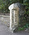 Milestone, Halifax Road, Stansfield - geograph.org.uk - 1532126.jpg 544 × 640; 166 KB
-
 Old Chapel - geograph.org.uk - 925791.jpg 480 × 640; 104 KB
-
 Path beside ponds - geograph.org.uk - 5569093.jpg 1,500 × 1,125; 1.85 MB
-
 Postbox in the High Street, Upper Street - geograph.org.uk - 4635663.jpg 1,240 × 930; 596 KB
-
 Purton Green Ford - geograph.org.uk - 4771287.jpg 1,086 × 724; 461 KB
-
 Road junction - geograph.org.uk - 916449.jpg 640 × 480; 87 KB
-
 Series of fish ponds - geograph.org.uk - 2021423.jpg 1,600 × 1,200; 626 KB
-
 Stansfield Hall - geograph.org.uk - 925845.jpg 640 × 480; 72 KB
-

-
 Thatched cottage, Upper Street - geograph.org.uk - 6255334.jpg 800 × 600; 134 KB
-
 The old chapel in Stansfield street - geograph.org.uk - 4635672.jpg 1,240 × 930; 627 KB
-
 Track up from Purton Ford - geograph.org.uk - 2021445.jpg 1,600 × 1,200; 946 KB
-
 Walkers following path over earthen field - geograph.org.uk - 5568399.jpg 1,499 × 782; 1.23 MB


