Category:Stadhuis (Doesburg)
Jump to navigation
Jump to search
| Object location | | View all coordinates using: OpenStreetMap |
|---|
 | |||||
| Upload media | |||||
| Instance of | |||||
|---|---|---|---|---|---|
| Location | Doesburg, Gelderland, Netherlands | ||||
| Street address |
| ||||
| Located on street | |||||
| Architectural style | |||||
| Heritage designation |
| ||||
 | |||||
|
This is a category about rijksmonument number 13060
|
| Address |
|
Subcategories
This category has only the following subcategory.
I
Media in category "Stadhuis (Doesburg)"
The following 55 files are in this category, out of 55 total.
-
 20150410 Sint Maarten stadhuis Doesburg.jpg 3,210 × 4,281; 1.39 MB
-
 20150410 stadhuis Doesburg.jpg 3,672 × 4,860; 1.16 MB
-
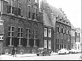
 Achtergevel - Doesburg - 20057913 - RCE.jpg 895 × 1,200; 188 KB
-
 Beeld van St.Maarten, v.d.Schaft - Doesburg - 20057920 - RCE.jpg 884 × 1,200; 241 KB
-
 Beeldhouwwerk v.d.Schaft - Doesburg - 20057921 - RCE.jpg 1,200 × 904; 155 KB
-
 Beeldhouwwerk v.d.Schaft - Doesburg - 20057922 - RCE.jpg 887 × 1,200; 140 KB
-
 Doesburg raadhuis.JPG 320 × 456; 59 KB
-
 Doesburg, Achterkant stadhuis.jpg 1,536 × 2,048; 1.46 MB
-
 Doesburg, Informatiebordje stadhuis.jpg 2,048 × 1,536; 700 KB
-
 Doesburg, Netherlands - panoramio (126).jpg 2,048 × 1,155; 889 KB
-
 Doesburg, Netherlands - panoramio (144).jpg 1,155 × 2,048; 1,005 KB
-
 Doesburg, Netherlands - panoramio (145).jpg 2,048 × 1,155; 616 KB
-
 Doesburg, Netherlands - panoramio (182).jpg 4,896 × 3,264; 5.62 MB
-
 Doesburg, Netherlands - panoramio (82).jpg 4,896 × 3,264; 2.9 MB
-
 Doesburg, Netherlands - panoramio (85).jpg 4,896 × 3,264; 2.78 MB
-
 Doesburg, Netherlands - panoramio (89).jpg 4,896 × 3,264; 2.62 MB
-
 Doesburg, Netherlands - panoramio (90).jpg 4,896 × 3,264; 3.47 MB
-
 Doesburg, Netherlands - panoramio - Ben Bender (7).jpg 4,896 × 3,264; 3.06 MB
-
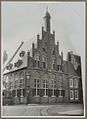
 Doesburg, Stadhuis.jpg 1,536 × 2,048; 794 KB
-
 Doesburgsjtadhoes.JPG 864 × 1,152; 256 KB
-
 Exterieur VOORGEVEL, LINKER ZIJGEVEL - Doesburg - 20265979 - RCE.jpg 1,200 × 838; 165 KB
-

-
 Gevel voor de afbikking - Doesburg - 20057911 - RCE.jpg 1,200 × 851; 171 KB
-
 Historic center of Doesburg with nice Dutcg gables - panoramio.jpg 4,928 × 3,264; 6.07 MB
-
 Hoek rechts - Doesburg - 20323178 - RCE.jpg 838 × 1,200; 161 KB
-
 Koepoortstr.-Roggestr., Stadhuis, overzicht - Doesburg - 20057871 - RCE.jpg 1,200 × 812; 225 KB
-
 Koepoortstr.-Roggestr., Stadhuis, overzicht - Doesburg - 20057872 - RCE.jpg 818 × 1,200; 191 KB
-
 Koepoortstr.-Roggestr., Stadhuis, overzicht - Doesburg - 20057873 - RCE.jpg 1,200 × 815; 211 KB
-
 Medieval buildings at Doesburg Holland - panoramio.jpg 3,648 × 2,432; 2.38 MB
-
 Na de restauratie - Doesburg - 20057914 - RCE.jpg 961 × 1,200; 231 KB
-
 Overzicht - Doesburg - 20425434 - RCE.jpg 757 × 1,200; 289 KB
-

-
 Overzicht voorgevel en rechter zijgevel - Doesburg - 20359518 - RCE.jpg 953 × 1,200; 208 KB
-
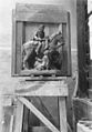
 Plaatsing St.Maartensgroep - Doesburg - 20057915 - RCE.jpg 834 × 1,200; 269 KB
-
 RM13060 Doesburg - Roggestraat 2.jpg 1,944 × 2,592; 1.15 MB
-
 Schets beeldhouwwerk v.d.Schaft - Doesburg - 20057923 - RCE.jpg 892 × 1,200; 163 KB
-
 Schilderij - Doesburg - 20057907 - RCE.jpg 1,200 × 945; 229 KB
-
 Schilderij door Jac.v.Elten - Doesburg - 20057908 - RCE.jpg 1,200 × 946; 265 KB
-
 Schilderij door Jac.v.Elten - Doesburg - 20057910 - RCE.jpg 1,200 × 942; 212 KB
-
 St.Maarten en ingang - Doesburg - 20057916 - RCE.jpg 856 × 1,200; 266 KB
-
 St.Maarten en ingang - Doesburg - 20057917 - RCE.jpg 860 × 1,200; 331 KB
-
 St.Maarten, ontwerp v.d.Schaft - Doesburg - 20057918 - RCE.jpg 829 × 1,200; 232 KB
-
 St.Maarten, ontwerp v.d.Schaft - Doesburg - 20057919 - RCE.jpg 835 × 1,200; 249 KB
-
 Stadhuis (Doesburg) DSF0108.jpg 6,000 × 4,000; 12.88 MB
-
 Stadhuis (Doesburg) P1400196.jpg 4,000 × 2,672; 5.72 MB
-
 Stadhuis en hotel "HOF GELRIA" - Unknown - 20522378 - RCE.jpg 1,200 × 900; 185 KB
-
 Tekening door J.de Beyer, 1773 - Doesburg - 20057909 - RCE.jpg 1,200 × 881; 242 KB
-
 Van af het Raadhuis - Doesburg - 20058113 - RCE.jpg 1,200 × 800; 171 KB
-
 Visafslag en achterzijde raadhuis - Doesburg - 20325611 - RCE.jpg 1,200 × 1,007; 184 KB
-

-
 Voor- en zijgevel uit de 15e eeuw - Doesburg - 20057912 - RCE.jpg 1,200 × 855; 152 KB
-
 Voorgevel en deel zijgevel tijdens restauratie - Doesburg - 20325404 - RCE.jpg 875 × 1,200; 161 KB
-
 Voorgevel en zijgevel links - Doesburg - 20325403 - RCE.jpg 1,200 × 876; 148 KB
-
 Zijgevel raadhuis en voorgevel hotel aan straat - Doesburg - 20323668 - RCE.jpg 789 × 1,200; 142 KB
-
 Zuidoostgevel - Doesburg - 20325402 - RCE.jpg 1,200 × 911; 217 KB


.jpg)
.jpg)
.jpg)
.jpg)
.jpg)
.jpg)
.jpg)
.jpg)
.jpg)


_DSF0108.jpg)
_P1400196.jpg)


