Category:St Tudy's Church, St Tudy
Jump to navigation
Jump to search
| Object location | | View all coordinates using: OpenStreetMap |
|---|
church in Cornwall, UK  | |||||
| Upload media | |||||
| Instance of | |||||
|---|---|---|---|---|---|
| Dedicated to | |||||
| Location | St Tudy, Cornwall, South West England, England | ||||
| Diocese | |||||
| Heritage designation |
| ||||
| Inception |
| ||||
| Religion or worldview | |||||
 | |||||
Media in category "St Tudy's Church, St Tudy"
The following 6 files are in this category, out of 6 total.
-

-
 Slate memorial I, St Tudius Church, St Tudy - geograph.org.uk - 3322793.jpg 1,600 × 924; 345 KB
-
 Slate memorial II, St Tudius Church, St Tudy - geograph.org.uk - 3322799.jpg 1,302 × 1,600; 590 KB
-
 St Tudy Church - geograph.org.uk - 1629250.jpg 640 × 392; 69 KB
-
 St Tudy church - geograph.org.uk - 2825346.jpg 1,024 × 680; 195 KB
-
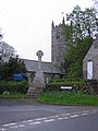 St Tudy Church and War Memorial - geograph.org.uk - 380729.jpg 480 × 640; 75 KB
%27_(11097443246).jpg)


