Category:St Stephens by Launceston Rural
Jump to navigation
Jump to search
civil parish in Cornwall, England, UK  | |||||
| Upload media | |||||
| Instance of | |||||
|---|---|---|---|---|---|
| Location | Cornwall, South West England, England | ||||
| Located in or next to body of water | |||||
 | |||||
English: St Stephen-by-Launceston is a civil parish in the east of Cornwall, United Kingdom. It is in the Registration district of Launceston. The population of the parish in the 2001 census was 312.
Subcategories
This category has the following 3 subcategories, out of 3 total.
Media in category "St Stephens by Launceston Rural"
The following 84 files are in this category, out of 84 total.
-
 A Christmas shop - geograph.org.uk - 1587072.jpg 640 × 480; 277 KB
-
 A388 north of Dutson - geograph.org.uk - 2834838.jpg 640 × 466; 74 KB
-

-
 Barn near Dutson - geograph.org.uk - 2834825.jpg 640 × 473; 80 KB
-
 Bridge that used to cross the railway - geograph.org.uk - 5512016.jpg 1,600 × 1,200; 355 KB
-
 By the road to Launceston - geograph.org.uk - 4393821.jpg 1,920 × 1,307; 566 KB
-
 Colhay - geograph.org.uk - 2834357.jpg 640 × 422; 75 KB
-
 Cottages at Dutson - geograph.org.uk - 611041.jpg 640 × 433; 70 KB
-
 Crossing the Ottery at Yeolmbridge - geograph.org.uk - 2020519.jpg 640 × 385; 61 KB
-
 Dutson - geograph.org.uk - 609202.jpg 640 × 462; 65 KB
-
 Dutson Tollhouse by the A338, Dutson (geograph 6095555).jpg 640 × 451; 84 KB
-
 Edge of field, Newmills - geograph.org.uk - 2836570.jpg 640 × 480; 103 KB
-
 Egloskerry this way - geograph.org.uk - 1882372.jpg 640 × 445; 77 KB
-
 Farmhouse at Lower Truscott - geograph.org.uk - 322918.jpg 640 × 426; 130 KB
-
 Farmland east of Egloskerry - geograph.org.uk - 4394079.jpg 1,920 × 1,196; 486 KB
-
 Field at Dutson - geograph.org.uk - 2834808.jpg 640 × 461; 62 KB
-
 Field by Hendragreen Wood - geograph.org.uk - 4389631.jpg 4,000 × 3,000; 1.86 MB
-
 Field by the Ottery - geograph.org.uk - 4395398.jpg 1,920 × 1,440; 686 KB
-
 Field near Cargentle - geograph.org.uk - 4389646.jpg 1,920 × 1,272; 730 KB
-
 Field near Higher Truscott - geograph.org.uk - 2836567.jpg 640 × 419; 58 KB
-
 Former toll house, Dutson - geograph.org.uk - 610985.jpg 640 × 456; 54 KB
-
 Four Winds - geograph.org.uk - 2836564.jpg 640 × 462; 62 KB
-
 Gunnera at Dutson - geograph.org.uk - 609183.jpg 640 × 480; 120 KB
-
 Ham Mill Bridge over the River Ottery.jpg 4,128 × 3,096; 7.47 MB
-
 Higher Dutson Farm - geograph.org.uk - 609148.jpg 640 × 509; 102 KB
-
 Homeleigh Garden Centre - geograph.org.uk - 1587056.jpg 640 × 480; 230 KB
-
 Junction near Langore - geograph.org.uk - 2836560.jpg 640 × 452; 48 KB
-
 Junction near Langore - geograph.org.uk - 2837580.jpg 640 × 480; 49 KB
-
 Kensey Valley - geograph.org.uk - 1902321.jpg 640 × 430; 57 KB
-
 Lane near Cargentle - geograph.org.uk - 4394334.jpg 1,920 × 1,320; 583 KB
-
 Lane to Newport - geograph.org.uk - 2834340.jpg 640 × 476; 62 KB
-
 Launceston Sewage Works - geograph.org.uk - 2834314.jpg 640 × 367; 41 KB
-

-

-

-

-

-
-

-

-

-
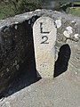
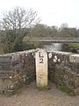
 Milestone - Launceston 2 - geograph.org.uk - 4450626.jpg 480 × 640; 117 KB
-
 Milestone - Launceston 2 - geograph.org.uk - 4450747.jpg 480 × 640; 101 KB
-
 Milestone - Launceston 3 - geograph.org.uk - 4450584.jpg 480 × 640; 129 KB
-
 Milestone on Higher New Bridge - geograph.org.uk - 3708614.jpg 480 × 640; 89 KB
-

-
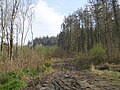 Muddy track in Castlehill Plantation - geograph.org.uk - 4922861.jpg 1,600 × 1,200; 483 KB
-
 Nether Bridge, River Tamar.jpg 3,868 × 2,753; 2.93 MB
-
 New Garden Centre at Dutson - geograph.org.uk - 327870.jpg 640 × 427; 100 KB
-

-

-

-

-
 Old Milestone east of Egloskerry - geograph.org.uk - 5623336.jpg 428 × 640; 97 KB
-

-
 Plant area at Homeleigh - geograph.org.uk - 1587067.jpg 640 × 480; 265 KB
-
 Railway bridge near Colhay - geograph.org.uk - 2834373.jpg 640 × 480; 87 KB
-
 River Ottery - geograph.org.uk - 4389639.jpg 1,920 × 1,391; 594 KB
-
 River Ottery at Yeolm Bridge - geograph.org.uk - 4922860.jpg 1,600 × 1,200; 566 KB
-
 River Tamar - geograph.org.uk - 2834877.jpg 480 × 640; 108 KB
-
 Road Junction at Trusscott - geograph.org.uk - 1882359.jpg 640 × 422; 70 KB
-
 Road to Egloskerry - geograph.org.uk - 4394064.jpg 1,920 × 1,359; 1,010 KB
-
 Rural view of sown fields nr Langore - geograph.org.uk - 1882346.jpg 640 × 414; 72 KB
-
 Scrub in Castlehill Plantation - geograph.org.uk - 4922863.jpg 1,200 × 1,600; 668 KB
-
 Sheep by the A388 - geograph.org.uk - 2834847.jpg 640 × 452; 65 KB
-
 Steam Engine at Newmills - geograph.org.uk - 1193294.jpg 640 × 427; 99 KB
-

-
 Tamar valley - geograph.org.uk - 609161.jpg 640 × 457; 46 KB
-
 Tamar valley - geograph.org.uk - 611027.jpg 640 × 480; 71 KB
-
 The edge of Castlehill Plantation - geograph.org.uk - 4923353.jpg 1,600 × 1,068; 323 KB
-

-
 Track to Hendragreen - geograph.org.uk - 4394016.jpg 1,920 × 2,415; 1.18 MB
-
 Trees above the Ottery valley - geograph.org.uk - 2836537.jpg 640 × 408; 57 KB
-
 View from the old reading room - geograph.org.uk - 4424396.jpg 1,024 × 768; 252 KB
-
 Woodland edges near Dutson - geograph.org.uk - 2834855.jpg 640 × 480; 85 KB
-
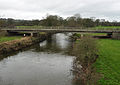
 Yeolm Bridge - geograph.org.uk - 4922859.jpg 1,600 × 1,200; 327 KB
-
 A Small Cemetery - geograph.org.uk - 322946.jpg 640 × 427; 107 KB
-
 Farmland west of Langore - geograph.org.uk - 322850.jpg 640 × 427; 97 KB
-
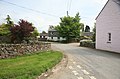
 Houses on the edge of Langore - geograph.org.uk - 323076.jpg 640 × 427; 93 KB
-
-
 St Stephens by Launceston, edge of wood - geograph.org.uk - 576082.jpg 640 × 427; 255 KB
-
 St Stephens by Launceston, Langore - geograph.org.uk - 576078.jpg 640 × 427; 184 KB
-
 Strip of Woodland by the Roadside - geograph.org.uk - 323099.jpg 427 × 640; 148 KB
-
 Woodpile and Sheep - geograph.org.uk - 322955.jpg 640 × 427; 110 KB


.jpg)


