Category:St Minver Highlands
Jump to navigation
Jump to search
civil parish in north Cornwall, England, UK | |||||
| Upload media | |||||
| Instance of | |||||
|---|---|---|---|---|---|
| Location | Cornwall, South West England, England | ||||
 | |||||
Subcategories
This category has the following 13 subcategories, out of 13 total.
C
D
- Doyden House (4 F)
E
- Epphaven Cove (4 F)
L
- Lundy Beach, St Minver Highlands (12 F)
N
P
- Plain Street, Cornwall (2 F)
R
- The Rumps (39 F)
S
T
- Tredrizzick (2 F)
- Trevelver (4 F)
Media in category "St Minver Highlands"
The following 200 files are in this category, out of 329 total.
(previous page) (next page)-
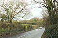
 A Hot Country Lane - geograph.org.uk - 205205.jpg 640 × 427; 100 KB
-
 A wide verge near Treglyn Farm - geograph.org.uk - 4185907.jpg 1,600 × 532; 565 KB
-
 Across the Camel estuary - geograph.org.uk - 5395658.jpg 2,951 × 1,428; 660 KB
-
 Amble valley from the B3314 - geograph.org.uk - 5699351.jpg 4,104 × 2,300; 1.61 MB
-
 Approaching The Rumps - geograph.org.uk - 2390326.jpg 640 × 480; 95 KB
-
 Arable farmland above the Camel estuary - geograph.org.uk - 5720066.jpg 4,288 × 2,848; 2.58 MB
-
 Arable farmland above the Camel estuary - geograph.org.uk - 5720147.jpg 3,069 × 2,529; 1.21 MB
-
 Arable field above the Camel estuary - geograph.org.uk - 5720078.jpg 4,288 × 2,848; 1.58 MB
-
 B3314 approaching Gutt Bridge - geograph.org.uk - 5710754.jpg 3,996 × 2,616; 1.8 MB
-
 B3314 near Treglyn Farm - geograph.org.uk - 5721062.jpg 2,936 × 1,354; 721 KB
-
 B3314 near Treglyn Farm - geograph.org.uk - 5721114.jpg 3,511 × 2,098; 1.16 MB
-
 Barn at Treglyn Farm - geograph.org.uk - 4185909.jpg 1,600 × 1,200; 1.35 MB
-
 Barns, Carlyon - geograph.org.uk - 5720198.jpg 3,944 × 1,891; 753 KB
-
 Barns, Pentireglaze - geograph.org.uk - 2388980.jpg 640 × 436; 70 KB
-
 Beach at Polzeath (5346).jpg 4,288 × 2,848; 5.68 MB
-
 Beach at Polzeath (5356).jpg 4,288 × 2,848; 6.75 MB
-
 Beach at Polzeath (5357).jpg 4,288 × 2,848; 6.08 MB
-
 Beach at Polzeath (5358).jpg 4,288 × 2,848; 6.83 MB
-
 Beach at Polzeath (5362).jpg 4,288 × 2,848; 6.28 MB
-
 Beach at Polzeath (5363).jpg 4,288 × 2,848; 5.82 MB
-
 Beach at Polzeath (5364).jpg 4,288 × 2,848; 5.46 MB
-
 Beach at Polzeath (5365).jpg 4,288 × 2,848; 6.23 MB
-
 Beach near Lundy Hole (5273).jpg 4,288 × 2,848; 6.38 MB
-
 Beach north of Pentireglaze Haven (5345).jpg 4,288 × 2,848; 6.37 MB
-
 Beach Polzeath - geograph.org.uk - 2403199.jpg 2,048 × 1,536; 739 KB
-
 Bluebells above Downhedge Cove - geograph.org.uk - 2389106.jpg 640 × 480; 80 KB
-
 Bluebells above Downhedge Cove - geograph.org.uk - 2389406.jpg 640 × 409; 112 KB
-
 Bluebells above Downhedge Cove - geograph.org.uk - 2389459.jpg 640 × 480; 113 KB
-
 Bluebells above Downhedge Cove - geograph.org.uk - 2389507.jpg 640 × 480; 151 KB
-
 Bluebells and gorse above Downhedge Cove - geograph.org.uk - 2389365.jpg 640 × 405; 107 KB
-
 Bluebells at Com Head - geograph.org.uk - 2389085.jpg 640 × 480; 111 KB
-
 Bluebells by the coast path - geograph.org.uk - 2389699.jpg 640 × 480; 122 KB
-
 Bluebells near Com Head - geograph.org.uk - 2389119.jpg 480 × 640; 106 KB
-
 Bluebells on the coast path - geograph.org.uk - 2389665.jpg 640 × 480; 103 KB
-
 Boat off the Rumps (5304).jpg 4,288 × 2,848; 6.38 MB
-
 Boats off Pentire Point (5342).jpg 4,288 × 2,848; 4.56 MB
-
 Broadagogue Cove from Pentire Point (5337).jpg 4,288 × 2,848; 6.31 MB
-
 Buildings at Port Quin - geograph.org.uk - 4177369.jpg 640 × 480; 175 KB
-
 Camel Estuary - geograph.org.uk - 5667006.jpg 3,237 × 1,634; 1.11 MB
-
 Camel Estuary - geograph.org.uk - 5710827.jpg 2,976 × 1,681; 757 KB
-
 Camel Estuary from Pentire Point (5336).jpg 4,288 × 2,848; 5.18 MB
-
 Camel Estuary from Pentire Point (5339).jpg 4,288 × 2,848; 3.84 MB
-
 Camel Fish - geograph.org.uk - 4177353.jpg 640 × 480; 117 KB
-
 Carnweather Point - geograph.org.uk - 4524213.jpg 2,098 × 3,147; 1.27 MB
-
 Carnweather Point and Kellan Head (5290).jpg 4,288 × 2,848; 6.25 MB
-
 Cattle in the River - geograph.org.uk - 202965.jpg 640 × 446; 130 KB
-
 Cliffs at Com Head (5305).jpg 4,288 × 2,848; 6.17 MB
-
 Cliffs at Com Head (5308).jpg 4,288 × 2,848; 6.32 MB
-
 Cliffs at Gilson's Cove (5266).jpg 4,288 × 2,848; 6.73 MB
-
 Cliffs between the Rumps and Pentire Point (5322).jpg 4,288 × 2,848; 5.96 MB
-
 Cliffs east of Pengirt Cove (5298).jpg 4,288 × 2,848; 6.29 MB
-
 Cliffs east of Pentire Point (5324).jpg 4,288 × 2,848; 6.38 MB
-
 Cliffs east of Pentire Point (5330).jpg 4,288 × 2,848; 6.37 MB
-
 Cliffs east of Pentire Point (5332).jpg 4,288 × 2,848; 6.28 MB
-
 Cliffs north of Pengirt Cove (5296).jpg 4,288 × 2,848; 6.37 MB
-
 Cliffs southeast of the Rumps (5314).jpg 4,288 × 2,848; 6.46 MB
-
 Cliffs southeast of the Rumps (5315).jpg 4,288 × 2,848; 6.34 MB
-
 Cliffs west of Carnweather Point (5287).jpg 4,288 × 2,848; 6.36 MB
-
 Cliffs west of Doyden Point (5260).jpg 4,288 × 2,848; 6.92 MB
-
 Cliffs west of Trevan Point (5268).jpg 4,288 × 2,848; 6.4 MB
-

-
 Coast around Lundy Hole - geograph.org.uk - 2437004.jpg 640 × 480; 105 KB
-
 Coast at Guglane - geograph.org.uk - 2390353.jpg 640 × 480; 88 KB
-
 Coast at Lundy Beach - geograph.org.uk - 2437036.jpg 640 × 480; 117 KB
-
 Coast at Pengirt Cove - geograph.org.uk - 2389806.jpg 529 × 640; 101 KB
-
 Coast at Pennywilgie Point - geograph.org.uk - 2436989.jpg 640 × 480; 117 KB
-
 Coast at Port Quin - geograph.org.uk - 2390556.jpg 640 × 480; 67 KB
-
 Coast northwest of Com Head - geograph.org.uk - 2390257.jpg 640 × 480; 102 KB
-
 Coast northwest of Com Head - geograph.org.uk - 2390294.jpg 480 × 640; 92 KB
-
 Coast Path above Carnweather Point - geograph.org.uk - 2436975.jpg 640 × 431; 95 KB
-
 Coast path above Pengirt Cove - geograph.org.uk - 2390099.jpg 640 × 480; 90 KB
-
 Coast path at Com Head - geograph.org.uk - 2390152.jpg 640 × 480; 93 KB
-
 Coast path to Pentire Point - geograph.org.uk - 2390499.jpg 640 × 480; 77 KB
-
 Coast path to Pentire Point - geograph.org.uk - 2390510.jpg 640 × 480; 92 KB
-
 Cold surfing at Polzeath - geograph.org.uk - 2257986.jpg 1,969 × 1,129; 2.03 MB
-
 Cormorants on The Mouls - geograph.org.uk - 4060305.jpg 1,600 × 1,200; 383 KB
-
 Cornish fields - geograph.org.uk - 4175788.jpg 640 × 480; 158 KB
-
 Cornish meadow at Pentire - geograph.org.uk - 2272002.jpg 3,247 × 2,083; 3.73 MB
-
 Cottages, Pentireglaze - geograph.org.uk - 2389158.jpg 640 × 411; 56 KB
-
 Cove north of Com Head5306).jpg 4,288 × 2,848; 6.51 MB
-
 Cove north of Pentireglaze Haven (5347).jpg 4,288 × 2,848; 6.32 MB
-
 Cove north of Pentireglaze Haven (5348).jpg 4,288 × 2,848; 6.51 MB
-
 Cowslips, Pentireglaze Haven - geograph.org.uk - 2392171.jpg 640 × 479; 87 KB
-
 Crossroads on the B3314 - geograph.org.uk - 5670739.jpg 4,281 × 2,129; 1.25 MB
-
 Descent to Lundy Bay - geograph.org.uk - 2911762.jpg 640 × 480; 100 KB
-
 Direction Sign - Signpost at St Minver - geograph.org.uk - 6102760.jpg 763 × 1,154; 86 KB
-
 Downhedge Cove (5289).jpg 2,848 × 4,288; 6.08 MB
-
 Downhedge Cove - geograph.org.uk - 4524198.jpg 427 × 640; 82 KB
-
 Doyden Castle (5258).jpg 4,288 × 2,848; 5.92 MB
-
 Doyden Point - geograph.org.uk - 5101876.jpg 640 × 480; 65 KB
-
 Doyden Point and Kellan Head (5267).jpg 4,288 × 2,848; 6.35 MB
-
 Droyden Point - geograph.org.uk - 5837716.jpg 1,024 × 768; 171 KB
-
 Dusty work on a clifftop field - geograph.org.uk - 2257957.jpg 2,625 × 1,969; 5.54 MB
-

-
 Entrance to Tregwarmond Mill - geograph.org.uk - 4134944.jpg 640 × 480; 149 KB
-
 Epphaven and Pennywilgie Point - geograph.org.uk - 2275511.jpg 1,969 × 1,312; 2.13 MB
-
 Epphaven Cove (5270).jpg 4,288 × 2,848; 6.7 MB
-
 Epphaven Cove - geograph.org.uk - 2437062.jpg 480 × 640; 96 KB
-
 Epphaven cove and caves by Pennywilgie Point - geograph.org.uk - 2270031.jpg 2,557 × 1,808; 2.92 MB
-
 Ewe and lambs, Pentireglaze - geograph.org.uk - 2392193.jpg 640 × 462; 95 KB
-
 Farm buildings and weeds - geograph.org.uk - 4134940.jpg 640 × 480; 150 KB
-
 Farm entrance, Lower Trevigo - geograph.org.uk - 2437981.jpg 640 × 375; 46 KB
-
 Farm gate near Pentire Farm - geograph.org.uk - 2267413.jpg 1,969 × 1,818; 3.07 MB
-
 Farmland by the Camel Estuary - geograph.org.uk - 5710815.jpg 4,266 × 1,754; 1.21 MB
-
 Farmland near Pityme - geograph.org.uk - 5667232.jpg 4,288 × 2,848; 2.58 MB
-
 Farmland Outside Polzeath - geograph.org.uk - 2281684.jpg 1,024 × 768; 230 KB
-
 Farmland, Carlyon - geograph.org.uk - 5667061.jpg 4,279 × 2,635; 1.5 MB
-
 Field by the B3314 - geograph.org.uk - 5710541.jpg 4,271 × 2,719; 2.09 MB
-
 Field by the B3314 - geograph.org.uk - 5710586.jpg 4,288 × 2,848; 2.26 MB
-
 Field by the B3314 - geograph.org.uk - 5710602.jpg 4,249 × 2,591; 2.16 MB
-
 Field by the B3314 - geograph.org.uk - 5710675.jpg 4,277 × 2,730; 1.94 MB
-
 Field near Dinham Farm Caravan Park - geograph.org.uk - 5710770.jpg 4,288 × 2,676; 2.16 MB
-
 Field near Quin Cross - geograph.org.uk - 2437973.jpg 640 × 350; 59 KB
-
 Field, Treglyn Farm - geograph.org.uk - 5670780.jpg 4,274 × 2,788; 1.96 MB
-
 Field, Treglyn Farm - geograph.org.uk - 5670788.jpg 4,288 × 2,848; 1.57 MB
-
 Fields at Pentire Farm - geograph.org.uk - 5093802.jpg 640 × 480; 67 KB
-
 Flowers near Polzeath (5359).jpg 4,288 × 2,848; 5.95 MB
-
 Flowers near Polzeath (5360).jpg 4,288 × 2,848; 6.53 MB
-
 Flowers near Polzeath (5361).jpg 4,288 × 2,848; 6.31 MB
-
 Footpath to Pentire Point - geograph.org.uk - 2281658.jpg 1,024 × 768; 232 KB
-
 For The Fallen - geograph.org.uk - 2136442.jpg 4,000 × 3,000; 3.69 MB
-
 Friends Burial Ground Sign.jpg 640 × 480; 154 KB
-
 Gorse at Com Head - geograph.org.uk - 2389095.jpg 640 × 480; 105 KB
-
 Great Lobb's Rock from the east (5269).jpg 4,288 × 2,848; 6.38 MB
-
 Harbour Cove from Pentire Point (5335).jpg 4,288 × 2,848; 4.7 MB
-
 Hayle Bay (5343).jpg 4,288 × 2,848; 6.61 MB
-
 Hayle Bay - geograph.org.uk - 1937695.jpg 2,288 × 1,712; 818 KB
-
 Hayle Bay - geograph.org.uk - 2391966.jpg 640 × 444; 69 KB
-
 Hayle Bay - geograph.org.uk - 2392000.jpg 480 × 640; 36 KB
-
 Hayle Bay - geograph.org.uk - 2823112.jpg 1,024 × 680; 127 KB
-
 Hayle Bay and Pentire Point - geograph.org.uk - 2823275.jpg 1,024 × 680; 129 KB
-
 Hayle Bay Beach - geograph.org.uk - 5101805.jpg 640 × 480; 59 KB
-
 Hayle Bay Cornwall - geograph.org.uk - 288998.jpg 640 × 480; 65 KB
-
 Hayle Bay, Polzeath - geograph.org.uk - 6278833.jpg 640 × 422; 62 KB
-
 House on the road to New Polzeath - geograph.org.uk - 4519382.jpg 2,765 × 1,843; 1.08 MB
-
 House overlooking Pentireglaze Haven (2) - geograph.org.uk - 1974793.jpg 2,134 × 2,848; 1,023 KB
-
 Houses overlooking Hayle Bay - geograph.org.uk - 2823103.jpg 1,024 × 680; 188 KB
-
 Insect on flowers near Lundy Hole (5278).jpg 4,288 × 2,848; 5.23 MB
-

-
 Jubilee Queen off Pentire Point (5331).jpg 4,288 × 2,848; 6.13 MB
-
 Keiro Lane - geograph.org.uk - 5667247.jpg 3,154 × 1,699; 780 KB
-
 Keiro Lane - geograph.org.uk - 5721038.jpg 3,382 × 2,345; 1.67 MB
-
 Keiro Lane - geograph.org.uk - 5721131.jpg 3,304 × 1,589; 642 KB
-
 Kellan Head and Doyden Point from Great Lobb's Rock (5283).jpg 4,288 × 2,848; 6.11 MB
-
 Kestrel over Gilson's Cove (5263).jpg 4,288 × 2,848; 3.54 MB
-
 Kestrel over Gilson's Cove (5264).jpg 4,288 × 2,848; 3.51 MB
-
 Lambs and ewes, Pentire Farm - geograph.org.uk - 2389053.jpg 640 × 360; 59 KB
-
 Lane at Pentireglaze - geograph.org.uk - 2388992.jpg 640 × 480; 94 KB
-
 Lane heading to Chapel Amble - geograph.org.uk - 4177253.jpg 640 × 480; 180 KB
-
 Lane to Pentireglaze - geograph.org.uk - 2389202.jpg 640 × 428; 78 KB
-
 Lane to Trevelver - geograph.org.uk - 5720151.jpg 2,751 × 1,292; 354 KB
-
 Looking across Hayle Bay in 1977 - geograph.org.uk - 3358069.jpg 640 × 421; 52 KB
-

-
 Looking Towards Pentireglaze - geograph.org.uk - 2281692.jpg 1,024 × 768; 223 KB
-
 Low tide in Port Quin - geograph.org.uk - 2031538.jpg 794 × 595; 186 KB
-
 Lundy Bay - geograph.org.uk - 2910835.jpg 640 × 480; 86 KB
-
 Lundy Beach - geograph.org.uk - 2437020.jpg 640 × 480; 95 KB
-
 Lundy from near Lundy Hole (5284).jpg 4,288 × 2,848; 4.73 MB
-
 Lundy Hole (5274).jpg 2,848 × 4,288; 6.4 MB
-
 Lundy Hole (5275).jpg 4,288 × 2,848; 6.33 MB
-
 Lundy Hole - geograph.org.uk - 4524219.jpg 2,163 × 3,245; 1.64 MB
-
 Lundy Hole from the West - geograph.org.uk - 2281585.jpg 1,024 × 673; 217 KB
-
 Markham's Quay (5279).jpg 4,288 × 2,848; 6.39 MB
-
 Markham's Quay (5280).jpg 4,288 × 2,848; 6.29 MB
-
 Markham's Quay (5281).jpg 4,288 × 2,848; 6.21 MB
-
 Medla, New Polzeath - geograph.org.uk - 2392147.jpg 640 × 463; 51 KB
-
 New Polzeath - geograph.org.uk - 2823245.jpg 1,024 × 680; 150 KB
-
 Newland ( Off Pentire Point) - geograph.org.uk - 2797564.jpg 800 × 600; 127 KB
-
 Newland - geograph.org.uk - 5101812.jpg 640 × 480; 42 KB
-
 Newlands Island - geograph.org.uk - 4420849.jpg 1,600 × 1,062; 465 KB
-

-
 Ordnance Survey Cut Mark - geograph.org.uk - 4450645.jpg 480 × 640; 144 KB
-
 Paths near Doyden House - geograph.org.uk - 2437184.jpg 640 × 452; 83 KB
-
 Pengirt Cove - geograph.org.uk - 4522185.jpg 2,038 × 3,057; 1.8 MB
-
 Pentire Farm (5302).jpg 4,288 × 2,848; 7.05 MB
-
 Pentire Farm - geograph.org.uk - 1974770.jpg 3,648 × 2,395; 2.24 MB
-
 Pentire Farm - geograph.org.uk - 2389068.jpg 640 × 441; 71 KB
-
 Pentire Farm - geograph.org.uk - 2390191.jpg 640 × 464; 79 KB
-
 Pentire Farm - geograph.org.uk - 5101819.jpg 640 × 480; 49 KB
-
 Pentire Point - geograph.org.uk - 2823237.jpg 1,024 × 680; 163 KB
-
 Pentire Point - geograph.org.uk - 4520142.jpg 2,147 × 3,221; 1.37 MB
-
 Pentire Point on the North Cornish Coast - geograph.org.uk - 2797574.jpg 800 × 600; 144 KB
-
 Pentireglaze - geograph.org.uk - 2389014.jpg 640 × 419; 60 KB
-
 Pentireglaze Haven (5349).jpg 4,288 × 2,848; 6.39 MB
-
 Pentireglaze Haven (5350).jpg 4,288 × 2,848; 6.97 MB
-
 Pentireglaze Haven (5351).jpg 4,288 × 2,848; 6.41 MB
-
 Pentireglaze Haven (5352).jpg 4,288 × 2,848; 6.26 MB
-
 Pentireglaze Haven - geograph.org.uk - 2281664.jpg 1,024 × 768; 283 KB
-
 Pentireglaze Haven - geograph.org.uk - 2390541.jpg 640 × 425; 65 KB
-
 Percival Institute - geograph.org.uk - 4450649.jpg 640 × 480; 59 KB
-
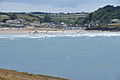
 Polzeath - geograph.org.uk - 2281678.jpg 1,024 × 768; 190 KB
-
 Polzeath and Hayle Bay - geograph.org.uk - 2111836.jpg 640 × 417; 62 KB
-
 Polzeath Beach - geograph.org.uk - 5093772.jpg 640 × 480; 40 KB
-
 Polzeath Ford - geograph.org.uk - 4684206.jpg 6,000 × 4,000; 6.33 MB
-
 Polzeath from Pentire Point (5338).jpg 4,288 × 2,848; 6.34 MB
-
 Polzeath in 1977 - geograph.org.uk - 2173563.jpg 872 × 575; 159 KB
-
 Polzeath in 1977 - geograph.org.uk - 2182302.jpg 1,037 × 668; 254 KB
-
 Port Quin (5255).jpg 4,288 × 2,848; 6.6 MB
-
 Port Quin (5256).jpg 4,288 × 2,848; 6.4 MB
-
 Port Quin - geograph.org.uk - 2390664.jpg 640 × 480; 100 KB


.jpg)
.jpg)
.jpg)
.jpg)
.jpg)
.jpg)
.jpg)
.jpg)
.jpg)
.jpg)


.jpg)
.jpg)
.jpg)


.jpg)
.jpg)


.jpg)

.jpg)
.jpg)
.jpg)
.jpg)
.jpg)
.jpg)
.jpg)
.jpg)
.jpg)
.jpg)
.jpg)
.jpg)
.jpg)
.jpg)


.jpg)
.jpg)
.jpg)


.jpg)

.jpg)

.jpg)


.jpg)


.jpg)
.jpg)
.jpg)


.jpg)
.jpg)
.jpg)


_-_geograph.org.uk_-_1974793.jpg)

.jpg)

.jpg)


.jpg)
.jpg)
.jpg)


.jpg)
.jpg)
.jpg)


.jpg)
.jpg)
.jpg)


_-_geograph.org.uk_-_2797564.jpg)


.jpg)


.jpg)
.jpg)
.jpg)
.jpg)


.jpg)


.jpg)
.jpg)
