Category:St Michael and All Angels Church, Muncaster
Jump to navigation
Jump to search
| Object location | | View all coordinates using: OpenStreetMap |
|---|
church in Muncaster, Cumbria, UK  | |||||
| Upload media | |||||
| Instance of | |||||
|---|---|---|---|---|---|
| Dedicated to | |||||
| Location | Muncaster, Copeland, Cumbria, North West England, England | ||||
| Architectural style | |||||
| Diocese | |||||
| Architect | |||||
| Heritage designation |
| ||||
| Inception |
| ||||
| Religion or worldview | |||||
| official website | |||||
 | |||||
Subcategories
This category has only the following subcategory.
Media in category "St Michael and All Angels Church, Muncaster"
The following 19 files are in this category, out of 19 total.
-

-

-
 Head & socket of ancient cross, Muncaster churchyard, Cumbria.jpg 1,284 × 2,200; 1.66 MB
-
 Inner inscription (left) of E gateway to Muncaster churchyard, Cumbria.jpg 2,200 × 1,240; 1.07 MB
-
 Inner inscription (right) of E gateway to Muncaster churchyard, Cumbria.jpg 2,200 × 1,240; 739 KB
-
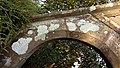
 Inner side of E gateway to Muncaster churchyard, Cumbria.jpg 1,484 × 2,200; 1.49 MB
-

-
 Outer inscription (left) of E gateway to Muncaster churchyard, Cumbria.jpg 2,200 × 1,240; 754 KB
-
 Outer inscription (right) of E gateway to Muncaster churchyard, Cumbria.jpg 2,200 × 1,119; 614 KB
-
 Outer side of E gateway to Muncaster churchyard, Cumbria.jpg 1,349 × 2,200; 1.19 MB
-

-
 Remains of ancient cross, Muncaster churchyard, Cumbria, from N.jpg 1,493 × 2,200; 1,002 KB
-
 Remains of ancient cross, Muncaster churchyard, Cumbria, from W.jpg 1,220 × 2,200; 1.12 MB
-

-

-
 St.Michael and All Angels Church, Muncaster - geograph.org.uk - 4355316.jpg 4,240 × 2,832; 6.38 MB
-
 St.Michael and All Angels Church, Muncaster - geograph.org.uk - 4355320.jpg 2,671 × 4,000; 6.26 MB
-
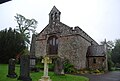 The Church, Muncaster Castle - geograph.org.uk - 1335680.jpg 640 × 430; 67 KB
-
 Top of inner side of E gateway to Muncaster churchyard, Cumbria.jpg 2,200 × 1,364; 1.29 MB


_of_E_gateway_to_Muncaster_churchyard,_Cumbria.jpg)
_of_E_gateway_to_Muncaster_churchyard,_Cumbria.jpg)


_of_E_gateway_to_Muncaster_churchyard,_Cumbria.jpg)
_of_E_gateway_to_Muncaster_churchyard,_Cumbria.jpg)


