Category:St Mary's Catholic Cemetery, Kensal Green
Jump to navigation
Jump to search
| Object location | | View all coordinates using: OpenStreetMap |
|---|
cemetery in Kensal Green, London, England  | |||||
| Upload media | |||||
| Instance of | |||||
|---|---|---|---|---|---|
| Location | Kensal Green, London Borough of Brent, Greater London, London, England | ||||
| Inception |
| ||||
| Number of graves |
| ||||
| official website | |||||
 | |||||
Subcategories
This category has only the following subcategory.
Media in category "St Mary's Catholic Cemetery, Kensal Green"
The following 12 files are in this category, out of 12 total.
-
 Grób Krystyny Skarbek na cmentarzu Kensal Green St. Mary w północnym Londynie.JPG 2,000 × 3,008; 2.44 MB
-
 Grób Rodziny Strońskich.jpg 2,955 × 4,015; 6.64 MB
-

-

-

-
 Lodge of Saint Mary's Catholic Cemetery (South Face - 01).jpg 4,592 × 3,448; 12.16 MB
-
 Lodge of Saint Mary's Catholic Cemetery (Southeast View - 01).jpg 4,592 × 3,448; 7.77 MB
-
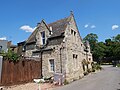 Lodge of Saint Mary's Catholic Cemetery (Southwest View - 01).jpg 4,269 × 3,192; 9.99 MB
-
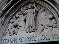 Mausoleum in St Mary's Catholic Cemetery.JPG 800 × 600; 128 KB
-
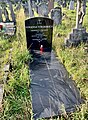
 Grób Jerzego Paciorkowskiego.jpg 1,500 × 2,000; 949 KB
-
 St Marys RC Cem London.jpg 2,304 × 3,072; 4.02 MB
-
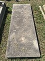
 Grób Henryka Strasburgera.jpg 1,333 × 2,000; 13.22 MB


.jpg)
.jpg)
.jpg)


