Category:St Dominick, Cornwall
Jump to navigation
Jump to search
civil parish in Cornwall, England  | |||||
| Upload media | |||||
| Instance of | |||||
|---|---|---|---|---|---|
| Named after |
| ||||
| Location | Cornwall, South West England, England | ||||
 | |||||
English: St Dominick is a village and civil parish in east Cornwall, United Kingdom. It is located between St Mellion and the River Tamar, with the National Trust house Cotehele to the north and the privately-owned Pentillie Estate to the south. It is partly rural and partly a commuter dormitory for Plymouth.
Subcategories
This category has the following 4 subcategories, out of 4 total.
Media in category "St Dominick, Cornwall"
The following 200 files are in this category, out of 282 total.
(previous page) (next page)-
 A Country Road - geograph.org.uk - 1220050.jpg 640 × 427; 121 KB
-
 Across the Tamar - geograph.org.uk - 4093737.jpg 1,920 × 1,122; 566 KB
-
 Across the Tamar Valley - geograph.org.uk - 1218227.jpg 640 × 427; 119 KB
-
 Across the Tamar Valley - geograph.org.uk - 39034.jpg 640 × 480; 86 KB
-
 Anglers at Halton Quay - geograph.org.uk - 1220041.jpg 640 × 427; 79 KB
-
 Animal feeder by the lane - geograph.org.uk - 4235873.jpg 1,920 × 1,440; 734 KB
-
 Animal feeders, Lower Baber Farm - geograph.org.uk - 3578958.jpg 640 × 375; 39 KB
-
 Approach to Cotehele Bridge - geograph.org.uk - 2897922.jpg 640 × 480; 127 KB
-
 Approaching Gooseford - geograph.org.uk - 4235894.jpg 1,795 × 1,603; 815 KB
-
 Approaching St Dominick - geograph.org.uk - 292208.jpg 640 × 427; 90 KB
-
 Ashton - geograph.org.uk - 4235976.jpg 1,920 × 1,312; 592 KB
-
 Assorted Farm Equipment - geograph.org.uk - 291870.jpg 640 × 428; 99 KB
-
 Back road at Cross - geograph.org.uk - 2316353.jpg 427 × 640; 183 KB
-
 Back road near Cross - geograph.org.uk - 2316396.jpg 640 × 427; 178 KB
-
 Beware of bull, Lower Baber Farm - geograph.org.uk - 3578955.jpg 480 × 640; 81 KB
-
 Bohetherick Green - geograph.org.uk - 2318108.jpg 427 × 640; 184 KB
-
 Bohetherick Wood and River Tamar, on a grey day - geograph.org.uk - 5988445.jpg 1,600 × 1,200; 752 KB
-
 Burraton from the south - geograph.org.uk - 2317066.jpg 640 × 427; 157 KB
-
 Burraton to St Dominick Road - geograph.org.uk - 2316483.jpg 640 × 427; 181 KB
-
 Calstock, by Cothele Bridge - geograph.org.uk - 1871721.jpg 640 × 427; 391 KB
-
 Cattle above the Mill Leat - geograph.org.uk - 4237377.jpg 3,995 × 2,775; 2.69 MB
-
 Cattle near Dupath - geograph.org.uk - 4237971.jpg 1,920 × 1,225; 568 KB
-
 Cattle pasture, Dupath Farm - geograph.org.uk - 4234374.jpg 1,920 × 1,347; 732 KB
-
 Cattle, Lower Baber Farm - geograph.org.uk - 3578940.jpg 640 × 419; 81 KB
-
 Chapel Farm overlooking River Tamar - geograph.org.uk - 3542210.jpg 1,024 × 768; 129 KB
-
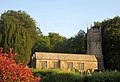 Church of St Dominica, St Dominick - geograph.org.uk - 3578998.jpg 640 × 440; 80 KB
-
 Churchyard, St Dominick - geograph.org.uk - 3578681.jpg 640 × 390; 61 KB
-
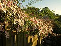 Clematis, St Dominick - geograph.org.uk - 3578901.jpg 640 × 480; 110 KB
-
 Climbing Vogus Lane - geograph.org.uk - 2313847.jpg 427 × 640; 183 KB
-
 Corneal Farm - geograph.org.uk - 4236230.jpg 1,918 × 1,110; 369 KB
-
 Cornwall , Cotehele Bridge - geograph.org.uk - 5755586.jpg 6,000 × 4,000; 6.89 MB
-
 Cornwall , Cotehele Mill - geograph.org.uk - 5753216.jpg 6,000 × 4,000; 6.71 MB
-
 Cornwall , Cotehele Mill - geograph.org.uk - 5753221.jpg 4,000 × 6,000; 7.61 MB
-
 Cornwall , Cotehele Mill - geograph.org.uk - 5753222.jpg 6,000 × 4,000; 6.88 MB
-
 Cornwall , Cotehele Mill - geograph.org.uk - 5755578.jpg 4,000 × 6,000; 5.94 MB
-
 Cornwall , Cotehele Mill Waterwheel - geograph.org.uk - 5753218.jpg 6,000 × 4,000; 7 MB
-
 Cornwall , Cotehele Mill Waterwheel - geograph.org.uk - 5753219.jpg 6,000 × 4,000; 6.35 MB
-
 Cornwall , Countryside Scenery - geograph.org.uk - 5759122.jpg 6,000 × 4,000; 5.71 MB
-
 Cornwall , Flowing Water - geograph.org.uk - 5755582.jpg 4,000 × 6,000; 6.84 MB
-
 Cornwall , Forge - geograph.org.uk - 5753217.jpg 6,000 × 4,000; 7.58 MB
-
 Cornwall , Grassy Field - geograph.org.uk - 5753220.jpg 6,000 × 4,000; 6.54 MB
-
 Cornwall , Halton Quay - geograph.org.uk - 5759077.jpg 6,000 × 4,000; 5.59 MB
-
 Cornwall , Halton Quay - geograph.org.uk - 5759080.jpg 6,000 × 4,000; 7.54 MB
-
 Cornwall , Millers House - geograph.org.uk - 5755572.jpg 6,000 × 4,000; 5.93 MB
-
 Cornwall , Saddlers Shop - geograph.org.uk - 5753214.jpg 6,000 × 4,000; 7.05 MB
-
 Cornwall , The Morden Stream - geograph.org.uk - 5753211.jpg 6,000 × 4,000; 7.24 MB
-
 Cornwall , The Morden Stream - geograph.org.uk - 5753212.jpg 4,000 × 6,000; 5.96 MB
-
 Cornwall , The Morden Stream - geograph.org.uk - 5755584.jpg 6,000 × 4,000; 6.29 MB
-
 Cornwall , The Morden Stream - geograph.org.uk - 5755585.jpg 6,000 × 4,000; 7.55 MB
-
 Cornwall , The River Tamar - geograph.org.uk - 5755587.jpg 6,000 × 4,000; 6.07 MB
-
 Cornwall , The River Tamar - geograph.org.uk - 5759081.jpg 6,000 × 4,000; 5.36 MB
-
 Cornwall , The River Tamar - geograph.org.uk - 5759097.jpg 6,000 × 4,000; 5.43 MB
-
 Cornwall , The River Tamar - geograph.org.uk - 5759128.jpg 6,000 × 4,000; 5.17 MB
-
 Cornwall , The River Tamar - geograph.org.uk - 5759130.jpg 6,000 × 4,000; 7.09 MB
-
 Cornwall , The River Tamar - geograph.org.uk - 5759135.jpg 6,000 × 4,000; 6.52 MB
-
 Cornwall , The River Tamar - geograph.org.uk - 5759137.jpg 6,000 × 4,000; 6.26 MB
-
 Cornwall , The River Tamar - geograph.org.uk - 5759221.jpg 6,000 × 4,000; 5.7 MB
-
 Cornwall , The River Tamar - geograph.org.uk - 5759222.jpg 6,000 × 4,000; 5.85 MB
-
 Cornwall , The River Tamar - geograph.org.uk - 5759223.jpg 6,000 × 4,000; 6.77 MB
-
 Cornwall , Water Pipe - geograph.org.uk - 5753210.jpg 4,000 × 6,000; 7.55 MB
-
 Cornwall , Wheelwrights - geograph.org.uk - 5753215.jpg 6,000 × 4,000; 7.66 MB
-
 Cotehele Bridge - geograph.org.uk - 1899597.jpg 640 × 480; 114 KB
-
 Cotehele Bridge - geograph.org.uk - 2897927.jpg 600 × 800; 452 KB
-
 Cotehele Bridge - geograph.org.uk - 5346758.jpg 1,600 × 1,067; 724 KB
-
 Cotehele Bridge - geograph.org.uk - 5671705.jpg 640 × 480; 161 KB
-
 Cotehele Hydroturbine - geograph.org.uk - 3127166.jpg 640 × 424; 275 KB
-
 Cotehele Mill - ancillary buildings - geograph.org.uk - 5671662.jpg 640 × 427; 138 KB
-
 Cotehele Mill - generator - geograph.org.uk - 5671684.jpg 427 × 640; 75 KB
-
 Cotehele Mill - geograph.org.uk - 3127162.jpg 640 × 424; 300 KB
-
 Cotehele Mill - geograph.org.uk - 3127163.jpg 424 × 640; 284 KB
-
 Cotehele Mill - geograph.org.uk - 3127164.jpg 640 × 424; 304 KB
-
 Cotehele Mill - geograph.org.uk - 3127174.jpg 424 × 640; 266 KB
-
 Cotehele Mill - geograph.org.uk - 3128585.jpg 640 × 424; 244 KB
-
 Cotehele Mill - geograph.org.uk - 3128587.jpg 424 × 640; 262 KB
-
 Cotehele Mill - geograph.org.uk - 3128588.jpg 424 × 640; 209 KB
-
 Cotehele Mill - geograph.org.uk - 3128589.jpg 640 × 424; 324 KB
-
 Cotehele Mill - geograph.org.uk - 3128590.jpg 424 × 640; 352 KB
-
 Cotehele Mill - geograph.org.uk - 5346764.jpg 1,067 × 1,600; 583 KB
-
 Cotehele Mill - geograph.org.uk - 5433999.jpg 640 × 427; 111 KB
-
 Cotehele Mill - geograph.org.uk - 5436220.jpg 640 × 427; 129 KB
-
 Cotehele Mill - geograph.org.uk - 5664826.jpg 662 × 1,000; 990 KB
-
 Cotehele Mill - ground floor - geograph.org.uk - 5671586.jpg 427 × 640; 99 KB
-
 Cotehele Mill - Hydroelectric Equipment - geograph.org.uk - 3127173.jpg 424 × 640; 245 KB
-
 Cotehele Mill - Hydroelectric Equipment - geograph.org.uk - 3127176.jpg 640 × 424; 291 KB
-
 Cotehele Mill - Meal Floor - geograph.org.uk - 3127169.jpg 640 × 424; 265 KB
-
 Cotehele Mill - overshot waterwheel - geograph.org.uk - 5436224.jpg 640 × 427; 131 KB
-
 Cotehele Mill - wagon shed - geograph.org.uk - 5671675.jpg 640 × 427; 77 KB
-
 Cotehele Mill - Waterwheel - geograph.org.uk - 3127159.jpg 640 × 424; 336 KB
-
 Cotehele Mill buildings - geograph.org.uk - 2897967.jpg 800 × 600; 520 KB
-
 Cotehele Mill, Bohetherick - geograph.org.uk - 6210397.jpg 7,788 × 3,846; 6.67 MB
-
 Cotehele Mill, Bohetherick - geograph.org.uk - 6210400.jpg 7,697 × 3,723; 6.84 MB
-
 Cotehele Mill, nr. Saltash, Cornwall - geograph.org.uk - 1912825.jpg 800 × 600; 212 KB
-
 Cotehele Mill, stone floor - geograph.org.uk - 5671644.jpg 640 × 427; 72 KB
-
 Cothele Bridge - geograph.org.uk - 2000139.jpg 640 × 480; 135 KB
-
 Cothele Mill - geograph.org.uk - 5604715.jpg 640 × 427; 304 KB
-
 Cothele Mill - geograph.org.uk - 5607858.jpg 640 × 427; 268 KB
-
 Cothele Millhouse - geograph.org.uk - 5604852.jpg 640 × 427; 260 KB
-
 Cottage, Ashton - geograph.org.uk - 4234254.jpg 1,920 × 1,692; 758 KB
-
 Cottages at Halton Quay - geograph.org.uk - 2000106.jpg 640 × 480; 75 KB
-
 Crossing the Mill Leat - geograph.org.uk - 4236574.jpg 1,920 × 1,440; 1.12 MB
-
 Crossing the Mill Leat - geograph.org.uk - 4236613.jpg 1,920 × 2,560; 1.94 MB
-
 Crossroads, Burraton - geograph.org.uk - 2316977.jpg 640 × 427; 191 KB
-
 Daffodils and Polytunnels - geograph.org.uk - 1218239.jpg 640 × 427; 106 KB
-
 Daffodils below Burraton - geograph.org.uk - 2324401.jpg 427 × 640; 175 KB
-
 Daffodils Everywhere - geograph.org.uk - 1218216.jpg 640 × 427; 119 KB
-
 Disused quarry in Cotehele Wood - geograph.org.uk - 2897943.jpg 600 × 800; 477 KB
-
 Down to the Valley Below - geograph.org.uk - 292281.jpg 640 × 427; 103 KB
-
 Downstream of Cotehele Mill - geograph.org.uk - 4570604.jpg 1,600 × 1,355; 1,005 KB
-
 Dymas Town Lane (1) - geograph.org.uk - 2324457.jpg 427 × 640; 189 KB
-
 Dymas Town Lane (2) - geograph.org.uk - 2324490.jpg 427 × 640; 184 KB
-
 Dymas Town Lane (3) - geograph.org.uk - 2324512.jpg 427 × 640; 189 KB
-
 Enjoying the view from Mount Ararat - geograph.org.uk - 1205431.jpg 640 × 480; 102 KB
-
 Farm building in a field near Haye - geograph.org.uk - 3542215.jpg 1,024 × 768; 109 KB
-
 Farmland by the A388 - geograph.org.uk - 4235654.jpg 1,920 × 1,440; 852 KB
-
 Farmland by the Tamar - geograph.org.uk - 326350.jpg 640 × 480; 103 KB
-
 Farmland near Welltown - geograph.org.uk - 4237555.jpg 1,911 × 1,347; 747 KB
-
 Field above Mill Leat valley - geograph.org.uk - 4236307.jpg 4,000 × 3,000; 1.92 MB
-
-
 Field at Lower Baber Farm - geograph.org.uk - 3578950.jpg 640 × 462; 104 KB
-
 Field entrance off Vogus Lane - geograph.org.uk - 2313904.jpg 640 × 427; 192 KB
-
 Field entrance off Vogus Lane - geograph.org.uk - 2314336.jpg 427 × 640; 193 KB
-
 Field near Gooseford - geograph.org.uk - 4235909.jpg 1,920 × 1,328; 600 KB
-
 Field, Ashton - geograph.org.uk - 4236036.jpg 1,920 × 1,440; 959 KB
-
 Field, Homefield - geograph.org.uk - 4237642.jpg 1,920 × 1,440; 933 KB
-
 Field, Mill Leat valley - geograph.org.uk - 4236589.jpg 1,920 × 1,103; 350 KB
-
 Footpath off Vogus Lane - geograph.org.uk - 2313865.jpg 640 × 427; 189 KB
-
 Former quarry in Cotehele Wood - geograph.org.uk - 2897952.jpg 600 × 800; 479 KB
-
 Gateway above Mill Leat valley - geograph.org.uk - 4237538.jpg 1,900 × 1,284; 678 KB
-
 Halton Quay - geograph.org.uk - 3542207.jpg 1,024 × 768; 131 KB
-
 Halton Quay - geograph.org.uk - 61638.jpg 640 × 421; 130 KB
-
-
 Halton Quay from South Hooe Farm - geograph.org.uk - 541324.jpg 640 × 480; 59 KB
-
 Halton Quay Limekilns - geograph.org.uk - 337350.jpg 640 × 480; 86 KB
-
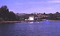
 Halton Quay on the River Tamar - geograph.org.uk - 469899.jpg 640 × 427; 78 KB
-
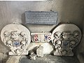 Headstone of Anthony Rous.jpg 4,032 × 3,024; 2.27 MB
-
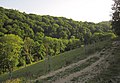
 Hillside and Wheal Langford - geograph.org.uk - 4237353.jpg 1,920 × 2,485; 1.21 MB
-
 Hornifast valley - geograph.org.uk - 3578082.jpg 640 × 445; 79 KB
-
 Hornifast valley - geograph.org.uk - 3578215.jpg 552 × 640; 94 KB
-
 Hornifast Wood - geograph.org.uk - 3578168.jpg 640 × 432; 100 KB
-
 Houses at Cross - geograph.org.uk - 3578660.jpg 640 × 330; 32 KB
-
 Houses, Ashton - geograph.org.uk - 4236041.jpg 1,920 × 1,313; 603 KB
-
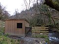 Hut for hydroelectric generator - geograph.org.uk - 3395633.jpg 1,024 × 768; 231 KB
-
 Junction near Berry Farm - geograph.org.uk - 3579020.jpg 640 × 480; 97 KB
-
 Junction on A388 - geograph.org.uk - 4235674.jpg 1,920 × 1,382; 722 KB
-
 Junction with Vogus Lane - geograph.org.uk - 2313830.jpg 427 × 640; 191 KB
-
 Lane at Ashton - geograph.org.uk - 4235986.jpg 1,920 × 1,399; 699 KB
-
 Lane junction at Gooseford - geograph.org.uk - 4234198.jpg 1,920 × 1,310; 757 KB
-
 Lane junction near Berry Farm - geograph.org.uk - 3579601.jpg 480 × 640; 117 KB
-
 Lane near Berry Farm - geograph.org.uk - 3579004.jpg 480 × 640; 97 KB
-
 Lane to Ashton - geograph.org.uk - 4235916.jpg 1,920 × 1,377; 586 KB
-
 Lane to Ashton - geograph.org.uk - 4235958.jpg 1,920 × 1,367; 599 KB
-
 Lane to Brendon - geograph.org.uk - 3579027.jpg 489 × 640; 131 KB
-
 Lane to Corneal - geograph.org.uk - 4237346.jpg 1,920 × 1,440; 1.05 MB
-
 Lane to Dupath - geograph.org.uk - 4237676.jpg 1,920 × 1,440; 1.18 MB
-
 Lane to Dupath - geograph.org.uk - 4237759.jpg 1,920 × 2,560; 2.1 MB
-
 Lane to Dupath - geograph.org.uk - 4237954.jpg 1,920 × 2,560; 1.89 MB
-
 Lane to Dupath - geograph.org.uk - 4237983.jpg 1,871 × 1,332; 947 KB
-
 Lane to Dupath - geograph.org.uk - 4238040.jpg 1,640 × 1,359; 733 KB
-
 Lane to Gooseford - geograph.org.uk - 4235682.jpg 1,920 × 1,440; 765 KB
-
 Lane to Gooseford - geograph.org.uk - 4235700.jpg 1,920 × 1,440; 868 KB
-
 Lane to Halton Quay - geograph.org.uk - 3578272.jpg 640 × 480; 102 KB
-
 Lane to Tremoan - geograph.org.uk - 3506101.jpg 506 × 640; 118 KB
-
 Lane, Ashton - geograph.org.uk - 4235998.jpg 1,920 × 2,335; 1.56 MB
-
 Lane, Ashton - geograph.org.uk - 4236025.jpg 1,801 × 1,481; 1.01 MB
-
 Lane, Ashton - geograph.org.uk - 4236031.jpg 1,920 × 2,612; 1.58 MB
-
 Lime kilns at Halton Quay - geograph.org.uk - 2000094.jpg 640 × 480; 82 KB
-
 Limekilns south of Cotehele Quay - geograph.org.uk - 2897915.jpg 800 × 600; 493 KB
-

-
 Looking east from Cotehele Bridge - geograph.org.uk - 3784154.jpg 1,536 × 1,152; 1.08 MB
-
 Looking up through Cotehele Wood - geograph.org.uk - 2897948.jpg 600 × 800; 528 KB
-
 Looking Upriver from Halton Quay - geograph.org.uk - 1220046.jpg 640 × 427; 57 KB
-
 Meadow, St Dominick - geograph.org.uk - 3578883.jpg 640 × 453; 90 KB
-
 Mill Leat - geograph.org.uk - 4236584.jpg 1,920 × 1,440; 822 KB
-
 Mill leat at Morden Mill - geograph.org.uk - 1899552.jpg 640 × 479; 132 KB
-
 Mill Leat Valley - geograph.org.uk - 4234280.jpg 1,854 × 1,253; 559 KB
-
 Mill Leat valley - geograph.org.uk - 4236436.jpg 1,920 × 1,203; 633 KB
-
 Mill Leat Valley - geograph.org.uk - 4236486.jpg 1,920 × 1,230; 787 KB
-
 Mill Leat Valley - geograph.org.uk - 4237834.jpg 1,920 × 1,238; 453 KB
-
 Mill Leat Valley - geograph.org.uk - 4237942.jpg 1,909 × 1,143; 677 KB
-
 Minor road to Stockwell - geograph.org.uk - 2316434.jpg 640 × 427; 184 KB
-

-
 Morden Mill - geograph.org.uk - 1899525.jpg 640 × 480; 133 KB
-
 Morden Mill - geograph.org.uk - 2002979.jpg 480 × 640; 132 KB
-
 Morden Stream - geograph.org.uk - 5664929.jpg 662 × 1,000; 1,008 KB
-
-
 No 4 West Burraton - geograph.org.uk - 2316990.jpg 427 × 640; 184 KB
-
 No.3 Broad View - geograph.org.uk - 2318056.jpg 640 × 428; 183 KB
-
 Over the Valley to Burcombe Farm - geograph.org.uk - 1220016.jpg 640 × 427; 82 KB
-
 Pasture near Halton Barton - geograph.org.uk - 3578284.jpg 640 × 464; 83 KB
-
 Pasture near St Dominick - geograph.org.uk - 3578630.jpg 640 × 426; 73 KB
-
 Path through churchyard, St Dominick - geograph.org.uk - 3578859.jpg 640 × 448; 85 KB
-
 Path to Cotehele mill - geograph.org.uk - 3150106.jpg 640 × 424; 302 KB
-

-
 Postbox, Ashton - geograph.org.uk - 4235988.jpg 1,920 × 3,011; 1.26 MB
-
 Quarry Farm - geograph.org.uk - 2317027.jpg 640 × 427; 181 KB
-

-
 Reduce speed now - geograph.org.uk - 2318012.jpg 424 × 640; 185 KB
-

-
-
 River Tamar - geograph.org.uk - 5108916.jpg 640 × 426; 67 KB


_-_geograph.org.uk_-_2324457.jpg)
_-_geograph.org.uk_-_2324490.jpg)
_-_geograph.org.uk_-_2324512.jpg)


