Category:St Buryan's Church, St Buryan
Jump to navigation
Jump to search
| Object location | | View all coordinates using: OpenStreetMap |
|---|
church in Cornwall, UK  | |||||
| Upload media | |||||
| Instance of | |||||
|---|---|---|---|---|---|
| Dedicated to | |||||
| Location | St Buryan, St Buryan, Lamorna and Paul, Cornwall, South West England, England | ||||
| Diocese | |||||
| Heritage designation |
| ||||
| Inception |
| ||||
| Religion or worldview | |||||
| official website | |||||
 | |||||
Subcategories
This category has the following 2 subcategories, out of 2 total.
S
- St Buryan Cross (6 F)
- St Buryan War Memorial (1 F)
Media in category "St Buryan's Church, St Buryan"
The following 24 files are in this category, out of 24 total.
-
 Cornwal - By H. Moll Geographer - btv1b53056815h.jpg 4,080 × 2,936; 1.96 MB
-
 Tomb at St Buriens.jpg 339 × 759; 54 KB
-
 Tomb of Clarice de Bolleit, St. Burian.jpg 957 × 2,431; 348 KB
-
 Buriana in stained glass (2).jpg 243 × 350; 32 KB
-
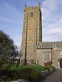
 BURYAN, St Buryan Exterior (42011728410).jpg 2,048 × 1,365; 364 KB
-
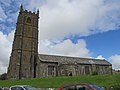
 Church of St Buryan - geograph.org.uk - 1402865.jpg 491 × 640; 85 KB
-
 Doorway of St Buryan Church - geograph.org.uk - 1389034.jpg 480 × 640; 106 KB
-
 Entering St Buryan - geograph.org.uk - 912368.jpg 640 × 480; 246 KB
-

-

-
 St Buryan Church - geograph.org.uk - 90713.jpg 480 × 640; 102 KB
-
 St Buryan church gable end.JPG 2,560 × 1,920; 1.13 MB
-
 St buryan church penwith cornwall.jpg 640 × 425; 103 KB
-
 St Buryan Church tower - geograph.org.uk - 1389023.jpg 477 × 640; 51 KB
-
 St Buryan churchyard - geograph.org.uk - 1389031.jpg 640 × 480; 93 KB
-
 St Buryan Cornwall.jpg 6,000 × 4,000; 6.27 MB
-

-
 St Buryan.jpg 1,048 × 770; 189 KB
-
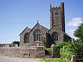
 St Buryan’s Church, St Buryan, Cornwall - geograph.org.uk - 3054451.jpg 2,816 × 2,112; 1.33 MB
-

-
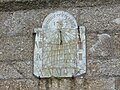 StBuryan Sundial.jpg 2,816 × 2,112; 2.64 MB
-
 StBuryanChurchBehind.jpg 2,560 × 1,920; 1.09 MB
-
 StBuryanChurchFront.jpg 2,560 × 1,920; 328 KB
-
 StBuryanChurchTurret.jpg 1,920 × 2,560; 302 KB


.jpg)
.jpg)


