Category:St. Petri (Woldegk)
Jump to navigation
Jump to search
| Object location | | View all coordinates using: OpenStreetMap |
|---|
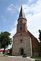
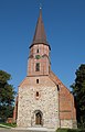
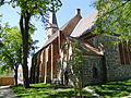
church building in Woldegk, Germany  | |||||
| Upload media | |||||
| Instance of | |||||
|---|---|---|---|---|---|
| Named after | |||||
| Location | Woldegk, Mecklenburgische Seenplatte District, Mecklenburg-Western Pomerania, Germany | ||||
| Heritage designation | |||||
 | |||||
Subcategories
This category has only the following subcategory.
I
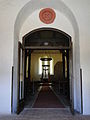
- Interior of St. Petri (Woldegk) (18 F)
Media in category "St. Petri (Woldegk)"
The following 15 files are in this category, out of 15 total.
-
 Woldegk Kirche IMG 3034.JPG 1,708 × 2,560; 2.06 MB
-
 Woldegk Kirche IMG 3042.JPG 2,560 × 1,707; 2.54 MB
-
 Woldegk Kirche IMG 3046.JPG 2,560 × 1,707; 2.06 MB
-
 Woldegk St Petri.jpg 1,850 × 2,880; 834 KB
-
 Woldegk St.-Petri-Kirche 2011-05-06 120.JPG 1,944 × 2,592; 2.23 MB
-
 Woldegk St.-Petri-Kirche 2011-05-06 123.JPG 1,944 × 2,592; 1.9 MB
-
 Woldegk St.-Petri-Kirche 2011-05-06 124.JPG 1,944 × 2,592; 2.17 MB
-
 Woldegk St.-Petri-Kirche 2011-05-06 126.JPG 1,944 × 2,592; 2.02 MB
-
 Woldegk St.-Petri-Kirche 2011-05-06 127.JPG 2,592 × 1,944; 2.29 MB
-
 Woldegk St.-Petri-Kirche 2011-05-06 129.JPG 1,944 × 2,592; 2.27 MB
-
 Woldegk St.-Petri-Kirche 2011-05-06 130.JPG 2,592 × 1,944; 2.22 MB
-
 Woldegk St.-Petri-Kirche 2011-05-06 134.JPG 1,944 × 2,592; 2.26 MB
-
 Woldegk St.-Petri-Kirche 2011-05-06 138.JPG 1,944 × 2,592; 2.26 MB
-
 Woldegk St.-Petri-Kirche Stein 2011-05-06 121.JPG 2,592 × 1,944; 2.24 MB
-
 Woldegk St.-Petri-Kirche Storchennest 2011-05-06 135.JPG 1,944 × 2,592; 2.12 MB


Categories:
- Churches in Woldegk
- Cultural heritage monuments in Woldegk
- Saint Peter churches in Mecklenburg-Vorpommern
- Churches in Propstei Neustrelitz
- Lutheran churches in Landkreis Mecklenburgische Seenplatte
- Fieldstone churches in Landkreis Mecklenburgische Seenplatte
- Brick Gothic churches in Landkreis Mecklenburgische Seenplatte
- Timber framed brick churches in Landkreis Mecklenburgische Seenplatte
- Brick Gothic hall churches in Mecklenburg-Vorpommern
- Woldegk (Woldegk)