Category:St. Nikolaus (Rüthen)
Jump to navigation
Jump to search
| Object location | | View all coordinates using: OpenStreetMap |
|---|
church building in Rüthen, Germany  | |||||
| Upload media | |||||
| Instance of | |||||
|---|---|---|---|---|---|
| Named after | |||||
| Dedicated to | |||||
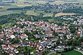
| Location | Rüthen, Soest, Arnsberg Government Region, North Rhine-Westphalia, Germany | ||||
| Architectural style | |||||
| Heritage designation | |||||
 | |||||
Media in category "St. Nikolaus (Rüthen)"
The following 94 files are in this category, out of 94 total.
-
 Rü.Nokol.fd (1).jpg 1,944 × 2,592; 1.05 MB
-
 Rü.Nokol.fd (3).jpg 1,944 × 2,592; 613 KB
-
 Rü.Nokol.fd (4).jpg 1,944 × 2,592; 644 KB
-
 Rü.Nokol.fd (5).jpg 1,944 × 2,592; 549 KB
-
 Rü.Nokol.fd (6).jpg 1,944 × 2,592; 1.18 MB
-
 Rüthen - St. Nikolaus - 1.jpg 2,789 × 2,755; 3.12 MB
-
 Rüthen - St. Nikolaus - Kanzel, Wappen.jpg 3,861 × 3,102; 4.28 MB
-
 Rüthen - St. Nikolaus - Portal, Inschrift.jpg 5,472 × 3,648; 8.71 MB
-
 Rüthen - St. Nikolaus - Seitenaltar - Wappen.jpg 4,864 × 3,648; 7.46 MB
-
 Rüthen - St. Nikolaus - Seitenaltar, Inschrift.jpg 4,864 × 3,648; 6.61 MB
-
 Rüthen - St. Nikolaus - Seitenaltar.jpg 3,070 × 4,670; 5.5 MB
-
 Rüthen - St. Nikolaus - Südportal - Schlussstein.jpg 4,224 × 3,393; 6.15 MB
-
 Rüthen FFSN-1943.jpg 4,464 × 2,969; 16.96 MB
-
 Rüthen Kirchturm.JPG 3,000 × 4,000; 7.29 MB
-
 Rüthen Nikolauskirche Abbild von - Unsere Liebe Frau von der immerwährenden Hilfe - 2.JPG 2,320 × 3,480; 1.29 MB
-
 Rüthen Nikolauskirche Abbild von - Unsere Liebe Frau von der immerwährenen Hilfe - 1.JPG 2,051 × 3,408; 1.27 MB
-
 Rüthen Nikolauskirche Aufgang zur Empore.JPG 2,448 × 3,696; 1.03 MB
-
 Rüthen Nikolauskirche Außenansicht rechts 1.JPG 2,448 × 3,696; 2.1 MB
-
 Rüthen Nikolauskirche Außenansicht rechts.JPG 2,700 × 2,448; 1.2 MB
-
 Rüthen Nikolauskirche Beichtstuhl links.JPG 3,603 × 2,371; 1.07 MB
-
 Rüthen Nikolauskirche Beichtstuhl rechts mit Heiligenfigur.JPG 1,410 × 2,106; 389 KB
-
 Rüthen Nikolauskirche Beichtstuhl rechts.JPG 2,628 × 2,351; 1.13 MB
-
 Rüthen Nikolauskirche Blick durch das Kirchenschiff auf den Haptaltar 2.JPG 2,337 × 3,576; 1.37 MB
-
 Rüthen Nikolauskirche Blick durch das Kirchenschiff auf den Hauptaltar 1.JPG 2,355 × 3,597; 1.13 MB
-
 Rüthen Nikolauskirche Blick durch das Kirchenschiff auf den Hauptaltar 3.JPG 2,448 × 3,696; 1.94 MB
-
 Rüthen Nikolauskirche Blick vom Altar durch das Kirchenschiff 1.JPG 3,696 × 2,448; 1.19 MB
-
 Rüthen Nikolauskirche Blick vom Altar durch das Kirchenschiff 2.JPG 3,090 × 2,302; 992 KB
-
 Rüthen Nikolauskirche Blick vom Altar durch das Kirchenschiff 3.JPG 3,621 × 2,359; 1.13 MB
-
 Rüthen Nikolauskirche Denkmal 1.JPG 1,756 × 2,614; 1.22 MB
-
 Rüthen Nikolauskirche Denkmal 2.JPG 2,448 × 3,696; 1.65 MB
-
 Rüthen Nikolauskirche Eingang außen.JPG 2,448 × 3,696; 3.36 MB
-
 Rüthen Nikolauskirche Eingang von außen 1.JPG 2,448 × 3,696; 3.43 MB
-
 Rüthen Nikolauskirche Eingang zum kleinen Turm.JPG 2,448 × 3,696; 5.17 MB
-
 Rüthen Nikolauskirche Fenster über dem Hauptportal von innen.JPG 1,843 × 1,687; 536 KB
-
 Rüthen Nikolauskirche Hauptaltar 2.JPG 2,128 × 3,696; 1.18 MB
-
 Rüthen Nikolauskirche Hauptaltar 3.JPG 2,296 × 3,574; 1.3 MB
-
 Rüthen Nikolauskirche Hauptaltar 4.JPG 2,323 × 3,611; 1.57 MB
-
 Rüthen Nikolauskirche Hauptaltar heiliger Bischof 1.JPG 1,976 × 2,768; 1.1 MB
-
 Rüthen Nikolauskirche Hauptaltar heiliger Bischof 2.JPG 2,052 × 2,685; 1.25 MB
-
 Rüthen Nikolauskirche Hauptaltar, Heilige Dreifaltigkeit.JPG 3,195 × 2,245; 1.18 MB
-
 Rüthen Nikolauskirche Hauptportal 1.JPG 2,064 × 2,288; 768 KB
-
 Rüthen Nikolauskirche Hauptportal 2.JPG 3,696 × 2,448; 4.82 MB
-
 Rüthen Nikolauskirche Heiligenfigur auf dem rechten Beichtstuhl 1.JPG 1,190 × 2,304; 450 KB
-
 Rüthen Nikolauskirche Heiligenfigur auf dem rechten Beichtstuhl 2.JPG 2,448 × 3,696; 1.28 MB
-
 Rüthen Nikolauskirche Heiliger mit Jesusknabe 2.JPG 1,744 × 2,600; 776 KB
-
 Rüthen Nikolauskirche Heiliger mit Jesusknabe.JPG 1,856 × 2,632; 735 KB
-
 Rüthen Nikolauskirche Ikone im Chor in einer Nische links 1.JPG 2,275 × 2,789; 906 KB
-
 Rüthen Nikolauskirche Ikone im Chor in einer Nische links.JPG 1,952 × 2,424; 878 KB
-
 Rüthen Nikolauskirche Infotafel außen.JPG 3,696 × 2,448; 1.25 MB
-
 Rüthen Nikolauskirche Kanzel 1.JPG 1,890 × 2,250; 568 KB
-
 Rüthen Nikolauskirche Kanzel 3.JPG 2,448 × 2,904; 1,008 KB
-
 Rüthen Nikolauskirche kleiner Turm links.JPG 2,448 × 3,696; 4.89 MB
-
 Rüthen Nikolauskirche Kreuz auf dem Hauptaltar 2.JPG 2,360 × 3,112; 1.07 MB
-
 Rüthen Nikolauskirche und Johanneskirche FFSN-1935.jpg 4,404 × 2,929; 17.4 MB
-
 Rüthen Nikolauskirche und Johanneskirche FFSN-1938.jpg 4,402 × 2,928; 16.87 MB
-
 Rüthen Orgel in St. Nikolaus.jpg 4,170 × 3,327; 9.01 MB
-
 Rüthen St Nikolaus Altar.jpg 3,456 × 4,608; 3.27 MB
-
 Rüthen St Nikolaus Kanzel.jpg 4,608 × 3,456; 3.58 MB
-
 Rüthen St Nikolaus Orgel.jpg 4,608 × 3,456; 3.63 MB
-
 Rüthen St. Nikolaus 1.jpg 2,848 × 4,272; 5.17 MB
-
 Rüthen St. Nikolaus 10.jpg 2,848 × 4,272; 4.48 MB
-
 Rüthen St. Nikolaus 11.jpg 2,848 × 4,272; 4.04 MB
-
 Rüthen St. Nikolaus 12.jpg 2,848 × 4,272; 5.87 MB
-
 Rüthen St. Nikolaus 13.jpg 2,848 × 4,272; 6.23 MB
-
 Rüthen St. Nikolaus 2.jpg 2,848 × 4,272; 4.98 MB
-
 Rüthen St. Nikolaus 3.jpg 2,848 × 4,272; 4.43 MB
-
 Rüthen St. Nikolaus 4.jpg 2,848 × 4,272; 3.85 MB
-
 Rüthen St. Nikolaus 5.jpg 4,272 × 2,848; 4.33 MB
-
 Rüthen St. Nikolaus 6.jpg 2,848 × 4,272; 4.19 MB
-
 Rüthen St. Nikolaus 7.jpg 2,848 × 4,272; 4.52 MB
-
 Rüthen St. Nikolaus 8.jpg 2,848 × 4,272; 4.16 MB
-
 Rüthen St. Nikolaus 9.jpg 2,848 × 4,272; 4.84 MB
-
 Rüthen St. Nikolaus Außenanlage.JPG 7,752 × 5,814; 21.62 MB
-
 Rüthen St. Nikolaus Blick auf die Turmuhr.JPG 3,000 × 4,000; 9.47 MB
-
 Rüthen St. Nikolaus Chorgestühl.JPG 4,000 × 3,000; 8.62 MB
-
 Rüthen St. Nikolaus Hauptaltar, Zelebrationsaltar und Kanzel.JPG 3,000 × 4,000; 8.44 MB
-
 Rüthen St. Nikolaus Hauptaltar.JPG 3,000 × 4,000; 6.67 MB
-
 Rüthen St. Nikolaus Hauptportal.JPG 4,000 × 3,000; 5.56 MB
-
 Rüthen St. Nikolaus Kirchenfenster.JPG 3,000 × 4,000; 8.66 MB
-
 Rüthen St. Nikolaus Kreuzwegstation.JPG 1,841 × 2,393; 2.69 MB
-
 Rüthen St. Nikolaus Nische mit Pietà.JPG 4,000 × 3,000; 7.48 MB
-
 Rüthen St. Nikolaus Seitenteilansicht.JPG 4,000 × 3,000; 9.54 MB
-
 Rüthen St. Nikolaus Turmansicht.JPG 3,000 × 4,000; 8.92 MB
-
 Rüthen St. Nikolaus Zelebrationsaltar.JPG 4,000 × 3,000; 6.03 MB
-
 Rüthen St. Nikolaus, Ambo.JPG 1,227 × 2,184; 1.97 MB
-
 Rüthen St. Nikolaus, Fenster Lamm Gottes.JPG 1,859 × 1,711; 1.67 MB
-
 Rüthen St. Nikolaus, Inschrift über dem Seitenportal.JPG 4,000 × 3,000; 7.11 MB
-
 Rüthen St. Nikolaus, Zelebrationsaltar.JPG 1,979 × 1,031; 1.35 MB
-
 Rüthen St.-Nikolaus-Kirche.jpg 4,320 × 3,240; 5.07 MB
-
 Rüthen, St. Nikolaus Blick auf den Hauptaltar.JPG 3,000 × 4,000; 6.31 MB
-
 Rüthen, St. Nikolaus Nikolausportal.JPG 3,000 × 4,000; 7.64 MB
-
 St-Nikolaus-Kirche-Eingangsportal.JPG 3,254 × 2,169; 4.18 MB
-
 St.-Nikolaus-Kirche, Rüthen, Pietà.jpg 2,784 × 4,176; 3.88 MB
-
 St.-Nikolaus-Kirche, Rüthen.jpg 4,176 × 2,784; 5.17 MB
.jpg)
.jpg)
.jpg)
.jpg)
.jpg)


