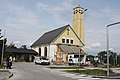
Category:St. Anton am Flugfeld
Jump to navigation
Jump to search
| Object location | | View all coordinates using: OpenStreetMap |
|---|
subsidiary church in Wiener Neustadt .JPG) | |||||
| Upload media | |||||
| Instance of |
| ||||
|---|---|---|---|---|---|
| Named after | |||||
| Location | Wiener Neustadt, Lower Austria, Austria | ||||
| Street address |
| ||||
| Architectural style | |||||
| Diocese | |||||
| Heritage designation | |||||
 | |||||
Media in category "St. Anton am Flugfeld"
The following 19 files are in this category, out of 19 total.
-
 Dr.-Karl-Renner-Hof.WienerNeustadt.Aa.jpg 4,752 × 3,168; 4.85 MB
-
 Flugfeld-Orgel.jpg 1,297 × 1,903; 331 KB
-
 Flugfeldkirche.A.jpg 4,752 × 3,168; 4.5 MB
-
 Flugfeldkirche.B.jpg 4,752 × 3,168; 5.13 MB
-
 Flugfeldkirche.C.jpg 4,752 × 3,168; 5.66 MB
-
 Flugfeldkirche.D.jpg 4,752 × 3,168; 4.42 MB
-
 Flugfeldkirche.E.jpg 4,752 × 3,168; 4.64 MB
-
 Flugfeldkirche.F.jpg 3,168 × 4,752; 5.73 MB
-
 GustavKraupaWohnhausanlage.StAntonAmFlugfeld.KaserneFlugfeld.A.JPG 2,048 × 1,536; 595 KB
-
 StAntonAmFlugfeld.WienerNeustadt.A.JPG 1,536 × 2,048; 487 KB
-
 StAntonAmFlugfeld.WienerNeustadt.Aa.JPG 2,048 × 1,536; 453 KB
-
 StAntonAmFlugfeld.WienerNeustadt.B.JPG 1,536 × 2,048; 793 KB
-
 StAntonAmFlugfeld.WienerNeustadt.D.JPG 1,536 × 2,048; 553 KB
-
 Wiener Neustadt - Kirche St. Anton (1).JPG 4,252 × 2,834; 9.67 MB
-
 Wiener Neustadt - Kirche St. Anton (2).JPG 3,531 × 3,850; 9.92 MB
-
 Wiener Neustadt Flugfeldkirche 4183.JPG 3,456 × 5,184; 5.06 MB
-
 Wiener Neustadt Flugfeldkirche 4187.JPG 5,184 × 3,456; 5.83 MB
-
 Wiener Neustadt Flugfeldkirche 4188.JPG 5,184 × 3,456; 8.21 MB
-
 Wiener Neustadt Flugfeldkirche 4191.JPG 3,456 × 5,184; 6.8 MB


.JPG)


