Category:St.-Bartholomäus-Kirche (Damgarten)
Jump to navigation
Jump to search
| Object location | | View all coordinates using: OpenStreetMap |
|---|
church in Ribnitz-Damgarten  | |||||
| Upload media | |||||
| Instance of | |||||
|---|---|---|---|---|---|
| Named after | |||||
| Location | Ribnitz-Damgarten, Vorpommern-Rügen District, Mecklenburg-Western Pomerania, Germany | ||||
| Street address |
| ||||
| Heritage designation | |||||
 | |||||
|
This is a category about the architectural monument in Vorpommern-Rügen identified by the ID 10934A
|
Media in category "St.-Bartholomäus-Kirche (Damgarten)"
The following 12 files are in this category, out of 12 total.
-
 RDG St.-Bartholomaeus Damgarten.jpg 2,321 × 1,996; 1.77 MB
-
 Ribnitz-Damgarten-St.-Bartholomaeus-in-Damgarten-23-02-2008-276a.jpg 1,024 × 768; 465 KB
-
 RDG Kirche St. Bartholomäus.jpg 752 × 1,024; 538 KB
-
 Ribnitzer See, Ribnitz-Damgarten ( 1070900).jpg 3,955 × 2,225; 5.56 MB
-
 St.-Bartholomäus-Kirche (Damgarten) Altar.jpg 3,024 × 4,032; 2.12 MB
-
 St.-Bartholomäus-Kirche (Damgarten) Blick in den Chor.jpg 3,024 × 4,032; 1.86 MB
-
 St.-Bartholomäus-Kirche (Damgarten) Blick ins Kirchenschiff Richtung Chor.jpg 4,032 × 3,024; 2.1 MB
-
 St.-Bartholomäus-Kirche (Damgarten) Epitaph Hans Ulrich von Schwerin.jpg 3,024 × 4,032; 2.06 MB
-
 St.-Bartholomäus-Kirche (Damgarten) Fünte und Gestühl.jpg 4,032 × 3,024; 1.75 MB
-
 St.-Bartholomäus-Kirche (Damgarten) Kanzel.jpg 3,024 × 4,032; 1.84 MB
-
 St.-Bartholomäus-Kirche (Damgarten) Kruzifix.jpg 3,024 × 4,032; 2.27 MB
-
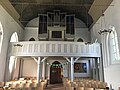 St.-Bartholomäus-Kirche (Damgarten) Orgelempore.jpg 4,032 × 3,024; 1.99 MB


.jpg)
_Altar.jpg)
_Blick_in_den_Chor.jpg)
_Blick_ins_Kirchenschiff_Richtung_Chor.jpg)
_Epitaph_Hans_Ulrich_von_Schwerin.jpg)
_F%C3%BCnte_und_Gest%C3%BChl.jpg)
_Kanzel.jpg)
_Kruzifix.jpg)
_Orgelempore.jpg)