Category:Spurn
Jump to navigation
Jump to search
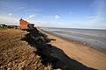
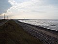
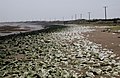
English: Spurn is a narrow sand spit on the tip of the coast of the East Riding of Yorkshire, England that reaches into the North Sea and forms the north bank of the mouth of the Humber estuary. It is over 3 miles (4.8 km) long, almost half the width of the estuary at that point, and as little as 50 yards (46 m) wide in places. The southernmost tip is known as Spurn Head or Spurn Point and is the home to an RNLI lifeboat station and disused lighthouse. It forms part of the civil parish of Easington.
Español: El Cabo Spurn o Punta Spurn es una estrecha lengua de arena en el extremo sureste del East Riding de Yorkshire, Inglaterra, que penetra en el Mar del Norte y forma la rivera norte de la desembocadura del estuario Humber. Tiene más de 4,8 km de largo, casi la mitad del ancho del estuario en ese punto, y en algunos lugares se estrecha hasta tan solo 46 m. En el extremo sur hay una estación de botes salvavidas de la RNLI y un faro en desuso. Forma parte de la parroquia de Easington.
Français : Le cap Spurn est une presqu'île à l'extrémité de la côte du Yorkshire de l'Est, en Angleterre, qui s'avance dans la mer du Nord et termine la rive nord de l'estuaire du Humber. Le Spurn mesure 5 km de long, soit près de la moitié de la largeur de l'embouchure à ce niveau, contre seulement 45 m de large par endroits. L'extrémité sud porte le nom de Spurn Point ou Spurn Head, et abrite un centre de la Royal National Lifeboat Institution (Institution Nationale Royale de Sauvetage en mer) ainsi qu'un phare abandonné. Il fait partie du territoire de la paroisse administrative d'Easington.
Українська: Мис Спурн ( або Spurn Head) — вузький пісчаний півострів на кінці Східного райдінга Йоркшира, Англія, що видається в Північне море і формує північний берег затоки Хамбер. Біля 5 км завдовжки, біля половини довжини затоки, та 45 м завширшки в найвузчому місці. В найпівденнішій точці розташована морська рятувальна станція і маяк, що більше не використовується. Півострів є частиною приходу Ізінгтон. Площа півострова біля 113 га, протяжність берегової лінії 1,81 км. З 1960 року півострів належить Йоркшірському трасту дикої природи і є Національний природним резервом.
narrow sand tidal island located off the tip of the coast of the East Riding of Yorkshire  Дюни і маяк Спурна в травні 2005 року | |||||
| Upload media | |||||
| Instance of | |||||
|---|---|---|---|---|---|
| Location |
| ||||
| Located in or next to body of water | |||||
 | |||||
Subcategories
This category has the following 2 subcategories, out of 2 total.
S
- Spurn Point Military Railway (10 F)
Media in category "Spurn"
The following 29 files are in this category, out of 29 total.
-
 Canal bank, Spurn - geograph.org.uk - 2697489.jpg 1,600 × 1,200; 795 KB
-
 Cliff erosion, Holderness (4451525067).jpg 2,048 × 1,371; 731 KB
-
 Cliff erosion, Holderness (4451528999).jpg 2,048 × 1,371; 297 KB
-
 Don't Spurn Spurn^ - geograph.org.uk - 373361.jpg 640 × 480; 102 KB
-
 Egrets on the shore - geograph.org.uk - 1515240.jpg 640 × 480; 59 KB
-
 Erosion on Spurn Peninsula. - geograph.org.uk - 530217.jpg 640 × 480; 64 KB
-
 Greedy Gut from Chalk Bank - geograph.org.uk - 307781.jpg 640 × 479; 122 KB
-
 Groyne, West Spurn - geograph.org.uk - 952050.jpg 640 × 425; 211 KB
-
 Kilnsea - Spurn Road - geograph.org.uk - 21768.jpg 640 × 480; 65 KB
-
 Old iron chimney on Spurn beach.jpg 720 × 540; 48 KB
-
 On the muddy side of Spurn - geograph.org.uk - 1515264.jpg 640 × 480; 66 KB
-
 Ordnance Survey One-Inch Sheet 105 Grimbsy, Published 1946.jpg 10,855 × 12,736; 12.27 MB
-
 Ordnance Survey One-Inch Sheet 105 Grimsby, Published 1962.jpg 8,251 × 9,918; 8.7 MB
-
 Pay here - geograph.org.uk - 817546.jpg 640 × 379; 38 KB
-
 Road to Spurn - geograph.org.uk - 1515221.jpg 640 × 480; 61 KB
-
 Road to Spurn Head - geograph.org.uk - 1257650.jpg 640 × 427; 69 KB
-
 Road to Spurn Head - geograph.org.uk - 1257666.jpg 640 × 428; 78 KB
-
 Ruth Do328 Spurn Hd Humber 16.08.12R edited-2.jpg 1,024 × 714; 596 KB
-
 Spurn Lifeboat and Humber Pilots jetty - geograph.org.uk - 5408424.jpg 800 × 596; 116 KB
-
 Spurn Lifeboat and Humber Pilots jetty - geograph.org.uk - 5408436.jpg 800 × 694; 222 KB
-
-
 The concrete road to Spurn Point. - geograph.org.uk - 530255.jpg 640 × 480; 71 KB
-
 The Humber Estuary - Spurn Peninsula. - geograph.org.uk - 530235.jpg 640 × 480; 50 KB
-
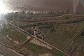
 The Humber estuary from the air - geograph.org.uk - 3845831.jpg 640 × 405; 72 KB
-
 The Road to and from Spurn Head. - geograph.org.uk - 530228.jpg 640 × 480; 52 KB
-
 The road to Spurn Head - geograph.org.uk - 817537.jpg 640 × 480; 54 KB
-
 The Road to Spurn Point - geograph.org.uk - 693586.jpg 640 × 480; 68 KB
-
 The road to Spurn Point - geograph.org.uk - 817461.jpg 640 × 359; 44 KB
-
 The Spurn Peninsula - geograph.org.uk - 307785.jpg 640 × 414; 104 KB

.jpg)
.jpg)


