Category:Spring in Lincolnshire
Jump to navigation
Jump to search
Ceremonial counties of England: Bedfordshire · Berkshire · Buckinghamshire · Cambridgeshire · Cheshire · Cornwall · Cumbria · Derbyshire · Devon · Dorset · Durham · East Sussex · Essex · Gloucestershire · Greater London · Hampshire · Herefordshire · Hertfordshire · Kent · Lancashire · Lincolnshire · Norfolk · North Yorkshire · Northumberland · Nottinghamshire · Oxfordshire · Shropshire · Somerset · South Yorkshire · Staffordshire · Suffolk · Surrey · Warwickshire · West Sussex · West Yorkshire · Wiltshire · Worcestershire
City-counties: Bristol · City of London
Former historic counties:
Other former counties:
City-counties: Bristol · City of London
Former historic counties:
Other former counties:
Subcategories
This category has the following 3 subcategories, out of 3 total.
Media in category "Spring in Lincolnshire"
The following 131 files are in this category, out of 131 total.
-
 'Mile'post 31km - geograph.org.uk - 418740.jpg 427 × 640; 169 KB
-
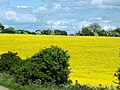
 A rapeseed field in the Lincolnshire Vales, South Kesteven, England 1.jpg 2,560 × 1,920; 5.61 MB
-
 A rapeseed field in the Lincolnshire Vales, South Kesteven, England 2.jpg 2,560 × 1,920; 5 MB
-
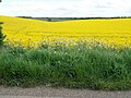
 A country lane in the Lincolnshire Vales, South Kesteven, England.jpg 2,560 × 1,920; 4.71 MB
-
 A rapeseed field in the Lincolnshire Vales, South Kesteven, England 3.jpg 2,560 × 1,707; 4.12 MB
-
 A rapeseed field in the Lincolnshire Vales, South Kesteven, England 4.jpg 2,560 × 1,920; 4.86 MB
-
 A rapeseed field in the Lincolnshire Vales, South Kesteven, England 5.jpg 2,560 × 1,920; 5.26 MB
-
 A rapeseed field in the Lincolnshire Vales, South Kesteven, England 6.jpg 2,560 × 1,920; 5.41 MB
-
 A farm track in the Lincolnshire Vales, South Kesteven, England.jpg 2,560 × 1,920; 3.24 MB
-
 A rapeseed field in the Lincolnshire Vales, South Kesteven, England 7.jpg 2,560 × 1,872; 6.93 MB
-
 A rapeseed field in the Lincolnshire Vales, South Kesteven, England 8.jpg 2,560 × 1,920; 6.34 MB
-
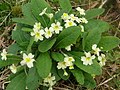 A welcome sign of Spring, Primroses - geograph.org.uk - 410997.jpg 640 × 480; 118 KB
-
 Spring in Temple Wood near Aslackby - geograph.org.uk - 407491.jpg 640 × 427; 141 KB
-
 Banks of River Witham - geograph.org.uk - 642926.jpg 640 × 480; 35 KB
-
 Barley fields north of Edenham - geograph.org.uk - 176393.jpg 640 × 480; 85 KB
-
 Signpost in Spring - geograph.org.uk - 743560.jpg 640 × 480; 102 KB
-
 Barton cement plant - geograph.org.uk - 1318144.jpg 640 × 480; 123 KB
-

-
 Burgate Post Office, Easter Sunday 2008 - geograph.org.uk - 734454.jpg 640 × 544; 130 KB
-
 Burgate, Easter Sunday 2008 - geograph.org.uk - 734439.jpg 640 × 480; 94 KB
-

-

-
-
 King Street, Easter Sunday 2008 - geograph.org.uk - 734946.jpg 640 × 467; 76 KB
-
 May Day, Burgate - geograph.org.uk - 54044.jpg 640 × 427; 145 KB
-
 Soutergate, Easter Sunday 2008 - geograph.org.uk - 734532.jpg 533 × 640; 124 KB
-
 Beach Huts along the Promenade - geograph.org.uk - 154948.jpg 640 × 473; 93 KB
-
 Belton House NT. Lincolnshire. - geograph.org.uk - 379100.jpg 640 × 480; 96 KB
-
 Bluebells in Fox Wood - geograph.org.uk - 410992.jpg 640 × 480; 159 KB
-
 Bluebells in Osgodby Coppice - geograph.org.uk - 412089.jpg 480 × 640; 141 KB
-
 Bluebells in Turton's Covert - geograph.org.uk - 412635.jpg 640 × 426; 194 KB
-
 Bone Mill Lock, River Slea - geograph.org.uk - 334455.jpg 640 × 427; 132 KB
-
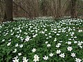
 Carpet of Wood Anemone in Bourne Wood - geograph.org.uk - 760533.jpg 640 × 480; 58 KB
-
 Footpath in Bourne Wood - geograph.org.uk - 760609.jpg 640 × 480; 59 KB
-
 Parched-cracked earth in Bourne Woods - geograph.org.uk - 410994.jpg 640 × 480; 135 KB
-
 Bourne Abbey Church-Geograph-404358-by-Brian-Green.jpg 640 × 480; 61 KB
-
 Bourne Eau Pumping Station - geograph.org.uk - 437357.jpg 640 × 477; 104 KB
-
 Bourneabbey.jpg 535 × 747; 48 KB
-

-
 Brigsley dandelions - geograph.org.uk - 1269844.jpg 426 × 640; 128 KB
-
 New River Ancholme - geograph.org.uk - 178012.jpg 640 × 480; 141 KB
-
 Chestnut Avenue to Grimsthorpe Castle - geograph.org.uk - 401710.jpg 640 × 480; 122 KB
-
 Church of the Holy Cross Great Ponton Lincolnshire England - chancel east window.jpg 3,339 × 4,454; 13.35 MB
-
 Church of the Holy Cross Great Ponton Lincolnshire England - from the northeast.jpg 3,456 × 3,456; 10.92 MB
-
 Church of the Holy Cross Great Ponton Lincolnshire England - from the southeast.jpg 4,410 × 3,309; 10.33 MB
-
 Church of the Holy Cross Great Ponton Lincolnshire England - north aisle from northwest.jpg 4,351 × 3,264; 8.56 MB
-
 Church of the Holy Cross Great Ponton Lincolnshire England - south porch door.jpg 2,962 × 4,196; 12.95 MB
-
 Church of the Holy Cross Great Ponton Lincolnshire England - south porch.jpg 4,608 × 3,456; 12.92 MB
-
 Church of the Holy Cross Great Ponton Lincolnshire England - tower at south.jpg 4,608 × 3,456; 13.03 MB
-
 Church of the Holy Cross Great Ponton Lincolnshire England - tower coat of arms.jpg 3,858 × 2,170; 6.83 MB
-
 Church of the Holy Cross Great Ponton Lincolnshire England - tower from northwest.jpg 3,267 × 4,357; 8.29 MB
-
 Church of the Holy Cross Great Ponton Lincolnshire England - tower gargoyle 1.jpg 3,456 × 4,608; 8.43 MB
-
 Church of the Holy Cross Great Ponton Lincolnshire England - tower gargoyle 2.jpg 3,456 × 4,608; 8.32 MB
-
 Church of the Holy Cross Great Ponton Lincolnshire England - tower gargoyles and parapet.jpg 4,235 × 3,176; 9.52 MB
-
 Church of the Holy Cross Great Ponton Lincolnshire England - tower niche gable 1.jpg 3,386 × 4,516; 11.85 MB
-
 Church of the Holy Cross Great Ponton Lincolnshire England - tower niche gable 2.jpg 3,259 × 4,347; 11.33 MB
-
 Church of the Holy Cross Great Ponton Lincolnshire England - tower niche gable 3.jpg 3,456 × 4,608; 11.7 MB
-
 Church of the Holy Cross Great Ponton Lincolnshire England - tower parapet and gargoyles.jpg 4,608 × 3,456; 10.76 MB
-
 Church of the Holy Cross Great Ponton Lincolnshire England - tower socle frieze.jpg 4,608 × 2,950; 10.83 MB
-
 Church of the Holy Cross Great Ponton Lincolnshire England - tower west door and window.jpg 3,415 × 4,555; 11.76 MB
-
 Cowbit village sign - geograph.org.uk - 132944.jpg 640 × 480; 276 KB
-
 Daffodil picking - geograph.org.uk - 372906.jpg 640 × 427; 63 KB
-
 Daffodils - geograph.org.uk - 365993.jpg 640 × 480; 121 KB
-
 Daffodils at High Hill farm - geograph.org.uk - 372873.jpg 640 × 427; 92 KB
-
 Dole Wood - geograph.org.uk - 637972.jpg 2,048 × 1,536; 1.76 MB
-
 Donkey Ride at Skegness Beach - geograph.org.uk - 630501.jpg 640 × 480; 77 KB
-
 Easton walled garden - geograph.org.uk - 232012.jpg 640 × 479; 89 KB
-
-
 Farmland at the edge of Pasture Wood - geograph.org.uk - 405272.jpg 640 × 427; 123 KB
-
 Finger post sign - geograph.org.uk - 378876.jpg 534 × 640; 57 KB
-
 Footpath to Manthorpe - geograph.org.uk - 141158.jpg 640 × 480; 91 KB
-
 Ford and bridge over the East Glen River - geograph.org.uk - 405505.jpg 640 × 427; 129 KB
-
 Ford at Little Bytham - geograph.org.uk - 176168.jpg 640 × 480; 139 KB
-
 Ford at Little Humby - geograph.org.uk - 139897.jpg 640 × 427; 102 KB
-
 Ford at Little Humby - geograph.org.uk - 155322.jpg 640 × 427; 150 KB
-
 Ford-Watery Lane-Dunholme-Flckr-433338763.jpg 801 × 488; 309 KB
-
 Ground-ivy Glechoma hederacea - geograph.org.uk - 412148.jpg 640 × 640; 124 KB
-
 St. Peter's church Gunby - geograph.org.uk - 1352093.jpg 640 × 480; 143 KB
-
 Harlaxton Cross - geograph.org.uk - 792243.jpg 640 × 427; 105 KB
-
 Hawthorn, crataegus monogyna - geograph.org.uk - 412179.jpg 640 × 561; 96 KB
-
 Heckington Station 2.jpg 640 × 448; 141 KB
-
 Hobba Dyke - geograph.org.uk - 359428.jpg 640 × 427; 70 KB
-
 Holmes Lane - geograph.org.uk - 1291927.jpg 640 × 399; 87 KB
-
 Holmes Lane - geograph.org.uk - 742143.jpg 640 × 425; 84 KB
-
 Green Lane on Horkstow Wolds - geograph.org.uk - 1332197.jpg 640 × 480; 147 KB
-
 Looking towards Turton's Covert - geograph.org.uk - 419889.jpg 640 × 426; 94 KB
-
 Middlegate near Saxby All Saints - geograph.org.uk - 1308630.jpg 640 × 606; 551 KB
-
 Rural Prospect near Horkstow - geograph.org.uk - 1332169.jpg 640 × 377; 81 KB
-
 The New River Ancholme - geograph.org.uk - 1268713.jpg 480 × 640; 87 KB
-
 Byway from Loveden Hill - geograph.org.uk - 391720.jpg 640 × 480; 109 KB
-
 Bluebells in the wood - geograph.org.uk - 412378.jpg 427 × 640; 165 KB
-

-
 Leake Ings - geograph.org.uk - 406149.jpg 640 × 427; 78 KB
-
 Louth Canal - geograph.org.uk - 1202076.jpg 640 × 426; 83 KB
-
 Low Locks Deeping St James geograph 1824623.jpg 2,560 × 1,920; 1.38 MB
-
 Mere Crossroads - geograph.org.uk - 1310432.jpg 640 × 480; 55 KB
-
 Monksthorpe - geograph.org.uk - 1263290.jpg 640 × 426; 108 KB
-
 Next stop Spalding - geograph.org.uk - 364307.jpg 640 × 427; 69 KB
-
 Oak leaves and flowers in Osgodby Coppice - geograph.org.uk - 412164.jpg 640 × 640; 114 KB
-
 Old Leake Medical Centre.jpg 1,632 × 1,224; 277 KB
-
 Osgodby Coppice - geograph.org.uk - 405127.jpg 640 × 427; 111 KB
-
 Osgodby Coppice - geograph.org.uk - 412080.jpg 640 × 427; 156 KB
-
 Papermill Lock on the River Slea - geograph.org.uk - 781994.jpg 640 × 427; 119 KB
-
 Polyommatus sp. - Small blue butterfly.jpg 1,024 × 768; 153 KB
-
 Rape and Obthorpe Lodge - geograph.org.uk - 437461.jpg 640 × 477; 95 KB
-
 River Glen at Surfleet-Seas-End - geograph.org.uk - 435567.jpg 640 × 477; 107 KB
-
 River Welland, Spalding. - geograph.org.uk - 111332.jpg 640 × 431; 149 KB
-
 River Witham facing east - geograph.org.uk - 1262974.jpg 640 × 480; 68 KB
-
 Near Brackenholmes - geograph.org.uk - 1321634.jpg 640 × 480; 103 KB
-
 Site of St Peters Church, Stamford-Geograph-2313562-by-Bob-Harvey.jpg 4,000 × 3,000; 3.9 MB
-
 Site of the Roman ford - geograph.org.uk - 487600.jpg 640 × 477; 138 KB
-

-
 Skegness Chalets.jpg 3,872 × 2,592; 802 KB
-
 Skegness Pier - geograph.org.uk - 549062.jpg 480 × 640; 90 KB
-
 Small wood at the side of Creeton Quarry - geograph.org.uk - 365235.jpg 640 × 480; 136 KB
-
 Humber Footpath east of Ferriby Sluice - geograph.org.uk - 1221321.jpg 640 × 480; 156 KB
-
 Pond north west of Ferriby Sluice - geograph.org.uk - 1221325.jpg 640 × 480; 157 KB
-
 South Ferriby Church - geograph.org.uk - 405134.jpg 640 × 463; 160 KB
-
-
 Southrey Woods, near Bardney - geograph.org.uk - 1569209.jpg 640 × 480; 116 KB
-
 Spanby Crossing Keeper's Cottage - geograph.org.uk - 154619.jpg 640 × 427; 71 KB
-
 Approaching Surfleet - geograph.org.uk - 435592.jpg 640 × 477; 104 KB
-
 The Bridge by Dovecote Farm - geograph.org.uk - 365981.jpg 640 × 480; 113 KB
-
 The Drake Stones - geograph.org.uk - 166197.jpg 640 × 427; 119 KB
-
 The East Glen River - geograph.org.uk - 420246.jpg 640 × 427; 143 KB
-
 The Old Grain Warehouse, South Road - geograph.org.uk - 404363.jpg 640 × 480; 60 KB
-
 Field Entry near Northfield Lane - geograph.org.uk - 767336.jpg 640 × 478; 104 KB
-
 Tupholme Abbey - geograph.org.uk - 383707.jpg 640 × 427; 61 KB
-
 Tupholme Abbey ruins - geograph.org.uk - 383714.jpg 640 × 427; 58 KB
-
 Witham Bank East, Boston - geograph.org.uk - 777592.jpg 640 × 480; 66 KB
-


