Category:Sports venues in the London Borough of Bromley
Jump to navigation
Jump to search
Boroughs of London: City of London · City of Westminster · Barking and Dagenham · Barnet · Bexley · Brent · Bromley · Camden · Croydon · Ealing · Enfield · Greenwich · Hackney · Hammersmith and Fulham · Haringey · Harrow · Havering · Hillingdon · Hounslow · Islington · Kensington and Chelsea · Kingston · Lambeth · Lewisham · Merton · Newham · Redbridge · Richmond · Southwark · Sutton · Tower Hamlets · Waltham Forest · Wandsworth
Subcategories
This category has the following 5 subcategories, out of 5 total.
Media in category "Sports venues in the London Borough of Bromley"
The following 102 files are in this category, out of 102 total.
-

-

-

-

-

-
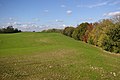
 (Former) cricket ground north of Holwood - geograph.org.uk - 2246647.jpg 640 × 480; 102 KB
-
 (Former) cricket ground north of Holwood - geograph.org.uk - 2437688.jpg 640 × 480; 112 KB
-
 10th Hole West Kent Golf Course - geograph.org.uk - 2535585.jpg 3,072 × 2,304; 1.47 MB
-
 4th Tee of Park Langley Golf Course - geograph.org.uk - 2581236.jpg 4,288 × 3,216; 4.94 MB
-
 9th Green, West Kent Golf Course - geograph.org.uk - 2536829.jpg 3,072 × 2,304; 2.36 MB
-
 All weather pitch, Aylesbury Rd, Bromley - geograph.org.uk - 1947598.jpg 640 × 430; 149 KB
-

-
 Beckenham Rugby Club - geograph.org.uk - 916505.jpg 640 × 480; 69 KB
-

-
 Bromley Golf Centre - geograph.org.uk - 2577311.jpg 4,288 × 3,216; 4.23 MB
-
 Bromley Indoor Bowls Centre - geograph.org.uk - 691152.jpg 640 × 480; 51 KB
-
 Bromley Public Golf Course - geograph.org.uk - 2577278.jpg 4,288 × 3,216; 6.36 MB
-

-
 Chelsfield Lakes driving range - geograph.org.uk - 1021769.jpg 640 × 426; 97 KB
-
 Chelsfield Lakes golf course - geograph.org.uk - 1021045.jpg 640 × 426; 95 KB
-
 Chelsfield Lakes golf course - geograph.org.uk - 2251639.jpg 640 × 426; 82 KB
-
 Chelsfield Lakes Golf Course - geograph.org.uk - 3626357.jpg 4,000 × 3,000; 4.35 MB
-
 Cherry Lodge Golf Course - geograph.org.uk - 2195914.jpg 3,072 × 2,304; 1.53 MB
-
 Cherry Lodge Golf Course Club House - geograph.org.uk - 2195861.jpg 3,072 × 2,304; 1.91 MB
-
 Cherry Lodge golf course, TN16 - geograph.org.uk - 67944.jpg 640 × 481; 101 KB
-
 Chislehurst Cricket Ground - geograph.org.uk - 2573111.jpg 640 × 425; 72 KB
-
 Chislehurst Golf Course - geograph.org.uk - 2318317.jpg 1,280 × 960; 601 KB
-
 Cray Valley Golf Course - geograph.org.uk - 2526904.jpg 3,072 × 2,304; 1.71 MB
-
 Cricket Ground, near New Beckenham - geograph.org.uk - 3395743.jpg 1,024 × 768; 126 KB
-
 Cudham cricket pavilion - geograph.org.uk - 2529950.jpg 1,024 × 768; 203 KB
-
 Cudham cricket pitch - geograph.org.uk - 2529949.jpg 1,024 × 768; 343 KB
-
 Early morning on Chislehurst Golf Course - geograph.org.uk - 2318310.jpg 1,280 × 960; 652 KB
-

-
 Fitness Exchange, Beckenham - geograph.org.uk - 33216.jpg 640 × 408; 68 KB
-

-
 Football pitch behind Palace Square - geograph.org.uk - 1929077.jpg 640 × 430; 164 KB
-
 Footsies Football Ground - geograph.org.uk - 2296812.jpg 640 × 480; 61 KB
-

-

-

-

-

-
 High Elms Golf Course - geograph.org.uk - 1718892.jpg 2,048 × 1,536; 1.22 MB
-
 High Elms Golf Course BR6 - geograph.org.uk - 55519.jpg 640 × 421; 38 KB
-

-

-
 HSBC Sports Ground - geograph.org.uk - 3628499.jpg 640 × 424; 54 KB
-
 Jaspar Group Riding for the Disabled - geograph.org.uk - 1706139.jpg 640 × 426; 121 KB
-
 Kent CCC ("London Office") - geograph.org.uk - 3628503.jpg 640 × 424; 67 KB
-
 Knoll Lawn Tennis Club - geograph.org.uk - 1529064.jpg 640 × 480; 178 KB
-
 Lake, Sundridge Park Golf Course (2) - geograph.org.uk - 2423694.jpg 640 × 480; 109 KB
-
 Lake, Sundridge Park Golf Course (3) - geograph.org.uk - 2423697.jpg 640 × 480; 83 KB
-
 Lake, Sundridge Park Golf Course (4) - geograph.org.uk - 2423705.jpg 640 × 480; 120 KB
-
 Lake, Sundridge Park Golf Course - geograph.org.uk - 2245656.jpg 640 × 480; 114 KB
-
 Lake, Sundridge Park Golf Course - geograph.org.uk - 3494722.jpg 511 × 640; 114 KB
-
 Langley Park Golf Club - geograph.org.uk - 34667.jpg 640 × 444; 193 KB
-
 Langley Park Golf Club BR3 - geograph.org.uk - 47237.jpg 640 × 443; 90 KB
-
 Langley Park golf course - geograph.org.uk - 2485717.jpg 640 × 480; 99 KB
-
 Langley Park golf course - geograph.org.uk - 2485731.jpg 640 × 480; 125 KB
-
 Langley Park Golf Course - geograph.org.uk - 2982787.jpg 4,000 × 3,000; 4.44 MB
-
 Langley Park Golf Course - geograph.org.uk - 2982796.jpg 4,000 × 3,000; 4.21 MB
-
 Looking across Ruxley Golf Course - geograph.org.uk - 2479539.jpg 4,000 × 3,000; 4.42 MB
-
 Meadow grasses off the fairway, High Elms Golf Course - geograph.org.uk - 2597435.jpg 1,600 × 1,064; 662 KB
-
 Mottingham Sports Ground - geograph.org.uk - 2009685.jpg 1,280 × 960; 635 KB
-
 Mottingham Sports Ground and Court Farm Road - geograph.org.uk - 2032319.jpg 1,280 × 960; 657 KB
-

-
 Old Elthamians Sports Clubhouse,Chislehurst - geograph.org.uk - 937559.jpg 3,072 × 2,304; 1.3 MB
-
 Palace Superbowl - geograph.org.uk - 1162613.jpg 480 × 640; 99 KB
-
 Pavilion, Chislehurst Cricket Club - geograph.org.uk - 1905609.jpg 640 × 480; 57 KB
-
 Recreation Ground by Widmore Road, BR1 - geograph.org.uk - 72529.jpg 640 × 481; 178 KB
-

-
 Shortlands Golf Course (2) - geograph.org.uk - 2257296.jpg 640 × 480; 83 KB
-
 Shortlands Golf Course (2) - geograph.org.uk - 2257523.jpg 640 × 480; 106 KB
-
 Shortlands Golf Course (3) - geograph.org.uk - 2257312.jpg 640 × 480; 86 KB
-
 Shortlands Golf Course (4) - geograph.org.uk - 2257314.jpg 640 × 480; 76 KB
-
 Shortlands Golf Course - geograph.org.uk - 2257290.jpg 640 × 480; 91 KB
-
 Shortlands Golf Course - geograph.org.uk - 2257506.jpg 640 × 480; 84 KB
-
 Shortlands Golf Course - geograph.org.uk - 2257517.jpg 640 × 480; 83 KB
-

-
 Small lake at Langley Park Golf Club - geograph.org.uk - 2400610.jpg 640 × 480; 88 KB
-
 South Hill Wood Bowling Club BR2 - geograph.org.uk - 47243.jpg 640 × 481; 75 KB
-
 Sports pavilion, New Beckenham - geograph.org.uk - 1633885.jpg 640 × 480; 45 KB
-
 St Nicholas Rifle and Pistol Club,Foxbury Avenue,Chislehurst - geograph.org.uk - 937563.jpg 3,072 × 2,304; 1.53 MB
-

-
 The entrance to Chislehurst Golf Club - geograph.org.uk - 2303967.jpg 1,280 × 960; 627 KB
-
 The entrance to Shortlands Golf Club - geograph.org.uk - 2257230.jpg 640 × 480; 87 KB
-

-
 Twelfth fairway, West Kent Golf Club - geograph.org.uk - 167200.jpg 640 × 480; 88 KB
-
 View across the golf course - geograph.org.uk - 740890.jpg 640 × 480; 75 KB
-
 View from Ruxley Golf Course - geograph.org.uk - 2479531.jpg 4,000 × 3,000; 4.09 MB
-
 View from Ruxley Golf Course - geograph.org.uk - 2479534.jpg 4,000 × 3,000; 4.29 MB
-
 Walnuts Leisure Centre - geograph.org.uk - 624548.jpg 640 × 480; 68 KB
-
 West Beckenham Bowling Club - geograph.org.uk - 943263.jpg 640 × 480; 67 KB
-
 West Kent Golf Club, Downe BR6 - geograph.org.uk - 68703.jpg 640 × 481; 73 KB
-
 West Kent Golf Course - geograph.org.uk - 3106358.jpg 640 × 425; 376 KB
-
 West Kent Golf Course - geograph.org.uk - 3106424.jpg 640 × 425; 325 KB
-
 West Kent Golf Course - geograph.org.uk - 3106452.jpg 640 × 425; 372 KB
-
 West Kent Golf Course nature reserve - geograph.org.uk - 2774571.jpg 640 × 480; 156 KB
-
 West Wickham Pools - geograph.org.uk - 34663.jpg 640 × 459; 206 KB
-

-

-
_cricket_ground_north_of_Holwood_(2)_-_geograph.org.uk_-_2246655.jpg)
_cricket_ground_north_of_Holwood_(2)_-_geograph.org.uk_-_2437698.jpg)
_cricket_ground_north_of_Holwood_(3)_-_geograph.org.uk_-_2246663.jpg)
_cricket_ground_north_of_Holwood_(3)_-_geograph.org.uk_-_2437713.jpg)
_cricket_ground_north_of_Holwood_(4)_-_geograph.org.uk_-_2437723.jpg)
_cricket_ground_north_of_Holwood_-_geograph.org.uk_-_2246647.jpg)
_cricket_ground_north_of_Holwood_-_geograph.org.uk_-_2437688.jpg)


_-_geograph.org.uk_-_2369769.jpg)
_-_geograph.org.uk_-_2369817.jpg)
_-_geograph.org.uk_-_2369826.jpg)
_-_geograph.org.uk_-_2369831.jpg)


_-_geograph.org.uk_-_3628503.jpg)

_-_geograph.org.uk_-_2423694.jpg)
_-_geograph.org.uk_-_2423697.jpg)
_-_geograph.org.uk_-_2423705.jpg)


_-_geograph.org.uk_-_2257296.jpg)
_-_geograph.org.uk_-_2257523.jpg)
_-_geograph.org.uk_-_2257312.jpg)
_-_geograph.org.uk_-_2257314.jpg)


_-_geograph.org.uk_-_2400616.jpg)


