Category:Spittal of Glenshee
Jump to navigation
Jump to search
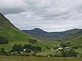
English: The Spittal of Glenshee lies at the head of Glenshee in the highlands of eastern Perth and Kinross, Scotland where the confluence of many small streams flowing south out of the Grampians form the Shee Water. For centuries, there has been a hostel or inn at the site and, in modern times, the small village has become a centre for travel, tourism and winter sports in the region, sited at a bend on the A93 trunk road which leads from Blairgowrie north past the Spittal to the Glenshee Ski Centre and on to Braemar.
Gàidhlig: 'S e baile-beag ann am Peairt agus Ceann Rois a th' ann an Spideal Ghlinn Sìdh. 'S e seo na co-chomharran aige: 56° 48′ 46.66″ Tuath agus 3° 27′ 33.84″ Iar.
village in Perth and Kinross, Scotland, UK  | |||||
| Upload media | |||||
| Instance of | |||||
|---|---|---|---|---|---|
| Location |
| ||||
 | |||||
Subcategories
This category has the following 5 subcategories, out of 5 total.
D
- Dalmunzie House Hotel (4 F)
- Dalmunzie Railway (2 F)
- Devil's Elbow, Glenshee (17 F)
G
- Glenshee Ski Centre (81 F)
S
- Spittal of Glenshee Church (10 F)
Media in category "Spittal of Glenshee"
The following 200 files are in this category, out of 207 total.
(previous page) (next page)-
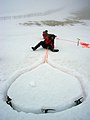 A Snow Bollard on Meall Odhar - geograph.org.uk - 774915.jpg 480 × 640; 35 KB
-
 Along the ridge from An Lairig - geograph.org.uk - 384214.jpg 640 × 480; 180 KB
-
 Alpine Lady's Mantle and Wild Thyme - geograph.org.uk - 531356.jpg 640 × 426; 103 KB
-
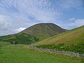
 Ben Gulabin - geograph.org.uk - 94060.jpg 640 × 481; 113 KB
-
 Ben Gulabin from Creag an Dubh Shluic - geograph.org.uk - 387193.jpg 640 × 480; 62 KB
-
 Ben Gulabin Plateau - geograph.org.uk - 78807.jpg 640 × 418; 56 KB
-
 Bridge ^ Kirk, Spittal of Glenshee - geograph.org.uk - 2259181.jpg 800 × 553; 410 KB
-
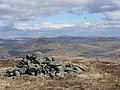 Cairn on Meall Uaine. - geograph.org.uk - 416158.jpg 640 × 480; 74 KB
-
 Car park, looking south, Glenshee - geograph.org.uk - 2276708.jpg 3,648 × 2,736; 2.19 MB
-
 Carn Mor hillside - geograph.org.uk - 1460412.jpg 640 × 427; 83 KB
-
 Church at the Spittal - geograph.org.uk - 78209.jpg 640 × 480; 85 KB
-
 Devilselbow2009.jpg 640 × 480; 100 KB
-
 Duchray Hill - west ridge - geograph.org.uk - 484598.jpg 640 × 424; 67 KB
-
 Duchray Hill boundary wall - geograph.org.uk - 484618.jpg 640 × 394; 65 KB
-
 Fahrt durch die Highlands bei Glenshee (26840785369).jpg 1,920 × 1,275; 614 KB
-
 Fahrt durch die Highlands bei Glenshee (37729426915).jpg 1,920 × 1,275; 828 KB
-
 Fahrt durch die Highlands bei Glenshee (37729427065).jpg 1,920 × 1,275; 369 KB
-
 Fahrt durch die Highlands bei Glenshee (37729427485).jpg 1,920 × 1,275; 751 KB
-
 Fahrt durch die Highlands bei Glenshee (37729427785).jpg 1,920 × 1,275; 515 KB
-
 Fahrt durch die Highlands bei Glenshee (37729429605).jpg 1,920 × 1,275; 443 KB
-
 Glacial Erratic, Gleann Taitneach - geograph.org.uk - 229443.jpg 640 × 480; 85 KB
-
 Glen Shee near Blacklunans - geograph.org.uk - 712885.jpg 640 × 480; 79 KB
-
 Glenshee - geograph.org.uk - 2259082.jpg 800 × 509; 365 KB
-
 Glenshee from the Spittal.jpg 640 × 419; 46 KB
-
 Glenshee Manse Cottage.jpg 4,592 × 3,448; 8.66 MB
-
 Inveredrie - geograph.org.uk - 230108.jpg 640 × 480; 49 KB
-
 Leaving Spittal of Glenshee eastwards - geograph.org.uk - 1135162.jpg 640 × 490; 102 KB
-
-
 Moraine around the Shee Water - geograph.org.uk - 551709.jpg 640 × 480; 55 KB
-
 Mount Blair Lodge - geograph.org.uk - 363253.jpg 640 × 480; 121 KB
-
 Ordnance Survey One-Inch Sheet 49 Blairgowrie, Published 1958 2.jpg 8,610 × 10,668; 19.76 MB
-
 Ordnance Survey One-Inch Sheet 49 Blairgowrie, Published 1958.jpg 8,241 × 9,880; 11.46 MB
-
 Shooting hut - geograph.org.uk - 620567.jpg 640 × 485; 74 KB
-
 Site of glacial lake - geograph.org.uk - 230078.jpg 640 × 487; 75 KB
-
 Snow in Glenshee - geograph.org.uk - 2174109.jpg 413 × 640; 23 KB
-
 Spittal bridge and Ben Gulabin - geograph.org.uk - 384476.jpg 640 × 333; 181 KB
-
 Spittal of Glenshee - geograph.org.uk - 78203.jpg 640 × 480; 62 KB
-
 Spittal of Glenshee's area on summer - panoramio.jpg 4,896 × 3,672; 7.99 MB
-
 The Highlands (in one photo) - geograph.org.uk - 46063.jpg 640 × 480; 86 KB
-
 View towards Ben Gulabin - geograph.org.uk - 384695.jpg 640 × 480; 60 KB
-
 A93 towards Spittal of Glenshee - geograph.org.uk - 1454871.jpg 640 × 482; 106 KB
-
 A93, looking north - geograph.org.uk - 1502783.jpg 640 × 480; 83 KB
-
 Abandoned potato spinner at Kerrow - geograph.org.uk - 1151736.jpg 640 × 480; 79 KB
-
 Above Gleann Beag - geograph.org.uk - 1453560.jpg 640 × 480; 105 KB
-
 Above the Allt a Mhadaidh - geograph.org.uk - 1143520.jpg 640 × 480; 98 KB
-
 Across the Allt a' Garbh-choire - geograph.org.uk - 492102.jpg 640 × 480; 144 KB
-
 Allt a' Ghlinne Bhig, Glen Shee - geograph.org.uk - 554618.jpg 640 × 480; 89 KB
-
 Allt a'Choire Dhomhain - geograph.org.uk - 1493967.jpg 480 × 640; 106 KB
-
 Allt Coolah - geograph.org.uk - 9860.jpg 640 × 453; 48 KB
-
 Allt Doire nan Eun - geograph.org.uk - 46089.jpg 640 × 480; 101 KB
-
 Allt Easgaidh - geograph.org.uk - 69874.jpg 480 × 640; 125 KB
-
 Allt Elrig looking southwest - geograph.org.uk - 9310.jpg 480 × 640; 126 KB
-
 Allt Elrig tributary - geograph.org.uk - 490306.jpg 640 × 402; 57 KB
-
 Allt Mor - geograph.org.uk - 1134602.jpg 640 × 427; 235 KB
-
 Allt-an-Buie, House - geograph.org.uk - 1134488.jpg 640 × 421; 189 KB
-
 Balancing boulders - geograph.org.uk - 1502776.jpg 640 × 480; 140 KB
-
 Ben Earb - geograph.org.uk - 46047.jpg 640 × 480; 76 KB
-
 Ben Earb Trig Point - geograph.org.uk - 384216.jpg 640 × 480; 75 KB
-
 Ben Gulabin - geograph.org.uk - 543418.jpg 640 × 475; 64 KB
-

-

-
 Boundary fence - geograph.org.uk - 237926.jpg 480 × 640; 78 KB
-
 Boys will be boys - geograph.org.uk - 254143.jpg 640 × 401; 87 KB
-
 Bridge over Allt an Daimh - geograph.org.uk - 227204.jpg 640 × 489; 140 KB
-
 Bridge over Glen Lochsie Burn - geograph.org.uk - 1504107.jpg 640 × 480; 95 KB
-
 Broughdearg, Glenshee - geograph.org.uk - 484649.jpg 640 × 404; 70 KB
-

-
 Cage trap - geograph.org.uk - 228006.jpg 640 × 480; 69 KB
-
 Carn Bhinnein 917 m - geograph.org.uk - 91287.jpg 640 × 427; 137 KB
-
 Carn Bhinnein from northwest - geograph.org.uk - 490267.jpg 640 × 400; 60 KB
-
 Carn Mor - geograph.org.uk - 9851.jpg 640 × 402; 54 KB
-
 Cast antler - geograph.org.uk - 394387.jpg 480 × 640; 192 KB
-
 Clais Bheag. - geograph.org.uk - 73931.jpg 640 × 377; 62 KB
-
 Coire an Laoigh - geograph.org.uk - 394341.jpg 640 × 480; 194 KB
-
 Coire Bhuraich - geograph.org.uk - 394336.jpg 640 × 480; 191 KB
-
 Coire Shith - geograph.org.uk - 9811.jpg 640 × 426; 66 KB
-

-
 Craig of Runavey - geograph.org.uk - 227977.jpg 640 × 480; 69 KB
-
 Craigenloch Hill - geograph.org.uk - 236746.jpg 640 × 480; 163 KB
-
 Creag an Dubh Shluic - geograph.org.uk - 384227.jpg 640 × 480; 194 KB
-
 Creag Bhreac eastside - geograph.org.uk - 490402.jpg 640 × 399; 44 KB
-
 Creag Dallaig - geograph.org.uk - 69884.jpg 480 × 640; 116 KB
-
 Creag Dhubh - geograph.org.uk - 110971.jpg 640 × 425; 66 KB
-
 Creag Lamhaich - geograph.org.uk - 482902.jpg 640 × 482; 91 KB
-
 Creag nan Eun - geograph.org.uk - 650650.jpg 640 × 426; 77 KB
-
 Deer grazing in Corrie on Ben Gulabin - geograph.org.uk - 9089.jpg 640 × 480; 106 KB
-
 Drainage ditches on Lamh Dearg - geograph.org.uk - 746240.jpg 640 × 480; 81 KB
-
 Drumfork Bridge - geograph.org.uk - 746202.jpg 640 × 480; 82 KB
-
 Drumore drive end - geograph.org.uk - 712935.jpg 640 × 480; 109 KB
-
 Drumturn Burn - geograph.org.uk - 712709.jpg 640 × 480; 54 KB
-
 East slope of Ben Earb - geograph.org.uk - 384206.jpg 480 × 640; 73 KB
-
 Fallen arches - Drumfork - geograph.org.uk - 713748.jpg 640 × 480; 117 KB
-
 Fashilloch Burn in Glen Brighty - geograph.org.uk - 236573.jpg 640 × 480; 102 KB
-
 Fence - geograph.org.uk - 384269.jpg 640 × 480; 77 KB
-
 Fence and wall - geograph.org.uk - 416203.jpg 640 × 480; 80 KB
-
 Field boundaries near Whitehouse - geograph.org.uk - 712907.jpg 640 × 480; 121 KB
-
 Ford, Ben Gulabin - geograph.org.uk - 554613.jpg 640 × 480; 144 KB
-
 Forest track - geograph.org.uk - 384350.jpg 640 × 480; 75 KB
-
 Forest, Drumore - geograph.org.uk - 712896.jpg 640 × 480; 70 KB
-
 Glas Choire Mhor - geograph.org.uk - 511411.jpg 640 × 480; 145 KB
-
 Glas Tulaichean path - geograph.org.uk - 69840.jpg 640 × 480; 113 KB
-
 Glas Tulaichean southeast ridge - geograph.org.uk - 490359.jpg 640 × 384; 49 KB
-

-
 Gleann Beag - geograph.org.uk - 8546.jpg 640 × 480; 128 KB
-
 Gleann Taitneach - geograph.org.uk - 69871.jpg 640 × 480; 111 KB
-
 Gleann Taitneach - geograph.org.uk - 69878.jpg 640 × 480; 127 KB
-
 Gleann Taitneach - geograph.org.uk - 69883.jpg 640 × 480; 94 KB
-
 Glen Lochsie - geograph.org.uk - 384511.jpg 640 × 480; 189 KB
-
 Glen Lochsie - geograph.org.uk - 46032.jpg 640 × 480; 84 KB
-
 Glen Lochsie Burn - geograph.org.uk - 69867.jpg 640 × 480; 135 KB
-
 Glen Lochsie Lodge - geograph.org.uk - 9029.jpg 640 × 480; 109 KB
-
 Glen Lochsie looking northwest - geograph.org.uk - 9304.jpg 640 × 480; 81 KB
-
 Glen Lochsie. - geograph.org.uk - 73935.jpg 640 × 413; 92 KB
-
 Glen Shee - geograph.org.uk - 46042.jpg 640 × 480; 92 KB
-
 Glen Taitneach looking north - geograph.org.uk - 18004.jpg 640 × 480; 68 KB
-
 Glen Taitneach. - geograph.org.uk - 73936.jpg 640 × 423; 61 KB
-
 Glenlochsie Lodge - geograph.org.uk - 705385.jpg 638 × 640; 107 KB
-
 Glenlochsie Lodge - geograph.org.uk - 9268.jpg 640 × 480; 87 KB
-
 Glenlochsie Lodge. - geograph.org.uk - 73934.jpg 640 × 414; 94 KB
-
 Grassy area above Drumfork - geograph.org.uk - 712720.jpg 637 × 440; 77 KB
-
 Heading back to Dalmunzie House - geograph.org.uk - 705461.jpg 640 × 409; 63 KB
-
 Heather and Peat - geograph.org.uk - 394314.jpg 640 × 480; 183 KB
-
 Heather bank, evening light - geograph.org.uk - 227995.jpg 640 × 460; 104 KB
-
 Heather in Bloom - geograph.org.uk - 46058.jpg 640 × 480; 109 KB
-
 Heather in bloom, Glen Shee - geograph.org.uk - 227189.jpg 640 × 480; 139 KB
-
 High peaty moorland - geograph.org.uk - 394306.jpg 640 × 480; 185 KB
-
 Hill Cafe - geograph.org.uk - 106895.jpg 640 × 480; 141 KB
-
 Hillside above Lair - geograph.org.uk - 746102.jpg 640 × 480; 75 KB
-
 Hillside below Carn Dubh - geograph.org.uk - 551712.jpg 640 × 480; 60 KB
-
 Lamh Dearg - geograph.org.uk - 746116.jpg 640 × 480; 78 KB
-
 Lichen-covered stile - geograph.org.uk - 746166.jpg 512 × 640; 101 KB
-
 Loch Vrotachan - geograph.org.uk - 648042.jpg 640 × 409; 72 KB
-
 Looking down into Glen Lochsie - geograph.org.uk - 384276.jpg 640 × 480; 195 KB
-
 Looking down to Gleann Beag - geograph.org.uk - 650140.jpg 640 × 480; 52 KB
-
 Meall a Choire Bhuidhe - geograph.org.uk - 384325.jpg 640 × 480; 191 KB
-
 Meall a' Mhuilt - geograph.org.uk - 46056.jpg 640 × 480; 73 KB
-
 Meall Easganan - geograph.org.uk - 394334.jpg 640 × 480; 181 KB
-
 Meall Gorm - geograph.org.uk - 650618.jpg 426 × 640; 84 KB
-
 Meall Odhar - geograph.org.uk - 318399.jpg 600 × 450; 45 KB
-

-
 Meall Odhar summit - geograph.org.uk - 394320.jpg 640 × 480; 194 KB
-
 Meall Ruigh Mor Thearlaich - geograph.org.uk - 69839.jpg 640 × 480; 99 KB
-
 Meall Uaine - geograph.org.uk - 46038.jpg 640 × 480; 107 KB
-
 Moorland - geograph.org.uk - 230103.jpg 640 × 480; 78 KB
-
 Moorland - geograph.org.uk - 384294.jpg 640 × 480; 76 KB
-
 Moorland - geograph.org.uk - 384704.jpg 640 × 480; 63 KB
-
 Moorland hillside - geograph.org.uk - 124162.jpg 640 × 480; 68 KB
-
 Moorland pool - geograph.org.uk - 416190.jpg 640 × 480; 78 KB
-
 Mountain Hare (Lepus timidus) - geograph.org.uk - 559324.jpg 640 × 416; 53 KB
-
 Muddy pool below Carn an Righ - geograph.org.uk - 69818.jpg 640 × 480; 130 KB
-
 NE ridge of Carn nan Sac - geograph.org.uk - 103347.jpg 640 × 480; 70 KB
-
 New Road, Carn Mor - geograph.org.uk - 9846.jpg 640 × 480; 88 KB
-
 North of Meall a Choire Bhuidhe - geograph.org.uk - 384491.jpg 640 × 480; 192 KB
-
 NW from Carn nan Sac - geograph.org.uk - 103341.jpg 640 × 480; 76 KB
-
 On Meall Uaine - geograph.org.uk - 416128.jpg 640 × 480; 67 KB
-
 Path below Mam nan Carn - geograph.org.uk - 69830.jpg 640 × 480; 134 KB
-
 Path to Glas Tulaichean - geograph.org.uk - 69821.jpg 640 × 480; 115 KB
-
 Path up Ben Gulabin - geograph.org.uk - 554610.jpg 480 × 640; 132 KB
-
 Peat hag on Meall Uaine - geograph.org.uk - 416145.jpg 640 × 480; 79 KB
-
 Ptarmigan (Lagopus mutus) - geograph.org.uk - 419263.jpg 640 × 480; 21 KB
-
 Red deer on Meall Odhar - geograph.org.uk - 416181.jpg 640 × 480; 70 KB
-
 Reeds below Meall Odhar - geograph.org.uk - 394322.jpg 640 × 480; 193 KB
-
 Reeds in marshy valley - geograph.org.uk - 124331.jpg 640 × 480; 147 KB
-
 Ridge - geograph.org.uk - 387172.jpg 640 × 480; 73 KB
-
 Ridge from Creag an Dubh Shluic - geograph.org.uk - 384240.jpg 640 × 480; 192 KB
-
 Ridge North of Creag Lamhaich - geograph.org.uk - 477342.jpg 640 × 399; 55 KB
-
 Ridge top pool - geograph.org.uk - 384220.jpg 640 × 480; 186 KB
-
 Shed NW of Carn Mor - geograph.org.uk - 477358.jpg 640 × 482; 71 KB
-
 Sheep - geograph.org.uk - 492069.jpg 640 × 496; 174 KB
-
 Sheep in Gleann Beag - geograph.org.uk - 551713.jpg 640 × 360; 51 KB
-
 Sheep in Glen Lochsie - geograph.org.uk - 384600.jpg 640 × 491; 191 KB
-
 Sheep in Glen Shee - geograph.org.uk - 227367.jpg 640 × 480; 129 KB
-

-
 Ski huts in summer - geograph.org.uk - 41028.jpg 640 × 480; 70 KB
-
 Slopes of Creag nan Eun - geograph.org.uk - 650640.jpg 426 × 640; 57 KB
-
 Southeast along the ridge - geograph.org.uk - 384257.jpg 640 × 480; 194 KB
-
 Southern ridge of Ben Earb - geograph.org.uk - 384228.jpg 640 × 480; 53 KB
-
 Spittal from Coire Lairige - geograph.org.uk - 384207.jpg 640 × 480; 185 KB
-
 Spittal of Glen Shee - geograph.org.uk - 91328.jpg 640 × 481; 105 KB
-
 Spittal of Glen Shee Bridge - geograph.org.uk - 91317.jpg 640 × 481; 147 KB
-
 Spittal of Glen Shee Bridge - geograph.org.uk - 94043.jpg 640 × 481; 128 KB
-
 Spittal of Glenshee - geograph.org.uk - 387220.jpg 640 × 480; 57 KB
-
 Spittal of Glenshee - geograph.org.uk - 474367.jpg 640 × 163; 33 KB
-
 Spittal of Glenshee - geograph.org.uk - 7012.jpg 619 × 411; 106 KB
-
 Split boulder - geograph.org.uk - 384252.jpg 640 × 480; 77 KB
-
 Standing stone at Spittal of Glenshee - geograph.org.uk - 36204.jpg 640 × 480; 86 KB
-

-
 Stile on Coire Lairige - geograph.org.uk - 387207.jpg 640 × 480; 75 KB
-
 Summit of Carn Mor - geograph.org.uk - 9847.jpg 640 × 434; 67 KB
-
 Switchback ridge by Ben Earb - geograph.org.uk - 384249.jpg 640 × 480; 193 KB
-
 Terminal moraine - geograph.org.uk - 230042.jpg 640 × 480; 74 KB
-
 The Coolah - geograph.org.uk - 9857.jpg 640 × 450; 59 KB
-
 The head of Gleann Beag - geograph.org.uk - 650634.jpg 640 × 426; 44 KB
-
 The head of Gleann Beag - geograph.org.uk - 650647.jpg 640 × 426; 104 KB
-
 The Spittal Of Glenshee - geograph.org.uk - 78206.jpg 640 × 480; 133 KB
-
 Top art - geograph.org.uk - 254140.jpg 640 × 341; 78 KB
-
 Track - geograph.org.uk - 384310.jpg 480 × 640; 78 KB
-
 Track and hut - geograph.org.uk - 41434.jpg 640 × 480; 65 KB
-
 Track at the roadside in Glen Shee - geograph.org.uk - 551780.jpg 640 × 480; 62 KB
-
 Track up Ben Gulabin - geograph.org.uk - 554616.jpg 640 × 480; 99 KB


.jpg)
.jpg)
.jpg)
.jpg)
.jpg)
.jpg)


_-_geograph.org.uk_-_46063.jpg)


_-_geograph.org.uk_-_559324.jpg)


_-_geograph.org.uk_-_419263.jpg)


