Category:South Thoresby
Jump to navigation
Jump to search
English: South Thoresby is a village and civil parish in East Lindsey in the county of Lincolnshire.
village and civil parish in Lincolnshire, United Kingdom  | |||||
| Upload media | |||||
| Instance of | |||||
|---|---|---|---|---|---|
| Location | East Lindsey, Lincolnshire, East Midlands, England | ||||
| Said to be the same as | South Thoresby (Wikimedia duplicated page, civil parish) | ||||
| official website | |||||
 | |||||
Subcategories
This category has only the following subcategory.
S
Media in category "South Thoresby"
The following 146 files are in this category, out of 146 total.
-
 A muddy Public Bridleway to Sutterby Holt - geograph.org.uk - 2910165.jpg 1,280 × 853; 418 KB
-
 A16 junction by Calceby Beck - geograph.org.uk - 3859384.jpg 640 × 427; 81 KB
-
 A16 Junctions - geograph.org.uk - 3571856.jpg 3,696 × 2,448; 2.27 MB
-
 A16 near Calceby - geograph.org.uk - 1934728.jpg 640 × 480; 70 KB
-

-
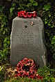
 Aircrew memorial at Ulceby Cross - geograph.org.uk - 6412065.jpg 4,608 × 3,072; 5.63 MB
-
 Arriving at South Thoresby - geograph.org.uk - 3859505.jpg 640 × 427; 84 KB
-
 Bridleway from Driby Top to Haugh - geograph.org.uk - 3977323.jpg 640 × 427; 62 KB
-

-
 Bridleway to Calceby - geograph.org.uk - 3862683.jpg 640 × 427; 72 KB
-

-
 Calceby cross roads on A16 south - geograph.org.uk - 3004238.jpg 640 × 433; 82 KB
-
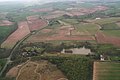
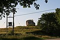
 Calceby DMV site, aerial 2018 (1) - geograph.org.uk - 5981761.jpg 800 × 533; 88 KB
-
 Calceby DMV site, aerial 2018 (2) - geograph.org.uk - 5981768.jpg 640 × 427; 78 KB
-
 Calceby farmhouse - geograph.org.uk - 980148.jpg 640 × 480; 99 KB
-
 Calceby Manor and copper beech tree - geograph.org.uk - 3544668.jpg 640 × 427; 100 KB
-
 Calceby Marsh Site - geograph.org.uk - 1951193.jpg 800 × 533; 147 KB
-
 Calceby Marsh Site information board - geograph.org.uk - 1951199.jpg 800 × 533; 80 KB
-

-

-

-

-
-
 Calceby, lake and caravan site - geograph.org.uk - 3451444.jpg 640 × 427; 58 KB
-
 Cattle Grid on road from Driby to the A16 - geograph.org.uk - 3068687.jpg 2,256 × 1,504; 2.32 MB
-
 Clearly marked footpath to Driby - geograph.org.uk - 4045055.jpg 640 × 427; 75 KB
-
 Crossing the beck by Driby Wood - geograph.org.uk - 3544652.jpg 640 × 427; 120 KB
-

-

-

-
-

-

-

-
 Disused pit between Driby and Calceby - geograph.org.uk - 3544653.jpg 640 × 427; 105 KB
-
 Door in a wall - geograph.org.uk - 3459504.jpg 640 × 427; 103 KB
-

-
 Driby DMV, aerial 2018 (1) - geograph.org.uk - 5965062.jpg 640 × 397; 49 KB
-
 Driby DMV, aerial 2018 (2) - geograph.org.uk - 5965065.jpg 1,024 × 600; 121 KB
-
 Driby DMV, aerial 2019 - geograph.org.uk - 6333986.jpg 800 × 533; 79 KB
-
 Driby Medieval Village, aerial 2014 - geograph.org.uk - 3800936.jpg 427 × 640; 52 KB
-
 Driby St. Michael - geograph.org.uk - 3544629.jpg 640 × 427; 89 KB
-
 Driby St. Michael - geograph.org.uk - 3544630.jpg 640 × 427; 124 KB
-
 Driby Top, aerial 2014 - geograph.org.uk - 3835327.jpg 640 × 427; 45 KB
-
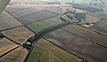
 Driby, aerial 2014 - geograph.org.uk - 3800397.jpg 640 × 427; 51 KB
-

-

-
 Earthworks at Driby - geograph.org.uk - 3544647.jpg 640 × 427; 63 KB
-
 Entrance to Manor Farm, South Thoresby - geograph.org.uk - 3102308.jpg 2,256 × 1,504; 2.19 MB
-
 Entrance to Public Footpath with stile - geograph.org.uk - 3102310.jpg 1,504 × 2,256; 2.5 MB
-
 Farm at Driby - geograph.org.uk - 3544636.jpg 640 × 427; 53 KB
-
 Farm track off Greenfield Lane - geograph.org.uk - 3359930.jpg 1,024 × 768; 171 KB
-
 Feed mill on Driby Top - geograph.org.uk - 3977022.jpg 640 × 427; 51 KB
-
 Field and Brambles - geograph.org.uk - 233130.jpg 640 × 480; 111 KB
-
 Field edge farm track - geograph.org.uk - 6073119.jpg 4,000 × 3,000; 3.83 MB
-

-

-
-
 Footpath off Bluestone Heath Road - geograph.org.uk - 3552588.jpg 2,256 × 1,504; 2.71 MB
-
 Gate into Furze Closes - geograph.org.uk - 3544852.jpg 640 × 427; 138 KB
-

-
 Haugh Lane near to Haugh Bottom Barn - geograph.org.uk - 6073442.jpg 3,856 × 2,892; 2.21 MB
-
 Haugh, aerial 2016 - geograph.org.uk - 5229013.jpg 427 × 640; 44 KB
-

-
 Houses in the hollow by Calceby Beck - geograph.org.uk - 3859397.jpg 640 × 427; 96 KB
-
 Junction of roads near to Calceby Manor - geograph.org.uk - 6073160.jpg 4,000 × 3,000; 3.19 MB
-
 Lane towards St Michael's church, Driby - geograph.org.uk - 3102226.jpg 2,256 × 1,504; 2.05 MB
-
 Lime Pits Farm - geograph.org.uk - 3459466.jpg 640 × 427; 65 KB
-
 Marsh Marigolds in the wetlands - geograph.org.uk - 3457971.jpg 640 × 427; 118 KB
-
 Medieval village of Calceby - geograph.org.uk - 3544665.jpg 640 × 427; 62 KB
-
 Memorial at Ulceby Cross - geograph.org.uk - 3179124.jpg 2,592 × 3,872; 2.45 MB
-
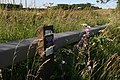
 Minor road leading to Sutterby - geograph.org.uk - 4150094.jpg 1,600 × 1,069; 377 KB
-
 Moated site at Driby - geograph.org.uk - 3544640.jpg 640 × 427; 70 KB
-
-

-

-

-
 Not dry at Driby, No.1 water borehole - geograph.org.uk - 3544624.jpg 640 × 427; 113 KB
-

-
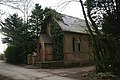 Old chapel in South Thoresby - geograph.org.uk - 3859510.jpg 640 × 427; 86 KB
-

-
 Old windpump - geograph.org.uk - 1951168.jpg 566 × 800; 70 KB
-

-
 Outbuilding at Calceby Manor - geograph.org.uk - 3544671.jpg 640 × 427; 102 KB
-

-
 Pathway through crops west of Driby - geograph.org.uk - 2150599.jpg 1,024 × 768; 252 KB
-
 Poppies in oilseed rape - geograph.org.uk - 3544829.jpg 640 × 427; 91 KB
-
 Postbox and farm at Driby - geograph.org.uk - 3544635.jpg 640 × 427; 69 KB
-
-
 Puddles on a Farm Track - geograph.org.uk - 2910172.jpg 1,280 × 853; 310 KB
-

-
 Road at Calceby - geograph.org.uk - 6073147.jpg 4,000 × 3,000; 3.02 MB
-
 Road entering South Thoresby - geograph.org.uk - 6073139.jpg 4,000 × 3,000; 4.68 MB
-
 Road from Haugh Manor joins the A16 - geograph.org.uk - 3068697.jpg 2,256 × 1,504; 1.7 MB
-
 Road in South Thoresby - geograph.org.uk - 6073438.jpg 4,000 × 3,000; 4.03 MB
-
 Road out of Driby - geograph.org.uk - 3544642.jpg 640 × 427; 77 KB
-

-
 Road to Public Weighbridge - geograph.org.uk - 3070171.jpg 2,256 × 1,504; 1.98 MB
-
 Road to South Thoresby - geograph.org.uk - 3552575.jpg 2,256 × 1,504; 2.38 MB
-

-
 Smith's garage, South Thoresby - geograph.org.uk - 3859455.jpg 800 × 533; 120 KB
-

-
 South Thoresby Chalk Quarry - geograph.org.uk - 3862697.jpg 1,024 × 683; 220 KB
-
 South Thoresby Chalk Quarry - geograph.org.uk - 3862702.jpg 640 × 427; 91 KB
-

-
 South Thoresby junction - geograph.org.uk - 1738562.jpg 640 × 426; 137 KB
-
 South Thoresby limestone quarry - geograph.org.uk - 3087556.jpg 640 × 427; 71 KB
-

-

-
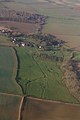
 South Thoresby, aerial 2016 - geograph.org.uk - 5011515.jpg 640 × 427; 45 KB
-

-

-
 South Thoresby, the old and the new - geograph.org.uk - 3459469.jpg 640 × 427; 105 KB
-
 South Thoresby, the old and the new - geograph.org.uk - 3459470.jpg 640 × 427; 67 KB
-
 Stables at the rear of the Vine Inn - geograph.org.uk - 1003696.jpg 640 × 480; 109 KB
-
 Start of the South Thoresby Walk - geograph.org.uk - 1003727.jpg 480 × 640; 68 KB
-
 Stile at Calceby - geograph.org.uk - 581266.jpg 640 × 480; 112 KB
-
 Stile by River - geograph.org.uk - 683151.jpg 640 × 480; 115 KB
-
 The Former Vine Inn - geograph.org.uk - 6206908.jpg 1,024 × 576; 124 KB
-
 The junction with Greenfield Lane - geograph.org.uk - 3359912.jpg 1,024 × 768; 132 KB
-

-
 To Aby and Alford - geograph.org.uk - 1738568.jpg 640 × 426; 117 KB
-
 Trout lake near Belleau - geograph.org.uk - 3451549.jpg 640 × 427; 53 KB
-

-
 Vine Inn, South Thoresby - geograph.org.uk - 1003681.jpg 640 × 480; 124 KB
-

-

-

-

-

-
 Woodland pool - geograph.org.uk - 1738574.jpg 640 × 426; 127 KB
-
 Belleau Bridge - geograph.org.uk - 394374.jpg 640 × 480; 148 KB
-
 Bridleway to Calceby - geograph.org.uk - 581121.jpg 640 × 480; 116 KB
-
 Bridleway to Haugh - geograph.org.uk - 581088.jpg 640 × 480; 103 KB
-
 Bridleway to Haugh - geograph.org.uk - 581089.jpg 640 × 480; 145 KB
-
 Bridleway to Haugh - geograph.org.uk - 581092.jpg 640 × 480; 119 KB
-
 Bridleway to Haugh - geograph.org.uk - 581097.jpg 640 × 480; 141 KB
-
 Bridleway to Haugh - geograph.org.uk - 581104.jpg 640 × 480; 137 KB
-
 Bridleway to Haugh - geograph.org.uk - 581107.jpg 640 × 480; 98 KB
-
 Bridleway to Haugh - geograph.org.uk - 581114.jpg 640 × 480; 95 KB
-
 Clouds and Field - geograph.org.uk - 235585.jpg 640 × 480; 118 KB
-
 Footpath to Belleau - geograph.org.uk - 769425.jpg 640 × 427; 87 KB
-
 Former Magic Wand Factory - geograph.org.uk - 482519.jpg 640 × 482; 113 KB
-
 Lane to Calceby - geograph.org.uk - 482530.jpg 640 × 482; 153 KB
-
 Road out of Calceby - geograph.org.uk - 581272.jpg 640 × 480; 78 KB
-
 Sunshine and Storm Clouds - geograph.org.uk - 235588.jpg 640 × 480; 125 KB


_-_geograph.org.uk_-_5981761.jpg)
_-_geograph.org.uk_-_5981768.jpg)


_-_geograph.org.uk_-_3459616.jpg)
_-_geograph.org.uk_-_3459626.jpg)
_-_geograph.org.uk_-_3459629.jpg)
_-_geograph.org.uk_-_3459634.jpg)
_-_geograph.org.uk_-_3459639.jpg)


_-_geograph.org.uk_-_6151569.jpg)
_-_geograph.org.uk_-_6151571.jpg)


_-_geograph.org.uk_-_5965062.jpg)
_-_geograph.org.uk_-_5965065.jpg)


_-_geograph.org.uk_-_6334118.jpg)


_at_Calceby_-_geograph.org.uk_-_3544672.jpg)
_at_Calceby_-_geograph.org.uk_-_3544814.jpg)


_near_Belleau_Bridge_-_geograph.org.uk_-_3459453.jpg)
_near_Belleau_Bridge_-_geograph.org.uk_-_3459456.jpg)


