Category:South Ormsby cum Ketsby
Jump to navigation
Jump to search
English: South Ormsby cum Ketsby is a civil parish in the East Lindsey district, in the county of Lincolnshire, England.
civil parish in East Lindsey, Lincolnshire, England | |||||
| Upload media | |||||
| Instance of | |||||
|---|---|---|---|---|---|
| Location | East Lindsey, Lincolnshire, East Midlands, England | ||||
 | |||||
Media in category "South Ormsby cum Ketsby"
The following 87 files are in this category, out of 87 total.
-

-

-
 Barn at Mill Farm, Ketsby - geograph.org.uk - 3861564.jpg 1,024 × 683; 158 KB
-
 Barns at Harden's Gap - geograph.org.uk - 3545944.jpg 640 × 427; 47 KB
-
 Bluestone Heath Road - geograph.org.uk - 3102238.jpg 1,504 × 2,256; 2.45 MB
-

-
 Bridleway north from Harden's Gap - geograph.org.uk - 3545959.jpg 640 × 427; 50 KB
-

-
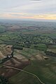
 Brinkhill, aerial 2017 - geograph.org.uk - 5391173.jpg 1,024 × 683; 118 KB
-
 Calceby DMV site, aerial 2018 (1) - geograph.org.uk - 5981761.jpg 800 × 533; 88 KB
-
-

-
-

-
 Crop Fields near South Ormsby - geograph.org.uk - 3068675.jpg 2,256 × 1,504; 2.2 MB
-

-

-
 Crop marks in a field near Ketsby, aerial 2018 - geograph.org.uk - 5928295.jpg 1,024 × 683; 107 KB
-

-
 Dropping down to Ketsby Mill - geograph.org.uk - 3861571.jpg 1,024 × 683; 282 KB
-
 Dutch barn at Mill Farm - geograph.org.uk - 1933363.jpg 3,648 × 2,736; 2.24 MB
-

-

-

-
 East of Snake Holt - geograph.org.uk - 4831549.jpg 5,047 × 3,672; 4.92 MB
-

-
 Exit gate, South Ormsby Park - geograph.org.uk - 3545554.jpg 640 × 427; 114 KB
-
 Farmland W and NW of Walmsgate, aerial 2020 - geograph.org.uk - 6361373.jpg 846 × 1,024; 164 KB
-

-
 Footpath up Warden Hill - geograph.org.uk - 803766.jpg 640 × 428; 129 KB
-
 Gable end relief, South Ormsby - geograph.org.uk - 1933412.jpg 3,648 × 2,736; 2.24 MB
-
 Gate into Furze Closes - geograph.org.uk - 3544852.jpg 640 × 427; 138 KB
-

-

-
 Harden's Gap - geograph.org.uk - 3545982.jpg 640 × 427; 36 KB
-
 Harden's Gap, after the rain storm - geograph.org.uk - 3972187.jpg 640 × 427; 45 KB
-
 Harden's Gap, after the rain storm - geograph.org.uk - 3972188.jpg 640 × 427; 58 KB
-
 Harden's Gap, No.2 - geograph.org.uk - 3545952.jpg 640 × 427; 48 KB
-
 Harrington, aerial 2017 - geograph.org.uk - 5391130.jpg 640 × 427; 49 KB
-

-

-
-
 Junction for Ketsby from A16 south - geograph.org.uk - 3004234.jpg 640 × 454; 70 KB
-

-
 Ketsby Top - geograph.org.uk - 2256605.jpg 640 × 427; 96 KB
-
 Ketsby Top - geograph.org.uk - 2256629.jpg 640 × 427; 81 KB
-
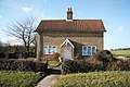 Lavender Cottage - geograph.org.uk - 2256634.jpg 640 × 427; 112 KB
-
 Mill Farm - geograph.org.uk - 2256638.jpg 640 × 427; 82 KB
-
 Moated site at Brinkhill, aerial 2018 - geograph.org.uk - 5846678.jpg 1,024 × 683; 134 KB
-
 New Plantation - geograph.org.uk - 803775.jpg 640 × 428; 119 KB
-
 Ordnance Survey Rivet - geograph.org.uk - 5481726.jpg 463 × 640; 135 KB
-
 Ormsby Hall, aerial 2018 (1) - geograph.org.uk - 5965021.jpg 640 × 427; 83 KB
-
 Ormsby Hall, aerial 2018 (2) - geograph.org.uk - 5965034.jpg 640 × 427; 66 KB
-
 Ormsby Hall, aerial 2018 (3) - geograph.org.uk - 5965031.jpg 640 × 427; 63 KB
-
 Ormsby Hall, aerial 2019 - geograph.org.uk - 6334070.jpg 1,024 × 683; 148 KB
-
 Ormsby Ring - geograph.org.uk - 1933384.jpg 3,648 × 2,736; 2.19 MB
-
 Ormsby Ring - geograph.org.uk - 1933392.jpg 3,648 × 2,736; 2.13 MB
-
 Parkland, South Ormsby - geograph.org.uk - 3545541.jpg 640 × 427; 74 KB
-
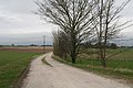
 Path to Brinkhill - geograph.org.uk - 3544861.jpg 640 × 427; 89 KB
-

-

-

-

-
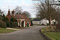
 Road junction and thatched cottage, South Ormesby (geograph 6595243).jpg 1,024 × 768; 252 KB
-
 Road to Ketsby - geograph.org.uk - 3553506.jpg 2,256 × 1,504; 2.71 MB
-
 Roman road east of Tetford, aerial 2018 - geograph.org.uk - 5839619.jpg 800 × 533; 102 KB
-

-
 South Ormsby Hall - geograph.org.uk - 3544947.jpg 640 × 427; 91 KB
-

-

-

-

-
 South Ormsby, aerial September 2018 - geograph.org.uk - 5964996.jpg 640 × 427; 61 KB
-
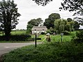
 South Ormsby, churchyard and park (geograph 6595456).jpg 1,024 × 768; 213 KB
-
 South Ormsby, School House and former school (geograph 6595452).jpg 1,024 × 768; 185 KB
-

-
-
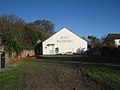 Swaby Village Hall - geograph.org.uk - 2159726.jpg 1,024 × 768; 165 KB
-

-
 The stream and land below Ketsby Mill - geograph.org.uk - 1933367.jpg 3,648 × 2,736; 2.2 MB
-
 The wheel and race at Ketsby Mill - geograph.org.uk - 1933421.jpg 3,648 × 2,736; 2.29 MB
-
 Track to Ketsby House Farm - geograph.org.uk - 3861566.jpg 640 × 427; 82 KB
-
 Track to The Rectory off Ormsby Ring - geograph.org.uk - 3536141.jpg 2,256 × 1,504; 2.6 MB
-

-

-
 White Pit, Swaby (2) - geograph.org.uk - 2159718.jpg 1,024 × 768; 163 KB
-


_-_geograph.org.uk_-_5981761.jpg)


_-_geograph.org.uk_-_5928309.jpg)
_-_geograph.org.uk_-_5929430.jpg)


_-_geograph.org.uk_-_6334118.jpg)


_-_geograph.org.uk_-_5965021.jpg)
_-_geograph.org.uk_-_5965034.jpg)
_-_geograph.org.uk_-_5965031.jpg)


.jpg)


_on_the_Bluestone_Heath_Road_-_geograph.org.uk_-_3972215.jpg)


.jpg)
.jpg)


_east_of_the_Bluestone_Heath_Road_at_South_Ormsby_-_geograph.org.uk_-_3861581.jpg)


_-_geograph.org.uk_-_2159718.jpg)
