Category:Sourton
Jump to navigation
Jump to search
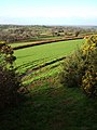
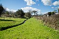
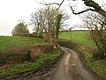
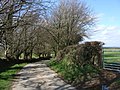
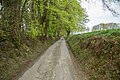
English: Sourton is a small village and civil parish in West Devon, England. It lies about south-west of Okehampton. It is at the north-western extremity of Dartmoor, a National Park of England and Wales and lies along the A386 road. Sourton Parish has a population of over 400.
village and civil parish in Devon, UK  | |||||
| Upload media | |||||
| Instance of | |||||
|---|---|---|---|---|---|
| Location | West Devon, Devon, South West England, England | ||||
 | |||||
Subcategories
This category has the following 4 subcategories, out of 4 total.
B
- Boasley Cross (1 F)
L
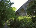
- Lake Viaduct (11 F)
- Lake, West Devon (5 F)
S
- St Thomas' church, Sourton (18 F)
Media in category "Sourton"
The following 200 files are in this category, out of 384 total.
(previous page) (next page)-
 A service station at Sourton Down - geograph.org.uk - 3489416.jpg 800 × 600; 80 KB
-
 A stream on Prewley Moor - geograph.org.uk - 1143876.jpg 640 × 480; 68 KB
-
 A30 bridging the A386 - geograph.org.uk - 3463018.jpg 640 × 480; 56 KB
-
 A30 south of Cowsen Down - geograph.org.uk - 3224594.jpg 3,648 × 2,048; 1.28 MB
-
 A30 southwest of Knowle - geograph.org.uk - 3224585.jpg 2,217 × 1,464; 543 KB
-
 A30 unnamed lane crosses north of Landymoor - geograph.org.uk - 3224600.jpg 3,648 × 2,048; 1.26 MB
-
 A30 westbound junction for A386 - geograph.org.uk - 3635200.jpg 1,839 × 1,093; 919 KB
-
 A3079 approaching crossroads - geograph.org.uk - 3664458.jpg 800 × 507; 56 KB
-
 A3079 at Ashbury Cross - geograph.org.uk - 5507699.jpg 1,600 × 1,200; 842 KB
-
 A3079 at Thorndon Cross - geograph.org.uk - 2781244.jpg 640 × 480; 107 KB
-
 A3079 bend ahead - geograph.org.uk - 3664446.jpg 1,695 × 1,023; 833 KB
-
 A3079 bridge at Thorndon Cross - geograph.org.uk - 4939599.jpg 1,600 × 1,067; 977 KB
-
 A3079 heading east - geograph.org.uk - 3634991.jpg 1,475 × 923; 621 KB
-
 A3079 Holsworthy Road - geograph.org.uk - 4109245.jpg 1,024 × 676; 165 KB
-
 A3079 Holsworthy Road towards Thorndon Cross - geograph.org.uk - 4154675.jpg 1,024 × 666; 127 KB
-
 A3079 west of Venndown Gates - geograph.org.uk - 5020009.jpg 1,600 × 1,068; 718 KB
-
 A386 at Bowerland Cross - geograph.org.uk - 3454051.jpg 1,024 × 768; 198 KB
-
 A386 Bowerland Road - geograph.org.uk - 3664378.jpg 1,664 × 1,138; 948 KB
-
 A386 heading north - geograph.org.uk - 3459011.jpg 640 × 480; 80 KB
-
 A386 heading north - geograph.org.uk - 3463001.jpg 640 × 480; 75 KB
-
 A386 heading north - geograph.org.uk - 3463011.jpg 640 × 480; 90 KB
-
 A386 heading north - geograph.org.uk - 3463016.jpg 640 × 480; 62 KB
-
 A386 heading through Sourton - geograph.org.uk - 3463009.jpg 640 × 480; 67 KB
-
 A386 heading towards Okehampton - geograph.org.uk - 3462997.jpg 640 × 480; 81 KB
-
 A386 in Lake - geograph.org.uk - 2895514.jpg 800 × 600; 343 KB
-
 A386 southbound towards the A30 - geograph.org.uk - 3664373.jpg 1,797 × 1,188; 1.16 MB
-
 Accommodation Bridge in West Bowerland Wood - geograph.org.uk - 4939594.jpg 1,600 × 1,067; 907 KB
-
 Across Prewley Moor - geograph.org.uk - 2437907.jpg 640 × 419; 244 KB
-
 An overgrown phone box at Thorndon Cross - geograph.org.uk - 5506588.jpg 1,600 × 1,200; 811 KB
-

-
 Approaching bridge at West Bowerland Wood - geograph.org.uk - 4939586.jpg 1,600 × 1,067; 827 KB
-
 Approaching Hardhill Cross - geograph.org.uk - 2778986.jpg 640 × 480; 99 KB
-
 Approaching Lake - geograph.org.uk - 6275947.jpg 4,032 × 3,024; 4.13 MB
-
 Approaching Lake Viaduct - geograph.org.uk - 2794454.jpg 800 × 600; 148 KB
-
 Approaching source of Crandford Brook - geograph.org.uk - 4263936.jpg 1,920 × 1,261; 745 KB
-
 Approaching Sourton Cross - geograph.org.uk - 6275972.jpg 4,032 × 3,024; 3.7 MB
-
 Approaching Stourton - geograph.org.uk - 6275955.jpg 4,032 × 3,024; 4 MB
-
 Ash tree at the moor's edge - geograph.org.uk - 4263692.jpg 1,920 × 2,560; 1.41 MB
-

-
 Bearslake Inn on the A386 at Lake - geograph.org.uk - 3483314.jpg 800 × 600; 121 KB
-
 Below Sourton Tors - geograph.org.uk - 320165.jpg 480 × 640; 103 KB
-
 Ben's Ponds - geograph.org.uk - 3512367.jpg 640 × 480; 126 KB
-

-
 Black Tor - geograph.org.uk - 15200.jpg 640 × 425; 108 KB
-
 Blank walls on the west side of Yelland Cottage - geograph.org.uk - 5021150.jpg 1,600 × 800; 532 KB
-
 Bluebells near Sourton - geograph.org.uk - 3512599.jpg 640 × 351; 56 KB
-
 Bluebells near Sourton - geograph.org.uk - 3512641.jpg 500 × 640; 126 KB
-
 Bluebells near Sourton - geograph.org.uk - 3512655.jpg 640 × 466; 115 KB
-
 Boasley Methodist chapel - geograph.org.uk - 364967.jpg 480 × 640; 115 KB
-
 Bowerland Road (A386) - geograph.org.uk - 3459027.jpg 640 × 480; 55 KB
-
 Bowerland Road - geograph.org.uk - 6275975.jpg 4,032 × 3,024; 3.58 MB
-
 Bridge and Signpost - geograph.org.uk - 5520113.jpg 1,024 × 768; 440 KB
-
 Bridge at Sourton - geograph.org.uk - 596486.jpg 640 × 480; 99 KB
-
 Bridge at Yelland - geograph.org.uk - 5020077.jpg 1,600 × 1,201; 691 KB
-
 Bridge between fields, near East Bowerland - geograph.org.uk - 5507674.jpg 1,200 × 1,600; 767 KB
-

-
 Bridge from West Bowerland Plantation to farmland - geograph.org.uk - 5507688.jpg 1,200 × 1,600; 802 KB
-
 Bridge on Granite Way - geograph.org.uk - 3512464.jpg 640 × 480; 89 KB
-
 Bridge over disused railway - geograph.org.uk - 1503672.jpg 640 × 407; 135 KB
-
 Bridge over old railway at Thorndon Cross - geograph.org.uk - 5506616.jpg 1,600 × 1,200; 857 KB
-
 Bridge over Pegasus Trail - geograph.org.uk - 5506633.jpg 1,600 × 1,200; 787 KB
-
 Bridge over the Cycle Track - geograph.org.uk - 5520057.jpg 1,024 × 768; 435 KB
-
 Bridge to West Bowerland - geograph.org.uk - 4939534.jpg 1,600 × 1,067; 771 KB
-
 Bridge, Sourton - geograph.org.uk - 3512836.jpg 640 × 451; 81 KB
-
 Bridleway to Southcott Cross from Yelland (1) - geograph.org.uk - 5545187.jpg 1,200 × 1,600; 730 KB
-
 Bridleway to the old A30 - geograph.org.uk - 4927038.jpg 1,600 × 1,067; 825 KB
-
 Bridleway to Thorndon Cross - geograph.org.uk - 4939565.jpg 1,600 × 1,067; 800 KB
-
 Bridleway towards the moor - geograph.org.uk - 2437831.jpg 640 × 422; 244 KB
-
 Bus shelter at Pool Cross - geograph.org.uk - 3391259.jpg 1,024 × 768; 113 KB
-
 Bus shelter at Thorndon Cross - geograph.org.uk - 5506607.jpg 1,600 × 1,200; 801 KB
-
 Buzzard near Sourton.jpg 1,288 × 990; 741 KB
-
 By the A3079 - geograph.org.uk - 2778035.jpg 640 × 398; 84 KB
-
 Corn Ridge from Sourton Tors - geograph.org.uk - 3519769.jpg 1,024 × 768; 397 KB
-
 Cottage (50113259582).jpg 3,796 × 2,391; 2.99 MB
-
 Cottages in Sourton - geograph.org.uk - 2895504.jpg 800 × 534; 281 KB
-
 Cottages, Lake - geograph.org.uk - 3462994.jpg 640 × 480; 69 KB
-
 Countryside around Sourton - geograph.org.uk - 677680.jpg 640 × 480; 86 KB
-
 Cowsen or Hardhill Cross^ - geograph.org.uk - 2777633.jpg 640 × 495; 91 KB
-
 Cross near Sourton Down - geograph.org.uk - 965031.jpg 500 × 375; 130 KB
-
 Crossroad at Venndown Gates - geograph.org.uk - 5020016.jpg 1,600 × 1,201; 825 KB
-
 Crossroads on A386 Bowerland Road - geograph.org.uk - 3631439.jpg 2,256 × 1,496; 873 KB
-
 Cuthman's Bridge - geograph.org.uk - 3512420.jpg 640 × 480; 120 KB
-
 Cycle path at Lake Viaduct - geograph.org.uk - 3511779.jpg 640 × 423; 66 KB
-
 Cyclists at Ashbury Cross - geograph.org.uk - 5020065.jpg 1,600 × 1,200; 825 KB
-
 Dartmoor from the Lake Viaduct - geograph.org.uk - 5520980.jpg 1,024 × 768; 443 KB
-
 Descending towards Albrea - geograph.org.uk - 316517.jpg 640 × 480; 101 KB
-
 East Bowerland - geograph.org.uk - 360583.jpg 640 × 480; 82 KB
-
 East of Lake Viaduct - geograph.org.uk - 317865.jpg 640 × 480; 108 KB
-
 Edge of the moor, Southerly Down - geograph.org.uk - 4263649.jpg 1,920 × 1,440; 1.05 MB
-
 Entering Sourton on the A386 - geograph.org.uk - 3489391.jpg 800 × 600; 120 KB
-
 Entering Sourton on the A386 - geograph.org.uk - 3489393.jpg 800 × 600; 188 KB
-

-
 Farm building, Sutherland - geograph.org.uk - 3463000.jpg 640 × 480; 101 KB
-
 Farm lane to Linnacombe - geograph.org.uk - 360292.jpg 640 × 480; 109 KB
-
 Farmland near Collaven Manor - geograph.org.uk - 3462996.jpg 640 × 480; 86 KB
-
 Farmland near Hewton Down - geograph.org.uk - 361004.jpg 640 × 480; 71 KB
-
 Farmland near Thorndon - geograph.org.uk - 2777611.jpg 640 × 480; 99 KB
-
 Farmland off Bowerland Road - geograph.org.uk - 3459026.jpg 640 × 480; 70 KB
-
 Farmland, Sourton Down - geograph.org.uk - 3463015.jpg 640 × 480; 69 KB
-
 Field above Jordan - geograph.org.uk - 2831815.jpg 640 × 480; 102 KB
-
 Field and houses, Thorndon Cross - geograph.org.uk - 2781252.jpg 640 × 461; 88 KB
-
 Field at East Bowerland - geograph.org.uk - 2837832.jpg 640 × 480; 56 KB
-
 Field at Lake - geograph.org.uk - 320261.jpg 640 × 480; 103 KB
-
 Field near Lake Viaduct - geograph.org.uk - 317303.jpg 480 × 640; 90 KB
-
 Field on Thorndon Down - geograph.org.uk - 1829341.jpg 640 × 480; 54 KB
-
 Field sloping to a hedge and stream near East Bowerland - geograph.org.uk - 5507669.jpg 1,600 × 1,200; 882 KB
-
 Field with a footpath and a small gate - geograph.org.uk - 5507695.jpg 1,600 × 1,200; 701 KB
-
 Fields and rainbows near Prewley. - geograph.org.uk - 332364.jpg 640 × 568; 82 KB
-
 Fields beside the A30 - geograph.org.uk - 368915.jpg 640 × 480; 99 KB
-
 Fields by the A3079 - geograph.org.uk - 1829379.jpg 640 × 480; 65 KB
-
 Fields on Thorndon Down - geograph.org.uk - 1829332.jpg 640 × 480; 81 KB
-
 Footpath to Cleave - geograph.org.uk - 4927352.jpg 1,600 × 1,067; 999 KB
-
 Footpath to Forda - geograph.org.uk - 4927099.jpg 1,600 × 1,067; 658 KB
-
 Footpath to Forda - geograph.org.uk - 4927118.jpg 1,600 × 1,067; 807 KB
-
 Ford at Crandford - geograph.org.uk - 5139663.jpg 6,000 × 4,000; 7.52 MB
-
 Ford at Crandford - geograph.org.uk - 5139672.jpg 6,000 × 4,000; 7.3 MB
-
 Ford on Sourton Bridleway 13 - geograph.org.uk - 320224.jpg 480 × 640; 151 KB
-
 Ford on the West Devon Way - geograph.org.uk - 4927228.jpg 1,600 × 1,067; 1.03 MB
-
 Ford on the West Devon Way - geograph.org.uk - 4927237.jpg 1,600 × 1,067; 1,011 KB
-
 Forest track into West Bowerland Plantation - geograph.org.uk - 5507648.jpg 1,200 × 1,600; 773 KB
-
 Former railway cutting - geograph.org.uk - 595988.jpg 480 × 640; 152 KB
-
 Former railway overbridge - geograph.org.uk - 2898752.jpg 640 × 427; 90 KB
-
 Former route of A386 - geograph.org.uk - 3209337.jpg 1,024 × 768; 480 KB
-
 Fossil tree near Sourton - geograph.org.uk - 596309.jpg 480 × 640; 141 KB
-
 Frozen puddles on Prewley Moor - geograph.org.uk - 1143997.jpg 640 × 480; 130 KB
-
 Gate leading to bridleway along old railway - geograph.org.uk - 5506611.jpg 1,200 × 1,600; 799 KB
-
 Gate off the moor, Southerly Down - geograph.org.uk - 4263680.jpg 1,920 × 1,447; 1.05 MB
-
 Gorse on Southerly Down - geograph.org.uk - 4263693.jpg 1,920 × 1,316; 693 KB
-

-
 Granite Way - geograph.org.uk - 4927312.jpg 1,600 × 1,067; 877 KB
-
 Granite Way - geograph.org.uk - 4927338.jpg 1,600 × 1,067; 1.05 MB
-
 Granite Way - geograph.org.uk - 4928250.jpg 1,600 × 1,067; 678 KB
-
 Granite Way and path to Lake - geograph.org.uk - 4927321.jpg 1,600 × 1,067; 653 KB
-
 Granite Way at Sourton (0194).jpg 4,288 × 2,848; 6.43 MB
-
 Granite Way at Sourton (0195).jpg 4,288 × 2,848; 6.48 MB
-
 Granite Way at Sourton - geograph.org.uk - 3512813.jpg 640 × 410; 76 KB
-
 Granite Way at Sourton Down - geograph.org.uk - 596258.jpg 640 × 480; 109 KB
-
 Granite Way near Albrea - geograph.org.uk - 3512433.jpg 640 × 424; 92 KB
-
 Granite Way near Sourton - geograph.org.uk - 3512516.jpg 640 × 423; 84 KB
-
 Granite Way near Sourton - geograph.org.uk - 3512623.jpg 640 × 480; 101 KB
-
 Granite Way near Sourton - geograph.org.uk - 3512670.jpg 511 × 640; 136 KB
-
 Granite Way south of Lake Viaduct - geograph.org.uk - 3512298.jpg 640 × 445; 58 KB
-
 Green at Sourton - geograph.org.uk - 3513134.jpg 640 × 480; 112 KB
-
 Hillside below Sourton Tors - geograph.org.uk - 3506527.jpg 640 × 449; 82 KB
-
 Hillside below Sourton Tors - geograph.org.uk - 3506578.jpg 640 × 444; 84 KB
-
 Hillside below Sourton Tors - geograph.org.uk - 3506636.jpg 640 × 449; 92 KB
-
 Hillside below Sourton Tors - geograph.org.uk - 3506670.jpg 640 × 416; 71 KB
-
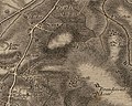 Historical map of Sourton.JPG 487 × 389; 68 KB
-
 House on Holsworthy Road (A3079) - geograph.org.uk - 3635003.jpg 1,662 × 994; 828 KB
-
 Ice below Sourton Tors (0198).jpg 4,288 × 2,848; 5.35 MB
-
 Icicles beside a stream on Prewley Moor - geograph.org.uk - 1144002.jpg 640 × 513; 132 KB
-
 In Stourton - geograph.org.uk - 6275958.jpg 3,680 × 2,760; 3.22 MB
-
 Inscription on Sourton Cross.-A Book of Dartmoor.jpg 624 × 324; 42 KB
-
 Junction at Sourton Down - geograph.org.uk - 4036514.jpg 640 × 344; 44 KB
-
 Junction on the Granite Way - geograph.org.uk - 3512865.jpg 640 × 427; 68 KB
-
 King Wall - geograph.org.uk - 4264487.jpg 1,920 × 1,315; 782 KB
-
 King Wall at source of Crandford Brook - geograph.org.uk - 4263954.jpg 1,920 × 1,122; 601 KB
-
 Kingfisher Pond - geograph.org.uk - 596437.jpg 640 × 480; 113 KB
-
 Lake and Coombe Downs - geograph.org.uk - 3512334.jpg 640 × 416; 63 KB
-
 Lake Down - geograph.org.uk - 317559.jpg 640 × 480; 108 KB
-
 Lake Down - geograph.org.uk - 3510600.jpg 640 × 404; 89 KB
-
 Lake Down - geograph.org.uk - 3510609.jpg 640 × 431; 83 KB
-
 Lake Down - geograph.org.uk - 3510827.jpg 640 × 425; 92 KB
-
 Lake Down - geograph.org.uk - 3510866.jpg 640 × 460; 76 KB
-
 Lake Down - geograph.org.uk - 3510890.jpg 640 × 407; 74 KB
-
 Lake Down - geograph.org.uk - 3510908.jpg 640 × 406; 72 KB
-
 Lake Down - geograph.org.uk - 3511763.jpg 640 × 446; 75 KB
-
 Lake Down - geograph.org.uk - 3512347.jpg 640 × 444; 54 KB
-
 Lake Down - geograph.org.uk - 43147.jpg 640 × 427; 77 KB
-
 Lake Down from Lake Viaduct - geograph.org.uk - 3512309.jpg 640 × 408; 47 KB
-
 Lake Ford - geograph.org.uk - 5927285.jpg 4,032 × 3,024; 5.21 MB
-
 Lake on the A386 - geograph.org.uk - 2134526.jpg 640 × 480; 249 KB
-
 Lake Viaduct - geograph.org.uk - 3511037.jpg 640 × 492; 102 KB
-
 Landrover in field - geograph.org.uk - 318536.jpg 640 × 480; 110 KB
-
 Landscape near Sourton Tors - geograph.org.uk - 2437899.jpg 640 × 426; 257 KB
-
 Lane at Thorndon - geograph.org.uk - 2778997.jpg 640 × 480; 96 KB
-
 Lane from Boasley Cross - geograph.org.uk - 2778960.jpg 640 × 486; 53 KB
-
 Lane near Lower Hewton - geograph.org.uk - 2778979.jpg 480 × 640; 118 KB
-
 Lane to Boasley Cross - geograph.org.uk - 2778981.jpg 640 × 480; 100 KB
-
 Lane to Bowerland - geograph.org.uk - 360379.jpg 640 × 480; 132 KB
-
 Lane to Bridestowe - geograph.org.uk - 320267.jpg 640 × 480; 84 KB
-
 Lane to East and West Bowerland - geograph.org.uk - 4939525.jpg 1,600 × 1,067; 829 KB
-
 Lane to Week Farm - geograph.org.uk - 2831845.jpg 640 × 468; 71 KB
-

-
 Large 'pebble' on Granite Way cycle path. - panoramio.jpg 1,037 × 778; 336 KB
-
 Lavis Bridge - geograph.org.uk - 596445.jpg 640 × 480; 101 KB
-
 Lay-by by the former A30 near Sourton - geograph.org.uk - 3936198.jpg 1,536 × 1,152; 1.2 MB
-
 Leaves bursting in trees on Sourton Down - geograph.org.uk - 3454039.jpg 1,024 × 768; 155 KB
-
 Leaving Lake on the A386 - geograph.org.uk - 3489384.jpg 800 × 600; 132 KB
-
 Leaving Sourton by the A386 - geograph.org.uk - 3489400.jpg 800 × 600; 124 KB
-
 Little Chef restaurant. - geograph.org.uk - 1199719.jpg 640 × 360; 64 KB
-
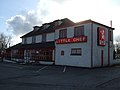 Little Chef, Sourton Cross - geograph.org.uk - 3463023.jpg 640 × 480; 52 KB
-

-
 Looking north-west along the Pegasus Trail - geograph.org.uk - 5507662.jpg 1,200 × 1,600; 896 KB
-
 Looking south from Lake along the A386 - geograph.org.uk - 2134530.jpg 640 × 480; 216 KB
-
 Looking west from Lake Viaduct - geograph.org.uk - 4928295.jpg 1,600 × 1,067; 510 KB
-
 Luddon, Boasley Cross - geograph.org.uk - 2774978.jpg 640 × 368; 50 KB
-
 Meldon Disused Railway - geograph.org.uk - 381820.jpg 640 × 480; 124 KB
-
 Meldon Junction to Holsworthy dismantled railway - geograph.org.uk - 4939549.jpg 1,067 × 1,600; 1.13 MB
-
 Moorland above Sourton - geograph.org.uk - 3506695.jpg 640 × 437; 64 KB


_-_geograph.org.uk_-_3459027.jpg)


_-_geograph.org.uk_-_5545187.jpg)


.jpg)


.jpg)
.jpg)


_-_geograph.org.uk_-_3635003.jpg)
.jpg)


