Category:Slindon, West Sussex
Jump to navigation
Jump to search
English: Slindon is a small village and civil parish in the Arun District of West Sussex, England, nestling in woodlands (much of it belonging to the National Trust) on the southern edge of the South Downs. Slindon lies approximately seven miles north-east of Chichester. The closest postal town is Arundel.
village and civil parish in West Sussex, United Kingdom  | |||||
| Upload media | |||||
| Instance of | |||||
|---|---|---|---|---|---|
| Location | Arun, West Sussex, South East England, England | ||||
| Area |
| ||||
| Different from | |||||
 | |||||
Subcategories
This category has the following 6 subcategories, out of 6 total.
H
- Slindon House, Arun (5 F)
S
- Slindon Cricket Club (1 F)
Media in category "Slindon, West Sussex"
The following 200 files are in this category, out of 447 total.
(previous page) (next page)-
 4 x 4 track area - geograph.org.uk - 1141368.jpg 640 × 480; 106 KB
-
 A canter on Stane Street - geograph.org.uk - 2748591.jpg 1,024 × 768; 184 KB
-
 A glimpse of houses at Dale Park - geograph.org.uk - 2629772.jpg 1,024 × 768; 210 KB
-
 A kiln^ - geograph.org.uk - 2116348.jpg 640 × 428; 200 KB
-
 A walk through the woods - geograph.org.uk - 2629921.jpg 768 × 1,024; 369 KB
-

-
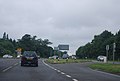
 A27 near Fontwell - geograph.org.uk - 3177339.jpg 640 × 479; 49 KB
-
 A27, B2132 turning - geograph.org.uk - 3177319.jpg 640 × 430; 39 KB
-
 A27, Fontwell bypass - geograph.org.uk - 3683377.jpg 640 × 404; 55 KB
-
 A29 , Fairmile Bottom - geograph.org.uk - 336651.jpg 640 × 428; 126 KB
-
 A29 - geograph.org.uk - 5569487.jpg 640 × 426; 45 KB
-
 A29 approaching bend by Chichester Lodge - geograph.org.uk - 2209490.jpg 3,264 × 2,448; 4.45 MB
-
 A29 north of The Danes - geograph.org.uk - 4037155.jpg 3,648 × 2,736; 1.64 MB
-
 A29, Slindon - geograph.org.uk - 5569481.jpg 640 × 325; 47 KB
-
 Agger, Stane Street - geograph.org.uk - 236545.jpg 640 × 479; 166 KB
-

-
 Approaching Shower - geograph.org.uk - 5679015.jpg 1,600 × 993; 201 KB
-
 Approaching Slindon - geograph.org.uk - 5678730.jpg 1,024 × 643; 244 KB
-
 Arriving at Great Down - geograph.org.uk - 6304573.jpg 4,000 × 3,000; 4.74 MB
-
 Arundel Road - geograph.org.uk - 2138077.jpg 640 × 480; 96 KB
-
 Bales, Court Hill Farm - geograph.org.uk - 2147772.jpg 640 × 480; 98 KB
-
 Bales, Stein Gate Field - geograph.org.uk - 2146392.jpg 640 × 480; 167 KB
-
 Bare tree on Stane Street - geograph.org.uk - 2748584.jpg 1,024 × 768; 167 KB
-
 Barn Croft - geograph.org.uk - 2138101.jpg 640 × 480; 66 KB
-
 Barn Field Ten Acres - geograph.org.uk - 2146822.jpg 640 × 480; 125 KB
-
 Barns, Court Hill Farm - geograph.org.uk - 2147802.jpg 640 × 480; 106 KB
-

-
 Baycombe Lane junction with the A29 - geograph.org.uk - 2859298.jpg 1,024 × 768; 312 KB
-
 Black sheep on Great Down - geograph.org.uk - 6304329.jpg 4,000 × 3,000; 4.33 MB
-
 Boundary at Ancient Earthwork - geograph.org.uk - 336717.jpg 640 × 428; 195 KB
-
 Boundary fence on Great Down - geograph.org.uk - 6304335.jpg 4,000 × 3,000; 4.43 MB
-
 Bridle road to Bignor - geograph.org.uk - 3526414.jpg 4,000 × 3,000; 3.69 MB
-
 Bridle Road to Bignor - geograph.org.uk - 5678687.jpg 1,024 × 654; 236 KB
-
 Bridleway across Little Down - geograph.org.uk - 2212454.jpg 3,264 × 2,448; 3.71 MB
-
 Bridleway along ancient earthwork - geograph.org.uk - 5543439.jpg 640 × 428; 192 KB
-

-

-
 Bridleway crossing on Great Down - geograph.org.uk - 1816071.jpg 800 × 600; 139 KB
-
 Bridleway going south towards Stane Street - geograph.org.uk - 2748537.jpg 1,024 × 768; 305 KB
-

-

-

-

-
 Bridleway junction at the end of Nore Wood Lane - geograph.org.uk - 2212280.jpg 3,264 × 2,448; 5.19 MB
-
 Bridleway junction in the valley - geograph.org.uk - 3819549.jpg 800 × 600; 203 KB
-

-
 Bridleway notice - geograph.org.uk - 1142102.jpg 640 × 480; 150 KB
-

-
 Bridleway to Bignor on Little Down - geograph.org.uk - 2545716.jpg 640 × 480; 139 KB
-
 Bridleway with footpath to the left - geograph.org.uk - 1815997.jpg 800 × 600; 234 KB
-
 Bridleway with timber stack - geograph.org.uk - 1816035.jpg 800 × 600; 180 KB
-
 Bridleway, Nore Wood - geograph.org.uk - 2147455.jpg 640 × 480; 212 KB
-
 Bucketing Down - geograph.org.uk - 2147831.jpg 480 × 640; 128 KB
-
 Buildings at Gumber Farm - geograph.org.uk - 6308228.jpg 1,600 × 1,067; 565 KB
-
 Butt Lane - geograph.org.uk - 2146275.jpg 640 × 480; 216 KB
-
 Butt Lane - geograph.org.uk - 5678726.jpg 1,024 × 602; 251 KB
-
 Butt Lane near Slindon - geograph.org.uk - 2545711.jpg 640 × 480; 194 KB
-
 Butt Lane, Slindon - geograph.org.uk - 1075483.jpg 480 × 640; 139 KB
-

-
 Cat and a pumpkin - geograph.org.uk - 5184956.jpg 4,608 × 3,456; 3.94 MB
-
 Cat at the Slindon Pumpkin Festival - geograph.org.uk - 5184928.jpg 4,608 × 3,456; 3.93 MB
-
 Cat guarding the 2016 Slindon Pumpkin Festival - geograph.org.uk - 5184921.jpg 4,608 × 3,456; 3.38 MB
-
 Cat guarding the 2016 Slindon Pumpkin Festival - geograph.org.uk - 5184935.jpg 4,608 × 3,456; 3.37 MB
-
 Cat in charge of the 2016 Slindon Pumpkin Festival - geograph.org.uk - 5184940.jpg 4,608 × 3,456; 3.4 MB
-
 Cat in charge of the 2016 Slindon Pumpkin Festival - geograph.org.uk - 5184946.jpg 4,608 × 3,456; 3.47 MB
-
 Cat patrol - geograph.org.uk - 5184949.jpg 4,608 × 3,456; 3.39 MB
-
 Choice of Bridleway near Great Down - geograph.org.uk - 236606.jpg 479 × 640; 207 KB
-
 Church Hill - geograph.org.uk - 2146205.jpg 640 × 480; 88 KB
-
 Church Hill, Slindon - geograph.org.uk - 1018455.jpg 640 × 427; 105 KB
-
 Church Hill, Slindon - geograph.org.uk - 4041207.jpg 4,000 × 3,000; 4.22 MB
-
 Church Hill, Slindon - geograph.org.uk - 6303347.jpg 4,000 × 3,000; 4.94 MB
-
 Church Lane, Slindon - geograph.org.uk - 1018457.jpg 640 × 511; 106 KB
-
 Cork Oak Tree - geograph.org.uk - 1907797.jpg 1,920 × 2,560; 1.89 MB
-
 Cork Oak Tree - geograph.org.uk - 1907804.jpg 1,920 × 2,560; 1.58 MB
-
 Coronation Hall - geograph.org.uk - 2138340.jpg 640 × 480; 69 KB
-
 Cottage in Slindon - geograph.org.uk - 5185007.jpg 4,506 × 3,338; 2.88 MB
-

-
 Cottages and post box in Slindon - geograph.org.uk - 2861808.jpg 1,024 × 768; 245 KB
-
 Court Hill - geograph.org.uk - 2147813.jpg 640 × 480; 170 KB
-
 Courthill Farm - geograph.org.uk - 5678741.jpg 1,024 × 626; 220 KB
-
 Cow Park - geograph.org.uk - 2146184.jpg 640 × 480; 109 KB
-
 Cows and straw bales at Courthill Farm - geograph.org.uk - 2210711.jpg 3,264 × 2,448; 4.13 MB
-
 Cricket memorial at Slindon - geograph.org.uk - 4041241.jpg 4,000 × 3,000; 4.34 MB
-
 Cricket Memorial Slindon - geograph.org.uk - 1986719.jpg 2,616 × 3,488; 2.11 MB
-
 Cross tracks - geograph.org.uk - 1816030.jpg 800 × 600; 212 KB
-
 Crossing Paths near to Upwaltham Hill - geograph.org.uk - 5677146.jpg 1,024 × 665; 269 KB
-
 Crosstracks in North Wood - geograph.org.uk - 3819703.jpg 600 × 800; 202 KB
-
 Cyclists at Slindon Bottom Road - geograph.org.uk - 3544595.jpg 4,000 × 3,000; 3.6 MB
-
 Danes Wood - geograph.org.uk - 1141254.jpg 640 × 480; 147 KB
-
 Dencher Wood - geograph.org.uk - 5678671.jpg 1,024 × 675; 264 KB
-
 Descending on the Bridleway - geograph.org.uk - 5679079.jpg 1,024 × 630; 272 KB
-
 Disc harrow and mystery mound - geograph.org.uk - 2116290.jpg 640 × 428; 109 KB
-
 Dog walkers on bridleway to Downe's Barn - geograph.org.uk - 2212417.jpg 3,264 × 2,448; 4.19 MB
-
 Downe's Barn - geograph.org.uk - 2146298.jpg 640 × 480; 123 KB
-
 Downe’s Barn (2) - geograph.org.uk - 5678722.jpg 1,600 × 1,047; 340 KB
-
 Downe’s Barn - geograph.org.uk - 5678718.jpg 1,024 × 666; 150 KB
-
 Downland landscape beside Monarch's Way footpath - geograph.org.uk - 6309025.jpg 1,600 × 1,067; 740 KB
-
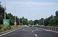
 Dual carriageway, A29 - geograph.org.uk - 5569476.jpg 640 × 426; 45 KB
-
 Dukes Road - geograph.org.uk - 2148007.jpg 480 × 640; 133 KB
-
 Eartham Wood - geograph.org.uk - 5580023.jpg 4,608 × 3,456; 6.62 MB
-
 East through Dencher Wood - geograph.org.uk - 3520256.jpg 4,000 × 3,000; 5.23 MB
-
 Easterly view from Nore Hill - geograph.org.uk - 2212266.jpg 3,264 × 2,448; 3.24 MB
-
 Energetic mole with a preference for west facing slope - geograph.org.uk - 1758527.jpg 1,600 × 1,200; 347 KB
-
 Ewe with sleepy twins - geograph.org.uk - 1815924.jpg 800 × 600; 137 KB
-
 Farmland near Slindon - geograph.org.uk - 5195279.jpg 480 × 640; 250 KB
-
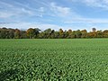
 Farmland, Slindon - geograph.org.uk - 893372.jpg 640 × 480; 127 KB
-
 Field and clump near North Wood - geograph.org.uk - 1815983.jpg 800 × 600; 170 KB
-
 Field by bridleway - geograph.org.uk - 1816044.jpg 800 × 600; 117 KB
-
 Field Entrance near Courthill Farm - geograph.org.uk - 5678752.jpg 1,024 × 573; 136 KB
-

-
 Fields and blue sky at The Folly - geograph.org.uk - 5678939.jpg 1,600 × 1,063; 401 KB
-
 Fields by bridleway on Great Down - geograph.org.uk - 2629837.jpg 1,024 × 768; 197 KB
-
 Fields near The Folly - geograph.org.uk - 5678919.jpg 1,600 × 962; 271 KB
-
 Fields near to Stane Street - geograph.org.uk - 5677205.jpg 1,024 × 629; 226 KB
-
 Fields near to Stane Street - geograph.org.uk - 5677216.jpg 1,600 × 1,043; 455 KB
-
 Finger Post - geograph.org.uk - 5678948.jpg 1,024 × 632; 169 KB
-
 Fire break in North Wood - geograph.org.uk - 3819678.jpg 600 × 800; 124 KB
-
 Five Acre Down - geograph.org.uk - 2146341.jpg 640 × 480; 83 KB
-
 Footpath beside Baycombe Wood - geograph.org.uk - 2212781.jpg 3,264 × 2,448; 5.2 MB
-
 Footpath goes ahead - geograph.org.uk - 2629903.jpg 1,024 × 768; 296 KB
-
 Footpath in Eartham Wood - geograph.org.uk - 2545645.jpg 640 × 480; 207 KB
-
 Footpath junction south of Nore Wood - geograph.org.uk - 3292752.jpg 800 × 523; 134 KB
-
 Footpath junction with Nore Wood lane - geograph.org.uk - 2210707.jpg 3,264 × 2,448; 4.35 MB
-
 Footpath leading into Danes Wood - geograph.org.uk - 1141149.jpg 640 × 480; 166 KB
-
 Footpath leaves road at Courthill Farm - geograph.org.uk - 3292718.jpg 800 × 600; 111 KB
-
 Footpath near The Folly on Nore Hill - geograph.org.uk - 2545648.jpg 640 × 480; 152 KB
-
 Footpath north through Dencher Wood - geograph.org.uk - 2212508.jpg 3,264 × 2,448; 5.44 MB
-
 Footpath off Stane Street - geograph.org.uk - 1815900.jpg 800 × 600; 162 KB
-
 Footpath passing Courthill Farm - geograph.org.uk - 5678746.jpg 1,024 × 662; 237 KB
-

-
 Footpath sign and stile on Park Lane - geograph.org.uk - 2859279.jpg 1,024 × 768; 231 KB
-
 Footpath skirting Oakfield - geograph.org.uk - 2212464.jpg 3,264 × 2,448; 3.55 MB
-
 Footpath to Nore Folly - geograph.org.uk - 3292748.jpg 800 × 774; 113 KB
-
 Footpath to Nore Wood - geograph.org.uk - 4041176.jpg 4,000 × 3,000; 4.01 MB
-
 Footpath to Slindon - geograph.org.uk - 2210320.jpg 3,264 × 2,448; 4.97 MB
-
 Footpath towards Eartham - geograph.org.uk - 3292733.jpg 600 × 800; 167 KB
-
 Footpath towards The Folly on Nore Hill - geograph.org.uk - 2545651.jpg 640 × 480; 189 KB
-
 Footpath towards Warren Barn - geograph.org.uk - 2545722.jpg 640 × 480; 150 KB
-

-
 Forestry Track, Nore Wood - geograph.org.uk - 2147461.jpg 640 × 480; 180 KB
-
 Forestry Work, Nore Wood - geograph.org.uk - 2147490.jpg 480 × 640; 213 KB
-
 Four Acres-Northwood Two Acres - geograph.org.uk - 2146838.jpg 640 × 480; 121 KB
-
 Four fine Beeches beside bridleway - geograph.org.uk - 1141361.jpg 640 × 480; 143 KB
-
 Gaston Farm Slindon - geograph.org.uk - 2210331.jpg 3,264 × 2,448; 3.56 MB
-
 Gate on footpath going up Great Down - geograph.org.uk - 2629911.jpg 1,024 × 768; 229 KB
-
 Gate on Great Down - geograph.org.uk - 2629835.jpg 1,024 × 740; 199 KB
-
 Gate on Great Down - geograph.org.uk - 6304343.jpg 4,000 × 3,000; 4.55 MB
-
 Gate on Great Down - geograph.org.uk - 6304348.jpg 3,663 × 2,747; 2.74 MB
-
 Gate on Great Down - geograph.org.uk - 6304357.jpg 3,807 × 2,855; 1.47 MB
-
 Gate on Great Down - geograph.org.uk - 6304366.jpg 4,000 × 3,000; 4.48 MB
-
 Gateway south onto Great Down - geograph.org.uk - 1816119.jpg 800 × 600; 182 KB
-
 Going west on track from Gumber Farm - geograph.org.uk - 3819654.jpg 600 × 800; 237 KB
-
 Gourds and Pumpkin Display - geograph.org.uk - 2680441.jpg 1,600 × 1,200; 451 KB
-
 Grave for two dogs next to Mill Lane - geograph.org.uk - 6304579.jpg 4,000 × 3,000; 4.82 MB
-
 Great Down - geograph.org.uk - 5678676.jpg 1,600 × 926; 281 KB
-

-
 Great Down, north of Slindon - geograph.org.uk - 6308221.jpg 1,600 × 1,067; 553 KB
-
 Great Down, Slindon - geograph.org.uk - 888190.jpg 640 × 480; 152 KB
-
 Great Down, Slindon - geograph.org.uk - 888194.jpg 640 × 480; 110 KB
-
 Great Down, Slindon - geograph.org.uk - 888201.jpg 640 × 480; 130 KB
-
 Great Down, Slindon - geograph.org.uk - 888236.jpg 640 × 480; 191 KB
-
 Great Down, Slindon - geograph.org.uk - 893402.jpg 640 × 427; 123 KB
-
 Gumber Farm - near Slindon, West Sussex - geograph.org.uk - 6381997.jpg 3,876 × 1,957; 1.45 MB
-
 Gumber Farm Cottages - geograph.org.uk - 3819590.jpg 800 × 600; 111 KB
-
 Hardlinch Twelve Acres - geograph.org.uk - 2147754.jpg 640 × 480; 74 KB
-
 Hedge line on Little Down - geograph.org.uk - 6304297.jpg 4,000 × 3,000; 5.14 MB
-
 Hollow tree on Stane Street - geograph.org.uk - 2748578.jpg 768 × 1,024; 438 KB
-
 Horse drawn plough by The Folly on Nore Hill - geograph.org.uk - 2212261.jpg 3,264 × 2,448; 5.52 MB
-

-
 House in Church Hill, Slindon - geograph.org.uk - 4041221.jpg 4,000 × 3,000; 4.4 MB
-
 House in Slindon - geograph.org.uk - 4041248.jpg 4,000 × 3,000; 3.91 MB
-
 Houses at Slindon Common - geograph.org.uk - 4872682.jpg 640 × 480; 67 KB
-
 Junction of bridleways at Gumber Corner - geograph.org.uk - 1407854.jpg 640 × 480; 116 KB
-

-
 Junction of Park Lane with the A29 - geograph.org.uk - 3606036.jpg 3,872 × 2,592; 4.78 MB
-
 Lay-by A29 - geograph.org.uk - 4888402.jpg 640 × 480; 120 KB
-
 Little Down - geograph.org.uk - 2146321.jpg 640 × 480; 80 KB
-
 Little Down - geograph.org.uk - 5678680.jpg 1,600 × 1,035; 394 KB
-
 Little Down to Bignor - geograph.org.uk - 5678695.jpg 1,600 × 891; 298 KB
-
 Little Down, Slindon - geograph.org.uk - 887768.jpg 640 × 480; 150 KB
-
 Little Down, Slindon - geograph.org.uk - 888130.jpg 640 × 480; 143 KB
-
 Little Down, Slindon - geograph.org.uk - 888143.jpg 640 × 480; 125 KB
-
 Little Down, Slindon - geograph.org.uk - 888154.jpg 640 × 480; 128 KB
-
 Little Down, Slindon - geograph.org.uk - 888185.jpg 640 × 480; 124 KB
-
 Little Down, Slindon - geograph.org.uk - 893406.jpg 640 × 480; 138 KB
-
 Little Down, Slindon - geograph.org.uk - 893409.jpg 640 × 480; 142 KB
-
 Log Pile - geograph.org.uk - 5678876.jpg 1,600 × 1,021; 441 KB
-
 Log piles on the edge of Nore Wood - geograph.org.uk - 2212276.jpg 3,264 × 2,448; 4.38 MB
-
 Logging work - geograph.org.uk - 5678906.jpg 1,024 × 618; 153 KB
-
 Logging work stopped on Sunday - geograph.org.uk - 2116318.jpg 640 × 428; 176 KB
-
 Logs at the corner - geograph.org.uk - 2115726.jpg 640 × 428; 173 KB
-
 Looking back to Little Down - geograph.org.uk - 6304570.jpg 3,731 × 2,798; 2.8 MB
-

-
 Looking inside Warren Barn - geograph.org.uk - 2629935.jpg 768 × 1,024; 139 KB
-
-

-
 Looking north on Great Down - geograph.org.uk - 2629839.jpg 768 × 1,024; 205 KB
-

-

-
 Looking south on Stane Street - geograph.org.uk - 1815882.jpg 800 × 600; 86 KB


_-_geograph.org.uk_-_5678722.jpg)


