Category:Skelmersdale
Jump to navigation
Jump to search
English: Skelmersdale is a town in West Lancashire, England. It lies on high-ground on the River Tawd, south-southwest of Preston. As of 2006, Skelmersdale had a population of 38,813, down from 41,000 in 2004. The town is known locally as Skem. (→Skelmersdale)
Italiano: Skelmersdale è una cittadina di 38.813 abitanti del Lancashire, in Inghilterra. (→Skelmersdale)
Nederlands: Skelmersdale is een plaats in het bestuurlijke gebied West Lancashire, in het Engelse graafschap Lancashire. De plaats telt 38.813 inwoners. (→Skelmersdale)
Norsk nynorsk: Skelmersdale er ein by i grevskapet Lancashire i England. Han har kring 39 000 innbyggjarar og ligg ved elva Tawd, 10 km vest for Wigan, 21 km nordaust for Liverpool, 24 km sørvest for Preston. Byen er nemnd i Domesday Book i 1086. (→Skelmersdale)
Română: Skelmersdale este un oraș în comitatul Lancashire, regiunea North West England, Anglia. Orașul se află în districtul West Lancashire. (→Skelmersdale)
Türkçe: Skelmersdale, Birleşik Krallık'a bağlı İngiltere'nin Kuzey-Batı İngiltere bölgesinde idari bakımdan birinci seviyeli yerel idare olan Lancashire kontluğuna bağlı olan West Lancashire ikinci seviyeli metropoliten-olmayan yerel idare bölgesinde bulunan bir kucuk bir "yeni kent"dir. (→Skelmersdale)
town in West Lancashire, England  | |||||
| Upload media | |||||
| Instance of | |||||
|---|---|---|---|---|---|
| Location | West Lancashire, Lancashire, North West England, England | ||||
 | |||||
Subcategories
This category has the following 14 subcategories, out of 14 total.
A
- Almond Tree, Skelmersdale (3 F)
C
E
- Sonia Evans (10 F)
G
- Glenburn Sports College (4 F)
H
- Hope House, Skelmersdale (3 F)
M
S
- Skelmersdale bus depot (1 F)
- Skelmersdale Library (4 F)
- Skelmersdale War Memorial (7 F)
T
- Tawd Valley Park (4 F)
U
- Upholland Labour Club (5 F)
V
Media in category "Skelmersdale"
The following 112 files are in this category, out of 112 total.
-

-
 A jewel of a traffic island - geograph.org.uk - 123882.jpg 640 × 426; 98 KB
-

-
 A Shell filling station - geograph.org.uk - 2159791.jpg 4,592 × 3,056; 6.13 MB
-
 A577 Stannanought Road, Skelmersdale.JPG 4,608 × 3,456; 3.42 MB
-

-
 Arriva Bus Depot - geograph.org.uk - 878540.jpg 640 × 426; 51 KB
-
 Arriva Bus Garage - geograph.org.uk - 878535.jpg 640 × 426; 55 KB
-
 Ashley Travel Stadium.JPG 2,848 × 2,136; 1.42 MB
-

-
 Beacon Lane on Ashurst's Beacon - geograph.org.uk - 6097282.jpg 1,600 × 1,067; 707 KB
-
 Bilingual sign, Skelmersdale.JPG 4,608 × 3,456; 3.69 MB
-
 Birleywood Health Centre, Skelmersdale (1).JPG 4,608 × 3,456; 3.52 MB
-
 Birleywood Health Centre, Skelmersdale (2).JPG 4,608 × 3,456; 3.4 MB
-
 Bodycote, Skelmersdale.JPG 4,608 × 3,456; 3.39 MB
-
 Bungalows in Digmoor, Skelmersdale.JPG 4,608 × 3,456; 3.32 MB
-
 Clayton Street, Skelmersdale.JPG 4,608 × 3,456; 3.21 MB
-
 Concourse shopping centre sign, Skelmersdale.JPG 4,608 × 3,456; 3.61 MB
-
 Crow Lane on Ashurst's Beacon - geograph.org.uk - 6097270.jpg 1,600 × 1,067; 720 KB
-
 Delf House, Skelmersdale - geograph.org.uk - 4825224.jpg 640 × 481; 459 KB
-
 Digmoor Community Centre, Skelmersdale.JPG 4,608 × 3,456; 3.49 MB
-
 Digmoor Road - Clay Brow Road roundabout, Skelmersdale.JPG 4,608 × 3,456; 3.32 MB
-
 Dolphin Fish & Chips, Skelmersdale.JPG 4,608 × 3,456; 3.44 MB
-
 Fast food shops on Skelmersdale High Street.JPG 4,608 × 3,456; 3.53 MB
-
 Ferney Knoll Farm - geograph.org.uk - 867739.jpg 640 × 479; 93 KB
-
 Ferney Knoll Stud - geograph.org.uk - 868288.jpg 640 × 479; 74 KB
-
 Field Street, Skelmersdale.JPG 4,608 × 3,456; 3.31 MB
-
 Footbridge across the A577 Stannanought Road, Skelmersdale.JPG 4,608 × 3,456; 3.39 MB
-
 Former estate agent offices, Skelmersdale.JPG 4,608 × 3,456; 3.32 MB
-
 Funeral Director and shops, Sandy Lane, Skelmersdale.JPG 4,608 × 3,456; 3.53 MB
-
 Golf and Glass - geograph.org.uk - 37908.jpg 640 × 511; 151 KB
-
 Grimshaw Lane Inn, Skelmersdale.JPG 4,608 × 3,456; 3.29 MB
-
 Grimshaw Road, Skelmersdale.JPG 4,608 × 3,456; 3.31 MB
-
 Hope Island.JPG 2,848 × 2,136; 1.45 MB
-
 Houses on Sandy Lane, Skelmersdale.JPG 4,608 × 3,456; 3.4 MB
-
 Jobs Nursery - geograph.org.uk - 123301.jpg 640 × 379; 89 KB
-
 K & H Hives general store, Skelmersdale.JPG 4,608 × 3,456; 3.53 MB
-
 Kingdom Hall of Jehova's Witnesses, Skelmersdale.JPG 4,608 × 3,456; 3.44 MB
-
 Lees Lane, Dalton - geograph.org.uk - 1537147.jpg 640 × 428; 98 KB
-
 Location map United Kingdom Skelmersdale.svg 490 × 449; 995 KB
-
 Marie Curie roundabout, Skelmersdale (1).JPG 4,608 × 3,456; 3.76 MB
-
 Marie Curie roundabout, Skelmersdale (2).JPG 4,608 × 3,456; 3.69 MB
-
 Mikes Fish & Chips, Skelmersdale.JPG 4,608 × 3,456; 3.43 MB
-
 Mini supermarket off license, Skelmersdale (1).JPG 4,608 × 3,456; 3.38 MB
-
 Mini supermarket off license, Skelmersdale (2).JPG 4,608 × 3,456; 3.5 MB
-
 Nye Bevan Pool, Skelmersdale.JPG 4,608 × 3,456; 3.38 MB
-
 Ophthalmic Optician, Skelmersdale.JPG 3,456 × 4,608; 3.62 MB
-
 Ormskirk Road General Store, Skelmersdale.JPG 4,608 × 3,456; 3.42 MB
-
 Pedestrian underpass, Grimshaw Road, Skelmersdale.JPG 4,608 × 3,456; 3.44 MB
-
 Public Footpath to Holland Moss - geograph.org.uk - 867735.jpg 640 × 479; 70 KB
-
 Quarry Bank Community House, Skelmersdale (1).JPG 4,608 × 3,456; 3.45 MB
-
 Quarry Bank Community House, Skelmersdale (2).JPG 4,608 × 3,456; 3.45 MB
-
 Rainbow over Castlehey, Skelmersdale (1).JPG 4,608 × 3,456; 3.42 MB
-
 Rainbow over Castlehey, Skelmersdale (2).JPG 4,608 × 3,456; 3.67 MB
-
 Roadside gas plant at Ferny Knoll - geograph.org.uk - 867749.jpg 640 × 479; 70 KB
-
 Sandy Lane Centre, Skelmersdale.JPG 4,608 × 3,456; 3.45 MB
-
 Sandy Lane Health Centre, Skelmersdale.JPG 4,608 × 3,456; 3.23 MB
-
 Sandy Lane, Skelmersdale (1).JPG 4,608 × 3,456; 3.28 MB
-
 School Lane Campus, Skelmersdale (1).JPG 4,608 × 3,456; 3.58 MB
-
 Seddon Place, Skelemersdale - geograph.org.uk - 1386010.jpg 640 × 480; 114 KB
-
 Shops on Hawthorn Crescent, Skelmersdale.JPG 4,608 × 3,456; 3.57 MB
-
 Shops on High Street, Skelmersdale (1).JPG 4,608 × 3,456; 3.62 MB
-
 Shops on High Street, Skelmersdale (2).JPG 4,608 × 3,456; 3.41 MB
-
 Shops on Sandy Lane, Skelmersdale (1).JPG 4,608 × 3,456; 3.57 MB
-
 Skate Park in Skelmersdale.JPG 4,608 × 3,456; 3.41 MB
-
 Skelmersdale bus station (1).JPG 4,608 × 3,456; 3.42 MB
-
 Skelmersdale bus station (2).JPG 4,608 × 3,456; 3.43 MB
-
 Skelmersdale Police Station - geograph.org.uk - 878474.jpg 640 × 426; 38 KB
-
 Skelmersdale Skip Hire, Seaton Place - geograph.org.uk - 1386011.jpg 640 × 480; 76 KB
-
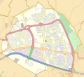
 Skelmersdale unparished area UK locator map.svg 1,173 × 1,306; 567 KB
-
 Skelmersdale Wines.JPG 4,608 × 3,456; 3.37 MB
-
 Skemsubway.JPG 640 × 480; 268 KB
-
 Temporary traffic lights in Skelmersdale (1).JPG 4,608 × 3,456; 3.64 MB
-
 Temporary traffic lights in Skelmersdale (2).JPG 4,608 × 3,456; 3.67 MB
-
 Temporary traffic lights in Skelmersdale (3).JPG 4,608 × 3,456; 3.51 MB
-
 Temporary traffic lights in Skelmersdale (4).JPG 4,608 × 3,456; 3.51 MB
-
 The Derby Arms, Skelmersdale.JPG 4,608 × 3,456; 3.4 MB
-

-
 The Railway Tavern, Blaguegate - geograph.org.uk - 66803.jpg 640 × 480; 60 KB
-
 The Viking pub, Skelmersdale (1).JPG 4,608 × 3,456; 3.4 MB
-
 The Viking pub, Skelmersdale (2).JPG 4,608 × 3,456; 3.57 MB
-
 Tower at the rear of Skelmersdale Fire Station (1).JPG 4,608 × 3,456; 3.23 MB
-
 Tower at the rear of Skelmersdale Fire Station (3).JPG 4,608 × 3,456; 3.55 MB
-

-
 Underpass under Glenburn Road, Skelmersdale.JPG 4,608 × 3,456; 3.43 MB
-
 Victoria Hotel, Skelmersdale.JPG 4,608 × 3,456; 3.61 MB
-
 Wallcroft Street, Skelmersdale - geograph.org.uk - 1110219.jpg 640 × 480; 110 KB
-
 Wallcroft Street, Skelmersdale - geograph.org.uk - 1110223.jpg 640 × 480; 94 KB
-
 Websters Farmhouse - Geograph 2077794.jpg 1,600 × 1,198; 489 KB
-

-

-
 Whiteledge Road, Skelmersdale.JPG 4,608 × 3,456; 3.61 MB
-
 WiganBUA.png 1,618 × 850; 1.82 MB
-
 Woods in Skelmersdale town centre.JPG 4,608 × 3,456; 3.55 MB
-
 A residential estate - geograph.org.uk - 194235.jpg 640 × 480; 105 KB
-

-
 Desert island for some - geograph.org.uk - 123305.jpg 640 × 426; 94 KB
-
 Exception to the rule - geograph.org.uk - 123319.jpg 640 × 426; 157 KB
-
 Famous names in Skelmersdale - geograph.org.uk - 98023.jpg 640 × 426; 78 KB
-
 Ivy House Farm - geograph.org.uk - 71552.jpg 640 × 480; 155 KB
-
 Moss Lane Farm - geograph.org.uk - 123298.jpg 640 × 426; 110 KB
-
 Ne'er the twain shall meet - geograph.org.uk - 123306.jpg 640 × 422; 70 KB
-
 Nice weather for some - geograph.org.uk - 98014.jpg 640 × 426; 115 KB
-
 Roadside Cottages - geograph.org.uk - 71555.jpg 640 × 480; 106 KB
-
 Roundabout Art, Skelmersdale - geograph.org.uk - 66821.jpg 640 × 480; 58 KB
-
 Sandy Lane, Old Skelmersdale - geograph.org.uk - 66814.jpg 640 × 480; 60 KB
-
 Sign of civilisation - geograph.org.uk - 98017.jpg 640 × 426; 74 KB
-
 Sign of the times - geograph.org.uk - 83139.jpg 640 × 426; 146 KB
-
 Skelmersdale fire station - geograph.org.uk - 266746.jpg 640 × 427; 194 KB
-
 Stanley Farm, near Skelmersdale - geograph.org.uk - 72016.jpg 640 × 427; 52 KB
-

-

_Squadron_-_Squadron_Crest_-_College_of_Arms_Approved_Version.jpg)


.JPG)
.JPG)


.JPG)
.JPG)

.JPG)
.JPG)


.JPG)
.JPG)
.JPG)
.JPG)


.JPG)
.JPG)


.JPG)
.JPG)
.JPG)

.JPG)
.JPG)


.JPG)
.JPG)
.JPG)
.JPG)


.JPG)
.JPG)
.JPG)
.JPG)


