Category:Signs in Oxfordshire
Jump to navigation
Jump to search
Ceremonial counties of England: Bedfordshire · Berkshire · Buckinghamshire · Cambridgeshire · Cheshire · Cornwall · Cumbria · Derbyshire · Devon · Dorset · Durham · East Riding of Yorkshire · East Sussex · Essex · Gloucestershire · Greater London · Greater Manchester · Hampshire · Herefordshire · Hertfordshire · Kent · Lancashire · Leicestershire · Lincolnshire · Merseyside · Norfolk · North Yorkshire · Northamptonshire · Northumberland · Nottinghamshire · Oxfordshire · Rutland · Shropshire · Somerset · South Yorkshire · Staffordshire · Suffolk · Surrey · Tyne and Wear · Warwickshire · West Midlands · West Sussex · West Yorkshire · Wiltshire · Worcestershire
City-counties: Bristol · City of London
Former historic counties:
Other former counties:
City-counties: Bristol · City of London
Former historic counties:
Other former counties:
Subcategories
This category has the following 15 subcategories, out of 15 total.
- Church signs in Oxfordshire (37 F)
*
- Signs in Didcot (18 F)
- Signs in Goring-on-Thames (14 F)
- Signs in Henley-on-Thames (19 F)
F
H
P
R
V
- Village signs in Oxfordshire (7 F)
Media in category "Signs in Oxfordshire"
The following 150 files are in this category, out of 150 total.
-
 No drinking allowed in Albert Park - geograph.org.uk - 1299842.jpg 445 × 640; 58 KB
-
 Abingdon Bridge - geograph.org.uk - 2334119.jpg 1,024 × 683; 257 KB
-
 Abingdon OckStreet 173 SE.jpg 1,023 × 1,280; 580 KB
-
 Abingdon OckStreet 173 south.jpg 959 × 1,280; 533 KB
-
 Archers Farmhouse sign - geograph.org.uk - 427041.jpg 480 × 640; 91 KB
-
 Arlo's Restaurant.jpg 1,004 × 280; 80 KB
-
 Barbed wire (blue background).jpg 800 × 600; 64 KB
-
 Barbed wire (brown background).jpg 800 × 600; 75 KB
-
 Barbed wire (plain wood).jpg 800 × 600; 84 KB
-
 Benchmark mostly hidden behind business's sign - geograph.org.uk - 3958398.jpg 1,024 × 683; 256 KB
-
 Beware cyclists sign.jpg 800 × 800; 162 KB
-
 Board by the gate - geograph.org.uk - 1617916.jpg 640 × 427; 98 KB
-
 Board in the Shrubbery - geograph.org.uk - 3623795.jpg 900 × 600; 159 KB
-
 Frog Cottage - geograph.org.uk - 1633507.jpg 640 × 480; 118 KB
-
 Gate to Snail Cottage - geograph.org.uk - 1633514.jpg 480 × 640; 100 KB
-
 Notice board by the window - geograph.org.uk - 1634789.jpg 480 × 640; 91 KB
-
 Botley Cemetery - geograph.org.uk - 1633525.jpg 480 × 640; 150 KB
-
 Boundary marker on Sonning bridge - geograph.org.uk - 952213.jpg 480 × 640; 79 KB
-
 Bridge 145 on the Southern Oxford Canal - geograph.org.uk - 31584.jpg 600 × 450; 129 KB
-
 Disc on the wall - geograph.org.uk - 1671118.jpg 533 × 800; 106 KB
-
 Garage along Brightwell Street - geograph.org.uk - 1671386.jpg 1,024 × 683; 131 KB
-
 Small sign on the wall - geograph.org.uk - 1671444.jpg 1,024 × 683; 172 KB
-
 Bus IMG 1608 (16168333109).jpg 2,520 × 1,890; 1.22 MB
-
 Bus IMG 2964 (16358632775).jpg 2,689 × 2,017; 1.18 MB
-
 Caution - Deep mud.jpg 800 × 600; 226 KB
-
 Hampden monument - geograph.org.uk - 1011652.jpg 640 × 480; 71 KB
-
 Cherwell Valley Services Sign.jpg 4,032 × 3,024; 2.29 MB
-
 It's a bit bright - geograph.org.uk - 1136250.jpg 426 × 640; 82 KB
-
 Claydon railway crossing - geograph.org.uk - 460962.jpg 640 × 477; 78 KB
-
 Courtney SN55 DVA Feb 2007.jpg 1,749 × 1,312; 636 KB
-
 Culham Lock - geograph.org.uk - 752137.jpg 640 × 480; 95 KB
-
 Danger - Walks closed.jpg 744 × 800; 224 KB
-
 Danger. Keep out^ - geograph.org.uk - 1404669.jpg 640 × 427; 76 KB
-
 May Fu Two in Deddington High Street - geograph.org.uk - 973391.jpg 480 × 640; 70 KB
-
 Wright StreetLite SK66 HRN Didcot Parkway.jpg 1,280 × 1,280; 643 KB
-
 Wright StreetLite SK66 HRO Didcot StationRd left.jpg 1,280 × 915; 457 KB
-
 Wright StreetLite SK66 HRO Didcot StationRd right.jpg 1,280 × 719; 432 KB
-
 Directional sign, London Oxford Airport, Oxfordshire, UK - 20120424.jpg 1,536 × 2,048; 1.01 MB
-
 Display on the bridge - geograph.org.uk - 1638843.jpg 640 × 480; 103 KB
-
 Board on the canal - geograph.org.uk - 1640355.jpg 640 × 480; 150 KB
-
 ... former Post Office at Eaton Hastings - the clues are there! (4032332168).jpg 2,167 × 3,037; 3.86 MB
-
 ENG Woodstock Blenheim Palace 004.jpg 3,012 × 4,016; 1,023 KB
-
 ENG Woodstock Blenheim Palace 006.jpg 3,993 × 2,995; 893 KB
-
 ENG Woodstock Blenheim Palace 097.jpg 3,012 × 4,016; 2.34 MB
-
 ENG Woodstock Blenheim Palace 100.jpg 3,933 × 2,950; 3.12 MB
-
 Entering Henley on Thames, Gravel Hill - geograph.org.uk - 5982483.jpg 1,024 × 681; 245 KB
-
 Entrance to Dalton Barracks - geograph.org.uk - 60907.jpg 640 × 480; 77 KB
-
 Faded on the wall - geograph.org.uk - 1408144.jpg 450 × 600; 86 KB
-
 Farmoor Reservoir, Farmoor, Oxon - geograph.org.uk - 442354.jpg 640 × 480; 60 KB
-
 Finstock station - geograph.org.uk - 1106466.jpg 640 × 427; 67 KB
-
 Finstock station sign - geograph.org.uk - 1106486.jpg 640 × 427; 64 KB
-
 Godstow Weir - geograph.org.uk - 909064.jpg 640 × 426; 77 KB
-
 Grain Lorries This Way.jpg 1,200 × 900; 468 KB
-

-
 Great Tew, Oxfordshire, sign on former post office (4606828621).jpg 2,868 × 1,942; 3.26 MB
-
 Hagbourne Mill Farm sign, Blewbury Road.jpg 900 × 675; 433 KB
-
 Signs on Icknield Way - geograph.org.uk - 1348389.jpg 640 × 480; 110 KB
-
 Hethe notice board and postbox - geograph.org.uk - 453487.jpg 640 × 510; 145 KB
-
 Hethe parish church with postbox - geograph.org.uk - 1416404.jpg 640 × 480; 98 KB
-
 Information Board for Chastleton House - geograph.org.uk - 3408508.jpg 4,000 × 3,000; 3.25 MB
-
 Keep out - geograph.org.uk - 1270328.jpg 640 × 426; 82 KB
-
 Across the railway - geograph.org.uk - 1635557.jpg 640 × 480; 77 KB
-
 Shed and log pile at Kingham, Oxfordshire.jpg 640 × 480; 97 KB
-

-
 Kirtington PostOffice.JPG 2,666 × 2,000; 2.64 MB
-

-
 Kirtlington C of E School - geograph.org.uk - 1416347.jpg 640 × 442; 96 KB
-
 Kirtlington Stores.jpg 1,245 × 1,280; 882 KB
-
 Court Hill Centre - geograph.org.uk - 1006609.jpg 640 × 480; 68 KB
-
 Level Crossing Closed - geograph.org.uk - 5936500.jpg 5,184 × 3,456; 3.68 MB
-
 Footpath in Lidstone - geograph.org.uk - 1582473.jpg 640 × 427; 156 KB
-
 Path meets road - geograph.org.uk - 1801788.jpg 4,000 × 3,000; 4.13 MB
-
-
 Market Place History - geograph.org.uk - 4106909.jpg 1,024 × 768; 130 KB
-
 Mooring sign above Sonning Lock - geograph.org.uk - 774187.jpg 640 × 480; 137 KB
-
 Museum sign - geograph.org.uk - 1143630.jpg 640 × 480; 87 KB
-
 National Trust sign for Watlington Hill - geograph.org.uk - 3301101.jpg 2,048 × 1,536; 772 KB
-
 Not in use, sorry.jpg 735 × 800; 124 KB
-
 Notice at the gate - geograph.org.uk - 2606866.jpg 1,024 × 683; 141 KB
-
 Notice in the river - geograph.org.uk - 1584341.jpg 480 × 640; 77 KB
-
 Notice on the gate - geograph.org.uk - 1584236.jpg 480 × 640; 80 KB
-
 Notice on the Side - geograph.org.uk - 4104657.jpg 1,024 × 768; 185 KB
-
 Nuffield BusStop sign.jpg 853 × 1,280; 534 KB
-

-
 Old Milepost (geograph 6098164).jpg 480 × 640; 130 KB
-

-
 Old Milestone by the A4095, Main Road, Long Hanborough (geograph 6035622).jpg 1,457 × 1,704; 502 KB
-
 Old sign at Kingham railway station - geograph.org.uk - 31814.jpg 640 × 480; 155 KB
-
 Outflow station at Farmoor Reservoir - geograph.org.uk - 637513.jpg 640 × 480; 55 KB
-
 Pink storage - geograph.org.uk - 1416044.jpg 640 × 480; 74 KB
-
 Oxford Bus Company 91 outside Volvo Truck and Bus, Didcot (8712195226).jpg 2,880 × 1,623; 1.85 MB
-
 Oxfordshire.jpg 1,174 × 526; 161 KB
-
 Please queue on this side.jpg 800 × 600; 127 KB
-
 Police - operation in progress sign.jpg 800 × 600; 215 KB
-
 Post box by the bank - geograph.org.uk - 1620793.jpg 426 × 640; 101 KB
-
 Private Property - geograph.org.uk - 1638085.jpg 640 × 480; 136 KB
-
 2019 at Shiplake station - old station sign.JPG 1,366 × 820; 672 KB
-
 2019 at Shiplake station - platform garden.JPG 1,366 × 820; 569 KB
-
 Shrivenham TarifaCottage notice.JPG 2,100 × 1,500; 1.08 MB
-
 City Sightseeing bus in Berinsfield Oxfordshire.jpg 2,788 × 2,091; 1.66 MB
-
 Sign at Day's Lock - geograph.org.uk - 640148.jpg 640 × 480; 92 KB
-
 Sign by the weir - geograph.org.uk - 1584336.jpg 640 × 480; 62 KB
-
 Sign on Hardwick Estate - geograph.org.uk - 857074.jpg 427 × 640; 74 KB
-
 Sign on Henley Bridge - geograph.org.uk - 2510740.jpg 1,024 × 680; 198 KB
-
-
-
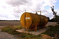 Fertilizer Tank near Steventon - geograph.org.uk - 1469469.jpg 640 × 427; 60 KB
-

-
 Tackley Crossing SignsEast.JPG 1,950 × 2,600; 1.7 MB
-
 Tackley Crossing SignsWest.JPG 2,000 × 2,666; 1.98 MB
-
-
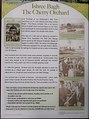 The Cherry Orchard, information sign - geograph.org.uk - 594981.jpg 477 × 640; 84 KB
-
 The Vicky Arms House Rules, Marston, Oxfordshire-geograph-3058188-by-Des-Blenkinsopp.jpg 2,887 × 1,978; 2.38 MB
-
 Town sign board on Gravel Hill - geograph.org.uk - 5203769.jpg 4,662 × 3,060; 3.31 MB
-
 It's a Sign - geograph.org.uk - 817335.jpg 640 × 480; 88 KB
-
 Path up route 44 - geograph.org.uk - 936626.jpg 640 × 426; 93 KB
-
 Board by the towpath - geograph.org.uk - 1640849.jpg 640 × 480; 134 KB
-
 Sign on the mill - geograph.org.uk - 1211401.jpg 640 × 426; 64 KB
-
 Warning - Beware of step.jpg 728 × 800; 180 KB
-
 Warning on the bank - geograph.org.uk - 1420218.jpg 640 × 426; 111 KB
-
 Warning sign - geograph.org.uk - 1137363.jpg 640 × 426; 100 KB
-
 Warning sign - geograph.org.uk - 591813.jpg 640 × 477; 85 KB
-
 Warning, edge of sign.jpg 737 × 800; 168 KB
-
 West Mill Wind Farm (1) - geograph.org.uk - 1555938.jpg 640 × 427; 72 KB
-
 West Mill Wind Farm (2) - geograph.org.uk - 1555943.jpg 640 × 427; 66 KB
-
 Weir Channel, Pinkhill Lock - geograph.org.uk - 909308.jpg 640 × 415; 79 KB
-
 Welcome to Days Lock - geograph.org.uk - 1410663.jpg 640 × 480; 110 KB
-
 Welcome to Wantage - geograph.org.uk - 1191080.jpg 640 × 426; 66 KB
-
 Canal by the road - geograph.org.uk - 1639238.jpg 640 × 480; 125 KB
-
 Map of the Wilts & Berks Canal - geograph.org.uk - 1639571.jpg 640 × 480; 129 KB
-
 Plaque relating to Whitchurch Toll Bridge - geograph.org.uk - 1721016.jpg 1,024 × 768; 317 KB
-
 Tolls to be taken - geograph.org.uk - 1480730.jpg 426 × 640; 71 KB
-
 Williamscot village notice board - geograph.org.uk - 435009.jpg 640 × 480; 184 KB
-
 Woodstock - Stagecoach 47457 (15743338823).jpg 2,263 × 1,697; 1.21 MB
-
 Harley-Davidson sign in Wootton - geograph.org.uk - 1372894.jpg 640 × 427; 57 KB
-
 Wrought iron bracket at Preston Crowmarsh, Oxfordshire.jpg 400 × 600; 96 KB
-
 Wyfold Court Estate - geograph.org.uk - 593848.jpg 640 × 477; 88 KB
-
 You have been warned - geograph.org.uk - 595753.jpg 640 × 477; 68 KB
-
 A34 layby - geograph.org.uk - 361689.jpg 640 × 477; 94 KB
-
 Another sign - geograph.org.uk - 1420261.jpg 400 × 600; 71 KB
-
 Hanwell village notice board - geograph.org.uk - 437169.jpg 640 × 480; 175 KB
-
 Hethe - geograph.org.uk - 344226.jpg 640 × 480; 82 KB
-
 Is the path open^ - geograph.org.uk - 595841.jpg 640 × 477; 81 KB
-
 Sign for Rushy Common Nature Reserve - geograph.org.uk - 401205.jpg 640 × 480; 96 KB
-
 Sign in Padbury's Bottom - geograph.org.uk - 453288.jpg 480 × 640; 168 KB
-

-
 Slow cats crossing - geograph.org.uk - 360378.jpg 640 × 477; 99 KB
-

-
 Stonepit Cottage sign - geograph.org.uk - 187344.jpg 639 × 479; 96 KB
-
 Tradesmans Entrance - geograph.org.uk - 441732.jpg 640 × 480; 131 KB


.jpg)
.jpg)
.jpg)


.jpg)
.jpg)


.jpg)


.jpg)


.jpg)
.jpg)
.jpg)


.jpg)


_-_geograph.org.uk_-_1555938.jpg)
_-_geograph.org.uk_-_1555943.jpg)


.jpg)


