Category:Sidley, East Sussex
Jump to navigation
Jump to search
village in United Kingdom  | |||||
| Upload media | |||||
| Instance of | |||||
|---|---|---|---|---|---|
| Location | Rother, East Sussex, South East England, England | ||||
| Area |
| ||||
| official website | |||||
 | |||||
English: Sidley is a village on the outskirts of Bexhill-on-Sea in East Sussex, England. Its governance falls within the jurisdiction of the Charter Trustees town of Bexhill. It is also a ward of Rother district council.
Subcategories
This category has the following 7 subcategories, out of 7 total.
Media in category "Sidley, East Sussex"
The following 54 files are in this category, out of 54 total.
-
 Allotments, Sidley - geograph.org.uk - 708603.jpg 640 × 480; 93 KB
-
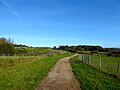
 Bexhill 35C Bridleway, Ring Wood - geograph.org.uk - 6310742.jpg 640 × 430; 138 KB
-
 Bridge Field - geograph.org.uk - 6310613.jpg 640 × 480; 66 KB
-
 Broom Field - geograph.org.uk - 6310622.jpg 640 × 600; 87 KB
-
 Buckholt Cottages, Buckholt Lane - geograph.org.uk - 6310696.jpg 640 × 575; 102 KB
-
 Buckholt Lane - geograph.org.uk - 6310729.jpg 480 × 640; 76 KB
-
 Buckholt Lane, Sidley - geograph.org.uk - 6310669.jpg 640 × 480; 103 KB
-
 Bus Shelter, Sidley - geograph.org.uk - 692730.jpg 640 × 480; 105 KB
-
 Church Mead - geograph.org.uk - 6310732.jpg 640 × 480; 119 KB
-
 Cole Wood - geograph.org.uk - 6310684.jpg 640 × 480; 165 KB
-
 Cole Wood Field - geograph.org.uk - 6310681.jpg 640 × 538; 96 KB
-
 Combe Valley Greenway - geograph.org.uk - 6310634.jpg 640 × 480; 62 KB
-
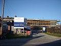 Construction Work, Sidley - geograph.org.uk - 692597.jpg 640 × 480; 61 KB
-
 Converted Barn, Acton's Farm - geograph.org.uk - 6310629.jpg 640 × 480; 80 KB
-
 Eight Acres - geograph.org.uk - 6310739.jpg 640 × 480; 59 KB
-
 Footpath, Summerhill, Bexhill-on-Sea - geograph.org.uk - 681347.jpg 640 × 480; 125 KB
-
 Glenburn Close, Sidley - geograph.org.uk - 6310647.jpg 640 × 627; 83 KB
-
 Glovers Lane, Sidley - geograph.org.uk - 6310664.jpg 640 × 561; 71 KB
-
 Great Henniker Field - geograph.org.uk - 6310689.jpg 640 × 480; 58 KB
-
 Great Henniker Wood - geograph.org.uk - 6310699.jpg 640 × 480; 134 KB
-
 Henniker Field - geograph.org.uk - 6310690.jpg 640 × 449; 61 KB
-
 Housing Association Offices, Sidley - geograph.org.uk - 692701.jpg 640 × 480; 65 KB
-
 Ingrams Avenue, Sidley - geograph.org.uk - 6310667.jpg 640 × 480; 79 KB
-
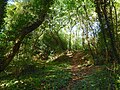 Levetts Wood - geograph.org.uk - 6310670.jpg 640 × 480; 139 KB
-
 Little High Field - geograph.org.uk - 6310616.jpg 640 × 375; 36 KB
-
 New roundabout on A269, Ninfield Road - geograph.org.uk - 6138109.jpg 1,024 × 684; 277 KB
-
 North Meadow - geograph.org.uk - 6310738.jpg 640 × 480; 56 KB
-
 Oasthouse, Buckholt Farm - geograph.org.uk - 6310735.jpg 640 × 534; 107 KB
-

-
 Pelham Hotel, Sidley - geograph.org.uk - 690506.jpg 640 × 480; 64 KB
-
 Playground, Sidley - geograph.org.uk - 692580.jpg 640 × 480; 80 KB
-
 Playground, Sidley - geograph.org.uk - 708596.jpg 640 × 480; 120 KB
-
 Primary School, Sidley - geograph.org.uk - 692582.jpg 640 × 480; 74 KB
-
 Railway Bridge, Sidley - geograph.org.uk - 692718.jpg 640 × 480; 90 KB
-
 Railway Bridge, Sidley - geograph.org.uk - 708585.jpg 640 × 480; 130 KB
-
 Residential Home, Sidley - geograph.org.uk - 692723.jpg 640 × 480; 64 KB
-
 Road Works at Sidley - geograph.org.uk - 690520.jpg 640 × 480; 74 KB
-

-
 Roundabout, A2691 - geograph.org.uk - 6310673.jpg 640 × 480; 53 KB
-
 Sidley Community Garden plaque, Buxton Drive, Bexhill.jpg 1,869 × 1,591; 429 KB
-
 Sidley United v Sidlesham (8137030560).jpg 3,296 × 2,472; 1.69 MB
-
 Sidley United v Sidlesham (8137033138).jpg 3,296 × 2,472; 1.68 MB
-
 Six Acre Brook - geograph.org.uk - 6310611.jpg 640 × 480; 59 KB
-
 Supermarket, Sidley - geograph.org.uk - 692732.jpg 640 × 480; 56 KB
-
 The Smuggling Trail Information Panel 4, Bexhill-on-Sea.jpg 2,900 × 2,050; 964 KB
-
 Upper Barn Field - geograph.org.uk - 6310632.jpg 640 × 480; 81 KB
-
 Watermill Lane Allotments, Sidley - geograph.org.uk - 712019.jpg 640 × 480; 101 KB
-
 Watermill Stream - geograph.org.uk - 6310608.jpg 480 × 640; 90 KB
-
 Community Centre, Sidley - geograph.org.uk - 692608.jpg 640 × 480; 65 KB
-

-
 Footpath to Stevens Close, Sidley - geograph.org.uk - 708582.jpg 640 × 480; 72 KB
-
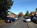
 Ninfield Road, Sidley - geograph.org.uk - 692678.jpg 640 × 480; 72 KB
-
 Sidley Working Men's Club - geograph.org.uk - 690439.jpg 640 × 480; 73 KB
-
 Temporary Medical Centre, Sidley - geograph.org.uk - 692645.jpg 640 × 480; 66 KB


.jpg)
.jpg)


