Category:Shrawardine
Jump to navigation
Jump to search
English: Shrawardine is a small village outside of Shrewsbury, the county town of Shropshire, England. Shrawardine is the home of less than two hundred people.
village in Shropshire, England, UK  | |||||
| Upload media | |||||
| Instance of | |||||
|---|---|---|---|---|---|
| Location | Montford, Shropshire, West Midlands, England | ||||
 | |||||
Subcategories
This category has only the following subcategory.
Media in category "Shrawardine"
The following 34 files are in this category, out of 34 total.
-
 A5 approaching Shrawardine Turn - geograph.org.uk - 2248583.jpg 640 × 480; 47 KB
-
 A5 north of the Shrawardine turn - geograph.org.uk - 2248586.jpg 640 × 480; 47 KB
-
 Caravan site entrance - geograph.org.uk - 1507821.jpg 640 × 480; 66 KB
-
 Low water in the river Severn - geograph.org.uk - 690141.jpg 640 × 480; 92 KB
-
 Milepost on the Holyhead road (A5) - geograph.org.uk - 664302.jpg 640 × 480; 75 KB
-
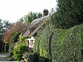 Nestling Thatch - geograph.org.uk - 361843.jpg 640 × 480; 122 KB
-
 Remains of bridge at Shrawardine - geograph.org.uk - 1753638.jpg 2,816 × 2,112; 2.84 MB
-
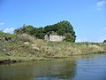
 Remains of Shrawardine Castle - geograph.org.uk - 464683.jpg 640 × 427; 82 KB
-
 Road junction in Shrawardine - geograph.org.uk - 1507830.jpg 640 × 480; 77 KB
-
 Severn at Shrawardine - geograph.org.uk - 883344.jpg 640 × 480; 102 KB
-
 Severn viewpoint at Shrawardine 1 - Shropshire - geograph.org.uk - 3606802.jpg 3,072 × 2,304; 2.26 MB
-
 Severn viewpoint at Shrawardine 2 - Shropshire - geograph.org.uk - 3606817.jpg 2,822 × 2,302; 1.45 MB
-
 Severn viewpoint at Shrawardine 3 - Shropshire - geograph.org.uk - 3606822.jpg 3,072 × 2,304; 2.16 MB
-
 Severn viewpoint at Shrawardine 4 - Shropshire - geograph.org.uk - 3606838.jpg 3,072 × 2,304; 2.19 MB
-
 Sh(r)awardine, 1796.jpg 808 × 629; 349 KB
-
 Shrawardine Salop.jpg 1,600 × 989; 238 KB
-
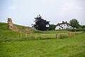
 Shrawardine Woods and Farm - geograph.org.uk - 649617.jpg 640 × 348; 62 KB
-
 Thatched timber-frame cottage - geograph.org.uk - 361823.jpg 640 × 480; 102 KB
-
 A5 junction - geograph.org.uk - 1509463.jpg 640 × 480; 62 KB
-
 Across the field to the river - geograph.org.uk - 790148.jpg 640 × 480; 67 KB
-
 Country Cottage - geograph.org.uk - 477783.jpg 640 × 480; 210 KB
-
 Cyclists resting on the Severn Way - geograph.org.uk - 360933.jpg 480 × 640; 129 KB
-
 Dumped by the farm track - geograph.org.uk - 757778.jpg 640 × 480; 118 KB
-
 Folly Pool - geograph.org.uk - 477781.jpg 640 × 480; 211 KB
-
 Grazing land near the A5 - geograph.org.uk - 659212.jpg 640 × 480; 65 KB
-
 Lane near Montford - geograph.org.uk - 659195.jpg 640 × 480; 47 KB
-
 Lane past Rodefern - geograph.org.uk - 664296.jpg 640 × 480; 99 KB
-

-

-
 Road junction by The Knolls - geograph.org.uk - 628756.jpg 640 × 480; 105 KB
-
 Safe cycling along the A5 - geograph.org.uk - 664307.jpg 640 × 480; 51 KB
-
 Sharper than it looks - geograph.org.uk - 659216.jpg 640 × 480; 62 KB
-
 Slow down you're coming upto the A5 - geograph.org.uk - 659208.jpg 640 × 480; 65 KB
-
 Wheatfield at Benthall - geograph.org.uk - 204753.jpg 640 × 480; 124 KB


_-_geograph.org.uk_-_664302.jpg)


awardine,_1796.jpg)


_-_geograph.org.uk_-_340064.jpg)


