Category:Shobdon
Jump to navigation
Jump to search
village in the United Kingdom  | |||||
| Upload media | |||||
| Instance of | |||||
|---|---|---|---|---|---|
| Location | Herefordshire, West Midlands, England | ||||
 | |||||
English: Shobdon is a small village in Herefordshire, England, situated 15 miles north of Hereford and six miles west of Leominster. It is 2 miles southwest of the Mortimer's Cross. According to the 2001 Census, the population of the parish of Shobdon was 769, consisting of 386 males and 383 females. The population had increased to 816 by the time of the 2011 Census. (→Shobdon)
Nederlands: Shobdon is een plaats en civil parish in het bestuurlijke gebied Herefordshire, in het Engelse graafschap Herefordshire met 769 inwoners. (→Shobdon)

Subcategories
This category has the following 3 subcategories, out of 3 total.
A
- Shobdon Arches (12 F)
J
Media in category "Shobdon"
The following 200 files are in this category, out of 318 total.
(previous page) (next page)-
 'There But Not There' - World War I memorial - geograph.org.uk - 5788066.jpg 1,024 × 680; 132 KB
-
 'There But Not There' - World War I memorial - geograph.org.uk - 5788069.jpg 1,024 × 680; 135 KB
-
 'There But Not There' - World War I memorial - geograph.org.uk - 5788073.jpg 680 × 1,024; 121 KB
-

-
 A Misty Day in Shobdon Hill Wood - geograph.org.uk - 4731211.jpg 4,000 × 2,664; 2.52 MB
-

-

-

-

-
 Apple orchard near Ledicot - geograph.org.uk - 2555754.jpg 640 × 480; 216 KB
-
 Approach road to Shobdon church and industrial estate - geograph.org.uk - 4274366.jpg 1,600 × 1,200; 1.78 MB
-
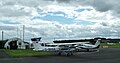
 Apron, Shobdon Airfield - geograph.org.uk - 5210600.jpg 1,024 × 683; 240 KB
-

-
 Avenue approaching Shobdon Court - geograph.org.uk - 5788646.jpg 1,024 × 680; 304 KB
-
 Avenue approaching Shobdon Court - geograph.org.uk - 5854341.jpg 1,024 × 768; 307 KB
-
 Avenue at The Arches (Shobdon) - geograph.org.uk - 5779171.jpg 1,920 × 1,080; 1.03 MB
-
 Avenue at The Arches (Shobdon) - geograph.org.uk - 5779176.jpg 1,920 × 1,080; 1,017 KB
-
 Avenue at The Arches (Shobdon) - geograph.org.uk - 6166772.jpg 3,648 × 2,736; 4.92 MB
-
 Avenue at The Arches (Shobdon) - geograph.org.uk - 6166801.jpg 3,648 × 2,056; 3.54 MB
-
 Avenue in Shobdon Park - geograph.org.uk - 4729627.jpg 1,600 × 980; 786 KB
-
 Avenue near Shobdon - geograph.org.uk - 5464037.jpg 640 × 405; 217 KB
-
 B4362 northeast of Tyn-y-Coed - geograph.org.uk - 3812562.jpg 3,648 × 2,736; 1.45 MB
-
 B4362 south of Belgate Farm - geograph.org.uk - 3733498.jpg 3,600 × 2,485; 1.56 MB
-
 B4362 west of Mortimer's Rock - geograph.org.uk - 3812571.jpg 3,648 × 2,736; 1.46 MB
-
 Barn and hay meadow, Easthampton - geograph.org.uk - 2685251.jpg 640 × 480; 94 KB
-
 Bateman Arms, Shobdon - geograph.org.uk - 5462721.jpg 640 × 480; 201 KB
-
 Belgate - geograph.org.uk - 4217122.jpg 640 × 480; 258 KB
-
 Belgate - geograph.org.uk - 4684612.jpg 800 × 600; 446 KB
-
 Belgate Lawn Coppice - geograph.org.uk - 4753129.jpg 3,468 × 2,664; 3.27 MB
-
 Bell turret and clock - geograph.org.uk - 5787983.jpg 680 × 1,024; 186 KB
-

-
 Beneath Shobdon Hill - geograph.org.uk - 4217076.jpg 800 × 600; 362 KB
-
 Blocked footpath to Shobdon - geograph.org.uk - 5834925.jpg 800 × 533; 139 KB
-
 Canal Pool in Shobdon Park - geograph.org.uk - 5834940.jpg 533 × 800; 95 KB
-
 Cat at St. John the Evangelist's Church (Shobdon) - geograph.org.uk - 6166674.jpg 3,648 × 2,736; 4.25 MB
-
 Cat at St. John the Evangelist's Church (Shobdon) - geograph.org.uk - 6166677.jpg 4,096 × 2,304; 4.78 MB
-
 Cat by the Former Pavilion (Shobdon) - geograph.org.uk - 6166687.jpg 3,648 × 2,736; 4.6 MB
-
 Cedar near Shobdon - geograph.org.uk - 5464042.jpg 473 × 640; 242 KB
-
 Cider orchard at Street Farm - geograph.org.uk - 802660.jpg 640 × 480; 105 KB
-
 Cider press on Shobdon Village Green - geograph.org.uk - 5834931.jpg 800 × 533; 123 KB
-

-
 Country road and cow parsley - geograph.org.uk - 5788599.jpg 1,024 × 680; 324 KB
-
 Disused machinery - geograph.org.uk - 914519.jpg 640 × 480; 62 KB
-
 Doorway near Shobdon - geograph.org.uk - 5464064.jpg 477 × 640; 198 KB
-
 Drive to St. John the Evangelist's Church (Shobdon) - geograph.org.uk - 5770635.jpg 1,920 × 1,080; 1.05 MB
-
 Drive to St. John the Evangelist's Church (Shobdon) - geograph.org.uk - 6166684.jpg 3,648 × 2,056; 3.59 MB
-
 Drive to St. John the Evangelist's Church (Shobdon) - geograph.org.uk - 6166779.jpg 3,648 × 2,056; 2.62 MB
-
 Drive to St. John the Evangelist's Church (Shobdon) - geograph.org.uk - 6166865.jpg 3,648 × 2,056; 3.54 MB
-
 Drive to Uphampton Farm - geograph.org.uk - 5788598.jpg 1,024 × 680; 356 KB
-
 Driveway to Shobdon Court - geograph.org.uk - 3939668.jpg 4,813 × 3,200; 4.88 MB
-
 Entrance gates to Shobdon Court - geograph.org.uk - 3938511.jpg 5,116 × 3,505; 6.6 MB
-
 Entrance Gates to St. John the Evangelist's Church (Shobdon) - geograph.org.uk - 6166699.jpg 3,648 × 2,736; 4.82 MB
-
 Entrance to Shobdon - geograph.org.uk - 3240684.jpg 640 × 436; 83 KB
-
 Entrance to Shobdon Court - geograph.org.uk - 5770636.jpg 1,920 × 1,080; 1.04 MB
-
 Entrance to Shobdon Court - geograph.org.uk - 5779168.jpg 1,920 × 1,080; 1.02 MB
-
 Entrance to Shobdon Court - geograph.org.uk - 5788592.jpg 1,024 × 680; 306 KB
-
 Entrance to Shobdon Court - geograph.org.uk - 6166913.jpg 3,648 × 2,736; 4.74 MB
-
 Entrance to Shobdon Court - geograph.org.uk - 6166922.jpg 3,648 × 2,056; 3.6 MB
-
 Entrance to Shobdon Field Station - geograph.org.uk - 3859584.jpg 1,500 × 1,125; 2.02 MB
-
 Entrance to St. John the Evangelist's Church (Shobdon) - geograph.org.uk - 5777268.jpg 2,048 × 1,360; 904 KB
-
 Entrance to St. John the Evangelist's Church (Shobdon) - geograph.org.uk - 5777271.jpg 2,048 × 1,360; 996 KB
-
 Entrance to The Arches (Shobdon) - geograph.org.uk - 5770639.jpg 1,920 × 1,080; 1.09 MB
-
 Fallen-Down Tree by Former Pavilion (Shobdon) - geograph.org.uk - 6166895.jpg 3,648 × 2,736; 5.12 MB
-
 Fallen-Down Tree by Former Pavilion (Shobdon) - geograph.org.uk - 6166903.jpg 3,648 × 2,736; 4.82 MB
-
 Farm building, Shobdon - geograph.org.uk - 4274385.jpg 1,600 × 1,200; 1.36 MB
-
 Farmland and the lane to Ledicot - geograph.org.uk - 2555743.jpg 640 × 480; 148 KB
-
 Field and Gorse Covert - geograph.org.uk - 5788621.jpg 1,024 × 680; 273 KB
-
 Field by Shobdon Court - geograph.org.uk - 6166885.jpg 3,648 × 2,056; 3.4 MB
-
-

-
 Footpath through Shobdon Park to Shobdon - geograph.org.uk - 5834983.jpg 533 × 800; 160 KB
-
-
 Former Pavilion (Shobdon) - geograph.org.uk - 5779148.jpg 1,920 × 1,080; 1.01 MB
-
 Former Pavilion (Shobdon) - geograph.org.uk - 5779202.jpg 1,920 × 1,080; 1.06 MB
-
 Former Pavilion (Shobdon) - geograph.org.uk - 6166681.jpg 3,648 × 2,736; 4.69 MB
-
 Former Pavilion (Shobdon) - geograph.org.uk - 6166726.jpg 3,648 × 2,736; 4.58 MB
-
 Former Pavilion (Shobdon) - geograph.org.uk - 6166790.jpg 3,648 × 2,056; 2.27 MB
-
 Former Pavilion (Shobdon) - geograph.org.uk - 6166897.jpg 3,648 × 2,736; 4.3 MB
-
 Former Pavilion (Shobdon) - geograph.org.uk - 6166915.jpg 3,648 × 2,056; 3.52 MB
-
 Former Pavilion and Entrance to Shobdon Court - geograph.org.uk - 6166796.jpg 3,648 × 2,056; 2.7 MB
-
 Former pavilion at Shobdon - geograph.org.uk - 5788802.jpg 1,024 × 680; 263 KB
-
 Former pavilion at Shobdon - geograph.org.uk - 5854335.jpg 1,024 × 768; 307 KB
-

-
 From Shobdon Hill - geograph.org.uk - 872901.jpg 640 × 480; 50 KB
-
 Frosty Shobdon airfield - geograph.org.uk - 4256728.jpg 1,280 × 640; 364 KB
-
 Gates near Shobdon - geograph.org.uk - 5462712.jpg 640 × 497; 262 KB
-
 Gates to Shobdon Park - geograph.org.uk - 3940111.jpg 1,506 × 1,032; 615 KB
-
 Gates to the former site of Shobdon Court - geograph.org.uk - 4274398.jpg 1,600 × 1,200; 1.5 MB
-
 Gates to Uphampton Farm - geograph.org.uk - 4771184.jpg 3,401 × 2,388; 1.94 MB
-
 Glider above Shobdon - geograph.org.uk - 6166804.jpg 3,648 × 2,056; 2.02 MB
-
 Grain store - geograph.org.uk - 913264.jpg 640 × 480; 65 KB
-
 Grass land on Shobdon Marsh - geograph.org.uk - 802671.jpg 640 × 305; 42 KB
-

-
 Hanbury Green junction - Shobdon, Herefordshire - geograph.org.uk - 4098535.jpg 2,625 × 2,299; 1.75 MB
-
 Hereford Lane - geograph.org.uk - 5631521.jpg 1,600 × 901; 696 KB
-
 Hereford Lane in early May looking south - geograph.org.uk - 2931256.jpg 4,752 × 3,168; 4.21 MB
-
 Hereford Lane, in the wet - geograph.org.uk - 2144365.jpg 640 × 480; 58 KB
-
 Herefords, Ty'n-y-Coed - geograph.org.uk - 2685264.jpg 640 × 480; 135 KB
-
 House near Shobdon Hill Wood - geograph.org.uk - 822523.jpg 640 × 480; 76 KB
-
 In Shobdon Hill Wood - geograph.org.uk - 4731243.jpg 4,000 × 2,664; 2.39 MB
-
 In the footsteps of the Romans - geograph.org.uk - 2555762.jpg 640 × 480; 186 KB
-
 Interior of Shobdon church - geograph.org.uk - 5788555.jpg 1,024 × 768; 175 KB
-
 Interior of Shobdon church - geograph.org.uk - 5788579.jpg 1,024 × 680; 191 KB
-
 Interior of Shobdon church - geograph.org.uk - 5788582.jpg 680 × 1,024; 184 KB
-
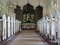 Interior of Shobdon church - geograph.org.uk - 5788618.jpg 1,024 × 768; 204 KB
-

-
 Lane at Easthampton - geograph.org.uk - 4730443.jpg 1,600 × 1,026; 798 KB
-
 Lane from Easthampton meets the B4362 - geograph.org.uk - 2555739.jpg 640 × 480; 179 KB
-
 Ledicot Lane - geograph.org.uk - 5631501.jpg 1,600 × 901; 698 KB
-
 Legacy of Bateman - Shobdon, Herefordshire - geograph.org.uk - 4112010.jpg 3,072 × 2,304; 1.93 MB
-
 Looking up the avenue of trees to Shobdon Arches - geograph.org.uk - 4274394.jpg 1,600 × 1,200; 1.83 MB
-

-
 Maize crop, Shobdon - geograph.org.uk - 2685245.jpg 640 × 480; 152 KB
-

-
 Memorial of John Lord Viscount Bateman (Shobdon) - geograph.org.uk - 5779069.jpg 3,648 × 2,736; 3.68 MB
-

-
 Methodist Chapel, Shobdon - geograph.org.uk - 154258.jpg 640 × 480; 80 KB
-
 Milestone, Shobdon - geograph.org.uk - 4701088.jpg 684 × 1,024; 452 KB
-
 Misty Signpost in Shobdon Hill Wood - geograph.org.uk - 4731218.jpg 4,000 × 2,664; 2.55 MB
-
 Mortimer Trail in the mist - geograph.org.uk - 4731232.jpg 4,000 × 2,664; 1.53 MB
-
 Muddy Lane to the Old Smithy - geograph.org.uk - 4771162.jpg 3,429 × 2,656; 2.52 MB
-
 No More Cricket at Shobdon Park - geograph.org.uk - 4729663.jpg 1,600 × 1,006; 547 KB
-
 Norman font, St John the Evangelist, Shobdon - geograph.org.uk - 4274379.jpg 1,600 × 1,200; 1.17 MB
-
 Old Stable Court, Shobdon (geograph 7265940).jpg 1,024 × 768; 136 KB
-
 Orchard, Shobdon - geograph.org.uk - 5210603.jpg 1,024 × 683; 505 KB
-
 Orchards near Ledicot, aerial 2018 - geograph.org.uk - 5843686.jpg 800 × 485; 64 KB
-
 Ornate and not so old - Shobdon, Herefordshire - geograph.org.uk - 4112013.jpg 3,072 × 2,304; 2.35 MB
-
 Ox House - geograph.org.uk - 1199125.jpg 640 × 441; 95 KB
-
 Park gate and railings in Shobdon Park - geograph.org.uk - 5834935.jpg 800 × 533; 119 KB
-
 Pasture land - geograph.org.uk - 5631500.jpg 1,600 × 901; 656 KB
-
 Path by the Shobdon Arches - geograph.org.uk - 6166798.jpg 3,648 × 2,056; 3.33 MB
-
 Path by the Shobdon Arches - geograph.org.uk - 6166807.jpg 3,648 × 2,056; 3.5 MB
-
 Path near Shobdon - geograph.org.uk - 5464123.jpg 640 × 480; 204 KB
-
 Peaceful pastures, 2017 - geograph.org.uk - 5631509.jpg 1,600 × 901; 647 KB
-
 Pearl Lake, Shobdon - geograph.org.uk - 5210606.jpg 1,024 × 683; 575 KB
-
 Ploughed field by the lane from Ledicot - geograph.org.uk - 2555755.jpg 640 × 480; 197 KB
-
 Pond near Shobdon church - geograph.org.uk - 4274391.jpg 1,600 × 1,200; 1.87 MB
-
 Poultry unit by Shobdon Airfield - geograph.org.uk - 802689.jpg 640 × 480; 98 KB
-
 RAF Hercules over Shobdon airfield - geograph.org.uk - 4876204.jpg 2,048 × 543; 515 KB
-
 RAF Hercules over Shobdon airfield - geograph.org.uk - 4876210.jpg 2,048 × 889; 676 KB
-

-
-
 Road Cut Into The Rock - geograph.org.uk - 743155.jpg 640 × 421; 98 KB
-
 Road junction at Easthampton - geograph.org.uk - 5788596.jpg 1,024 × 680; 296 KB
-
 Road, Shobdon Hill - geograph.org.uk - 4282595.jpg 427 × 640; 82 KB
-
 Roadside and woods. - geograph.org.uk - 822808.jpg 640 × 480; 68 KB
-
 Roadside with spring fields - geograph.org.uk - 822800.jpg 640 × 480; 80 KB
-
 Seat at St. John the Evangelist's Church (Shobdon) - geograph.org.uk - 6166694.jpg 3,648 × 2,736; 4.74 MB
-
 Sheep by the Arches (Shobdon) - geograph.org.uk - 6166769.jpg 3,648 × 2,736; 4.07 MB
-
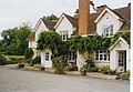
 Shobdon - Bateman Arms pub - geograph.org.uk - 822503.jpg 640 × 480; 86 KB
-
 Shobdon - disused filling station - geograph.org.uk - 821577.jpg 640 × 480; 80 KB
-
 Shobdon - geograph.org.uk - 5683721.jpg 1,024 × 576; 354 KB
-
 Shobdon - Hanbury Green estate - geograph.org.uk - 822528.jpg 640 × 480; 81 KB
-
 Shobdon - The Woodhouse - geograph.org.uk - 821580.jpg 640 × 480; 76 KB
-

-
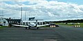
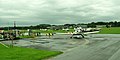
 Shobdon Airfield - geograph.org.uk - 3089215.jpg 4,048 × 2,343; 3.1 MB
-
 Shobdon Airfield - geograph.org.uk - 3931043.jpg 1,553 × 698; 549 KB
-
 Shobdon Airfield - geograph.org.uk - 5210604.jpg 1,024 × 683; 267 KB
-
 Shobdon Airfield - geograph.org.uk - 6199506.jpg 4,048 × 2,029; 2.45 MB
-
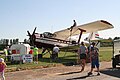
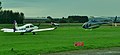
 Shobdon Airfield - Shorts Skyvan and Extra EA300 - geograph.org.uk - 6199500.jpg 4,048 × 2,030; 2.57 MB
-
 Shobdon Airfield - Shorts Skyvan and Piper PA-38 Tomahawk - geograph.org.uk - 6199517.jpg 3,266 × 2,029; 1.92 MB
-
 Shobdon Airfield apron - geograph.org.uk - 6199513.jpg 4,048 × 2,113; 2.08 MB
-
 Shobdon Airfield buildings - geograph.org.uk - 6199512.jpg 4,048 × 2,029; 2.3 MB
-
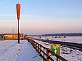 Shobdon airfield winter - geograph.org.uk - 3307734.jpg 2,548 × 1,884; 1.76 MB
-
 Shobdon Airfield. King's Cup Air Race Day 2012 - geograph.org.uk - 3095309.jpg 3,922 × 1,796; 2.85 MB
-
 Shobdon Airfield. King's Cup Air Race Day 2012 - geograph.org.uk - 3095314.jpg 4,048 × 1,535; 2.93 MB
-
 Shobdon Airfield. King's Cup Air Race Day 2012 - geograph.org.uk - 3095318.jpg 3,711 × 1,504; 2.2 MB
-
 Shobdon Airfield. King's Cup Race Day - geograph.org.uk - 3089229.jpg 4,048 × 2,225; 2.76 MB
-
 Shobdon Airfield. King's Cup Race Day - geograph.org.uk - 3089240.jpg 4,048 × 2,028; 2.92 MB
-
 Shobdon Airfield. King's Cup Race Day - geograph.org.uk - 3089245.jpg 2,848 × 1,083; 1.27 MB
-
 Shobdon Arches - geograph.org.uk - 4274363.jpg 1,024 × 768; 330 KB
-
 Shobdon Arches - geograph.org.uk - 5788649.jpg 1,024 × 680; 319 KB
-
 Shobdon Arches - geograph.org.uk - 5788766.jpg 1,024 × 680; 338 KB
-
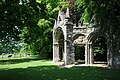 Shobdon Arches - geograph.org.uk - 5788769.jpg 1,024 × 680; 342 KB
-
 Shobdon Arches near Shobdon - geograph.org.uk - 5462700.jpg 640 × 498; 259 KB
-
 Shobdon church - geograph.org.uk - 5787975.jpg 1,024 × 680; 285 KB
-
 Shobdon church - geograph.org.uk - 5787977.jpg 1,024 × 680; 330 KB
-
 Shobdon church - geograph.org.uk - 5788573.jpg 680 × 1,024; 340 KB
-
 Shobdon church - geograph.org.uk - 5788637.jpg 1,024 × 680; 312 KB
-
 Shobdon church with the old stable block beyond - geograph.org.uk - 4276327.jpg 1,600 × 1,200; 1.48 MB
-
 Shobdon churchyard and church tower - geograph.org.uk - 4276331.jpg 1,600 × 1,200; 1.49 MB
-
 Shobdon Churchyard Yews - geograph.org.uk - 4644422.jpg 1,440 × 960; 920 KB
-
 Shobdon Court (geograph 3939708).jpg 5,357 × 3,562; 4.1 MB
-
 Shobdon Court (Stable Block) - geograph.org.uk - 5770659.jpg 2,048 × 1,360; 1.38 MB
-
 Shobdon Court (Stable Block) - geograph.org.uk - 5779078.jpg 1,920 × 1,080; 1.05 MB
-
 Shobdon Court (Stable Block) - geograph.org.uk - 6166701.jpg 2,736 × 3,648; 4.69 MB
-
 Shobdon Court (Stable Block) - geograph.org.uk - 6166713.jpg 3,648 × 2,736; 4.47 MB
-
 Shobdon Court (Summer House) - geograph.org.uk - 6166883.jpg 3,648 × 2,056; 3.13 MB
-
 Shobdon Court - geograph.org.uk - 6166710.jpg 3,648 × 2,736; 4.75 MB
-
 Shobdon Court - geograph.org.uk - 6166879.jpg 3,648 × 2,056; 3.48 MB
-
 Shobdon Court gateway - geograph.org.uk - 822506.jpg 640 × 480; 104 KB
-
 Shobdon Hill - geograph.org.uk - 3370234.jpg 2,592 × 1,944; 2.3 MB
-
 Shobdon Old Stable Court - geograph.org.uk - 5787980.jpg 1,024 × 680; 294 KB
-
 Shobdon Old Stable Court - geograph.org.uk - 5788586.jpg 1,024 × 680; 266 KB
-
 Shobdon post office - geograph.org.uk - 822500.jpg 640 × 480; 82 KB
-
 Shobdon to Byton Hand road - geograph.org.uk - 822813.jpg 640 × 480; 54 KB
-
 Shobdon village green - geograph.org.uk - 822534.jpg 640 × 480; 91 KB
-
 Shobdon's cider press - geograph.org.uk - 2685271.jpg 640 × 480; 156 KB
-
 Shobdon, St. John the Evangelist's Church - geograph.org.uk - 5750319.jpg 4,670 × 3,116; 2.8 MB
-


_-_geograph.org.uk_-_5834736.jpg)
_-_geograph.org.uk_-_5834738.jpg)
_-_geograph.org.uk_-_5834743.jpg)


_-_geograph.org.uk_-_5779171.jpg)
_-_geograph.org.uk_-_5779176.jpg)
_-_geograph.org.uk_-_6166772.jpg)
_-_geograph.org.uk_-_6166801.jpg)


_-_geograph.org.uk_-_5779052.jpg)


_-_geograph.org.uk_-_6166674.jpg)
_-_geograph.org.uk_-_6166677.jpg)
_-_geograph.org.uk_-_6166687.jpg)


_-_geograph.org.uk_-_5777282.jpg)


_-_geograph.org.uk_-_5770635.jpg)
_-_geograph.org.uk_-_6166684.jpg)
_-_geograph.org.uk_-_6166779.jpg)
_-_geograph.org.uk_-_6166865.jpg)


_-_geograph.org.uk_-_6166699.jpg)


_-_geograph.org.uk_-_5777268.jpg)
_-_geograph.org.uk_-_5777271.jpg)
_-_geograph.org.uk_-_5770639.jpg)
_-_geograph.org.uk_-_6166895.jpg)
_-_geograph.org.uk_-_6166903.jpg)


_-_geograph.org.uk_-_5779148.jpg)
_-_geograph.org.uk_-_5779202.jpg)
_-_geograph.org.uk_-_6166681.jpg)
_-_geograph.org.uk_-_6166726.jpg)
_-_geograph.org.uk_-_6166790.jpg)
_-_geograph.org.uk_-_6166897.jpg)
_-_geograph.org.uk_-_6166915.jpg)


_-_geograph.org.uk_-_6166824.jpg)


_-_geograph.org.uk_-_6166876.jpg)
_-_geograph.org.uk_-_5779069.jpg)
_-_geograph.org.uk_-_6166698.jpg)


.jpg)


_-_geograph.org.uk_-_5834749.jpg)


_-_geograph.org.uk_-_6166694.jpg)
_-_geograph.org.uk_-_6166769.jpg)


.jpg)
_-_geograph.org.uk_-_5770659.jpg)
_-_geograph.org.uk_-_5779078.jpg)
_-_geograph.org.uk_-_6166701.jpg)
_-_geograph.org.uk_-_6166713.jpg)
_-_geograph.org.uk_-_6166883.jpg)


_-_geograph.org.uk_-_5750343.jpg)