Category:Shirburn
Jump to navigation
Jump to search
English: Shirburn is a village and civil parish about south of Thame in Oxfordshire. The eastern part of the parish is in the Chiltern Hills.
village and civil parish in South Oxfordshire district, Oxfordshire, England _All_Saints_Church_-_geograph.org.uk_-_69744.jpg) | |||||
| Upload media | |||||
| Instance of | |||||
|---|---|---|---|---|---|
| Location | South Oxfordshire, Oxfordshire, South East England, England | ||||
| Area |
| ||||
 | |||||
Subcategories
This category has the following 4 subcategories, out of 4 total.
Media in category "Shirburn"
The following 56 files are in this category, out of 56 total.
-
 A misty Ridgeway - geograph.org.uk - 1172969.jpg 640 × 480; 112 KB
-
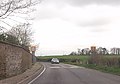
 B4009 approaching Shirburn - geograph.org.uk - 3924011.jpg 640 × 391; 81 KB
-
-
 Barn at New Gardens - geograph.org.uk - 3452016.jpg 4,688 × 3,072; 2.89 MB
-
 Barn at Portobello Farm, Shirburn - geograph.org.uk - 6024666.jpg 1,024 × 716; 172 KB
-
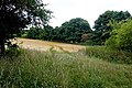
 Brookside Covert - geograph.org.uk - 2784649.jpg 1,024 × 600; 183 KB
-
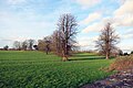
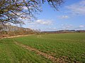
 Farmland, Shirburn - geograph.org.uk - 2818794.jpg 640 × 480; 170 KB
-

-
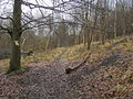 Footpath Junction - geograph.org.uk - 1174403.jpg 640 × 480; 139 KB
-
 Footpath Over The Brook - geograph.org.uk - 2784659.jpg 1,024 × 624; 281 KB
-
 Hillside, Shirburn - geograph.org.uk - 2333188.jpg 640 × 427; 126 KB
-
 In Blackmoor Wood - geograph.org.uk - 1435223.jpg 427 × 640; 239 KB
-
 In Blackmoor Wood - geograph.org.uk - 1435225.jpg 640 × 426; 203 KB
-
 K6 Telephone Box and Post Box in Shirburn - geograph.org.uk - 5462982.jpg 1,944 × 2,592; 944 KB
-
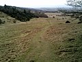
 Look back at a path going up Shirburn Hill - geograph.org.uk - 3301096.jpg 2,048 × 1,536; 576 KB
-
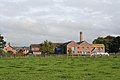
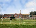 Model Farm - geograph.org.uk - 4874138.jpg 1,024 × 807; 216 KB
-
 Model Farm, Shirburn - geograph.org.uk - 720438.jpg 640 × 480; 150 KB
-
 Model Farm, Shirburn.jpg 3,456 × 2,304; 1.6 MB
-
 Mouse nest - Flickr - gailhampshire.jpg 3,608 × 3,352; 2.71 MB
-
 Not In My Woods.... - geograph.org.uk - 3495792.jpg 2,560 × 1,920; 1.56 MB
-
 Over the wall in Shirburn Park - geograph.org.uk - 4776970.jpg 4,000 × 2,664; 2.67 MB
-
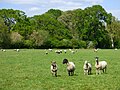 Pasture, Shirburn - geograph.org.uk - 6165419.jpg 1,024 × 768; 280 KB
-
 Pasture, Shirburn - geograph.org.uk - 720439.jpg 640 × 480; 142 KB
-
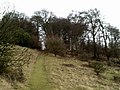
 Path down Shirburn Hill - geograph.org.uk - 3301094.jpg 2,048 × 1,536; 631 KB
-
 Path down Shirburn Hill - geograph.org.uk - 3558901.jpg 4,000 × 3,000; 2.23 MB
-
 Public footpath to Lewknor - geograph.org.uk - 3301092.jpg 2,048 × 1,536; 801 KB
-
 Road Closed (23670163833).jpg 1,280 × 720; 263 KB
-
 Shirburn Hill - geograph.org.uk - 110077.jpg 640 × 480; 173 KB
-
 Shirburn Hill - geograph.org.uk - 1416870.jpg 640 × 427; 79 KB
-
 Shirburn Hill from the Ridgeway - geograph.org.uk - 3301098.jpg 2,048 × 1,536; 567 KB
-
 Shirburn Hill, Shirburn - geograph.org.uk - 6024672.jpg 1,024 × 768; 279 KB
-
 Shirburn Wood - geograph.org.uk - 1308405.jpg 640 × 480; 125 KB
-
 Shotridge Wood - geograph.org.uk - 1435229.jpg 640 × 425; 213 KB
-
 The Back of Blenheim Road (geograph 4200632).jpg 1,600 × 1,132; 471 KB
-
 The Marl Brook near South Weston - geograph.org.uk - 4873138.jpg 785 × 1,024; 387 KB
-
 The Oxfordshire Way near Shirburn - geograph.org.uk - 4456655.jpg 4,000 × 2,856; 3.51 MB
-
 The Ridgeway - geograph.org.uk - 1435572.jpg 640 × 426; 204 KB
-
 This way towards Watlington - geograph.org.uk - 3301099.jpg 2,048 × 1,536; 691 KB
-
 Towards Brookside Covert - geograph.org.uk - 2784637.jpg 1,024 × 560; 256 KB
-
 Trees on Shirburn Hill - geograph.org.uk - 3301097.jpg 2,048 × 1,536; 422 KB
-
 Trig point on Shirburn Hill - geograph.org.uk - 3301093.jpg 2,048 × 1,536; 774 KB
-
 Shirburn benchmark - geograph.org.uk - 3507967.jpg 533 × 800; 108 KB
-
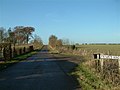
 Watlington Road - geograph.org.uk - 3507966.jpg 1,024 × 683; 154 KB
-
 Watlington Road - geograph.org.uk - 815406.jpg 640 × 480; 63 KB
-
 Woodland and pasture, Shirburn - geograph.org.uk - 2333179.jpg 640 × 480; 150 KB
-
 Woodland, Shirburn - geograph.org.uk - 6003541.jpg 1,024 × 768; 318 KB
-
 Yard at Portobello Farm - geograph.org.uk - 3668696.jpg 1,024 × 673; 153 KB
-
 Farmland and copse, Shirburn - geograph.org.uk - 720436.jpg 640 × 480; 163 KB
-
 Farmland and woodland, Shirburn - geograph.org.uk - 720442.jpg 640 × 480; 120 KB
-
 Farmland, Shirburn - geograph.org.uk - 718777.jpg 640 × 480; 155 KB
-
 Field off the Ridgeway - geograph.org.uk - 1435565.jpg 640 × 426; 201 KB
-
 Ridgeway below Shirburn Hill - geograph.org.uk - 585779.jpg 640 × 480; 135 KB
-
 Ridgeway near Shirburn - geograph.org.uk - 123128.jpg 640 × 480; 206 KB
-
 The road to Model Farm - geograph.org.uk - 93430.jpg 640 × 481; 41 KB
-
 Timber Yard, Pyrton Hill - geograph.org.uk - 110025.jpg 640 × 395; 117 KB
-
 Track to Shirburn - geograph.org.uk - 585782.jpg 640 × 480; 74 KB


.jpg)


.jpg)


