Category:Sharnbrook
Jump to navigation
Jump to search
village and civil parish in Bedfordshire, UK  | |||||
| Upload media | |||||
| Instance of | |||||
|---|---|---|---|---|---|
| Location | Bedford, Bedfordshire, East of England, England | ||||
 | |||||
Subcategories
This category has the following 5 subcategories, out of 5 total.
A
- Sharnbrook Academy (4 F)
C
- Colworth House (3 F)
F
- Felmersham Gravel Pits (20 F)
R
- Sharnbrook railway station (1 F)
S
- St Peter's church, Sharnbrook (12 F)
Media in category "Sharnbrook"
The following 144 files are in this category, out of 144 total.
-
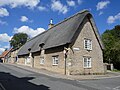
 28 to 32 High Street, Sharnbrook (geograph 7583131).jpg 1,024 × 768; 172 KB
-
 31 Sharnbrook.jpg 1,369 × 946; 278 KB
-
 32 High Street.jpg 1,306 × 828; 144 KB
-
 42 High Street, Sharnbrook (geograph 7584166).jpg 1,024 × 768; 203 KB
-
 48 High Street, Sharnbrook (geograph 7584178).jpg 1,024 × 768; 191 KB
-
 61 High Street, Sharnbrook (geograph 7571655).jpg 1,024 × 768; 211 KB
-
 A6 heading south - geograph.org.uk - 3131756.jpg 640 × 480; 58 KB
-
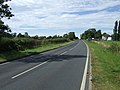 A6 towards Rushden - geograph.org.uk - 3131744.jpg 640 × 480; 72 KB
-
 Barleycroft - geograph.org.uk - 4741166.jpg 640 × 409; 49 KB
-
 Bedford Road, Sharnbrook - geograph.org.uk - 5441021.jpg 2,014 × 1,490; 872 KB
-
 Bedford Road, Sharnbrook - geograph.org.uk - 5441023.jpg 2,048 × 1,536; 1.01 MB
-
 Bench on Park Lane - geograph.org.uk - 6267837.jpg 1,600 × 1,066; 432 KB
-
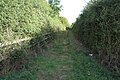
 Bridleway to Sharnbrook - geograph.org.uk - 6171344.jpg 1,600 × 1,066; 466 KB
-
 Bridleway to Sharnbrook - geograph.org.uk - 6171346.jpg 1,600 × 1,066; 511 KB
-
 Bridleway to the A6 - geograph.org.uk - 6267845.jpg 1,600 × 1,066; 534 KB
-
 Bridleway towards Temple Wood - geograph.org.uk - 6267838.jpg 1,600 × 1,066; 625 KB
-
 Castle Close Wildlife and Heritage Site - geograph.org.uk - 4423974.jpg 3,672 × 4,896; 6 MB
-

-
 Cottages, Sharnbrook (geograph 7583126).jpg 1,024 × 768; 235 KB
-
 Ditch and farmland near The Driftway - geograph.org.uk - 6267818.jpg 1,600 × 1,066; 532 KB
-
 Down MML HST passing Sharnbrook in the rain.jpg 1,719 × 1,752; 2.4 MB
-
 Drive to Colworth House by The Swell - geograph.org.uk - 6267794.jpg 1,600 × 1,066; 525 KB
-
 Entrance to Felmersham Gravel Pits Nature Reserve - geograph.org.uk - 4423820.jpg 4,896 × 3,672; 5.89 MB
-
 Entrance to Sharnbrook - geograph.org.uk - 3819726.jpg 640 × 480; 54 KB
-
 Farmland near Francroft Wood - geograph.org.uk - 4741167.jpg 640 × 418; 60 KB
-
 Farmland off the A6 - geograph.org.uk - 3131754.jpg 640 × 480; 58 KB
-
 Farmland towards Greenacres - geograph.org.uk - 3131752.jpg 640 × 480; 53 KB
-
 Farmland towards kennels - geograph.org.uk - 3131741.jpg 640 × 488; 93 KB
-
 Farmland towards Temple Wood - geograph.org.uk - 3131736.jpg 640 × 480; 100 KB
-
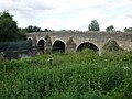 Felmersham Bridge (geograph 7582382).jpg 1,024 × 768; 230 KB
-
 Felmersham bridge - geograph.org.uk - 3856626.jpg 4,320 × 3,240; 4.98 MB
-
 Felmersham bridge - geograph.org.uk - 4423187.jpg 2,048 × 1,536; 397 KB
-
 Felmersham Bridge - geograph.org.uk - 4552186.jpg 4,320 × 3,240; 4.82 MB
-
 Felmersham Bridge - geograph.org.uk - 4861127.jpg 4,896 × 3,672; 6.07 MB
-
 Felmersham Bridge - geograph.org.uk - 5713951.jpg 5,308 × 3,542; 5.23 MB
-
 Felmersham Bridge - geograph.org.uk - 5714369.jpg 7,360 × 4,912; 7.5 MB
-
 Felmersham Bridge - geograph.org.uk - 5720415.jpg 4,560 × 3,043; 3.8 MB
-
 Felmersham Bridge - geograph.org.uk - 5924348.jpg 4,896 × 2,301; 2.98 MB
-
 Felmersham Bridge 1 - geograph.org.uk - 247925.jpg 640 × 442; 128 KB
-
 Felmersham bridge ^ River Ouse - geograph.org.uk - 3892554.jpg 640 × 427; 125 KB
-
 Felmersham Causeway - geograph.org.uk - 3020123.jpg 3,264 × 2,448; 3.91 MB
-
 Felmersham Gravel Pits (nature reserve) - geograph.org.uk - 6171338.jpg 1,600 × 1,066; 364 KB
-
 Felmersham Gravel Pits Nature Reserve - geograph.org.uk - 4423809.jpg 4,896 × 3,672; 6.38 MB
-
 Felmersham Gravel Pits Nature Reserve - geograph.org.uk - 5713956.jpg 4,188 × 2,795; 1.84 MB
-
 Felmersham Gravel Pits Nature Reserve - geograph.org.uk - 5719867.jpg 1,857 × 1,239; 511 KB
-
 Felmersham Gravel Pits Nature Reserve entrance - geograph.org.uk - 5713958.jpg 7,360 × 4,912; 5.64 MB
-
 Felmersham, St. Mary's Church - geograph.org.uk - 5713945.jpg 7,174 × 4,787; 6.88 MB
-
 Footbridge at Felmersham Gravel Pits - geograph.org.uk - 4422989.jpg 1,800 × 3,200; 2.68 MB
-
 Footpath and track to Winsey Farm - geograph.org.uk - 6267819.jpg 1,600 × 1,066; 441 KB
-
 Footpath going over the railway - geograph.org.uk - 6267830.jpg 1,600 × 1,066; 501 KB
-
 Footpath into the Felmersham Gravel Pits - geograph.org.uk - 6171336.jpg 1,600 × 1,066; 440 KB
-
 Footpath into the Rookery - geograph.org.uk - 6267805.jpg 1,600 × 1,066; 513 KB
-
 Footpath Sign at Sharnbrook - geograph.org.uk - 4423930.jpg 3,672 × 4,896; 5.98 MB
-
 Footpath through Woodland - geograph.org.uk - 269780.jpg 640 × 480; 128 KB
-
 Footpath to the A6 - geograph.org.uk - 6267841.jpg 1,600 × 1,066; 525 KB
-
 Footpath to the Rookery - geograph.org.uk - 6267798.jpg 1,600 × 1,066; 552 KB
-
 Footpath to the Rookery - geograph.org.uk - 6267813.jpg 1,600 × 1,066; 659 KB
-
 Footpath to Winsey Farm - geograph.org.uk - 6267834.jpg 1,600 × 1,066; 402 KB
-
 Footpath towards the A6 - geograph.org.uk - 6267547.jpg 1,600 × 1,066; 402 KB
-
 Footpath towards the Fordham Arms - geograph.org.uk - 6267826.jpg 1,600 × 1,066; 548 KB
-
 Former Police Station at Sharnbrook - geograph.org.uk - 445787.jpg 640 × 480; 102 KB
-
 Gate from Odell Road - geograph.org.uk - 4422953.jpg 3,200 × 1,800; 1.86 MB
-
 Gate of St. Peter’s Church Sharnbrook - geograph.org.uk - 4422961.jpg 904 × 1,877; 548 KB
-
 Glasshouses - geograph.org.uk - 4782884.jpg 640 × 426; 56 KB
-
 Halsey Wood - geograph.org.uk - 6171354.jpg 1,600 × 1,066; 352 KB
-
 HorseFireEngineBedfordMuseum.JPG 2,340 × 1,764; 775 KB
-
 In Deadmans Spinney - geograph.org.uk - 3131750.jpg 480 × 640; 157 KB
-
 John-Gibbard-Lower-School-Sharnbrook.jpg 3,008 × 2,000; 2.9 MB
-
 Junction of Odell Road and The Causeway - geograph.org.uk - 4850224.jpg 4,896 × 3,672; 6.96 MB
-
 Lake at Felmersham Gravel Pits - geograph.org.uk - 4422947.jpg 1,800 × 3,200; 1.36 MB
-
 Lawn down to the Ouse - geograph.org.uk - 6171349.jpg 1,600 × 1,066; 489 KB
-
 Leaning bench by the junction of footpaths - geograph.org.uk - 6267824.jpg 1,600 × 1,066; 516 KB
-
 Little Thatch, Sharnbrook (geograph 7584170).jpg 1,024 × 768; 219 KB
-

-
 Market Garden sunflowers - geograph.org.uk - 6267848.jpg 1,600 × 1,066; 630 KB
-

-
 Minor road towards the A6 - geograph.org.uk - 3131737.jpg 640 × 480; 69 KB
-
 Modern House and Converted Windmill in Sharnbrook - geograph.org.uk - 4423927.jpg 4,896 × 3,672; 6.17 MB
-
 New Farm - geograph.org.uk - 4851516.jpg 640 × 640; 159 KB
-
 North Lodge for the Colworth estate - geograph.org.uk - 6267792.jpg 1,600 × 1,066; 463 KB
-
 Old-Police-Station-Sharnbrook.jpg 3,008 × 2,000; 2.76 MB
-
 Parking area on Bedford Road, Sharnbrook - geograph.org.uk - 5441028.jpg 2,048 × 1,536; 1.11 MB
-
 Parking area on Bedford Road, Sharnbrook - geograph.org.uk - 5441030.jpg 2,048 × 1,536; 1.54 MB
-
 Parking area on Bedford Road, Sharnbrook - geograph.org.uk - 6292605.jpg 1,920 × 1,280; 1.2 MB
-
 Parking area on Bedford Road, Sharnbrook - geograph.org.uk - 6292606.jpg 1,870 × 1,202; 1.02 MB
-
 Path through Castle Close - geograph.org.uk - 6267814.jpg 1,600 × 1,066; 496 KB
-
 Railway Bridge at Sharnbrook - geograph.org.uk - 445794.jpg 640 × 480; 118 KB
-
-
 Right turn on Bedford Road, Sharnbrook - geograph.org.uk - 6292604.jpg 1,920 × 1,280; 1.69 MB
-

-
 River Great Ouse by Radwell Bridge - geograph.org.uk - 86505.jpg 640 × 477; 63 KB
-
 River Great Ouse near Felmersham - geograph.org.uk - 4861121.jpg 4,896 × 3,672; 7.14 MB
-
 River Great Ouse near Felmersham - geograph.org.uk - 4861123.jpg 4,896 × 3,672; 6.41 MB
-
 River Ouse near Felmersham - geograph.org.uk - 5724255.jpg 1,024 × 683; 283 KB
-
 Round Wood across a newly ploughed field - geograph.org.uk - 6267802.jpg 1,600 × 1,066; 593 KB
-
 Roundabout on Bedford Road, Sharnbrook - geograph.org.uk - 6292607.jpg 1,854 × 1,172; 1.03 MB
-
 Roundabout on the A6, Sharnbrook - geograph.org.uk - 5428725.jpg 2,048 × 1,536; 1.5 MB
-
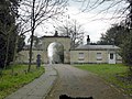
 Security Gate - geograph.org.uk - 270255.jpg 640 × 480; 106 KB
-
 Sharnbrook - geograph.org.uk - 3856845.jpg 4,320 × 3,240; 4.74 MB
-
 Sharnbrook Midland Main line - geograph.org.uk - 2666867.jpg 640 × 417; 66 KB
-
 Sharnbrook Mill.jpg 1,944 × 2,024; 1.03 MB
-
 Sharnbrook Primary School (geograph 7583129).jpg 1,024 × 753; 177 KB
-
 Sharnbrook School - geograph.org.uk - 4423947.jpg 4,896 × 3,672; 5.47 MB
-
 Sharnbrook Scout 'Hut' - geograph.org.uk - 5713929.jpg 5,247 × 3,502; 4.04 MB
-
 Sharnbrook Watermill - geograph.org.uk - 247161.jpg 640 × 456; 140 KB
-
 Sharnbrook windmill.jpg 395 × 640; 74 KB
-
 Sharnbrook, St. Peter's Church - geograph.org.uk - 5713937.jpg 6,398 × 4,268; 6.6 MB
-
 Sharnbrook-High-Street.jpg 3,008 × 2,000; 2.6 MB
-
 Signs at footpath in The Swell - geograph.org.uk - 4422957.jpg 1,800 × 3,200; 1.59 MB
-
 Small tree by Bedford Road, Sharnbrook - geograph.org.uk - 5441031.jpg 2,048 × 1,536; 1.5 MB
-
 St Peter's churchyard - geograph.org.uk - 6267815.jpg 1,600 × 1,066; 543 KB
-
 St. Peter’s Churchyard Sharnbrook - geograph.org.uk - 4422969.jpg 1,800 × 3,200; 2.08 MB
-
 Swan with 2 Nicks, Sharnbrook - geograph.org.uk - 4423209.jpg 2,048 × 1,536; 387 KB
-
 The A6 near Sharnbrook - geograph.org.uk - 6351090.jpg 1,920 × 1,280; 1.43 MB
-
 The Causeway, Felmersham - geograph.org.uk - 4423806.jpg 4,896 × 3,672; 6.44 MB
-
 The Lodge Sharnbrook - geograph.org.uk - 4423201.jpg 2,048 × 1,536; 419 KB
-
 The Swan with Two Nicks - geograph.org.uk - 6267816.jpg 1,600 × 1,066; 362 KB
-
 Towards Barwick Spinney - geograph.org.uk - 4851515.jpg 640 × 640; 77 KB
-
 Towards Lee Farm - geograph.org.uk - 4851514.jpg 640 × 640; 84 KB
-
 Unilever research establishment across the fields - geograph.org.uk - 6166397.jpg 1,600 × 1,066; 482 KB
-
 View from Felmersham Bridge - geograph.org.uk - 247938.jpg 640 × 426; 94 KB
-

-
 Woodland round Felmersham gravel pits - geograph.org.uk - 6171347.jpg 1,600 × 1,066; 447 KB
-
 Yelnow Lane - geograph.org.uk - 269791.jpg 640 × 480; 118 KB
-
 Clay-pit lakes behind Radwell - geograph.org.uk - 88687.jpg 640 × 480; 66 KB
-
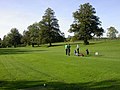 Colworth Golf Club - geograph.org.uk - 270253.jpg 640 × 480; 86 KB
-
 Colworth Laboratories - geograph.org.uk - 270251.jpg 640 × 480; 117 KB
-

-
 Felmersham Bridge 2 - geograph.org.uk - 247928.jpg 640 × 433; 151 KB
-
 Footpath through Woodland - geograph.org.uk - 270259.jpg 640 × 480; 144 KB
-
 Moor end - geograph.org.uk - 88690.jpg 640 × 480; 82 KB
-
 Riding school in Radwell - geograph.org.uk - 88686.jpg 640 × 480; 95 KB
-
 Road to Radwell Bridge - geograph.org.uk - 86497.jpg 640 × 480; 129 KB
-
 Sharnbrook - Railway Bridges in Mill Road - geograph.org.uk - 249899.jpg 640 × 480; 120 KB
-

-
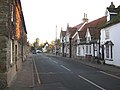 Sharnbrook High Street - geograph.org.uk - 84324.jpg 640 × 480; 115 KB
-
 Sharnbrook Industrial Estate - Mill Road - geograph.org.uk - 249922.jpg 640 × 434; 170 KB
-
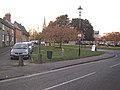 Sharnbrook Village - geograph.org.uk - 84330.jpg 640 × 480; 115 KB
-
 Stile - geograph.org.uk - 503325.jpg 640 × 480; 47 KB
-
 The road to Radwell - geograph.org.uk - 86504.jpg 640 × 469; 59 KB
-
 Trainspotters - geograph.org.uk - 86506.jpg 640 × 480; 91 KB
-
 Water meadows north of Sharnbrook - geograph.org.uk - 472415.jpg 640 × 480; 90 KB
-
 Wildlife Ponds at Felmersham - geograph.org.uk - 330300.jpg 640 × 480; 150 KB
-
 Yelnow Lane near Colworth Golf Club - geograph.org.uk - 393039.jpg 640 × 480; 100 KB
.jpg)


.jpg)
.jpg)
.jpg)


.jpg)


.jpg)


_-_geograph.org.uk_-_6171338.jpg)


.jpg)


.jpg)


