Category:Shap
Jump to navigation
Jump to search

village in Cumbria, United Kingdom  | |||||
| Upload media | |||||
| Instance of | |||||
|---|---|---|---|---|---|
| Location | Eden, Cumbria, North West England, England | ||||
 | |||||
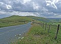
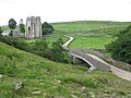
English: Shap is a linear village located amongst fells and isolated dales in Eden district, Cumbria, England. The village lies along the A6 road and is near to the M6 motorway. It is situated 10 miles from Penrith and about 15 miles from Kendal.
Subcategories
This category has the following 14 subcategories, out of 14 total.
B
- The Bulls Head Inn, Shap (4 F)
C
- Crown Inn, Shap (2 F)
G
- Greyhound Hotel, Shap (6 F)
K
- Kings Arms Hotel, Shap (6 F)
L
- Longfell Gill (2 F)
M
R
- Shap railway station (1 F)
S
- Shap Market Cross (4 F)
- Shap Pink Quarry (7 F)
- Shap Spa (9 F)
- Shap Stone Avenue (5 F)
- Shap Wells Hotel (26 F)
W
- Wet Sleddale Reservoir (13 F)
Media in category "Shap"
The following 200 files are in this category, out of 330 total.
(previous page) (next page)-
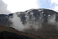
 66623 at Shap Summit - August 2016 - geograph.org.uk - 5064298.jpg 1,250 × 763; 1.01 MB
-
 A granite wall. - geograph.org.uk - 92249.jpg 640 × 480; 101 KB
-
 A high motorway junction. - geograph.org.uk - 88767.jpg 640 × 445; 71 KB
-
 A narrow lane signposted for Shap Abbey - geograph.org.uk - 2668378.jpg 4,592 × 3,056; 5.41 MB
-
 A rainy A6 south of Shap - geograph.org.uk - 2643586.jpg 1,024 × 768; 128 KB
-
 A6 - geograph.org.uk - 173666.jpg 640 × 480; 246 KB
-
 A6 bridge over the West Coast Main Line - geograph.org.uk - 4922888.jpg 1,632 × 1,224; 463 KB
-
 A6 heading north - geograph.org.uk - 5201234.jpg 640 × 480; 50 KB
-
 A6 heading north east - geograph.org.uk - 5201209.jpg 640 × 480; 49 KB
-
 A6 near Shap Blue Quarry - geograph.org.uk - 5201212.jpg 640 × 480; 76 KB
-

-
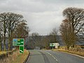
 A6 north entering Shap - geograph.org.uk - 2947207.jpg 640 × 506; 73 KB
-
 A6 towards Penrith - geograph.org.uk - 5201803.jpg 640 × 480; 112 KB
-
 A6 towards Shap - geograph.org.uk - 5201219.jpg 640 × 480; 57 KB
-
 Abbey Bridge - geograph.org.uk - 3685440.jpg 1,000 × 750; 627 KB
-
 Abbey Bridge, Shap Abbey, Cumbria - geograph.org.uk - 3073337.jpg 1,200 × 750; 330 KB
-
 Abbey Coffee Shop, Shap - geograph.org.uk - 5201271.jpg 640 × 480; 77 KB
-
 Above Shap - geograph.org.uk - 1882612.jpg 640 × 360; 53 KB
-
 Above Sleddale Beck - geograph.org.uk - 294193.jpg 640 × 480; 121 KB
-
 Across the fields to the Goggleby Stone - geograph.org.uk - 121504.jpg 640 × 480; 112 KB
-
 Across the railway to the limeworks - geograph.org.uk - 2947200.jpg 640 × 470; 69 KB
-
 An oversized plant pot - geograph.org.uk - 2668190.jpg 2,665 × 2,253; 5.8 MB
-
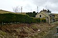
 Barn to the east of Plane Trees, Shap - geograph.org.uk - 5367333.jpg 1,632 × 1,224; 960 KB
-
 Blea Beck - geograph.org.uk - 173668.jpg 640 × 480; 166 KB
-
 Blea Beck - geograph.org.uk - 5201204.jpg 640 × 480; 76 KB
-
 Brackenber Lodge - geograph.org.uk - 3512404.jpg 3,872 × 2,592; 4.81 MB
-
 Bridge on the "Cement Road" - geograph.org.uk - 603327.jpg 640 × 552; 118 KB
-

-
 Cemetery at Shap - geograph.org.uk - 1979946.jpg 3,872 × 2,592; 4.71 MB
-
 Church Street, Shap - geograph.org.uk - 1979795.jpg 3,872 × 2,499; 3.15 MB
-
 Church Street, Shap - geograph.org.uk - 2643578.jpg 1,600 × 1,200; 536 KB
-
 Close up, Elizabeth II postbox on Main Street (A6), Shap - geograph.org.uk - 5202226.jpg 1,613 × 2,612; 455 KB
-
 Coopers Green Below Wet Sleddale - geograph.org.uk - 73134.jpg 640 × 480; 58 KB
-
 Cottage in Main Street Shap dated 1696 - geograph.org.uk - 3137368.jpg 3,264 × 2,448; 2.17 MB
-
 Country south of Shap - geograph.org.uk - 3589107.jpg 2,592 × 1,944; 1.5 MB
-
 Covered reservoir, east of Shap - geograph.org.uk - 5933828.jpg 1,024 × 768; 221 KB
-
 Cream 17, coffee shop, Shap - geograph.org.uk - 2643573.jpg 1,600 × 1,499; 512 KB
-
 Croft Avenue, Shap - geograph.org.uk - 4426516.jpg 1,142 × 857; 336 KB
-
 Cross Cottage Cross Farmhouse With Adjoining Barn-Byre Range maybe.jpg 8,000 × 6,000; 14.52 MB
-
 Cumbria Fire ^ Rescue Service, Shap - geograph.org.uk - 5201274.jpg 640 × 480; 53 KB
-
 Dam near Shap Granite Works - geograph.org.uk - 5201215.jpg 640 × 480; 47 KB
-
 Distant hills (3334832069).jpg 3,872 × 2,592; 4.21 MB
-
 Docker Beck before its confluence with the River Lowther - geograph.org.uk - 3489553.jpg 4,320 × 3,240; 5.37 MB
-
 Drive View - geograph.org.uk - 3210095.jpg 800 × 600; 95 KB
-
 Dry stone wall - geograph.org.uk - 649255.jpg 640 × 480; 75 KB
-

-

-

-
 Entering Shap - geograph.org.uk - 5201240.jpg 640 × 480; 70 KB
-
 Entrance to Shap Blue Quarry - geograph.org.uk - 5201211.jpg 640 × 480; 53 KB
-

-
 Field south of Shap - geograph.org.uk - 4698796.jpg 1,152 × 768; 1.07 MB
-
 Field west of the A6 - geograph.org.uk - 1979930.jpg 3,872 × 2,592; 3.97 MB
-
 Fields and stone walls north of Shap - geograph.org.uk - 4024316.jpg 640 × 480; 503 KB
-
 Fields by the Wet Sleddale road - geograph.org.uk - 2856603.jpg 640 × 480; 73 KB
-
 Fields near Shap - geograph.org.uk - 2585536.jpg 640 × 480; 65 KB
-
 Fields near the West Coast main line - geograph.org.uk - 3685458.jpg 1,000 × 750; 431 KB
-
 Fields west of Shap - geograph.org.uk - 6204509.jpg 1,280 × 850; 468 KB
-
 Fields with High Buildings Farm beyond - geograph.org.uk - 3353500.jpg 2,052 × 1,047; 391 KB
-
 Footbridge over M6, southeast of Shap - geograph.org.uk - 3029216.jpg 612 × 424; 110 KB
-
 Footbridge over the M6 near Shap - geograph.org.uk - 2990711.jpg 1,600 × 1,198; 322 KB
-
 Footbridge over the M6 SE of Shap - geograph.org.uk - 3134236.jpg 3,264 × 2,448; 2.3 MB
-
 Footpath near Shap - geograph.org.uk - 2910201.jpg 640 × 480; 82 KB
-
 Footpath to the Bampton Road - geograph.org.uk - 3002315.jpg 2,592 × 1,944; 1.53 MB
-
 Force Bridge, Shap - geograph.org.uk - 2585556.jpg 640 × 480; 117 KB
-
 Ford near Shap - geograph.org.uk - 58622.jpg 480 × 360; 15 KB
-
 Former Shap station - March 2017 - geograph.org.uk - 5328838.jpg 5,454 × 3,803; 4.9 MB
-
 Gate leading into Keld Lane - geograph.org.uk - 3137404.jpg 3,264 × 2,448; 1.99 MB
-
 Geological Map NW England Garwood 1912 03.jpg 8,929 × 8,234; 8.04 MB
-
 Goggleby Stone - geograph.org.uk - 3489326.jpg 4,320 × 3,240; 5.72 MB
-
 Goggleby Stone - geograph.org.uk - 6254978.jpg 640 × 480; 153 KB
-
 Goggleby Stone near Shap - geograph.org.uk - 3137395.jpg 3,264 × 2,448; 1.6 MB
-
 Goggleby Stone, Shap - geograph.org.uk - 5512554.jpg 640 × 480; 86 KB
-
 Goggleby stone,Shap - geograph.org.uk - 1989951.jpg 640 × 480; 78 KB
-
 Grazing and stone wall - geograph.org.uk - 5201214.jpg 640 × 480; 64 KB
-
 Grazing by Skellaw Hill - geograph.org.uk - 3685446.jpg 1,000 × 750; 330 KB
-
 Grazing east of the A6 - geograph.org.uk - 5201802.jpg 640 × 480; 64 KB
-
 Grazing off the A6 - geograph.org.uk - 5201217.jpg 640 × 480; 56 KB
-
 Grazing west of the A6 - geograph.org.uk - 5201229.jpg 640 × 480; 70 KB
-
 Green Farm, Shap - geograph.org.uk - 5201256.jpg 640 × 480; 77 KB
-
 Green House, Shap (geograph 6205028).jpg 1,280 × 1,280; 708 KB
-
 Greyhound Hotel, Shap - August 2016 (1) - geograph.org.uk - 5079148.jpg 1,250 × 883; 1.01 MB
-
 Greyhound Hotel, Shap - August 2016 (2) - geograph.org.uk - 5079153.jpg 1,250 × 753; 876 KB
-
 Greyhound Hotel, Shap - August 2016 (3) - geograph.org.uk - 5079161.jpg 561 × 1,250; 846 KB
-
 Hardendale Lime Kilns - geograph.org.uk - 293749.jpg 640 × 429; 113 KB
-
 Hardendale Lime Works - geograph.org.uk - 5202498.jpg 1,600 × 1,032; 289 KB
-
 Hardendale Lime Works - geograph.org.uk - 73044.jpg 640 × 480; 55 KB
-
 Hardendale Lime Works viewed from the M6 - geograph.org.uk - 1867674.jpg 2,672 × 2,009; 875 KB
-
 Hardendale Lime Works, Shap - geograph.org.uk - 3344615.jpg 640 × 427; 309 KB
-
 Hardendale Quarry Works - geograph.org.uk - 2461637.jpg 800 × 473; 75 KB
-
 Hardendale quarry works next the M6 motorway - geograph.org.uk - 2990709.jpg 1,600 × 1,198; 238 KB
-
 Herding sheep near Shap Abbey - geograph.org.uk - 4534334.jpg 4,000 × 2,264; 2.66 MB
-
 High Raise from Sleddale Pike - geograph.org.uk - 294510.jpg 640 × 480; 91 KB
-
 House near to Shap Abbey - geograph.org.uk - 4279901.jpg 1,500 × 1,033; 1.98 MB
-
 House on Main Street (A6), Shap - geograph.org.uk - 5201243.jpg 640 × 480; 101 KB
-
 Keld Chapel, Keld, near Shap - geograph.org.uk - 5512602.jpg 640 × 480; 84 KB
-
 Keld Lane - geograph.org.uk - 5201282.jpg 640 × 480; 75 KB
-
 Keld Lane, near Shap - geograph.org.uk - 4534338.jpg 3,672 × 2,754; 2.81 MB
-
 Keld village from the south-west - geograph.org.uk - 3002304.jpg 2,592 × 1,944; 1.85 MB
-
 Kemp Howe - geograph.org.uk - 3270695.jpg 2,592 × 1,944; 1.28 MB
-
 Kemp Howe - geograph.org.uk - 782874.jpg 640 × 480; 86 KB
-
 Land west of A6 near Shap - geograph.org.uk - 5007986.jpg 1,499 × 924; 1.16 MB
-
 Lane descending to Shap - geograph.org.uk - 4277912.jpg 1,500 × 999; 1.82 MB
-
 Lay-by on A6 near Shap - geograph.org.uk - 4035452.jpg 1,024 × 768; 149 KB
-
 Layby on the A6 - geograph.org.uk - 1979937.jpg 3,872 × 2,592; 4.82 MB
-
 Leaving Shap - geograph.org.uk - 1554813.jpg 640 × 480; 69 KB
-
 Lime kilns at Tata Steel's Hardendale lime works - geograph.org.uk - 4698802.jpg 1,100 × 825; 1.1 MB
-
 Limekiln east of Wintertarn - geograph.org.uk - 551148.jpg 640 × 480; 200 KB
-
 Limestone Walls - geograph.org.uk - 1202147.jpg 640 × 427; 333 KB
-
 Limestone Walls, Keld Lane - geograph.org.uk - 1202150.jpg 640 × 427; 346 KB
-
 Little bridge to the world beyond - geograph.org.uk - 940956.jpg 640 × 428; 99 KB
-
 Longfell Gill Farm details, Shap, Cumbria.jpg 4,779 × 2,126; 3.27 MB
-
 Longfell Gill, Shap, Cumbria.jpg 4,896 × 2,633; 3.06 MB
-
 Low Cloud (3334838281).jpg 3,872 × 2,592; 3.65 MB
-
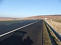
 M6 - geograph.org.uk - 551128.jpg 640 × 480; 173 KB
-
 M6 Ahead - geograph.org.uk - 3210153.jpg 800 × 600; 87 KB
-
 M6 Central - geograph.org.uk - 3210168.jpg 800 × 600; 97 KB
-
 M6 Central View - geograph.org.uk - 3210180.jpg 800 × 600; 89 KB
-
 M6 heading north - geograph.org.uk - 4278001.jpg 1,500 × 1,013; 1.3 MB
-
 M6 northbound near Shap village - geograph.org.uk - 3505803.jpg 640 × 480; 45 KB
-
 M6 South of junction 39. - geograph.org.uk - 114640.jpg 640 × 480; 72 KB
-
 M6 southbound - geograph.org.uk - 3453391.jpg 640 × 427; 43 KB
-
 Main Line Heading North through Shap - geograph.org.uk - 3134248.jpg 3,264 × 2,448; 2.2 MB
-
 Main Street (A6), Shap - geograph.org.uk - 3344660.jpg 640 × 480; 388 KB
-
 Main Street (A6), Shap - geograph.org.uk - 5201277.jpg 640 × 480; 69 KB
-
 Main Street, Shap (A6) - geograph.org.uk - 3664614.jpg 640 × 480; 69 KB
-
 Main Street, Shap - geograph.org.uk - 3344655.jpg 640 × 480; 353 KB
-
 Main Street, Shap - geograph.org.uk - 4024914.jpg 640 × 480; 421 KB
-
 Mardale burial area at Shap cemetery - geograph.org.uk - 1989941.jpg 640 × 362; 97 KB
-
 Mast above the Edges, east of Shap - geograph.org.uk - 5933822.jpg 1,024 × 768; 228 KB
-
 Milestone - Kendal 16 - geograph.org.uk - 5720797.jpg 540 × 640; 106 KB
-
 Milestone at the Greyhound Inn, Shap - geograph.org.uk - 3589128.jpg 2,592 × 1,944; 1.49 MB
-
 Near Shap - geograph.org.uk - 6254974.jpg 640 × 480; 98 KB
-
 Near Shap - geograph.org.uk - 6254981.jpg 640 × 480; 107 KB
-
 Near the Greyhound Inn, Shap - geograph.org.uk - 2585549.jpg 640 × 454; 84 KB
-

-
 New Ing Farm, Shap - geograph.org.uk - 1133694.jpg 640 × 480; 108 KB
-
 New Ing Lodge, Shap - geograph.org.uk - 4277884.jpg 1,500 × 1,058; 2.2 MB
-
 Nook Farm Shap - geograph.org.uk - 5201283.jpg 640 × 480; 67 KB
-
 Northbound A6 near Shap - geograph.org.uk - 3344605.jpg 640 × 480; 410 KB
-
 Old lime kiln on the Edges - geograph.org.uk - 4024920.jpg 640 × 480; 480 KB
-

-
 Old Milepost by the A6, north of Shap - geograph.org.uk - 6051304.jpg 640 × 480; 182 KB
-

-

-
 Old Railway Cottages - geograph.org.uk - 3323735.jpg 1,024 × 685; 147 KB
-
 One carful owner - geograph.org.uk - 964563.jpg 428 × 640; 105 KB
-
 Ordnance Survey 1GL Bolt - geograph.org.uk - 5906235.jpg 1,024 × 590; 281 KB
-
 Ordnance Survey One-Inch Sheet 83 Penrith, Published 1947.jpg 8,199 × 9,555; 10.96 MB
-
 Ordnance Survey One-Inch Sheet 83 Penrith, Published 1964.jpg 8,283 × 9,885; 11.8 MB
-

-
 OS bolt ^ benchmark - Shap, St Michael's Church - geograph.org.uk - 4922906.jpg 979 × 1,306; 661 KB
-
 OS flush bracket - Shap Community Library - geograph.org.uk - 3933794.jpg 857 × 1,142; 524 KB
-

-
 Part of the Shap stone row - geograph.org.uk - 5681254.jpg 1,600 × 887; 855 KB
-
 Path in Shap Quarry - geograph.org.uk - 6254951.jpg 640 × 480; 146 KB
-
 Plane Trees, Shap - geograph.org.uk - 5367328.jpg 1,632 × 1,224; 851 KB
-
 Plaque on Shap Market House - geograph.org.uk - 3137355.jpg 3,264 × 2,448; 2.44 MB
-
 Ponds by A6 - geograph.org.uk - 2538620.jpg 640 × 480; 98 KB
-
 Post Office and shop, Shap - geograph.org.uk - 5201263.jpg 640 × 480; 65 KB
-
 Post Office, Shap - geograph.org.uk - 1878405.jpg 640 × 480; 93 KB
-
 Postbox, Shap - geograph.org.uk - 1878442.jpg 480 × 640; 73 KB
-
 Postman's bike (9692876998).jpg 2,736 × 3,648; 6.44 MB
-
 Postman's bike, Shap - geograph.org.uk - 2643581.jpg 1,200 × 1,600; 706 KB
-
 Pow Lane coming into Shap - geograph.org.uk - 4922898.jpg 1,306 × 979; 715 KB
-

-
 Red Deer, Todcrags - geograph.org.uk - 294531.jpg 496 × 640; 82 KB
-
 Road over Shap - geograph.org.uk - 1436119.jpg 640 × 457; 310 KB
-
 Rogues' Gallery, Turnmire Bottom - geograph.org.uk - 72670.jpg 640 × 480; 79 KB
-
 Rough grazing near the Blea Beck - geograph.org.uk - 5201207.jpg 640 × 480; 51 KB
-
 RV3828.jpg 3,024 × 4,032; 4.79 MB
-
 Shap - geograph.org.uk - 2585543.jpg 640 × 480; 93 KB
-
 Shap Abbey - geograph.org.uk - 5512510.jpg 640 × 480; 92 KB
-
 Shap Abbey - geograph.org.uk - 6373682.jpg 4,320 × 3,240; 4.26 MB
-
 Shap Blue Quarry - geograph.org.uk - 2538632.jpg 640 × 480; 65 KB
-
 Shap Bowling Club - geograph.org.uk - 5201264.jpg 640 × 480; 60 KB
-
 Shap C.E. Primary School - geograph.org.uk - 2038608.jpg 640 × 427; 259 KB
-
 Shap CA10, UK - panoramio.jpg 3,264 × 2,448; 2.25 MB
-

-
 Shap Endowed CofE Primary School.jpg 8,000 × 6,000; 11.98 MB
-
 Shap fire station - geograph.org.uk - 1908353.jpg 640 × 427; 222 KB
-
 Shap from the footpath to Keld - geograph.org.uk - 1882311.jpg 640 × 427; 64 KB
-
 Shap Library - geograph.org.uk - 1979977.jpg 3,872 × 2,475; 2.48 MB
-
 Shap Library - geograph.org.uk - 3161408.jpg 640 × 480; 95 KB
-
 Shap Library Link.jpg 8,000 × 6,000; 12.98 MB
-
 Shap Market House - geograph.org.uk - 3137346.jpg 3,264 × 2,448; 1.7 MB
-
 Shap Memorial Park (1) - geograph.org.uk - 4505821.jpg 1,250 × 709; 763 KB
-
 Shap Memorial Park (2) - geograph.org.uk - 4505828.jpg 794 × 1,250; 821 KB
-
 Shap Memorial Park - geograph.org.uk - 1979990.jpg 3,872 × 2,499; 3.28 MB
-
 Shap Open Air Swimming Pool - exterior - geograph.org.uk - 4505850.jpg 1,250 × 664; 513 KB
-
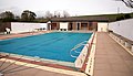 Shap Open Air Swimming Pool - interior (1) - geograph.org.uk - 4505842.jpg 1,250 × 719; 751 KB
-
 Shap Open Air Swimming Pool - interior (2) - geograph.org.uk - 4505847.jpg 1,250 × 826; 761 KB
-
 Shap Primary School - geograph.org.uk - 5201269.jpg 640 × 480; 79 KB
-
 Shap railway from the Shap Wells Hotel, Cumbria.jpg 4,896 × 2,847; 2.76 MB
-
 Shap Rural, UK - panoramio (6).jpg 3,264 × 2,448; 2.2 MB
-
 Shap Summit Memorial 4 - geograph.org.uk - 964544.jpg 640 × 428; 75 KB
-
 Shap's main street, Cumbria - view from the north.jpg 4,896 × 3,672; 3.78 MB
-
 Shap, Cumbria, St Michael ^ All Angels - geograph.org.uk - 5904037.jpg 4,608 × 3,456; 4.04 MB
-
 Sheep dip - geograph.org.uk - 3073340.jpg 1,200 × 750; 391 KB
-
 Sheep in field with High Buildings beyond - geograph.org.uk - 4279104.jpg 1,500 × 842; 1.31 MB


,_Shap_-_geograph.org.uk_-_5201254.jpg)


,_Shap_-_geograph.org.uk_-_5202226.jpg)


.jpg)


,_Shap_-_geograph.org.uk_-_5202228.jpg)
,_Shap_-_geograph.org.uk_-_5202225.jpg)


.jpg)
_-_geograph.org.uk_-_5079148.jpg)
_-_geograph.org.uk_-_5079153.jpg)
_-_geograph.org.uk_-_5079161.jpg)


,_Shap_-_geograph.org.uk_-_5201243.jpg)


.jpg)


,_Shap_-_geograph.org.uk_-_3344660.jpg)
,_Shap_-_geograph.org.uk_-_5201277.jpg)
_-_geograph.org.uk_-_3664614.jpg)


.jpg)


.jpg)


_-_geograph.org.uk_-_4505821.jpg)
_-_geograph.org.uk_-_4505828.jpg)


_-_geograph.org.uk_-_4505842.jpg)
_-_geograph.org.uk_-_4505847.jpg)


.jpg)


