Category:Septimerpass
Jump to navigation
Jump to search
| Object location | | View all coordinates using: OpenStreetMap |
|---|
mountain pass  | |||||
| Upload media | |||||
| Pronunciation audio | |||||
|---|---|---|---|---|---|
| Instance of | |||||
| Part of |
| ||||
| Location | Grisons, Switzerland | ||||
| Mountain range | |||||
| Elevation above sea level |
| ||||
 | |||||
Media in category "Septimerpass"
The following 27 files are in this category, out of 27 total.
-
 Bridge south of Pass da Sett 1.jpg 3,888 × 5,184; 10.19 MB
-
 Bridge south of Pass da Sett 2.jpg 3,024 × 4,032; 3.75 MB
-
 Bridge south of Pass da Sett 3.jpg 3,024 × 4,032; 4.45 MB
-

-

-
De-Septimerpass.ogg 1.5 s; 47 KB
-
 Descente du Septimerpass sur Casaccia.jpg 900 × 1,200; 593 KB
-
-

-
It-Passo del Settimo.ogg 1.7 s; 52 KB
-
 Jahresbericht der Naturforschenden Gesellschaft Graubündens BHL10639804.jpg 2,839 × 2,243; 327 KB
-
 Pavage Romain dans le Septimerpass.jpg 1,920 × 1,080; 903 KB
-
-

-
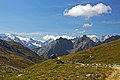
 Piz Forcellina and Piz Turba as seen from near Pass da Sett.jpg 4,008 × 2,264; 1.76 MB
-
Roh-surmiran-Pass da Sett.ogg 1.4 s; 48 KB
-
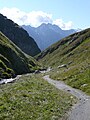
 Septimer Pass 01.jpg 1,600 × 1,067; 411 KB
-
 Septimer Pass 02.jpg 1,600 × 1,034; 609 KB
-
 Septimer Pass 03.jpg 1,600 × 1,067; 812 KB
-
 Septimer pass 2.jpg 240 × 320; 116 KB
-
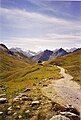
 Septimer-Passhöhe.jpg 3,072 × 2,304; 3.21 MB
-
 Septimerpass - panoramio.jpg 1,024 × 768; 330 KB
-
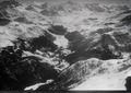
 Septimerpass as seen from Piz Turba.jpg 5,184 × 3,888; 5.18 MB
-
 Septimerpass Siegfriedkarte 1906.jpg 1,100 × 676; 141 KB
-
 Septimerpass-N.jpg 3,072 × 2,304; 3.34 MB
-
 Septimerpasshöhe.jpg 514 × 764; 125 KB
-


,_Passo_del_Settimo_-_panoramio_-_Qwesy.jpg)
,_Passo_del_Settimo,_Sentiero_Storico_-_panoramio.jpg)


,_Passo_del_Settimo_-_panoramio.jpg)


,_Passo_del_Settimo,_2310_m_-_panoramio_-_Qwesy.jpg)