Category:September 2013 in Utah
Jump to navigation
Jump to search
English: Images/pictures taken in Utah during September 2013. Note this is not the date of the upload, nor the date a photo was scanned.
States of the United States: Alabama · Alaska · Arizona · Arkansas · California · Colorado · Connecticut · Delaware · Florida · Georgia · Hawaii · Idaho · Illinois · Indiana · Iowa · Kansas · Kentucky · Louisiana · Maine · Maryland · Massachusetts · Michigan · Minnesota · Mississippi · Missouri · Montana · Nebraska · Nevada · New Hampshire · New Jersey · New Mexico · New York · North Carolina · North Dakota · Ohio · Oklahoma · Oregon · Pennsylvania · Rhode Island · South Carolina · South Dakota · Tennessee · Texas · Utah · Vermont · Virginia · Washington · West Virginia · Wisconsin · Wyoming – Washington, D.C.
Puerto Rico
Puerto Rico
| September 2012 | ← | September 2013 | → | September 2014 | |||||||||
| Jan | Feb | Mar | Apr | May | Jun | Jul | Aug | Sep | Oct | Nov | Dec | ||
| ← | 46 | 41 | 118 | 74 | 425 | 312 | 139 | 108 | 352 | 168 | 65 | 56 | → |
|---|---|---|---|---|---|---|---|---|---|---|---|---|---|
Subcategories
This category has only the following subcategory.
Media in category "September 2013 in Utah"
The following 200 files are in this category, out of 351 total.
(previous page) (next page)-
 130913-F-WT312-203 (9918744386).jpg 4,664 × 2,980; 4.88 MB
-
 2013 Wells Fargo Center Salt Lake City.jpg 968 × 1,296; 367 KB
-
 2013-09-21 11 19 21 View north along Interstate 15 in Utah near milepost 5.5.JPG 3,264 × 2,448; 2.39 MB
-
 2013-09-21 12 22 38 View north along Interstate 15 in Utah near milepost 90.5.JPG 3,264 × 2,448; 2.2 MB
-
-
 2013-09-21 12 28 07 View south from the western end of Utah State Route 20.JPG 3,264 × 2,448; 2.87 MB
-
 2013-09-21 12 28 39 View east along Utah State Route 20 near Interstate 15.JPG 3,264 × 2,448; 2.82 MB
-

-
 2013-09-21 13 10 49 View east along Utah State Route 12 near milepost 0.1.JPG 3,264 × 2,448; 2.44 MB
-
 2013-09-21 13 13 12 View east along Utah State Route 12 near milepost 2.6.JPG 3,264 × 2,448; 2.62 MB
-
 2013-09-21 13 14 30 View east along Utah State Route 12 near milepost 2.8.JPG 3,264 × 2,448; 2.32 MB
-
 2013-09-21 13 15 15 View east along Utah State Route 12 near milepost 4.3.JPG 3,264 × 2,448; 2.33 MB
-
 2013-09-21 13 15 46 View east along Utah State Route 12 near milepost 4.6.JPG 3,264 × 2,448; 2.22 MB
-
 2013-09-21 13 15 53 View east along Utah State Route 12 near milepost 4.7.JPG 3,264 × 2,448; 2.79 MB
-
 2013-09-21 13 15 55 View east along Utah State Route 12 near milepost 4.8.JPG 3,264 × 2,448; 3.01 MB
-
 2013-09-21 13 17 00 View east along Utah State Route 12 near milepost 5.5.JPG 3,264 × 2,448; 2.39 MB
-
 2013-09-21 13 19 32 View east along Utah State Route 12 near milepost 7.5.JPG 3,264 × 2,448; 1.7 MB
-
 2013-09-21 13 23 16 View east along Utah State Route 12 near milepost 11.4.JPG 3,264 × 2,448; 1.86 MB
-
-

-

-

-

-

-

-
 2013-09-22 15 10 54 Blowing dust and sand south of U.S. Route 163 in Utah.JPG 3,264 × 2,448; 1.95 MB
-

-
 2013-09-22 15 24 26 View north along U.S. Route 191 in Cow Canyon near Bluff, Utah.JPG 3,264 × 2,448; 1.79 MB
-
 2013-09-22 16 24 09 Church Rock viewed from U.S. Route 191.JPG 3,264 × 2,448; 1.77 MB
-
 2013-09-22 16 46 30 View north along U.S. Route 191 towards Hole N"The Rock.JPG 3,264 × 2,448; 2 MB
-
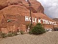 2013-09-22 16 46 47 View of Hole N"The Rock from U.S. Route 191.JPG 3,264 × 2,448; 2.9 MB
-
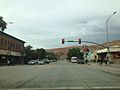 2013-09-22 17 03 30 View north along U.S. Route 191 in downtown Moab, Utah.JPG 3,264 × 2,448; 1.94 MB
-
 2013-09-22 17 36 40 Sign at the northern entrance to Canyonlands National Park.JPG 3,264 × 2,448; 1.78 MB
-
 2013-09-22 17 37 18 Panorama east from the north entrance to Canyonlands National Park.JPG 9,904 × 2,422; 15.26 MB
-
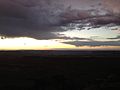 2013-09-22 19 21 04 Sunset viewed from Grand View Point in Canyonlands National Park.JPG 3,264 × 2,448; 1.31 MB
-
 2013-09-22 19 21 07 Sunset viewed from Grand View Point in Canyonlands National Park.JPG 3,264 × 2,448; 1.32 MB
-
 2013-09-22 19 32 34 Sunset viewed from Grand View Point in Canyonlands National Park.JPG 3,264 × 2,448; 947 KB
-
 2013-09-22 19 35 30 Sunset viewed from Grand View Point in Canyonlands National Park.JPG 3,264 × 2,448; 1.19 MB
-
 2013-09-22 19 38 20 Sunset viewed from Grand View Point in Canyonlands National Park.JPG 3,264 × 2,448; 845 KB
-
 2013-09-22 19 38 39 Sunset viewed from Grand View Point in Canyonlands National Park.JPG 3,264 × 2,448; 1.06 MB
-

-

-

-
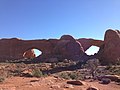 2013-09-23 09 31 38 View of North Window and South Window in Arches National Park.JPG 3,264 × 2,448; 2.49 MB
-

-
-

-

-

-

-

-

-

-

-
-

-

-

-

-

-

-

-

-

-

-

-

-

-

-

-

-

-

-

-

-

-

-

-

-

-

-

-

-

-

-

-

-

-
-

-

-

-
 2013-09-23 15 52 39 Pinus edulis near Panorama Point in Capitol Reef National Park.JPG 3,264 × 2,448; 3.72 MB
-
 2013-09-23 15 53 07 Pinus edulis near Panorama Point in Capitol Reef National Park.JPG 3,264 × 2,448; 3.79 MB
-

-

-

-

-
 2013-09-23 16 04 35 Pinus edulis near Goosenecks Overlook in Capitol Reef National Park.JPG 3,264 × 2,448; 3.54 MB
-
 2013-09-23 16 05 00 Pinus edulis near Goosenecks Overlook in Capitol Reef National Park.JPG 3,264 × 2,448; 3.58 MB
-

-

-

-

-

-

-

-
-

-

-

-
 2013-09-23 16 09 58 View west from Goosenecks Overlook in Capitol Reef National Park.JPG 2,448 × 3,264; 3.05 MB
-

-

-

-
 2013-09-23 16 10 04 View south from Goosenecks Overlook in Capitol Reef National Park.JPG 2,448 × 3,264; 3.49 MB
-
-

-
 2013-09-23 16 11 37 Panorama from Goosenecks Overlook in Capitol Reef National Park.JPG 8,032 × 2,332; 11.92 MB
-

-
 2013-09-23 16 13 02 Pinus edulis near Goosenecks Overlook in Capitol Reef National Park.JPG 3,264 × 2,448; 3.83 MB
-
 2013-09-23 16 14 14 Pinus edulis near Goosenecks Overlook in Capitol Reef National Park.JPG 3,264 × 2,448; 4.37 MB
-

-
 2013-09-23 17 14 40 View across Koosharem Reservoir from Utah State Route 24.JPG 3,264 × 2,448; 2.58 MB
-
 2013-09-23 17 21 55 Pinyon-Juniper woodland along Utah State Route 24 near milepost 21.4.JPG 3,264 × 2,448; 3.23 MB
-

-
 2013-09-23 18 27 35 View north along Interstate 15 in Utah near milepost 206.JPG 3,264 × 2,448; 2.07 MB
-
 2013-09-23 18 28 47 View north along Interstate 15 in Utah near milepost 208.JPG 3,264 × 2,448; 1.96 MB
-
 2013-09-23 18 36 50 View north along Interstate 15 in Utah near milepost 219.JPG 3,264 × 2,448; 2.23 MB
-
 2013-09-23 18 49 43 View north along Interstate 15 in Utah near milepost 237.JPG 3,264 × 2,448; 2 MB
-
 775th Civil Engineering Squadron EOD-EM training exercise 130906-F-SP601-121.jpg 3,607 × 2,405; 559 KB
-
 775th Civil Engineering Squadron EOD-EM training exercise 130906-F-SP601-494.jpg 2,483 × 3,723; 1.25 MB
-
 775th Civil Engineering Squadron EOD-EM training exercise 130906-F-SP601-602.jpg 3,928 × 2,619; 822 KB
-
 775th Civil Engineering Squadron EOD-EM training exercise 130906-F-SP601-605.jpg 4,248 × 2,832; 934 KB
-
 99c-ice-cream-wendover.jpg 2,592 × 1,552; 789 KB
-
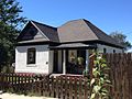
 Allsop Anderson House Sandy UT.jpg 2,048 × 1,536; 1.12 MB
-
 Anderson House Sandy UT.jpg 2,048 × 1,536; 1.06 MB
-
 Approaching Grand View Point - panoramio.jpg 1,600 × 1,200; 609 KB
-
 Arches National Park 5.JPG 7,520 × 2,486; 6.31 MB
-
 Arches National Park and Blue Sky.JPG 4,272 × 2,848; 5.36 MB
-
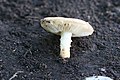 Armillaria fusca (Mitchel & A.H. Sm.) Bon 367315.jpg 3,504 × 2,336; 858 KB
-
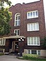 Ashby Apartments.JPG 1,224 × 1,632; 673 KB
-
 Bateman Ag and Dev Co Building Sandy UT.jpg 2,048 × 1,536; 1 MB
-
 Bateman Building Sandy UT.jpg 2,048 × 1,536; 1.03 MB
-
 Below Grand View Point - panoramio (1).jpg 1,200 × 1,600; 448 KB
-
 Below Grand View Point - panoramio.jpg 1,600 × 1,200; 607 KB
-
 Bertolini Block.jpg 3,096 × 4,128; 2.74 MB
-
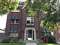 Bigelow Apartments.JPG 1,632 × 1,224; 1.12 MB
-
 Brady House Sandy UT.jpg 2,048 × 1,536; 1.12 MB
-
 Broadway Hotel.jpg 3,152 × 1,968; 1.42 MB
-
 Bryce Amphitheater from Sunrise Point Highres 2013.jpg 19,709 × 6,688; 74.69 MB
-
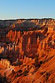
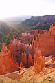
 Bryce Canyon (10027309714).jpg 3,872 × 2,592; 2.92 MB
-
 Bryce Canyon (10027312874).jpg 2,592 × 3,872; 2.02 MB
-
 Bryce Canyon (10027319384).jpg 3,607 × 2,414; 1.97 MB
-
 Bryce Canyon (10027331194).jpg 3,872 × 2,592; 1.46 MB
-
 Bryce Canyon (10027334334).jpg 2,592 × 3,872; 1.43 MB
-
 Bryce Canyon (10027338294).jpg 3,872 × 2,592; 3.3 MB
-
 Bryce Canyon (10027347464).jpg 3,777 × 2,529; 2.44 MB
-
 Bryce Canyon (10027358404).jpg 3,872 × 2,592; 4.22 MB
-
 Bryce Canyon (10027360254).jpg 3,872 × 2,592; 3.32 MB
-
 Bryce Canyon (10027369996).jpg 3,872 × 2,592; 3.29 MB
-
 Bryce Canyon (10027380116).jpg 2,592 × 3,872; 1.54 MB
-
 Bryce Canyon (10027385456).jpg 2,592 × 3,872; 1.98 MB
-
 Bryce Canyon (10027391885).jpg 2,425 × 3,553; 2.39 MB
-
 Bryce Canyon (10027396396).jpg 3,872 × 2,592; 2.01 MB
-
 Bryce Canyon (10027404116).jpg 2,592 × 3,872; 3.75 MB
-
 Bryce Canyon (10027404895).jpg 3,872 × 2,592; 3.54 MB
-
 Bryce Canyon (10027405756).jpg 3,872 × 2,592; 3.49 MB
-
 Bryce Canyon (10027409546).jpg 3,698 × 2,477; 2.11 MB
-
 Bryce Canyon (10027439973).jpg 2,592 × 3,872; 2.75 MB
-
 Bryce Canyon (10027459653).jpg 2,592 × 3,872; 2.56 MB
-
 Bryce Canyon (10027462563).jpg 3,872 × 2,592; 2.67 MB
-
 Bryce Canyon (10027472633).jpg 3,644 × 2,438; 3.58 MB
-
 Bryce Canyon (10027485623).jpg 2,592 × 3,872; 3.8 MB
-
 Bryce Canyon (10027487403).jpg 3,872 × 2,592; 1.68 MB
-
 Bryce Canyon (10027498123).jpg 3,765 × 2,521; 2.62 MB
-
 Bryce Canyon (26134833580).jpg 3,456 × 2,304; 6.02 MB
-
 Bryce Canyon (27757324292) (cropped).jpg 863 × 885; 1.02 MB
-
 Bryce Canyon (27757324292).jpg 3,456 × 2,304; 9.17 MB
-
 Bryce Canyon (30075751926).jpg 3,142 × 2,304; 4.63 MB
-
 Bryce Canyon from Sunrise Point 02 2013.jpg 4,430 × 2,936; 6.87 MB
-
 Bryce Canyon from Sunrise Point 2013.jpg 4,544 × 2,875; 6.06 MB
-
 Bryce Natural Bridge - panoramio.jpg 3,008 × 2,000; 4.04 MB
-
 Building at 561 West 200 South Salt Lake City 2.JPG 1,224 × 1,632; 490 KB
-
 Building at 561 West 200 South Salt Lake City.JPG 1,632 × 1,224; 672 KB
-
 Building at rear 537 West 200 South Salt Lake City.JPG 1,632 × 1,224; 838 KB
-
 Canyonlands National Park - Sunsets.JPG 4,272 × 2,848; 2.78 MB
-
 Canyonlands National Park 2.JPG 4,272 × 2,848; 3.65 MB
-
 Capital Reef National Park.JPG 4,272 × 2,848; 5.29 MB
-
 Capital Reef NP 2.JPG 4,272 × 2,848; 5.61 MB
-
 Capital Reef NP 3.JPG 4,272 × 2,848; 5.57 MB
-
 Capital Reef NP 4.JPG 4,272 × 2,848; 6.16 MB
-
 Capital Reef NP Petroglyphs 2.JPG 4,272 × 2,848; 6.4 MB
-
 Capital Reef NP Petroglyphs.JPG 4,272 × 2,848; 6.33 MB
-
 Capital Reef NP.JPG 4,272 × 2,848; 5.21 MB
-
 Capitol Dome - Capital Reef National Park.JPG 4,272 × 2,848; 5.77 MB
-
 Capitol Reef - panoramio (3).jpg 5,184 × 3,456; 8.31 MB
-
 Capitol Reef - panoramio (4).jpg 5,184 × 3,456; 8.72 MB
-
 Capitol Reef - panoramio (5).jpg 5,184 × 3,456; 8.75 MB
-
 Centennial Home SLC.jpeg 4,288 × 3,216; 6.81 MB
.jpg)


_along_Utah_State_Route_24_near_mile_post_33.2.JPG)


_along_U.S._Route_50_in_Utah_near_what_would_be_milepost_148_(if_counted_from_the_state_line).JPG)


_Bon_367315.jpg)


.jpg)


.jpg)
.jpg)
.jpg)
.jpg)
.jpg)
.jpg)
.jpg)
.jpg)
.jpg)
.jpg)
.jpg)
.jpg)
.jpg)
.jpg)
.jpg)
.jpg)
.jpg)
.jpg)
.jpg)
.jpg)
.jpg)
.jpg)
.jpg)
.jpg)
.jpg)
.jpg)
_(cropped).jpg)
.jpg)
.jpg)


.jpg)
.jpg)
.jpg)
