Category:September 2009 in County Down
Jump to navigation
Jump to search
English: Images taken in County Down, Northern Ireland in this month of 2009 (not the date of the upload).
| Jan | Feb | Mar | Apr | May | Jun | Jul | Aug | Sep | Oct | Nov | Dec | ||
| ← | 59 | 46 | 48 | 61 | 33 | 30 | 72 | 224 | 115 | 109 | 34 | 154 | → |
|---|
Subcategories
This category has the following 2 subcategories, out of 2 total.
D
N
Media in category "September 2009 in County Down"
The following 113 files are in this category, out of 113 total.
-
 'BandM Bargains', Bangor - geograph.org.uk - 1501145.jpg 640 × 340; 207 KB
-
 'Manx Sea Quest' at Bangor - geograph.org.uk - 1500083.jpg 640 × 474; 291 KB
-
 A ferny corner of Hillsborough forest - geograph.org.uk - 1506666.jpg 618 × 405; 124 KB
-
 Albert Street, Bangor - geograph.org.uk - 1501172.jpg 640 × 489; 285 KB
-
 Annadorn Road, Woodgrange - geograph.org.uk - 1476249.jpg 640 × 480; 66 KB
-

-
 Autumn by the River Lagan - geograph.org.uk - 1504922.jpg 635 × 414; 146 KB
-
 Autumn leaves near Helen's Bay - geograph.org.uk - 1503523.jpg 575 × 397; 122 KB
-
 Balliggan Townland - geograph.org.uk - 1509830.jpg 640 × 480; 88 KB
-
 Ballybryan Road, Greyabbey - geograph.org.uk - 1509785.jpg 640 × 480; 95 KB
-
 Ballybryan Road, Greyabbey - geograph.org.uk - 1509790.jpg 640 × 480; 128 KB
-
 Ballybryan Townland - geograph.org.uk - 1509787.jpg 640 × 480; 81 KB
-
 Ballybryan Townland - geograph.org.uk - 1509802.jpg 640 × 480; 91 KB
-

-
 Ballykeel Townland - geograph.org.uk - 1484185.jpg 640 × 480; 58 KB
-
 Ballykine Road, Cluntagh - geograph.org.uk - 1483775.jpg 640 × 480; 89 KB
-
 Ballylintagh Road, Hillsborough - geograph.org.uk - 1484564.jpg 640 × 480; 115 KB
-
 Ballymurphy Road, Annahilt - geograph.org.uk - 1483761.jpg 640 × 480; 97 KB
-
 Ballymurphy Road, Annahilt - geograph.org.uk - 1483765.jpg 640 × 480; 66 KB
-
 Ballymurphy Townland - geograph.org.uk - 1483762.jpg 640 × 480; 46 KB
-
 Ballymurphy Townland - geograph.org.uk - 1483766.jpg 640 × 480; 63 KB
-
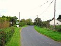
 Ballynahinch Road at Ballyworfy - geograph.org.uk - 1484757.jpg 640 × 480; 90 KB
-
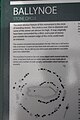
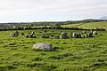
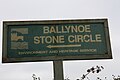
 Ballynoe (01), September 2009.JPG 4,272 × 2,848; 6.66 MB
-
 Ballynoe (03), September 2009.JPG 4,272 × 2,848; 3.83 MB
-
 Ballynoe (04), September 2009.JPG 2,848 × 4,272; 6.39 MB
-
 Ballynoe (05), September 2009.JPG 4,272 × 2,848; 7.05 MB
-
 Ballynoe (07), September 2009.JPG 4,272 × 2,848; 6.49 MB
-
 Ballynoe (09), September 2009.JPG 4,272 × 2,848; 3.27 MB
-
 Ballynoe (10), September 2009.JPG 4,272 × 2,848; 2.69 MB
-
 Ballynoe (11), September 2009.JPG 2,848 × 4,272; 5.66 MB
-
 Ballynoe (12), September 2009.JPG 4,272 × 2,848; 6.75 MB
-
 Ballynoe (13), September 2009.JPG 4,272 × 2,848; 3.5 MB
-
 Ballynoe (15), September 2009.JPG 2,848 × 4,272; 3.82 MB
-
 Ballynoe (16), September 2009.JPG 4,272 × 2,848; 4.06 MB
-
 Ballynoe (19), September 2009.JPG 4,272 × 2,848; 5.24 MB
-
 Ballynoe (20), September 2009.JPG 4,272 × 2,848; 7.69 MB
-
 Ballynoe (25), September 2009.JPG 4,272 × 2,848; 5.43 MB
-
 Ballynoe (32), September 2009.JPG 4,272 × 2,848; 6.86 MB
-
 Ballynoe (37), September 2009.JPG 4,272 × 2,848; 6.14 MB
-
 Ballynoe (40), September 2009.JPG 4,272 × 2,848; 8.38 MB
-
 Ballynoe (43), September 2009.JPG 2,848 × 4,272; 5.85 MB
-
 Ballynoe (46), September 2009.JPG 4,272 × 2,848; 4.72 MB
-
 Ballynoe (47), September 2009.JPG 2,848 × 4,272; 7.07 MB
-
 Ballynoe (53), September 2009.JPG 4,272 × 2,848; 5.64 MB
-
 Ballynoe (54), September 2009.JPG 4,272 × 2,848; 6.49 MB
-
 Ballynoe (58), September 2009.JPG 4,272 × 2,848; 2.94 MB
-
 Ballyvicknacally Townland - geograph.org.uk - 1496847.jpg 640 × 480; 66 KB
-
 Ballyvicknacally Townland - geograph.org.uk - 1496932.jpg 640 × 480; 65 KB
-
 Ballyvicknacally Townland - geograph.org.uk - 1496988.jpg 640 × 480; 50 KB
-
 Ballyworfy Townland - geograph.org.uk - 1484760.jpg 640 × 480; 68 KB
-
 Black Abbey Townland - geograph.org.uk - 1509804.jpg 640 × 480; 98 KB
-
 Burren Townland - geograph.org.uk - 1483770.jpg 640 × 480; 95 KB
-
 Cargygray Townland - geograph.org.uk - 1483760.jpg 640 × 480; 82 KB
-

-
 Cattle, Woodgrange Townland - geograph.org.uk - 1476213.jpg 640 × 480; 133 KB
-
 Caugheys Road, Ballyvicknacally - geograph.org.uk - 1496947.jpg 640 × 480; 98 KB
-
 Cluntagh Townland - geograph.org.uk - 1483772.jpg 640 × 480; 80 KB
-
 Cumber Gardens, Drumaness - geograph.org.uk - 1475841.jpg 640 × 480; 61 KB
-
 Dromara Road, Ballykeel - geograph.org.uk - 1484184.jpg 640 × 480; 58 KB
-
 Dromore Road at Cluntagh - geograph.org.uk - 1483776.jpg 640 × 480; 64 KB
-
 Dufferin Coaching Inn , Killyleagh - geograph.org.uk - 1582039.jpg 640 × 480; 86 KB
-
 Farmyard, Woodgrange Townland - geograph.org.uk - 1476402.jpg 640 × 480; 126 KB
-
 Farranfad Road near Seaforde - geograph.org.uk - 1476454.jpg 640 × 480; 65 KB
-
 Former Presbyterian church, Strangford - geograph.org.uk - 1494117.jpg 613 × 407; 119 KB
-
 Frederick Street and castle, Killyleagh - geograph.org.uk - 1582027.jpg 640 × 560; 110 KB
-
 Fungus, Hillsborough forest (09-6) - geograph.org.uk - 1506842.jpg 624 × 364; 97 KB
-
 Fungus, Hillsborough forest (09-7) - geograph.org.uk - 1506848.jpg 640 × 544; 84 KB
-
 Fungus, Hillsborough forest 09-4 - geograph.org.uk - 1473147.jpg 511 × 424; 101 KB
-
 Garden of Killyleagh Castle - geograph.org.uk - 1477608.jpg 640 × 480; 125 KB
-
 Glenview, Annahilt - geograph.org.uk - 1483755.jpg 640 × 480; 66 KB
-
 Guided tour of Killyleagh Castle - geograph.org.uk - 1581390.jpg 640 × 621; 132 KB
-
 Helen's Bay station (6) - geograph.org.uk - 1503708.jpg 640 × 422; 72 KB
-
 Inishargy Road, Balliggan - geograph.org.uk - 1509814.jpg 640 × 480; 124 KB
-

-
 Killyleagh Castle - geograph.org.uk - 1581375.jpg 640 × 488; 81 KB
-

-

-
 Kingshill Orange Hall.jpg 640 × 480; 67 KB
-
 Kircubbin Road, Balliggan - geograph.org.uk - 1509820.jpg 640 × 480; 104 KB
-
 Laneway at Ballyworfy - geograph.org.uk - 1484761.jpg 640 × 480; 131 KB
-
 Lintagh Park, Annahilt - geograph.org.uk - 1484230.jpg 640 × 480; 58 KB
-
 Lough Quarter Road, Woodgrange - geograph.org.uk - 1476349.jpg 640 × 480; 56 KB
-
 Lough Quarter, Woodgrange Townland - geograph.org.uk - 1476367.jpg 640 × 480; 161 KB
-
 Loughaghery Presbyterian Church - geograph.org.uk - 1483758.jpg 640 × 480; 60 KB
-
 Magheraconluce Road, Annahilt - geograph.org.uk - 1483756.jpg 640 × 480; 65 KB
-
 Magheradartin Road, Hillsborough - geograph.org.uk - 1484653.jpg 640 × 480; 93 KB
-
 Magheradartin Road, Hillsborough - geograph.org.uk - 1484678.jpg 640 × 480; 92 KB
-
 Magheradartin Townland - geograph.org.uk - 1484663.jpg 640 × 480; 61 KB
-
 Magheradartin Townland - geograph.org.uk - 1484666.jpg 640 × 480; 93 KB
-
 Portnacoo near Ballyhornan - geograph.org.uk - 1497976.jpg 640 × 480; 79 KB
-
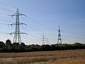 Pylons at Magheradartin - geograph.org.uk - 1484628.jpg 640 × 480; 58 KB
-
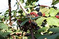
 Red berry tree at Magheradartin - geograph.org.uk - 1484708.jpg 640 × 480; 132 KB
-
 Ross Monument Rostrevor N.Ireland.jpg 2,592 × 1,944; 1.1 MB
-
 Scarva Street Banbridge - geograph.org.uk - 1508790.jpg 640 × 360; 59 KB
-

-
 Sheepland More Townland - geograph.org.uk - 1497967.jpg 640 × 480; 60 KB
-
 Sign, Ballyvicknacally (1-2) - geograph.org.uk - 1496959.jpg 640 × 480; 149 KB
-
 Sign, Ballyvicknacally (2-2) - geograph.org.uk - 1496973.jpg 640 × 480; 166 KB
-
 Spirehill Road, Ballyworfy - geograph.org.uk - 1484748.jpg 640 × 480; 101 KB
-
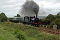 Steam Enterprise - geograph.org.uk - 551299.jpg 640 × 426; 112 KB
-
 Strangford Castle - geograph.org.uk - 1494004.jpg 640 × 419; 97 KB
-

-
-
 The Ballievey Road, Banbridge (2) - geograph.org.uk - 549390.jpg 640 × 426; 121 KB
-
 The Strangford Bay path (1) - geograph.org.uk - 1495460.jpg 640 × 456; 89 KB
-

-
 Woodgrange Mission Hall - geograph.org.uk - 1476324.jpg 640 × 480; 86 KB
-
 Woodgrange Orange Hall - geograph.org.uk - 1476241.jpg 640 × 480; 63 KB
-
 Woodgrange Road at Lough Quarter - geograph.org.uk - 1476337.jpg 640 × 480; 78 KB
-
 Woodgrange Road near Annacloy - geograph.org.uk - 1476175.jpg 640 × 480; 86 KB
-
 Woodgrange Road, Hollymount - geograph.org.uk - 1476405.jpg 640 × 480; 128 KB
-
 Woodgrange Townland - geograph.org.uk - 1476237.jpg 640 × 480; 54 KB
-
 Woodstack, Hillsborough forest - geograph.org.uk - 1506749.jpg 608 × 408; 103 KB


_-_geograph.org.uk_-_1509878.jpg)


,_September_2009.JPG)
,_September_2009.JPG)
,_September_2009.JPG)
,_September_2009.JPG)
,_September_2009.JPG)
,_September_2009.JPG)
,_September_2009.JPG)
,_September_2009.JPG)
,_September_2009.JPG)
,_September_2009.JPG)
,_September_2009.JPG)
,_September_2009.JPG)
,_September_2009.JPG)
,_September_2009.JPG)
,_September_2009.JPG)
,_September_2009.JPG)
,_September_2009.JPG)
,_September_2009.JPG)
,_September_2009.JPG)
,_September_2009.JPG)
,_September_2009.JPG)
,_September_2009.JPG)
,_September_2009.JPG)
,_September_2009.JPG)


_-_geograph.org.uk_-_1506842.jpg)
_-_geograph.org.uk_-_1506848.jpg)


_-_geograph.org.uk_-_1503708.jpg)


_-_geograph.org.uk_-_1496959.jpg)
_-_geograph.org.uk_-_1496973.jpg)


_-_geograph.org.uk_-_549390.jpg)
_-_geograph.org.uk_-_1495460.jpg)


