Category:September 2008 in Gloucestershire
Jump to navigation
Jump to search
Ceremonial counties of England: Bedfordshire · Berkshire · Buckinghamshire · Cambridgeshire · Cheshire · Cornwall · Cumbria · Derbyshire · Devon · Dorset · Durham · East Riding of Yorkshire · East Sussex · Essex · Gloucestershire · Greater London · Greater Manchester · Hampshire · Herefordshire · Hertfordshire · Isle of Wight · Kent · Lancashire · Leicestershire · Lincolnshire · Merseyside · Norfolk · North Yorkshire · Northamptonshire · Northumberland · Nottinghamshire · Oxfordshire · Rutland · Shropshire · Somerset · South Yorkshire · Staffordshire · Suffolk · Surrey · Tyne and Wear · Warwickshire · West Midlands · West Sussex · West Yorkshire · Wiltshire · Worcestershire
City-counties: Bristol ·
Former historic counties:
Other former counties:
City-counties: Bristol ·
Former historic counties:
Other former counties:
Deutsch: Bilder, die im September 2008 in Gloucestershire aufgenommen worden sind. Bitte beachten Sie, dass dies weder das Datum des Uploads noch das Datum des Scannens eines Fotos ist.
English: Images/pictures taken in Gloucestershire during September 2008. Note this is not the date of the upload, nor the date a photo was scanned.
Español: Fotografías o imágenes tomadas en Gloucestershire durante septiembre 2008. No es la fecha de subida ni escaneo, sino la fecha en que las fotografías o imágenes se crearon.
Esperanto: Bildoj faritaj en Gloucestershire en septembro 2008. Tio ne estas la dato, kiam la bildoj estis alŝutitaj aŭ skanitaj.
Français : Photographies ou images prises en Gloucestershire durant septembre 2008. Ce n'est pas la date du téléchargement ou du scan.
Galego: Fotografías ou imaxes tomadas en Gloucestershire durante setembro 2008. Non é a data de subida nin escaneamento, senón a data na que se crearon as fotografías ou imaxes.
Italiano: Fotografie o immagini scattate a Gloucestershire nel settembre 2008. Nota bene: la data non si riferisce né a quella di upload né a quella in cui la foto è stata digitalizzata.
Norsk bokmål: Bilder tatt i Gloucestershire i løpet av september 2008. Merk at dette ikke er datoen for opplasting, eller når et bilde har blitt skannet.
Norsk nynorsk: Bilete teke i Gloucestershire i løpet av september 2008. Merk at dette ikkje er datoen for opplasting, eller når eit bilete har vorte skanna.
Русский: Изображения, сделанные в Gloucestershire в течение сентябрь 2008 (не дата загрузки изображения).
Українська: Зображення, зроблені в Gloucestershire протягом вересень 2008. Зауважте, що це не дата завантаження чи дата сканування фотографії.
| September 2007 | ← | September 2008 | → | September 2009 | |||||||
| Jan | Feb | Mar | Apr | May | Jun | Jul | Aug | Sep | Oct | Nov | Dec |
| 26 | 47 | 54 | 73 | 39 | 33 | 56 | 37 | 35 | 42 | 62 | 91 |
|---|---|---|---|---|---|---|---|---|---|---|---|
Subcategories
This category has the following 3 subcategories, out of 3 total.
Media in category "September 2008 in Gloucestershire"
The following 32 files are in this category, out of 32 total.
-
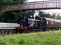 9681 at St Marys Halt.JPG 728 × 547; 122 KB
-
 Ada's Cottage - geograph.org.uk - 961245.jpg 640 × 480; 66 KB
-
 Automobile Association Village sign - geograph.org.uk - 998282.jpg 640 × 467; 95 KB
-

-
 Churcham church - geograph.org.uk - 1150927.jpg 640 × 480; 68 KB
-
 Churcham church - geograph.org.uk - 1150929.jpg 640 × 480; 71 KB
-
 Churcham church - geograph.org.uk - 1150954.jpg 640 × 480; 85 KB
-
 Cliffs above the River Wye at Woodcroft - geograph.org.uk - 1163345.jpg 640 × 480; 108 KB
-
 Cottages at Harleywood - geograph.org.uk - 978023.jpg 640 × 480; 119 KB
-
 Cottages in Bledington - geograph.org.uk - 998245.jpg 640 × 426; 91 KB
-
 Field near Stockwell - geograph.org.uk - 986715.jpg 640 × 480; 62 KB
-
 Footbridge over Dillay Brook - geograph.org.uk - 962335.jpg 640 × 480; 125 KB
-
 Footpath from the churchyard, Deerhurst - geograph.org.uk - 987326.jpg 640 × 480; 181 KB
-
 Footpath near Gatcombe - geograph.org.uk - 1172351.jpg 640 × 480; 142 KB
-
 Footpath South - geograph.org.uk - 962338.jpg 640 × 480; 145 KB
-
 Footpath to Rayer's Hill, Deerhurst - geograph.org.uk - 987255.jpg 640 × 480; 160 KB
-
 Footpath to the River Severn - geograph.org.uk - 988686.jpg 640 × 480; 169 KB
-
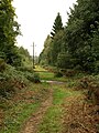 Forest ride near Coalway - geograph.org.uk - 965603.jpg 480 × 640; 112 KB
-
 Forest track near Coalway - geograph.org.uk - 965593.jpg 480 × 640; 136 KB
-
 Grave of Alfred Hook - geograph.org.uk - 1150946.jpg 640 × 480; 113 KB
-
 Inquisitive livestock - geograph.org.uk - 251060.jpg 640 × 480; 128 KB
-
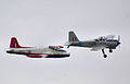 Jet and prop provosts arp.jpg 1,676 × 1,071; 2.26 MB
-
 Lansdown Road, Stroud - geograph.org.uk - 977143.jpg 510 × 640; 91 KB
-
 Longhope church - geograph.org.uk - 1529965.jpg 640 × 480; 43 KB
-
 Looking down in to the quarry, Woodcroft - geograph.org.uk - 1163359.jpg 640 × 480; 114 KB
-
 Main Road, Whiteshill - geograph.org.uk - 977078.jpg 640 × 480; 90 KB
-
 Plateau above the River Wye at Woodcroft - geograph.org.uk - 1163350.jpg 640 × 480; 112 KB
-
 Plateau above the River Wye at Woodcroft - geograph.org.uk - 1163352.jpg 640 × 480; 115 KB
-
 The Gloucester to Bristol line - geograph.org.uk - 986042.jpg 640 × 429; 123 KB
-
 Woodcroft - entrance to quarry footpath - geograph.org.uk - 1163366.jpg 640 × 480; 133 KB
-
 Woodcroft - footpath to quarry - geograph.org.uk - 1163356.jpg 640 × 480; 134 KB
-
 Woodcroft - footpath to quarry - geograph.org.uk - 1163362.jpg 640 × 480; 161 KB


